 Block
Newhouse, Minnesota
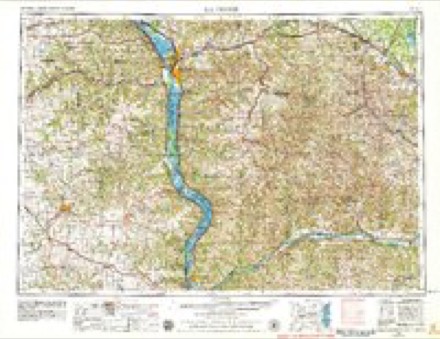
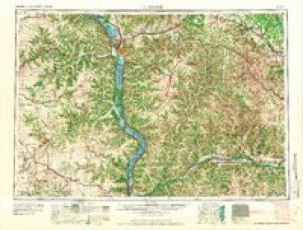
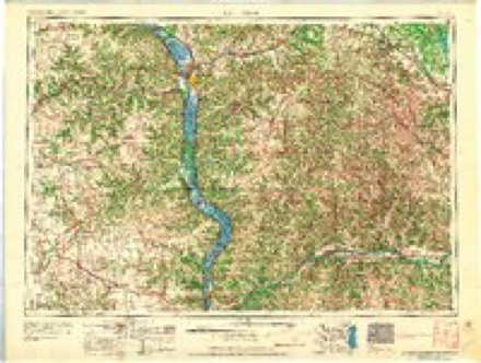
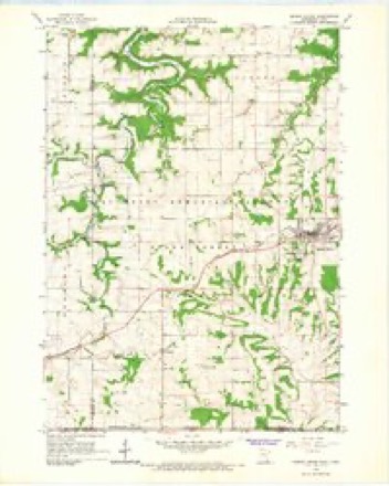
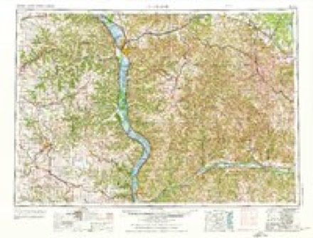
8 topographic sheets cover this place, the earliest surveyed in 1958 and the latest in 1990. It stands in Spring Grove Township. It lies in ZIP code area 55954. The Survey maps it on the Spring Grove quadrangle. It stands 1,197 feet above sea level.
Topographic sheets covering this place
7 surveys from 8 printed sheetsMatched by testing this settlement's coordinate against the published boundary of every sheet in the United States Geological Survey's historical collection. Each opens the scanned sheet at the Survey.
- 1958 USGS La Crosse quadrangle1:250000, 2 printings
- 1961 USGS La Crosse quadrangle1:250000
- 1965 USGS La Crosse quadrangle1:250000
- 1965 USGS Spring Grove quadrangle1:24000
- 1976 USGS La Crosse quadrangle1:250000
- 1984 USGS La Crosse quadrangle1:100000
- 1990 USGS La Crosse quadrangle1:100000
In the county-history sources
4,415 words on this townshipHistory of Houston County, Minnesota, published 1919 names this settlement in its chapter on Spring Grove Township. These are the passages that mention it, exactly as the scans read.
The Onsgard State Bank had its beginning in the seventies when Nels Olson Onsgard, then a store keeper, began to handle the financial affairs of his customers as a personal accommodation, selling them drafts, arranging loans and the like. In 1890, this business was organized as the Bank of Spring Grove, and established in the rear of the store. Later a brick addition was built, facing northward on the other street. Sept. 6, 1907, the Onsgard State Bank was incorporated, with Nels O. Onsgard as president, O. K. Dahle as vice-president, O. N. Onsgard as cashier, and B. N. Onsgard as assistant cashier. In 1911, O. N. Onsgard became vice-president, B. N. Onsgard cashier and O. E. Hallan, assistant cashier. In 1915, after the death of Nels Olson Onsgard, O. K. Dahle became president, the other officers remaining as before. In 1917, P. T. Newhouse succeeded O. N. Onsgard as vice-president. On Nov. 1, 1918, B. T. Haugen became second assistant cashier. The officers are now: president, O. K. Dahle; vicepresident, P. T. Newhouse; cashier, B. N. Onsgard; assistant cashier, O. E. Hallan ; second assistant cashier, B. T. Haugen. The institution moved to its sightly new banking house, Feb. 7, 1916. This building is well equipped for its purpose, having aside from the main banking room, a consulting room and an officers' room, with other conveniences. The bank has a capital of $25,000, surplus and undivided profits of $16,622.96 ; loans and discounts of $266,758.18; total deposits of $388,054.81; and immediate cash reserve of $53,463.70, according to the report of Dec. 31, 1918. The bank aims to give to its patrons every service compatible with conservative banking judgment. Realizing that in the development of the rural districts hes the future of the village, it is helping in that development in every way possible, and impresses on the farmers that the banking house is their real financial headquarters, where consultation may be had on all subjects pertaining to their mutual interests.
Passage source: History of Houston County, Minnesota, published 1919.
Machine-read from a century-old scan, so expect the errors a machine makes: misspelled names, dropped words, stray characters.
Read the whole chapter on Spring Grove Township - it names this place 1 more 1 time.
Fires near this place
10 since 2003Regional context, not property-specific evidence. The federal wildfire occurrence database lists 10 fires within 5 miles of Newhouse between 2003 and 2018, burning about 30 acres in total. None started naturally. None was recorded as arson. Distance is straight-line from the map coordinates, so a fire counted here may appear on a neighbouring settlement's page as well.
| Reported cause | Fires |
|---|---|
| Debris and open burning | 5 |
| Missing data/not specified/undetermined | 3 |
| Equipment and vehicle use | 2 |
The most recent of them, most recent first, with the day each was reported and the service that recorded it.
| Date | Cause | Size | Reported by | Name on the report |
|---|---|---|---|---|
| 17 September 2018 | Missing data/not specified/undetermined | under an acre | Minnesota Department of Natural Resources | not named |
| 7 May 2004 | Equipment and vehicle use | under an acre | Minnesota Department of Natural Resources | not named |
| 29 May 2003 | Debris and open burning | under an acre | Minnesota Department of Natural Resources | not named |
| 8 April 2004 | Equipment and vehicle use | under an acre | Minnesota Department of Natural Resources | not named |
| 4 April 2004 | Debris and open burning | under an acre | Minnesota Department of Natural Resources | not named |
| 28 April 2013 | Missing data/not specified/undetermined | 5.0 acres | Iowa Department of Natural Resources | not named |
| 21 April 2007 | Debris and open burning | under an acre | Minnesota Department of Natural Resources | not named |
| 2 April 2009 | Debris and open burning | under an acre | Minnesota Department of Natural Resources | not named |
Settlements close enough to share some of these fires:
Mines and quarries near this place
7 within 5 milesRegional context, not property-specific evidence. The federal mineral resources record lists 7 workings within 5 miles of Newhouse: 5 producers, 2 past producers. 5 still produce. What was taken out: Stone, Crushed/Broken. Distance is straight-line from the map coordinates, so a quarry counted here may appear on a neighbouring settlement's page as well.
| Where | Site | Commodity | Status | Recorded |
|---|---|---|---|---|
| Forde Quarry | Stone, Crushed/Broken | Producer | ||
| Hanson Quarry | Stone, Crushed/Broken | Producer | ||
| Otterness Quarry | Stone, Crushed/Broken | Producer | ||
| Roverud Quarry | Stone, Crushed/Broken | Producer | ||
| Underpass Quarry | Stone, Crushed/Broken | Producer | ||
| Unknown | Stone, Crushed/Broken | Past Producer | ||
| Unknown | Stone, Crushed/Broken | Past Producer |
Storms near this place
5 since 2008Regional context, not property-specific evidence. The National Weather Service names Newhouse in 5 storm reports between 2008 and 2018: 3 flash flood, 1 thunderstorm wind, 1 hail. No death or injury is recorded in these reports. Each account below is quoted exactly as the forecast office filed it, from the NOAA Storm Events Database, and each date opens the federal record of that event.
| When | Event | Place named | Harm | What the report says |
|---|---|---|---|---|
| June 2008 | Flash Flood | Newhouse | $2,500,000 | Very heavy rain led to flash flooding through much of the county. A rainfall total of 7.18 inches was measured 3 miles southwest of Reno. The bridge over Clear Creek was reported damaged and unsafe for use. In addition, highway 26 was closed due to mudslides. County Highways 5, 23, 31 and 249 were closed due to high water and washouts. |
| June 2018 | Flash Flood | Newhouse | $110,000 | Flash flooding was reported across mainly southwest parts of Houston County from rounds of heavy rain. |
| September 2016 | Flash Flood | Newhouse | $40,000 | A mudslide north of Brownsville caused boulders to tumble down the side of a bluff. One of these boulders hit a house causing considerable damage. Numerous roads in the southern sections of Houston County had water over them prompting officials to close some of them, including State Highway 16 near La Crescent. Flood waters from Winnebago Creek damaged a road in Camp Winnebago south of Caledonia and covered County Highway 5 in the extreme southern part of the county. |
| June 2010 | Thunderstorm Wind | Newhouse | $1,000 | Trees were blown down across Highway 44. |
| June 2018 | Hail | Newhouse | - | Dime sized hail caused extensive damage to a strawberry farm in the southwest corner of Houston County. Approximately 75 percent of the crop was loss with estimated damages of $75,000. |
Nearest settlements
The eight closest, with where each one stands in the county. Distances are straight-line, computed from the Geographic Names Information System coordinates.
| Map | Place | Distance | Sheets |
|---|---|---|---|
| Riceford | 3.8 miles | 8 | |
| Spring Grove | 4.2 miles | 8 | |
| Black Hammer | 6.6 miles | 8 | |
| Bee | 7.1 miles | 9 | |
| Willington Grove | 7.4 miles | 9 | |
| Wilmington | 8.5 miles | 9 | |
| Yucatan | 10.7 miles | 8 | |
| Schechs Mill | 11.7 miles | 9 |
Elsewhere
Matched on this settlement's Geographic Names Information System number rather than its name, so it cannot be a different place of the same name in another state.
| Wikipedia article on Newhouse | An encyclopaedic summary. Its text is share-alike, so it is linked here rather than copied. |
| Wikidata item Q29641806 | The structured record the population and elevation above come from. Public domain (CC0). |
Provenance
This settlement is recorded in the Geographic Names Information System as feature 654846. The sheet list is computed by point-in-boundary test against the United States Geological Survey's historical topographic inventory. Both are works of the United States government and carry no copyright under 17 U.S.C. 105.
Wildfire. Short, Karen C. 2022. Spatial wildfire occurrence data for the United States, 1992-2020 [FPA_FOD_20221014]. 6th Edition. Fort Collins, CO: Forest Service Research Data Archive. https://doi.org/10.2737/RDS-2013-0009.6 Collected with United States Government funding and usable without additional permissions or fees.
Mines and quarries. USGS Mineral Resources Data System (MRDS) https://mrdata.usgs.gov/mrds/ A work of the United States government, no copyright under 17 U.S.C. 105.
Storms. NOAA National Centers for Environmental Information, Storm Events Database https://www.ncei.noaa.gov/stormevents/ A work of the United States government, no copyright under 17 U.S.C. 105. Narratives are quoted verbatim from the National Weather Service report and are not edited or summarised.