 Block
Morristown, Minnesota
10 topographic sheets cover this place, the earliest surveyed in 1953 and the latest in 1985. It stands in Morristown City. It lies in ZIP code area 55052. The Survey maps it on the Morristown quadrangle. 949 people lived here at the 2020 count. It stands 1,004 feet above sea level.
On record in Morristown
Buildings and businesses the archive holds for this place. Each opens its own page, with the source record it came from.
On the National Register 1 record
- Morristown Feed Milllisted 2019
Population over time
2 figuresMorristown fell from 987 to 949 between 2010 and 2020. These are the recorded population figures Wikidata holds for this place, reached through the Geographic Names Information System number this page is keyed on rather than by name, so they belong to this place and not to another of the same name. Most are census counts, but not all are: an early figure may be a founding or settlement estimate, and an estimate published within five years of a census is left out. The change column is computed, and is left blank where more than 20 years separate a figure from the one before it, because a gap that long is not a change between two counts.
| Year | People | Change |
|---|---|---|
| 2010 | 987 | |
| 2020 | 949 | -38 (-4%) |
Topographic sheets covering this place
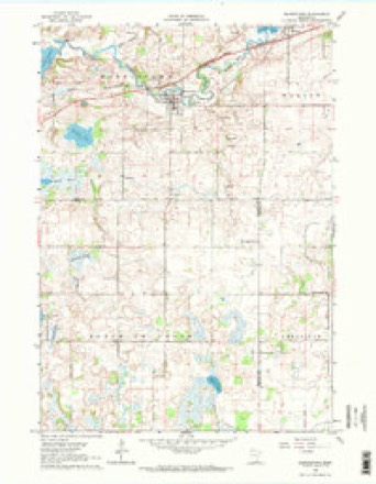
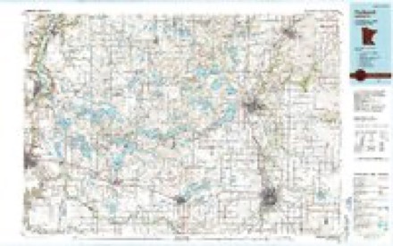
6 surveys from 10 printed sheetsMatched by testing this settlement's coordinate against the published boundary of every sheet in the United States Geological Survey's historical collection. Each opens the scanned sheet at the Survey.
- 1953 USGS Saint Paul quadrangle1:250000, 3 printings
- 1953 USGS St. Paul quadrangle1:250000
- 1959 USGS Saint Paul quadrangle1:250000
- 1959 USGS St. Paul quadrangle1:250000
- 1962 USGS Morristown quadrangle1:24000, 2 printings
- 1985 USGS Faribault quadrangle1:100000, 2 printings




In the county-history sources
4,698 words on this townshipHistory of Rice County, published 1882 names this settlement in its chapter on Morristown City. These are the passages that mention it, exactly as the scans read.
Early Settlement. - The first settlement of the village commenced shortly after that of the township, and since the beginning has been rapid and constant. About the middle of April, 185.5, Mr. Jonathan Morris, who Lad the year before settled at Faribault, started up Cannon Kiver, in company with Walter Morris, in search of a mill jjower. They followed the course of the river as far up as the present site of Waterville, then returned as far as Mr. Story's, where they remained over night, receiving at the hands of Mr. Story and his excellent wife, true pioneer hospitality. Finding that nature had provided a splendid water power at this point, they decided upon locating at the present site of Morristown, and in a few days thereafter, erected a log cabin near where Mr. Hershey's dwelling now stands, and moved in the same.
Passage source: History of Rice County, published 1882.
In the month of January, 1857, Mr. Charles D. Adams returned to Morristown bringing with him a stock of merchandise, and opened up for business in the store formerly occupied by Mr. Collins. Daring Mr. Adams' absence one Benjamine Dexter jumped the claim of Adams & Allen, which created quite an excitement, and on the return of Mr. Adams, several members of the "claim society" proposed to remove Dexter from the claim. In the early settlement of this country, the claim societies often resorted to violence to accomplish their object, but Mr. Adams bein^ a man of peace desired to avoid all trouble and finally paid Daxter $212 to leave the claim, and Uext.-r found it convenient to leave the country, it not being considered a very healthy locality for claim jumpers.
Passage source: History of Rice County, published 1882.
Time or space will not admit of giving a full account of every event that transpired in the early days of wliat is now the lieautiful and flourishing village of Morristown. Where but a few years ago the wigwam of the untutored savage stood, has, by the hand of industry, been transformed into a tliriving village, containing churches, schools, stores, milts, hotels, and in short, all the conveniences of civilization.
Passage source: History of Rice County, published 1882.
Machine-read from a century-old scan, so expect the errors a machine makes: misspelled names, dropped words, stray characters.
Read the whole chapter on Morristown City - it names this place 24 more 24 times.
Fires near this place
3 since 2002Regional context, not property-specific evidence. The federal wildfire occurrence database lists 3 fires within 5 miles of Morristown between 2002 and 2003, burning about 4 acres in total. None started naturally. None was recorded as arson. Distance is straight-line from the map coordinates, so a fire counted here may appear on a neighbouring settlement's page as well.
| Reported cause | Fires |
|---|---|
| Smoking | 2 |
| Missing data/not specified/undetermined | 1 |
The most recent of them, most recent first, with the day each was reported and the service that recorded it.
| Date | Cause | Size | Reported by | Name on the report |
|---|---|---|---|---|
| 10 April 2003 | Smoking | 2.0 acres | Minnesota Department of Natural Resources | not named |
| 17 December 2002 | Smoking | 2.0 acres | Minnesota Department of Natural Resources | not named |
| 20 October 2003 | Missing data/not specified/undetermined | under an acre | Minnesota Department of Natural Resources | not named |
Settlements close enough to share some of these fires:
Mines and quarries near this place
1 within 5 milesRegional context, not property-specific evidence. The federal mineral resources record lists 1 working within 5 miles of Morristown: 1 producer. All of them still produce. What was taken out: Sand and Gravel, Construction. Distance is straight-line from the map coordinates, so a quarry counted here may appear on a neighbouring settlement's page as well.
| Where | Site | Commodity | Status | Recorded |
|---|---|---|---|---|
| Walbern Pit | Sand and Gravel, Construction | Producer |
Storms near this place
43 since 1995Regional context, not property-specific evidence. The National Weather Service names Morristown in 43 storm reports between 1995 and 2025: 18 thunderstorm wind, 17 hail, 7 tornado, 1 flood. No death or injury is recorded in these reports. Each account below is quoted exactly as the forecast office filed it, from the NOAA Storm Events Database, and each date opens the federal record of that event.
| When | Event | Place named | Harm | What the report says |
|---|---|---|---|---|
| April 2022 | Thunderstorm Wind | Morristown | $10,000,000 | There was significant wind damage from a downburst that expanded in width as it traveled northeast. By the time it stopped producing damage, it was 8 wide on either side of Nerstrand. The damage began east-southeast of Morristown (near the Rice, Waseca, and Steele County line), moved across the south side of Faribault, and northeast to near the Nerstrand Big Woods State Park and then Nerstrand. The damage path became more isolated as it exited eastern Rice county.||Numerous trees, power lines, roofs, and pole barns were damaged along this path. In addition, nine semi trucks were blown over on I-35 south of Faribault due to straight-line winds. Just over $1 Million dollars in damages were to public infrastructure, with remaining damages to houses, farms, and vehicles. |
| September 2016 | Flood | Morristown | $700,000 | Runoff from torrential rainfall that occurred across most of southern Rice County Wednesday night, September 21st, caused numerous roads to remain impassable and closed. The flooding incident created over $700,000 in property damage amounts, according to Rice County Emergency Management. |
| May 2022 | Thunderstorm Wind | Morristown | - | A severe wind gust was measured by a local emergency manager. This was with the leading shelf cloud ahead of the main storms. |
| September 2018 | Tornado (EF1) | Morristown | - | A NWS storm survey, plus areal footage of drone and satellite data, concluded that an EF1 tornado started north of Morristown. It moved northeast to the intersection of Cedar Lake Blvd, and Fairbanks Avenue, and continued moving northeast across the southeast part of Roberds Lake. It lifted just north of the Faribault airport after being on the ground for nearly 8.6 miles. ||The damage was consistent with EF1 damage with maximum wind speeds of 95 mph and a width of 440 yards. Damage was significant along this path with the worst damage along the south and east sides of Roberds Lake. Areal footage and pictures concluded that hundred of trees, up to 3 feet in diameter, were uprooted or blown down onto houses on the east side of the lake from this tornado. Many of these large trees landed on homes and nearly split them in half. |
| September 2018 | Tornado (EF2) | Morristown | - | A NWS storm survey, plus areal footage of drone, fixed wing aircraft, and satellite data, concluded that an EF2 tornado tracked nearly 5 miles from southwest of Morristown, north-northeast to just west and north of Cannon Lake before lifting. ||Tornado damage was consistent with EF2 damage with winds up to 130 mph, and a maximum path width of 300 yards. The worst damage occurred on the southeast side of Morristown. ||On the southeast side of Morristown, several family homes had large sections of roof structure removed, and a few had all their exterior walls collapsed. Only small interior rooms were intact. The remainder of the tornadic track was consistent with uprooted trees, power lines, corn and soy bean field damage, and outbuildings. |
| September 2018 | Thunderstorm Wind | Morristown | - | A NWS storm survey, plus drone footage, concluded that damaging downburst winds, up to 95 mph, occurred from west of Horseshoe Lake on the southwest side of Rice county, then northeast to the southwest part of Roberds Lake. Damage was generally directed from west-southwest to east-northeast. ||The worst damage occurred to a home and outbuilding on the south side of Cedar Lake. Drone footage showed at this location that a metal roof and shed was blown over with wall panels pulled from the buildings. |
| June 2017 | Thunderstorm Wind | Morristown | - | A storm chaser measured a wind gust of 58 mph in the city of Morristown. There was also several trees blown down in the city. |
| June 2017 | Thunderstorm Wind | Morristown | - | Several reports of downed trees, power lines and power outages occurred from Morristown, northeast toward the city of Faribault. Some of the spotters measured wind gusts of 59 and 62 mph. |
| June 2016 | Tornado (EF0) | Morristown | - | The tornado originated in Le Sueur County and continued in Rice County. It occasionally touched down, knocking over a few trees and breaking some large limbs. |
| May 2014 | Thunderstorm Wind | Morristown | - | A measured wind gust occurred in the city of Morrisville. |
| May 2012 | Hail | Morristown | - | In addition to quarter size hail, winds were measured at 51 mph in Morristown. |
| July 2008 | Thunderstorm Wind | Morristown | - | Numerous corn fields flattened throughout town. |
| July 2008 | Thunderstorm Wind | Morristown | - | Trees down near Highway 60. |
| July 2008 | Thunderstorm Wind | Morristown | - | Several large hay bales blown across road. An 18 inch diameter tree blown down. |
| July 2008 | Thunderstorm Wind | Morristown | - | Thirty foot pine tree uprooted. Eighteen inch diameter tree toppled. |
| July 2008 | Thunderstorm Wind | Morristown | - | Numerous corn fields flattened throughout town. |
| May 2005 | Thunderstorm Wind | Morristown | - | Scattered trees were downed. |
| June 2005 | Thunderstorm Wind | Morristown | - | A 121-year-old barn was blown down along Highway 72 in Morristown Township, Section 14. |
| June 2005 | Thunderstorm Wind | Morristown | - | Numerous trees were downed onto homes, streets, and yards. Several homes sustained significant roof damage and broken windows. A fallen tree punched a hole in the roof and a branch stuck through into an upstairs bedroom at a home on Division Street South. A person sleeping in a bed below the hole was awakened when insulation fell on them but was otherwise unharmed. A trampoline in the yard was thrown with such force that it bent a fence. A town resident said the high winds lasted for nearly 15 minutes. |
| September 2005 | Thunderstorm Wind | Morristown | - | Trees up to 3 feet in diameter were downed. |
| September 2004 | Hail | Morristown | - | Dime sized hail fell near Upper and Lower Lake Sakatah. |
| August 1999 | Tornado (F0) | Morristown | - | Multiple vortex tornado crossed open fields. Continuation of tornado from Le Sueur County. |
| August 1999 | Tornado (F0) | Morristown | - | Trees down in Camp Omega. Continuation of tornado from Le Sueur County. |
| August 1999 | Tornado (F0) | Morristown | - | Few trees felled. Tornado cut swath through bean field. |
| July 2025 | Hail | Morristown | - | no account filed |
| August 2023 | Hail | Morristown | - | no account filed |
| September 2019 | Hail | Morristown | - | no account filed |
| June 2017 | Hail | Morristown | - | no account filed |
| May 2015 | Hail | Morristown | - | no account filed |
| May 2014 | Hail | Morristown | - | no account filed |
| May 2012 | Hail | Morristown | - | no account filed |
| July 2011 | Hail | Morristown | - | no account filed |
| June 2010 | Hail | Morristown | - | no account filed |
| June 2007 | Hail | Morristown | - | no account filed |
| June 2005 | Hail | Morristown | - | no account filed |
| June 2005 | Hail | Morristown | - | no account filed |
| May 2004 | Hail | Morristown | - | no account filed |
| July 2002 | Hail | Morristown | - | no account filed |
| May 2002 | Hail | Morristown | - | no account filed |
| July 1998 | Thunderstorm Wind | Morristown | - | no account filed |
| June 1996 | Thunderstorm Wind | Morristown | - | no account filed |
| September 1995 | Thunderstorm Wind | Morristown | - | no account filed |
| September 1995 | Tornado (F0) | Morristown | - | no account filed |
Nearest settlements
The eight closest, with where each one stands in the county. Distances are straight-line, computed from the Geographic Names Information System coordinates.
| Map | Place | Distance | Sheets |
|---|---|---|---|
| Warsaw | 3.1 miles | 10 | |
| Shieldsville | 9.8 miles | 12 | |
| Faribault | 10.4 miles | 10 | |
| Walcott | 13.8 miles | 9 | |
| Prairieville | 13.9 miles | 11 | |
| Cannon City | 14.2 miles | 11 | |
| Comus | 14.7 miles | 10 | |
| Millersburg | 15.1 miles | 10 |
Elsewhere
Matched on this settlement's Geographic Names Information System number rather than its name, so it cannot be a different place of the same name in another state.
| Wikipedia article on Morristown | An encyclopaedic summary. Its text is share-alike, so it is linked here rather than copied. |
| Wikidata item Q2228478 | The structured record the population and elevation above come from. Public domain (CC0). |
Provenance
This settlement is recorded in the Geographic Names Information System as feature 648124. The sheet list is computed by point-in-boundary test against the United States Geological Survey's historical topographic inventory. Both are works of the United States government and carry no copyright under 17 U.S.C. 105.
Wildfire. Short, Karen C. 2022. Spatial wildfire occurrence data for the United States, 1992-2020 [FPA_FOD_20221014]. 6th Edition. Fort Collins, CO: Forest Service Research Data Archive. https://doi.org/10.2737/RDS-2013-0009.6 Collected with United States Government funding and usable without additional permissions or fees.
Mines and quarries. USGS Mineral Resources Data System (MRDS) https://mrdata.usgs.gov/mrds/ A work of the United States government, no copyright under 17 U.S.C. 105.
Storms. NOAA National Centers for Environmental Information, Storm Events Database https://www.ncei.noaa.gov/stormevents/ A work of the United States government, no copyright under 17 U.S.C. 105. Narratives are quoted verbatim from the National Weather Service report and are not edited or summarised.