 Block
Columbus, Missouri
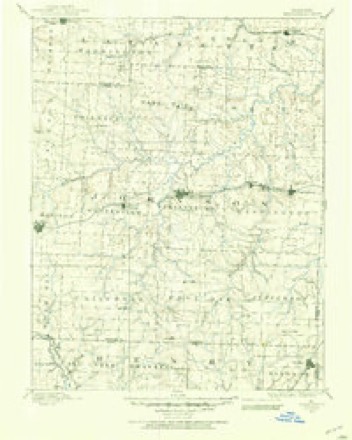
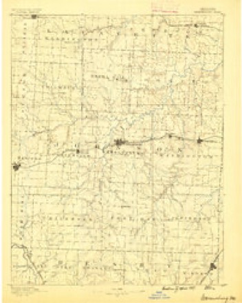
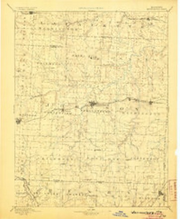
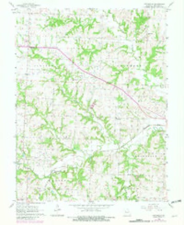
19 topographic sheets cover this place, the earliest surveyed in 1885 and the latest in 1983. It stands in Columbus Township. It lies in ZIP code area 64019. The Survey maps it on the Pittsville quadrangle.
Topographic sheets covering this place
10 surveys from 19 printed sheetsMatched by testing this settlement's coordinate against the published boundary of every sheet in the United States Geological Survey's historical collection. Each opens the scanned sheet at the Survey.
- 1885 USGS Warrensburg quadrangle1:125000
- 1887 USGS Warrensburg quadrangle1:125000
- 1894 USGS Warrensburg quadrangle1:125000, 5 printings
- 1947 USGS Jefferson City quadrangle1:250000
- 1954 USGS Jefferson City quadrangle1:250000, 2 printings
- 1955 USGS Jefferson City quadrangle1:250000, 4 printings
- 1958 USGS Jefferson City quadrangle1:250000
- 1959 USGS Jefferson City quadrangle1:250000
- 1963 USGS Pittsville quadrangle1:24000, 2 printings
- 1983 USGS Sedalia quadrangle1:100000





What happened here
An account from the chapter on Columbus township. The inset identifies its exact source book and publication year.
Abraham B. Whaley
one of the most prominent school teachers of the county; was born in Palmyra, Missouri, April 13, 1835. His father and mother lived in Marion county up to 1865. The subject of this sketch was a captain in Marmaduke's brigade, and was captured during the war in Monroe county, north Missouri, and was held as a political prisoner in Cincinnati, until the close of the war.
In the county-history sources
4,323 words on this townshipThe History of Johnson County, Missouri : Including a Reliable History of the Townships, Cities, and Towns, Together with a Map of the County; a Condensed History of Missouri; the State Constitution; an Abstract of the Most Important Laws; the Physical Features of the County; the Early Settlers and Pioneers; the Political and War History; the Religious and Educational History...statistics and Miscellaneous Matters, Etc., Etc, published 1881 names this settlement in its chapter on Columbus Township. These are the passages that mention it, exactly as the scans read.
Like many other enterprising young men, Mr. Allen came to Johnson county, because he thought it possessed many advantages over other local¬ ities. He came with his young wife to Warrensburg, and remained there a few years. He then commenced to improve his present farm, near Columbus. His means were limited, and, like most of the settlers in a new country, the numerous obstacles and difficulties had to be met by per¬ severing energy and industry. He owns, at present, a snug little farm, and is gradually surrounding himself with stock of all kinds. They have two boys: Jesse and Frank, who are now beginning to be some help to their father, and it will be but a few years until he will be able to spend his remaining years under the shadow of his own vine, and enjoy the fruits of his labor.
The name that heads this sketch is well known throughout the county as one among the earliest settlers. He was born in Lee valley, Lee county, Virginia, on March 15, 1811. His parents were natives of Vir¬ ginia. His father moved to Tennessee after the battle of New Orleans. The subject of this sketch lived with his parents in Tennessee, till the year 1829 in Ray county, one mile from the Cherokee Nation. He recollects the assembly of men at the treaty of the Hiawathy Purchase, and was present at that treaty, and recollects Gen. Jackson and Gen. Houston, and was only a boy at that time. He came with his parents to this state in the year 1829, and drove a four-horse wagon from Tennessee to Tabo Grove, Lafayette county, and went from there to St. Charles in 1834. He attended medical lectures at the medical college of Ohio, in the citv of Cincinnati, during the sessions of 1831 and 1832. He settled in Columbus when it was the count} seat of Johnson county. The doctor "tells an amusing story of the trial of one of the first criminal cases. Hav¬ ing no jail to confine the prisoner, the court ordered the sheriff' to confine him in an old wagon box, which he did by turning the box over him, and jury proceeded to literally and judicially sit on the case. Aftei a short deliberation the jury accpiitted the prisoner, and the couit, juiy and prisoner adjourned to a large tree, near which there was a fine spring of water, and there the assembled court and citizens proceeded to refresh themselves after their judicial labors, under the cooling shade of the tiees, with a few gallons of good Bourbon whiskey, and after the manner of ye early pioneer. He was married on May 5, 1836, to Elisabeth C. Houx, daughter of one of the earliest settlers of this county. They have had 10 children, six of whom are now living. He has filled several offices in the county. ? He was appointed commissioner in bankruptcy, and acted in that capacity for two or three years. He represented the citizens of this county and district in the state legislature during the years 1836, 1838 and 1840. He was also one of the directors of the State Bank of Missouri for about 4 years. Besides giving each of his children a tract of land, he owns at present in the county about 2300 acres of fine land. His home is who forms the subject of this sketch, is a native of Kentucky, was born in Woodford county in the year 1814. His father was a native of Vir¬ ginia, and his mother a native of North Carolina. He was married in the year 1836 to Miss Julia Boone, of Kentucky, who is a lineal decendant of the distinguished pioneer of that name - already famous in history for his deeds of courage and daring. Mr. Hammond moved with his family to Missouri in the year 1855, and having considerable money he bought 500 - acres in a body of as fine land as there is in the township. His pleasant home is part of the old Cockrell homestead, and was the birth place of the present United States senator of that name. Johnson county contains no better land. It is well adapted for all kinds of grain and grass, and finely situated for raising and feeding all kinds of stock. He has added considerable to the farm in the way of permanent improvements and it now contains about 560 acres, nearly all under cultivation. He has raised thiee sons, one of whom (Wm. Marion Hammond) was killed at the battle of Helena, Ark.; Wyatt Hammond, another son, is a farmer, and settled about three miles from his father; Thos. Dudley Hammond, his y Ounoest son> 's stiW living at home. Although considerably advanced in years, Mr. Hammond still possesses a great deal of hearty vigor, and with his genial disposition bids fair to live many years to enjoy his possessions
Among the many enterprising farmers of this township none is held in higher esteem than the subject of this sketch. He was born on the 26th of July, 1812, in Bourbon county, Ky. He emigrated to Johnson county Mo., in the year 1839, in the month of June. He bought some land soon after his arrival and opened a farm, and has continued the business ever since. He directs his attention principally to raising cattle, hogs and mules, and is very successful in raising stock. Believing in the sound political maxim " that the office ought to seek the man, and not the man the office," he has never been an office seeker, but the people of his dis¬ trict knowing him to be strictly honest and discreet, cast upon him the office of justice of the peace, which he reluctantly accepted and filled with credit to his constituents for one term. He was married to Miss Lena Ann Houx, March 23, 1843, who was a daughter of Nick Houx, one of the oldest settlers in the county. He has seven living children: three boys, now at home, and one daughter. His farm at present consists of about 425 acres of land, situated in sections 21, 22 and 28, adjoining the town of Columbus.
Machine-read from a century-old scan, so expect the errors a machine makes: misspelled names, dropped words, stray characters.
Read the whole chapter on Columbus Township - it names this place 9 more 9 times.
Fires near this place
33 since 2003Regional context, not property-specific evidence. The federal wildfire occurrence database lists 33 fires within 5 miles of Columbus between 2003 and 2019, burning about 124 acres in total. None started naturally. None was recorded as arson. Distance is straight-line from the map coordinates, so a fire counted here may appear on a neighbouring settlement's page as well.
| Reported cause | Fires |
|---|---|
| Missing data/not specified/undetermined | 17 |
| Debris and open burning | 12 |
| Equipment and vehicle use | 3 |
| Recreation and ceremony | 1 |
The most recent of them, most recent first, with the day each was reported and the service that recorded it.
| Date | Cause | Size | Reported by | Name on the report |
|---|---|---|---|---|
| 6 August 2003 | Debris and open burning | 3.0 acres | Missouri State Fire Marshal's Office | not named |
| 4 August 2018 | Missing data/not specified/undetermined | under an acre | Missouri Department of Conservation | 177654-05130-08042018-1128 |
| 3 August 2018 | Debris and open burning | 4.2 acres | Missouri Department of Conservation | 177653-05130-08032018-1325 |
| 27 August 2003 | Missing data/not specified/undetermined | under an acre | Missouri State Fire Marshal's Office | not named |
| 19 August 2003 | Equipment and vehicle use | under an acre | Missouri State Fire Marshal's Office | not named |
| 18 August 2003 | Equipment and vehicle use | under an acre | Missouri State Fire Marshal's Office | not named |
| 10 August 2003 | Recreation and ceremony | 3.0 acres | Missouri State Fire Marshal's Office | not named |
| 10 August 2003 | Debris and open burning | 2.0 acres | Missouri State Fire Marshal's Office | not named |
Settlements close enough to share some of these fires:
Mines and quarries near this place
3 within 5 milesRegional context, not property-specific evidence. The federal mineral resources record lists 3 workings within 5 miles of Columbus: 3 past producers. None of them still produces. What was taken out: Stone, Crushed/Broken. Distance is straight-line from the map coordinates, so a quarry counted here may appear on a neighbouring settlement's page as well.
| Where | Site | Commodity | Status | Recorded |
|---|---|---|---|---|
| Bates City Quarry | Stone, Crushed/Broken | Past Producer | ||
| Unknown - Ls. | Stone, Crushed/Broken | Past Producer | ||
| Unknown - Ls. | Stone, Crushed/Broken | Past Producer |
Storms near this place
9 since 1999Regional context, not property-specific evidence. The National Weather Service names Columbus in 9 storm reports between 1999 and 2023: 6 hail, 2 thunderstorm wind, 1 flash flood. No death or injury is recorded in these reports. Each account below is quoted exactly as the forecast office filed it, from the NOAA Storm Events Database, and each date opens the federal record of that event.
| When | Event | Place named | Harm | What the report says |
|---|---|---|---|---|
| September 2023 | Hail | Columbus | - | Ping pong ball sized hail was reported 5 miles SE of Lake Lafayette. |
| August 2020 | Thunderstorm Wind | Columbus | - | A trained spotter reported an estimated 70 mph wind gust. |
| April 2015 | Hail | Columbus | - | This report was gained via social media. |
| June 2015 | Flash Flood | Columbus | - | NW M Highway and NW OO Highway was closed due to flooding. |
| August 1999 | Thunderstorm Wind | Columbus | - | Numerous downed trees were reported near Columbus. |
| April 2022 | Hail | Columbus | - | no account filed |
| April 2016 | Hail | Columbus | - | no account filed |
| March 2015 | Hail | Columbus | - | no account filed |
| May 2000 | Hail | Columbus | - | no account filed |
Nearest settlements
The eight closest, with where each one stands in the county. Distances are straight-line, computed from the Geographic Names Information System coordinates.
| Map | Place | Distance | Sheets |
|---|---|---|---|
| Greendoor | 4.3 miles | 19 | |
| Pittsville | 5.3 miles | 19 | |
| Robbins | 5.5 miles | 19 | |
| Fayetteville | 7.3 miles | 19 | |
| Elm | 8.0 miles | 14 | |
| Centerview | 8.3 miles | 19 | |
| Hoffman | 8.3 miles | 19 | |
| Blackwater (historical) | 9.1 miles | 22 |
Elsewhere
Matched on this settlement's Geographic Names Information System number rather than its name, so it cannot be a different place of the same name in another state.
| Wikipedia article on Columbus | An encyclopaedic summary. Its text is share-alike, so it is linked here rather than copied. |
| Wikidata item Q28954096 | The structured record the population and elevation above come from. Public domain (CC0). |
Provenance
This settlement is recorded in the Geographic Names Information System as feature 716141. The sheet list is computed by point-in-boundary test against the United States Geological Survey's historical topographic inventory. Both are works of the United States government and carry no copyright under 17 U.S.C. 105.
Wildfire. Short, Karen C. 2022. Spatial wildfire occurrence data for the United States, 1992-2020 [FPA_FOD_20221014]. 6th Edition. Fort Collins, CO: Forest Service Research Data Archive. https://doi.org/10.2737/RDS-2013-0009.6 Collected with United States Government funding and usable without additional permissions or fees.
Mines and quarries. USGS Mineral Resources Data System (MRDS) https://mrdata.usgs.gov/mrds/ A work of the United States government, no copyright under 17 U.S.C. 105.
Storms. NOAA National Centers for Environmental Information, Storm Events Database https://www.ncei.noaa.gov/stormevents/ A work of the United States government, no copyright under 17 U.S.C. 105. Narratives are quoted verbatim from the National Weather Service report and are not edited or summarised.