 Block
Pittsville, Missouri
19 topographic sheets cover this place, the earliest surveyed in 1885 and the latest in 1983. It stands in Jackson Township. It lies in ZIP code area 64040. The Survey maps it on the Pittsville quadrangle.
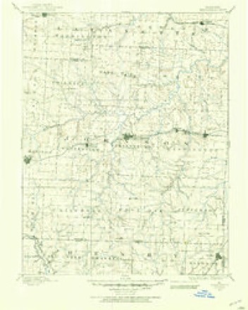
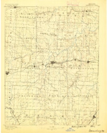
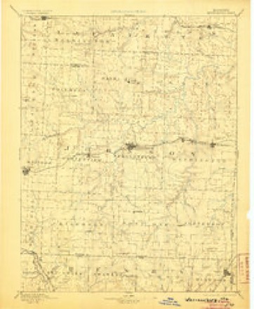
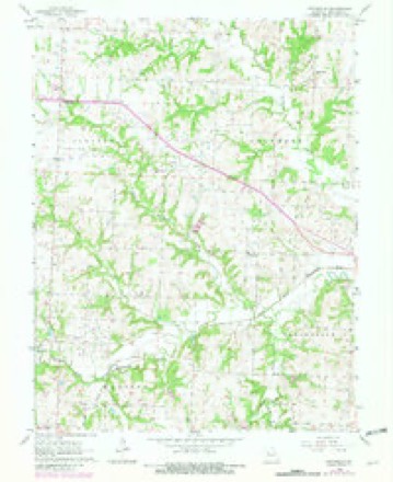
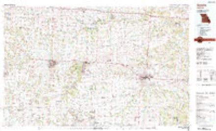
Topographic sheets covering this place
10 surveys from 19 printed sheetsMatched by testing this settlement's coordinate against the published boundary of every sheet in the United States Geological Survey's historical collection. Each opens the scanned sheet at the Survey.
- 1885 USGS Warrensburg quadrangle1:125000
- 1887 USGS Warrensburg quadrangle1:125000
- 1894 USGS Warrensburg quadrangle1:125000, 5 printings
- 1947 USGS Jefferson City quadrangle1:250000
- 1954 USGS Jefferson City quadrangle1:250000, 2 printings
- 1955 USGS Jefferson City quadrangle1:250000, 4 printings
- 1958 USGS Jefferson City quadrangle1:250000
- 1959 USGS Jefferson City quadrangle1:250000
- 1963 USGS Pittsville quadrangle1:24000, 2 printings
- 1983 USGS Sedalia quadrangle1:100000





In the county-history sources
30,364 words on this townshipThe History of Johnson County, Missouri : Including a Reliable History of the Townships, Cities, and Towns, Together with a Map of the County; a Condensed History of Missouri; the State Constitution; an Abstract of the Most Important Laws; the Physical Features of the County; the Early Settlers and Pioneers; the Political and War History; the Religious and Educational History...statistics and Miscellaneous Matters, Etc., Etc, published 1881 names this settlement in its chapter on Jackson Township. These are the passages that mention it, exactly as the scans read.
Mr. Hopper is one of the oldest settlers; is a native of Hamilton county East Tennessee; was born October 27, 1820. He lived in his place of nativity until, twenty years of age, then moved with his father, John Hop¬ per, to Missouri, in the spring of 1840; stopped a short time in Lafayette county, then moved, and settled in Johnson county, about midway between Chapel Hill, in Lafayette county, and Pittsville, in Johnson county, then known as Brushy Knob district. Here his father died, January 18, 1842. Excepting four years during the war, Wm. has always lived on the farm his father settled here. He was married to Miss Lettie M. Cobb, Janu¬ ary 4, 1844, and six children have been born to them, as follows: Eliza¬ beth J., Martha S., Meredeth W., Mandaville L., Sarah A. M. and Mary Rebecca, four of whom are living, the other two are dead. The son and two eldest daughters are married. His early education was not neglected, receiving for the most part his early training in the schools of Tennessee! His occupation has always been that of farmer and stock raiser. Prior to the war he was a member of the Methodist Episcopal church, South; since the war he has held no membership with any denomination. During the war he belonged to the M. S. M., and was under Colonel Nuget's command. He was in the noted battle of Lone Jack, August 16, 1862. At this battle, Mr. Hopper was strack by three bullets; one seered the back part of his hand, the second struck him squarely on the' knuckles, but being a spent ball, it did him little injury. The third played a freak - hy stnkin£ and glancing from the side of a building, near to which he was, in the act of loading his gun, and struck him on the back part of his head, knocking him sprawling on the face to the ground. However, he had nothing to do but get up again, though he was considerably shook up. He had a large cord tie round his hat, and singular as it may seem, this cord in this last shot, undoubtedly saved his life. It was tied in a knot behind, and the ball struck squarely upon the large knot; thus he received its force more as a blow, with the result already related. He was mustered out of the service in 1863. Staid in Ray county until the close of the war, then came back to the old homestead in Johnson county, where he has ever since resided. John Hopper, his father, was a native of North Carolina; was born 1789; was married to Miss Mary Davenport, a native of the same state, who was born 1793. They had nine children: Jane, Sarah, Elizabeth, James, William, John, David, and Robert; the last died in infancy, John Hopper died January 1842, and his wife March 3, 1876, at the extremely old age of eighty-three. She died in Johnson county, and at the time was one of the oldest
P. O. Pittsville, Jackson township; an enterprising farmer of this town¬ ship, was born in Rockingham county, North Carolina, February 27, 1824. Samuel Maxwell, his father, was a native of the same county and state. In 1844 he emigrated to Missouri, and settled in Lafayette county, and died the same year. A. G.'s mother was a native of North Carolina, and died in the same state, 1843. His grandfather, on his mother's side, was from Ireland. His grandfather on his father's side, was born in Pennsylvania, and was one of the pioneers of North Carolina. A. G., who is our subject, after the death of his father, set out in life for himself, engaging in farming, and was married to Miss Duley Harmon, daughter of Lewis Harmon, in 1857, in Lafayette county, where he remained until 1868, when he moved to Johnson county, and settled on his present farm of 200 acres of well improved land, with substantial buildings. Mrs. M. died in 1868, leaving four children: Cora A., Samuel L., Albert P. and Robert E. In 1878 Mr. M. again married Mrs. Susan F. Merrill, daughter of Joseph Smith. By this union were born two daughters: Minnie S; and Ethlene P. Mrs. M. had three children by her former husband: Joseph A., Flora A. and W. H. Merrill. Mr. Maxwell is a successful wheat grower, and among one of the best stock raisers in his township; is a man who has set a good example, and is much respected.
P. O. Pittsville. Among the enterprising citizens of Jackson township, may be mentioned Merideth Rice, who was boin in Madison county, Ky., April 11, 1825. His parents were both natives of Virginia. His father died in 1863. His mother died in 1862. Merideth, the subject of this sketch, came from Kentucky to Missouri in 1869, and settled in Johnson county, near where he lives at the present time. He was manied Aug. 25, 1868, to Miss Catherine A. Nelson, daughter of Archibald Nelson, of Green county, East Tennessee. Mr. Rice has a family of six children, viz: Minnie B., Charles L., Beauregard, Joseph, Laura S. and Merideth. Mr. R. has 120 acres of good land. He is a successful stock raiser and dealer, and while in Kentucky he drove horses, cattle and mules from Kentucky into Virginia, South Carolina, North Carolina, Georgia, Ala¬ bama and Florida. He was elected assessor of Jackson township, and served one term, giving general satisfaction. He was appointed consta¬ ble for the same township in the spring of 1877, and was elected to the same office in 1878, and re-elected in 1880. Mr. R. commenced his edu¬ cation at the subscription schools, and finished with a two years couise at the Richmond Seminary, Ky. He commenced his career with small cap¬ ital. Mrs. R. is a member of the M. E. church, south.
Machine-read from a century-old scan, so expect the errors a machine makes: misspelled names, dropped words, stray characters.
Read the whole chapter on Jackson Township - it names this place 6 more 6 times.
Fires near this place
50 since 2003Regional context, not property-specific evidence. The federal wildfire occurrence database lists 50 fires within 5 miles of Pittsville between 2003 and 2020, burning about 176 acres in total. None started naturally. None was recorded as arson. Distance is straight-line from the map coordinates, so a fire counted here may appear on a neighbouring settlement's page as well.
| Reported cause | Fires |
|---|---|
| Missing data/not specified/undetermined | 36 |
| Debris and open burning | 12 |
| Equipment and vehicle use | 2 |
The most recent of them, most recent first, with the day each was reported and the service that recorded it.
| Date | Cause | Size | Reported by | Name on the report |
|---|---|---|---|---|
| 4 August 2018 | Missing data/not specified/undetermined | under an acre | Missouri Department of Conservation | 177654-05130-08042018-1128 |
| 3 August 2018 | Debris and open burning | 4.2 acres | Missouri Department of Conservation | 177653-05130-08032018-1325 |
| 24 June 2016 | Equipment and vehicle use | 6.0 acres | Missouri Department of Conservation | 137813-05161-06242016-1442 |
| 3 May 2015 | Missing data/not specified/undetermined | under an acre | Missouri Department of Conservation | 123771-05161-05032015-1256 |
| 1 April 2003 | Debris and open burning | 1.0 acres | Missouri State Fire Marshal's Office | not named |
| 1 April 2003 | Debris and open burning | 1.0 acres | Missouri State Fire Marshal's Office | not named |
| 8 March 2015 | Missing data/not specified/undetermined | 6.0 acres | Missouri Department of Conservation | 119950-05161-03082015-1218 |
| 7 March 2004 | Missing data/not specified/undetermined | under an acre | Missouri State Fire Marshal's Office | not named |
Settlements close enough to share some of these fires:
Mines and quarries near this place
3 within 5 milesRegional context, not property-specific evidence. The federal mineral resources record lists 3 workings within 5 miles of Pittsville: 3 past producers. None of them still produces. What was taken out: Stone, Crushed/Broken. Distance is straight-line from the map coordinates, so a quarry counted here may appear on a neighbouring settlement's page as well.
| Where | Site | Commodity | Status | Recorded |
|---|---|---|---|---|
| Unknown - Ls. | Stone, Crushed/Broken | Past Producer | ||
| Unknown - Ls. | Stone, Crushed/Broken | Past Producer | ||
| Unknown - Ls. | Stone, Crushed/Broken | Past Producer |
Storms near this place
28 since 1993Regional context, not property-specific evidence. The National Weather Service names Pittsville in 28 storm reports between 1993 and 2024: 14 hail, 10 thunderstorm wind, 3 flash flood, 1 flood. No death or injury is recorded in these reports. Each account below is quoted exactly as the forecast office filed it, from the NOAA Storm Events Database, and each date opens the federal record of that event.
| When | Event | Place named | Harm | What the report says |
|---|---|---|---|---|
| August 1993 | Thunderstorm Wind | Pittsville | $5,000 | Several sheds were knocked down. |
| April 2011 | Thunderstorm Wind | Pittsville | $3,000 | Thunderstorm winds were estimated up to 60 mph, and caused downed powerlines. |
| May 2024 | Thunderstorm Wind | Pittsville | - | Social media report and photos of a carport displaced, multiple trees downed, and a tree down onto a roof at a property near Pittsville. |
| June 2018 | Thunderstorm Wind | Pittsville | - | Several large trees were damaged or downed near Pittsville. |
| July 2016 | Flood | Pittsville | - | Several roads across Johnson County Missouri were closed due to lingering flooding from heavy rain. |
| May 2010 | Flash Flood | Pittsville | - | Highway 131 at Highway 50, was closed due to flash flooding. |
| June 2007 | Flash Flood | Pittsville | - | Several roads were closed due to flooding. These included portions of Highway Z and Highway 2. |
| June 2005 | Thunderstorm Wind | Pittsville | - | Wind knocked over shed. |
| May 2001 | Thunderstorm Wind | Pittsville | - | Thunderstorm winds blew down several large trees. |
| April 2001 | Flash Flood | Pittsville | - | Law enforcement reported many roads flooded. Up to 2 inches of rain fell in 30 minutes. |
| April 1999 | Thunderstorm Wind | Pittsville | - | Trees down |
| June 1998 | Thunderstorm Wind | Pittsville | - | The Johnson County heriff's Office reported a wind gust to 70 MPH during a severe thunderstorm along Route W a mile west of Pittsville. |
| August 2022 | Hail | Pittsville | - | no account filed |
| April 2015 | Hail | Pittsville | - | no account filed |
| March 2015 | Hail | Pittsville | - | no account filed |
| February 2011 | Hail | Pittsville | - | no account filed |
| February 2011 | Hail | Pittsville | - | no account filed |
| May 2010 | Hail | Pittsville | - | no account filed |
| May 2010 | Hail | Pittsville | - | no account filed |
| June 2008 | Thunderstorm Wind | Pittsville | - | no account filed |
| February 2007 | Hail | Pittsville | - | no account filed |
| February 2007 | Hail | Pittsville | - | no account filed |
| May 2003 | Hail | Pittsville | - | no account filed |
| May 2002 | Hail | Pittsville | - | no account filed |
| May 2002 | Thunderstorm Wind | Pittsville | - | no account filed |
| April 2001 | Hail | Pittsville | - | no account filed |
| March 2000 | Hail | Pittsville | - | no account filed |
| September 2000 | Hail | Pittsville | - | no account filed |
Nearest settlements
The eight closest, with where each one stands in the county. Distances are straight-line, computed from the Geographic Names Information System coordinates.
| Map | Place | Distance | Sheets |
|---|---|---|---|
| Elm | 2.8 miles | 14 | |
| Fulkerson | 5.2 miles | 14 | |
| Columbus | 5.3 miles | 19 | |
| Kingsville | 8.5 miles | 14 | |
| Greendoor | 8.9 miles | 19 | |
| Holden | 9.4 miles | 18 | |
| Robbins | 10.4 miles | 19 | |
| Centerview | 10.6 miles | 19 |
Elsewhere
Matched on this settlement's Geographic Names Information System number rather than its name, so it cannot be a different place of the same name in another state.
| Wikipedia article on Pittsville | An encyclopaedic summary. Its text is share-alike, so it is linked here rather than copied. |
| Wikidata item Q27985524 | The structured record the population and elevation above come from. Public domain (CC0). |
Provenance
This settlement is recorded in the Geographic Names Information System as feature 724451. The sheet list is computed by point-in-boundary test against the United States Geological Survey's historical topographic inventory. Both are works of the United States government and carry no copyright under 17 U.S.C. 105.
Wildfire. Short, Karen C. 2022. Spatial wildfire occurrence data for the United States, 1992-2020 [FPA_FOD_20221014]. 6th Edition. Fort Collins, CO: Forest Service Research Data Archive. https://doi.org/10.2737/RDS-2013-0009.6 Collected with United States Government funding and usable without additional permissions or fees.
Mines and quarries. USGS Mineral Resources Data System (MRDS) https://mrdata.usgs.gov/mrds/ A work of the United States government, no copyright under 17 U.S.C. 105.
Storms. NOAA National Centers for Environmental Information, Storm Events Database https://www.ncei.noaa.gov/stormevents/ A work of the United States government, no copyright under 17 U.S.C. 105. Narratives are quoted verbatim from the National Weather Service report and are not edited or summarised.