 Block
Greenton, Missouri
17 topographic sheets cover this place, the earliest surveyed in 1889 and the latest in 1982. It stands in Clay Township. It lies in ZIP code area 64076. The Survey maps it on the Odessa North quadrangle.
Topographic sheets covering this place
8 surveys from 17 printed sheetsMatched by testing this settlement's coordinate against the published boundary of every sheet in the United States Geological Survey's historical collection. Each opens the scanned sheet at the Survey.
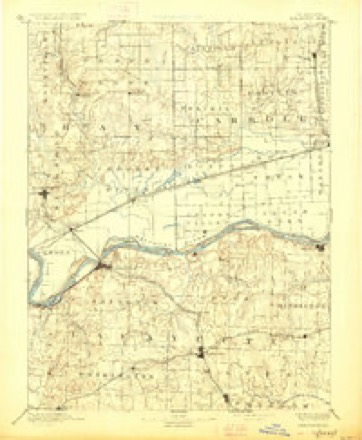
- 1889 USGS Lexington quadrangle1:125000, 6 printings
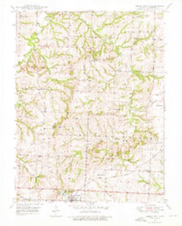
- 1949 USGS Odessa North quadrangle1:24000, 2 printings
- 1950 USGS Odessa North quadrangle1:24000, 2 printings
- 1953 USGS Moberly quadrangle1:250000
- 1954 USGS Moberly quadrangle1:250000, 3 printings
- 1957 USGS Moberly quadrangle1:250000
- 1960 USGS Moberly quadrangle1:250000
- 1982 USGS Marshall quadrangle1:100000




What happened here
An account from the chapter on Clay township. The inset identifies its exact source book and publication year.
Dark Deeds
Among the incidents worthy of here being recorded are the following: During the Civil war days James Johnson, who lived at Bates City, was killed by a band of "Kansas Jayhawkers," supposed to have been at the instigation of a negro, whom he had once whipped while acting as constable in his township. The act was forced upon him by law, but the dire spirit of revenge upon the part of the black man caused him to call upon these troops, who took Mr.
In the county-history sources
20,313 words on this townshipHistory of Lafayette County, Mo. , Carefully Written and Compiled from the Most Authentic Official and Private Sources, Including a History of Its Townships, Cities, Towns, and Villages, Together with a Condensed History of Missouri; the Constitution of the United States, and State of Missouri; a Military Record of Volunteers in Either Army of the Great Civil War .., published 1881 names this settlement in its chapter on Clay Township. These are the passages that mention it, exactly as the scans read.
Shortlv afterwards another settlement sprang into existence about two miles north of the present site of Greenton, of which John Whitsett, father of William Whitsett, of Washington township, was the first settler, he having purchased the previously entered claim of one Michael Ferrin. In the course of a vear or two he was joined by Nicholas Turner, Timothy Dunn, Elias Baker, William Hall, William and Elisha Evans.
According to the statement of Mr. Jesse Rankin, who was born March 20, 1792, in Person county, Kentucky, was a soldier of 1S12, and came to Lafavette county in [1835, where he still resides, Anselm Harner, Elias Barker, William and Allen Jennings, all from Tennessee: Joseph Green, Isaac Gann and Joseph White settled in Clay township previous to 1835. Dr. Ward, from Kentuckv, also settled there at about the same time and was one of the first physicians in that section. The Rev. Robert Sloan, who since died in Cass countv, was among the first school teachers there, having taught in a log school-house near the present site of Greenton.
The plat was filed for record August 23d, 1837, and recorded September 4th, of the same vear. The first house was built by Peter Wolfe, and he was owner of the first store in the town. The first school-house was built in the year 1843; the present school-house was built in the year 1850. The first school was taught by Richard Hales, in the year 1843; Dr. Wm. M. Boran was the first physician. The first religious service was held in the Old Union church, which was used by all denominations as a place of worship. Wellington contains about 380 inhabitants, and its various business comprises five stores, one blacksmith shop, one saddlery shop, one tin shop, one wagon and carpenter shop, and one commission merchant. The Missouri Pacific Narrow Gauge Railroad is running by this place, and has a good depot.
Machine-read from a century-old scan, so expect the errors a machine makes: misspelled names, dropped words, stray characters.
Read the whole chapter on Clay Township - it names this place 25 more 25 times.
Fires near this place
7 since 2005Regional context, not property-specific evidence. The federal wildfire occurrence database lists 7 fires within 5 miles of Greenton between 2005 and 2019, burning about 96 acres in total. None started naturally. 1 was recorded as arson. Distance is straight-line from the map coordinates, so a fire counted here may appear on a neighbouring settlement's page as well.
| Reported cause | Fires |
|---|---|
| Missing data/not specified/undetermined | 3 |
| Recreation and ceremony | 1 |
| Arson/incendiarism | 1 |
| Debris and open burning | 1 |
| Equipment and vehicle use | 1 |
The most recent of them, most recent first, with the day each was reported and the service that recorded it.
| Date | Cause | Size | Reported by | Name on the report |
|---|---|---|---|---|
| 5 April 2006 | Arson/incendiarism | 1.0 acres | Missouri State Fire Marshal's Office | not named |
| 2 April 2005 | Recreation and ceremony | 10 acres | Missouri State Fire Marshal's Office | not named |
| 29 March 2005 | Missing data/not specified/undetermined | 60 acres | Missouri State Fire Marshal's Office | not named |
| 10 March 2019 | Missing data/not specified/undetermined | under an acre | Missouri Department of Conservation | 178276-05441-03102019-1323 |
| 22 October 2019 | Missing data/not specified/undetermined | under an acre | Missouri Department of Conservation | 179463-05441-10222019-1450 |
| 2 October 2018 | Equipment and vehicle use | 5.4 acres | Missouri Department of Conservation | 177733-05440-10022018-1627 |
| 10 January 2018 | Debris and open burning | 19 acres | Missouri Department of Conservation | 177732-05440-01102018-1929 |
Settlements close enough to share some of these fires:
Mines and quarries near this place
10 of 11 shownRegional context, not property-specific evidence. The federal mineral resources record lists 11 workings within 5 miles of Greenton: 11 past producers. None of them still produces. What was taken out: Stone, Crushed/Broken. Distance is straight-line from the map coordinates, so a quarry counted here may appear on a neighbouring settlement's page as well.
| Where | Site | Commodity | Status | Recorded |
|---|---|---|---|---|
| Horstman Quarry | Stone, Crushed/Broken | Past Producer | ||
| Jim Thurman Quarry | Stone, Crushed/Broken | Past Producer | ||
| Unknown | Stone, Crushed/Broken | Past Producer | ||
| Unknown | Stone, Crushed/Broken | Past Producer | ||
| Unknown | Stone, Crushed/Broken | Past Producer | ||
| Unknown | Stone, Crushed/Broken | Past Producer | ||
| Unknown | Stone, Crushed/Broken | Past Producer | ||
| Unknown | Stone, Crushed/Broken | Past Producer | ||
| Unknown | Stone, Crushed/Broken | Past Producer | ||
| Unknown | Stone, Crushed/Broken | Past Producer |
Nearest settlements
The eight closest, with where each one stands in the county. Distances are straight-line, computed from the Geographic Names Information System coordinates.
| Map | Place | Distance | Sheets |
|---|---|---|---|
| Odessa | 3.5 miles | 18 | |
| Wellington | 6.0 miles | 17 | |
| Bates City | 6.4 miles | 19 | |
| Waterloo | 6.9 miles | 21 | |
| Mayview | 7.1 miles | 16 | |
| Lake Lafayette | 7.1 miles | 18 | |
| Napoleon | 8.0 miles | 21 | |
| Oakland (historical) | 8.6 miles | 19 |
Provenance
This settlement is recorded in the Geographic Names Information System as feature 739641. The sheet list is computed by point-in-boundary test against the United States Geological Survey's historical topographic inventory. Both are works of the United States government and carry no copyright under 17 U.S.C. 105.
Wildfire. Short, Karen C. 2022. Spatial wildfire occurrence data for the United States, 1992-2020 [FPA_FOD_20221014]. 6th Edition. Fort Collins, CO: Forest Service Research Data Archive. https://doi.org/10.2737/RDS-2013-0009.6 Collected with United States Government funding and usable without additional permissions or fees.
Mines and quarries. USGS Mineral Resources Data System (MRDS) https://mrdata.usgs.gov/mrds/ A work of the United States government, no copyright under 17 U.S.C. 105.