 Block
Napoleon, Missouri
21 topographic sheets cover this place, the earliest surveyed in 1894 and the latest in 1983. It stands in Clay Township. It lies in ZIP code area 64074. It stands on Hicklin Branch. The Survey maps it on the Camden quadrangle. 211 people lived here at the 2020 count. It stands 748 feet above sea level.
Population over time
2 figuresNapoleon fell from 222 to 211 between 2010 and 2020. These are the recorded population figures Wikidata holds for this place, reached through the Geographic Names Information System number this page is keyed on rather than by name, so they belong to this place and not to another of the same name. Most are census counts, but not all are: an early figure may be a founding or settlement estimate, and an estimate published within five years of a census is left out. The change column is computed, and is left blank where more than 20 years separate a figure from the one before it, because a gap that long is not a change between two counts.
| Year | People | Change |
|---|---|---|
| 2010 | 222 | |
| 2020 | 211 | -11 (-5%) |
Topographic sheets covering this place
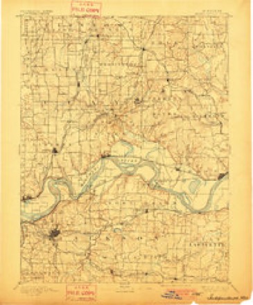
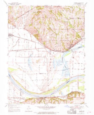
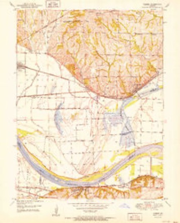
8 surveys from 21 printed sheetsMatched by testing this settlement's coordinate against the published boundary of every sheet in the United States Geological Survey's historical collection. Each opens the scanned sheet at the Survey.
- 1894 USGS Independence quadrangle1:125000, 5 printings
- 1950 USGS Camden quadrangle1:24000, 4 printings
- 1950 USGS Kansas City quadrangle1:250000
- 1951 USGS Camden quadrangle1:24000, 2 printings
- 1954 USGS Kansas City quadrangle1:250000
- 1956 USGS Kansas City quadrangle1:250000, 4 printings
- 1960 USGS Kansas City quadrangle1:250000, 3 printings
- 1983 USGS Kansas City quadrangle1:100000




What happened here
An account from the chapter on Clay township. The inset identifies its exact source book and publication year.
Dark Deeds
Among the incidents worthy of here being recorded are the following: During the Civil war days James Johnson, who lived at Bates City, was killed by a band of "Kansas Jayhawkers," supposed to have been at the instigation of a negro, whom he had once whipped while acting as constable in his township. The act was forced upon him by law, but the dire spirit of revenge upon the part of the black man caused him to call upon these troops, who took Mr.
In the county-history sources
20,313 words on this townshipHistory of Lafayette County, Mo. , Carefully Written and Compiled from the Most Authentic Official and Private Sources, Including a History of Its Townships, Cities, Towns, and Villages, Together with a Condensed History of Missouri; the Constitution of the United States, and State of Missouri; a Military Record of Volunteers in Either Army of the Great Civil War .., published 1881 names this settlement in its chapter on Clay Township. These are the passages that mention it, exactly as the scans read.
The Methodist Episcopal Church South, of Wellington, was organized in the year 1850, with the following members: Morley Arnold, Melissa Arnold, Affiah Arnold, Nancy Cundift, Thomas Bryant, Cornelia A. Corn, Elizabeth Crews, John A. Mahan, Cynthia M. Mahan, Sarah Bryant, Susan Duck, P. Ferrell, Eliza Ferrell, George W. Ferrell, Man- Lewis, Barbara Carr. A brick church was built in the year 1853, at a cost of $2,500, and dedicated in 1854, by Bishop John Early. The ministers in charge have been J. L. Porter, P. O. Clayton, Ephraim Wagoner, Wm. M. Leftwick, H. W. Webster, J. R. Bennett, John R. Murphy, Wallace Potsman, Newton Cordon, W. F. Truslow, Rev. Bedsworth, John Shackleford, Wm. Pitts, Wm. M. Bewley, Preston Phillips, and L. W. Pierce. The number of present membership is 65, and with the exception of the time during the war have held services regular.
Napoleon is situated in the Northwestern part of Lafayette county, twelve miles west of Lexington on the Missouri river and on the line of the Missouri Pacific Narrow Gauge railroad. The original plat was laid out in the year 1836, by Wm. Ish, Nathaniel Tucker and others. It was previously known as " Poston's Landing. " Samuels & Ish opened the first business house, followed by John A. Poston in the dry-goods and grocery trade. During the money crisis in 1837 the town was abandoned. Then in the year 1854 Dr. James Belt went to the place and found the lines of the town obliterated. All that remained of the town was two houses, one log dwelling partlv demolished, and one log store. Dr. Belt began to improve the town and called it Lisbon. However, the Post Office maintained the original name, Napoleon. Napoleon has a natural landing on the Missouri river for steamboats, and more wheat, stock and other merchandise are shipped from Napoleon than any other point on the Narrow Gauge Rail Road between Independence and Lexington.
A stave and heading factory with saw mill combined was established by Crary Bros, in 1876, in Napoleon, twelve miles west of Lexington and thirty miles east of Kansas City on the Narrow Gauge railroad. The building is a frame, 70x35, with engine room containing engine of 80 horse power, 25x35, and a kiln connected built of brick. The capital invested in buildings is $1,500; in machinery, $8,000; in raw material,
Machine-read from a century-old scan, so expect the errors a machine makes: misspelled names, dropped words, stray characters.
Read the whole chapter on Clay Township - it names this place 25 more 25 times.
Fires near this place
11 since 1992Regional context, not property-specific evidence. The federal wildfire occurrence database lists 11 fires within 5 miles of Napoleon between 1992 and 2020, burning about 48 acres in total. None started naturally. None was recorded as arson. Distance is straight-line from the map coordinates, so a fire counted here may appear on a neighbouring settlement's page as well.
| Reported cause | Fires |
|---|---|
| Debris and open burning | 8 |
| Missing data/not specified/undetermined | 3 |
The most recent of them, most recent first, with the day each was reported and the service that recorded it.
| Date | Cause | Size | Reported by | Name on the report |
|---|---|---|---|---|
| 30 April 1992 | Debris and open burning | 3.0 acres | Missouri Department of Conservation | not named |
| 30 April 1992 | Debris and open burning | 5.0 acres | Missouri Department of Conservation | not named |
| 30 April 1992 | Debris and open burning | 12 acres | Missouri Department of Conservation | not named |
| 30 April 1992 | Debris and open burning | 2.0 acres | Missouri Department of Conservation | not named |
| 30 April 1992 | Debris and open burning | 1.0 acres | Missouri Department of Conservation | not named |
| 23 April 2018 | Debris and open burning | 4.3 acres | Missouri Department of Conservation | 176663-04828-04232018-1634 |
| 15 April 2020 | Debris and open burning | under an acre | Missouri Department of Conservation | 190461-04828-04152020-1420 |
| 13 April 2019 | Debris and open burning | under an acre | Missouri Department of Conservation | 178716-04828-04132019-1705 |
Settlements close enough to share some of these fires:
Mines and quarries near this place
3 within 5 milesRegional context, not property-specific evidence. The federal mineral resources record lists 3 workings within 5 miles of Napoleon: 3 past producers. None of them still produces. What was taken out: Stone, Crushed/Broken, Stone, Dimension. Distance is straight-line from the map coordinates, so a quarry counted here may appear on a neighbouring settlement's page as well.
| Where | Site | Commodity | Status | Recorded |
|---|---|---|---|---|
| Breuer Qsuarry | Stone, Dimension | Past Producer | ||
| Prock Quarry | Stone, Crushed/Broken | Past Producer | ||
| Unknown | Stone, Crushed/Broken | Past Producer |
Storms near this place
25 since 2005Regional context, not property-specific evidence. The National Weather Service names Napoleon in 25 storm reports between 2005 and 2025: 9 flood, 6 hail, 6 thunderstorm wind, 2 flash flood. No death or injury is recorded in these reports. Each account below is quoted exactly as the forecast office filed it, from the NOAA Storm Events Database, and each date opens the federal record of that event.
| When | Event | Place named | Harm | What the report says |
|---|---|---|---|---|
| March 2025 | Thunderstorm Wind | Napoleon | - | Downed wires near Old Santa Fe Trail. |
| September 2025 | Thunderstorm Wind | Napoleon | - | Social media report of downed tree limbs on U.S. Highway 24 near Napoleon. Utility company reported tree and wire damage in this area as well. |
| March 2024 | Hail | Napoleon | - | Two inch hail was reported just south of US Highway 24 about 2 miles SSW of Napoleon. |
| May 2024 | Thunderstorm Wind | Napoleon | - | Downed wires and power outages near Old Santa Fe Trail. |
| May 2024 | Tornado (EF0) | Napoleon | - | An EF0 tornado developed from the same mesovortex that produced the Grain Valley tornado a few minutes later. The tornado began north of Oak Grove, damaging trees at several farm residences along Hudnall Road and Doris Neer Road in far eastern Jackson County. The tornado moved northeast in northwestern Lafayette County, uprooting a tree along Old Santa Fe Trail and damaging several others northeast to State Highway 24. Utility wires were damaged by the tornado along the highway as well. The tornado then moved northeast, crossing Chestnut Street south of Napoleon. An outbuilding was damaged, and several trees were downed or snapped near their tops along this stretch. The tornado appears to have dissipated as it approached Napoleon, with only minor damage to tree limbs observed south of State Highway 224. |
| May 2019 | Flood | Napoleon | - | Highway D was closed in both directions. |
| July 2017 | Flood | Napoleon | - | Numerous roads were closed across Lafayette County. Route FF near HWY D was closed in both directions between Bates City and Odessa. Missouri HWY 224 was closed in both directions west of Lexington. Missouri HWY 13 was closed in both directions near Page City Road. |
| July 2017 | Flash Flood | Napoleon | - | According to the fire department and emergency management of Lafayette County, several roads were under water due to heavy rain induced flash flooding. |
| June 2017 | Tornado (EF0) | Napoleon | - | A tornado formed in western Lafayette County late in the evening of June 17, 2017 just north of Bates City and west of Mayview. This tornado remained mostly over rural portions of Lafayette County and caused mostly minor damage to some residences as well as snapping trunks of a few large trees. |
| July 2016 | Thunderstorm Wind | Napoleon | - | Large tree branches of unknown size or condition were down in Napoleon. |
| April 2014 | Thunderstorm Wind | Napoleon | - | Several trees down or split, one barn leaning and one destroyed. Also, a two day old calf was missing. |
| July 2010 | Flood | Napoleon | - | Ponding of water was reported on several roads, such as Mountain View Road, Highway D, and Highway F. These roads had to be closed in several locations. |
| June 2007 | Flood | Napoleon | - | The Missouri River at Napolean crested at 18.13 feet, or 1.13 feet above flood stage. |
| September 2007 | Thunderstorm Wind | Napoleon | - | Multiple trees down near the intersection of Hwy's 224 and D. One reported to be blocking the roadway near Napoleon. |
| May 2007 | Flood | Napoleon | - | The Missouri River at Napoean crested at 17.27 feet, or 0.27 feet above flood stage. |
| May 2007 | Flood | Napoleon | - | The Missouri River near Napolean crested at 21.69 feet, or 4.69 feet above flood stage. |
| May 2007 | Flood | Napoleon | - | The Missouri River near Napolean on May 9th, had its highest crest ever at 28.86 feet, or 11.86 feet above flood stage. |
| October 2007 | Flood | Napoleon | - | The Missouri River at Napolean crested at 17.74 feet, or 0.74 feet above flood stage. |
| October 2007 | Flood | Napoleon | - | The Missouri River at Napolean crested at 17.23 feet, or 0.23 feet above flood stage. |
| June 2005 | Flash Flood | Napoleon | - | Highway D closed south of Napolean due to flooding. |
| May 2009 | Hail | Napoleon | - | no account filed |
| May 2009 | Hail | Napoleon | - | no account filed |
| April 2008 | Hail | Napoleon | - | no account filed |
| June 2008 | Hail | Napoleon | - | no account filed |
| May 2005 | Hail | Napoleon | - | no account filed |
Nearest settlements
The eight closest, with where each one stands in the county. Distances are straight-line, computed from the Geographic Names Information System coordinates.
| Map | Place | Distance | Sheets |
|---|---|---|---|
| Waterloo | 1.9 miles | 21 | |
| Wellington | 4.7 miles | 17 | |
| Greenton | 8.0 miles | 17 | |
| Bates City | 8.6 miles | 19 | |
| Myrick | 9.4 miles | 17 | |
| Lexington | 10.8 miles | 17 | |
| Odessa | 11.0 miles | 18 | |
| Mayview | 13.8 miles | 16 |
Elsewhere
Matched on this settlement's Geographic Names Information System number rather than its name, so it cannot be a different place of the same name in another state.
| Wikipedia article on Napoleon | An encyclopaedic summary. Its text is share-alike, so it is linked here rather than copied. |
| Wikidata item Q958465 | The structured record the population and elevation above come from. Public domain (CC0). |
Provenance
This settlement is recorded in the Geographic Names Information System as feature 723115. The sheet list is computed by point-in-boundary test against the United States Geological Survey's historical topographic inventory. Both are works of the United States government and carry no copyright under 17 U.S.C. 105.
Wildfire. Short, Karen C. 2022. Spatial wildfire occurrence data for the United States, 1992-2020 [FPA_FOD_20221014]. 6th Edition. Fort Collins, CO: Forest Service Research Data Archive. https://doi.org/10.2737/RDS-2013-0009.6 Collected with United States Government funding and usable without additional permissions or fees.
Mines and quarries. USGS Mineral Resources Data System (MRDS) https://mrdata.usgs.gov/mrds/ A work of the United States government, no copyright under 17 U.S.C. 105.
Storms. NOAA National Centers for Environmental Information, Storm Events Database https://www.ncei.noaa.gov/stormevents/ A work of the United States government, no copyright under 17 U.S.C. 105. Narratives are quoted verbatim from the National Weather Service report and are not edited or summarised.