 Block
Mayview, Missouri
16 topographic sheets cover this place, the earliest surveyed in 1889 and the latest in 1982. It stands in Washington Township. It lies in ZIP code area 64071. The Survey maps it on the Mayview quadrangle. 208 people lived here at the 2020 count. It stands 899 feet above sea level.
Topographic sheets covering this place
8 surveys from 16 printed sheetsMatched by testing this settlement's coordinate against the published boundary of every sheet in the United States Geological Survey's historical collection. Each opens the scanned sheet at the Survey.
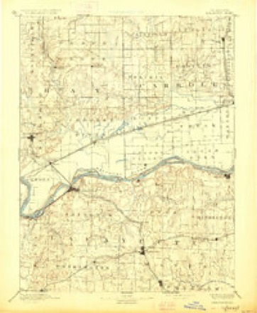
- 1889 USGS Lexington quadrangle1:125000, 6 printings
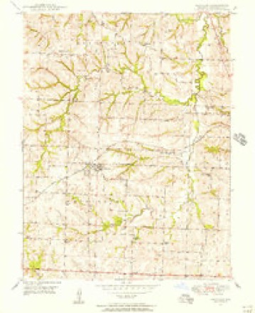
- 1949 USGS Mayview quadrangle1:24000, 2 printings
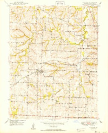
- 1950 USGS Mayview quadrangle1:24000
- 1953 USGS Moberly quadrangle1:250000
- 1954 USGS Moberly quadrangle1:250000, 3 printings
- 1957 USGS Moberly quadrangle1:250000
- 1960 USGS Moberly quadrangle1:250000
- 1982 USGS Marshall quadrangle1:100000




What happened here
An account from the chapter on Washington township. The inset identifies its exact source book and publication year.
Wm. T. Gammon
The subject of the following sketch is a native of Pocahontas county, W. Va.; born August 6, 1826. Was raised and educated there. In 1861 he enlisted in the confederate army, joining the 25th Virginia Regiment. Was elected captain of his company. At the battle of Cross Keys, June 8, 1862, he was severely wounded, and failing to improve where he was, he went to Georgia for the purpose of recruiting his health.
In the county-history sources
9,416 words on this townshipHistory of Lafayette County, Mo. , Carefully Written and Compiled from the Most Authentic Official and Private Sources, Including a History of Its Townships, Cities, Towns, and Villages, Together with a Condensed History of Missouri; the Constitution of the United States, and State of Missouri; a Military Record of Volunteers in Either Army of the Great Civil War .., published 1881 names this settlement in its chapter on Washington Township. These are the passages that mention it, exactly as the scans read.
The subject of the following sketch is a native of Bourbon county, Kentucky, and at the age of six years came with his parents to Lafayette county, where he has resided ever since, engaged in farming since arriving at his majority. April 18th, 1867, he married Miss Mary, daughter of John Young, and grand-daughter of Col. James Young, of Lafayette county. They have five children living: James Y., George R., Stoddard F., Upton B. and William. Mr. Smith is a member of the Christian church, and Mrs. Smith of the Cumberland Presbyterian church. In 1862 Mr. S. enlisted in the confederate service, Capt. Wither's company, Col. Elliott's regiment. He served four months and was in the battle of Lexington. He has a good record as a soldier, and stands high in the esteem of his fellows. Post-office, Mayview.
Mr. Tiefel was born in Bavaria, Germany, in 1828, where he lived until 1847, when he came with his parents to the United States, and settled in Ohio. He remained there until November, 1865, when he removed to Lafayette county, where he now lives, engaged in farming. Mr. Tiefel was united in marriage to Miss Barbara Smith, of Ohio, by whom he has eight children. Is a member of the Lutheran church. He is a fit representative of that class of Germans who are noted for industry and economy, and by continuous application of these two qualities he has been eminently successful in business, securing for himself a fine farm of 320 acres and a comfortable home for his family. Postoffice, Mayview.
The subject of this sketch was born in Lafa}-ette county, in 1840. Has been a continuous resident of this county since his birth, obtaining as liberal an education in the meantime, as the limited school facilties of the county in that dav would permit. At the present time he is actively engaged in farming and stockraising. He was married in 1859, to Miss Dorinda Hatton, of Johnson county. Thirteen children have been born to them, ten of whom are now living. Mr. Powell enlisted in 1862, in the enrolled Mo. milita, under Capt. Summers. He served eighteen months. He is the son of Richard Powell, who was the first settler of Washington township. Is an active member of the Christian church. His P. O. is Lexington.
Machine-read from a century-old scan, so expect the errors a machine makes: misspelled names, dropped words, stray characters.
Read the whole chapter on Washington Township - it names this place 18 more 18 times.
Fires near this place
24 since 1995Regional context, not property-specific evidence. The federal wildfire occurrence database lists 24 fires within 5 miles of Mayview between 1995 and 2020, burning about 159 acres in total. None started naturally. None was recorded as arson. Distance is straight-line from the map coordinates, so a fire counted here may appear on a neighbouring settlement's page as well.
| Reported cause | Fires |
|---|---|
| Missing data/not specified/undetermined | 12 |
| Debris and open burning | 9 |
| Equipment and vehicle use | 2 |
| Smoking | 1 |
The most recent of them, most recent first, with the day each was reported and the service that recorded it.
| Date | Cause | Size | Reported by | Name on the report |
|---|---|---|---|---|
| 22 September 2018 | Debris and open burning | 4.8 acres | Missouri Department of Conservation | 177731-05440-09222018-1823 |
| 22 August 2016 | Missing data/not specified/undetermined | 1.0 acres | Missouri Department of Conservation | 142911-02459-08222016-1040 |
| 13 August 2015 | Missing data/not specified/undetermined | 1.0 acres | Missouri Department of Conservation | 129856-05438-08132015-1915 |
| 8 June 2018 | Debris and open burning | under an acre | Missouri Department of Conservation | 178152-05438-06082018-1707 |
| 7 June 2018 | Smoking | 1.6 acres | Missouri Department of Conservation | 177730-05440-06072018-1010 |
| 5 June 2020 | Debris and open burning | under an acre | Missouri Department of Conservation | 220641-05438-06052020-1204 |
| 28 June 2015 | Missing data/not specified/undetermined | 1.5 acres | Missouri Department of Conservation | 129854-05438-06282015-1155 |
| 10 May 2016 | Missing data/not specified/undetermined | 1.0 acres | Missouri Department of Conservation | 139133-02459-05102016-1727 |
Settlements close enough to share some of these fires:
Mines and quarries near this place
4 within 5 milesRegional context, not property-specific evidence. The federal mineral resources record lists 4 workings within 5 miles of Mayview: 4 past producers. None of them still produces. What was taken out: Stone, Crushed/Broken. Distance is straight-line from the map coordinates, so a quarry counted here may appear on a neighbouring settlement's page as well.
| Where | Site | Commodity | Status | Recorded |
|---|---|---|---|---|
| Horstman Quarry | Stone, Crushed/Broken | Past Producer | ||
| Unknown | Stone, Crushed/Broken | Past Producer | ||
| Unknown | Stone, Crushed/Broken | Past Producer | ||
| Unknown | Stone, Crushed/Broken | Past Producer |
Storms near this place
11 since 2000Regional context, not property-specific evidence. The National Weather Service names Mayview in 11 storm reports between 2000 and 2024: 6 hail, 3 thunderstorm wind, 1 funnel cloud, 1 tornado. No death or injury is recorded in these reports. Each account below is quoted exactly as the forecast office filed it, from the NOAA Storm Events Database, and each date opens the federal record of that event.
| When | Event | Place named | Harm | What the report says |
|---|---|---|---|---|
| July 2000 | Thunderstorm Wind | Mayview | $10,000 | Storm spotters reported downed trees and power lines, and damage to a roof. |
| June 2024 | Thunderstorm Wind | Mayview | - | Measured gusts up to 60 mph near Interstate 70 and Highway 13. |
| March 2017 | Tornado (EF1) | Mayview | - | The embedded supercell that produced several tornadoes in eastern Kansas through Jackson County Missouri produced a brief tornado in Mayview where several structures were damaged, the most of which was some garage door and external wall damage to a residence in Mayview. |
| July 2004 | Thunderstorm Wind | Mayview | - | Cars blown off road at Mayview exit along Interstate 70. |
| August 2017 | Hail | Mayview | - | no account filed |
| April 2016 | Hail | Mayview | - | no account filed |
| April 2015 | Hail | Mayview | - | no account filed |
| July 2015 | Hail | Mayview | - | no account filed |
| May 2011 | Funnel Cloud | Mayview | - | no account filed |
| May 2011 | Hail | Mayview | - | no account filed |
| April 2001 | Hail | Mayview | - | no account filed |
Nearest settlements
The eight closest, with where each one stands in the county. Distances are straight-line, computed from the Geographic Names Information System coordinates.
| Map | Place | Distance | Sheets |
|---|---|---|---|
| Fortyville (historical) | 3.5 miles | 16 | |
| Simpson | 4.8 miles | 15 | |
| Oakland (historical) | 6.0 miles | 19 | |
| Higginsville | 6.2 miles | 15 | |
| Greenton | 7.1 miles | 17 | |
| Page City | 7.3 miles | 17 | |
| Odessa | 7.5 miles | 18 | |
| Aullville | 8.4 miles | 15 |
Elsewhere
Matched on this settlement's Geographic Names Information System number rather than its name, so it cannot be a different place of the same name in another state.
| Wikipedia article on Mayview | An encyclopaedic summary. Its text is share-alike, so it is linked here rather than copied. |
| Wikidata item Q965405 | The structured record the population and elevation above come from. Public domain (CC0). |
Provenance
This settlement is recorded in the Geographic Names Information System as feature 730144. The sheet list is computed by point-in-boundary test against the United States Geological Survey's historical topographic inventory. Both are works of the United States government and carry no copyright under 17 U.S.C. 105.
Wildfire. Short, Karen C. 2022. Spatial wildfire occurrence data for the United States, 1992-2020 [FPA_FOD_20221014]. 6th Edition. Fort Collins, CO: Forest Service Research Data Archive. https://doi.org/10.2737/RDS-2013-0009.6 Collected with United States Government funding and usable without additional permissions or fees.
Mines and quarries. USGS Mineral Resources Data System (MRDS) https://mrdata.usgs.gov/mrds/ A work of the United States government, no copyright under 17 U.S.C. 105.
Storms. NOAA National Centers for Environmental Information, Storm Events Database https://www.ncei.noaa.gov/stormevents/ A work of the United States government, no copyright under 17 U.S.C. 105. Narratives are quoted verbatim from the National Weather Service report and are not edited or summarised.