 Block
Hallsville, Missouri
18 topographic sheets cover this place, the earliest surveyed in 1890 and the latest in 1985. It stands in Rocky Fork Township. It lies in ZIP code area 65255. The Survey maps it on the Hallsville quadrangle. 1,614 people lived here at the 2020 count. It stands 902 feet above sea level.
On record in Hallsville
Buildings and businesses the archive holds for this place. Each opens its own page, with the source record it came from.
On the National Register 1 record
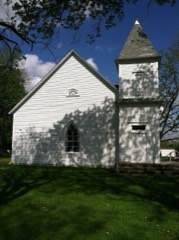 Mount Zion Church and Cemeterylisted 2013
Population over time
2 figuresHallsville grew from 1,491 to 1,614 between 2010 and 2020. These are the recorded population figures Wikidata holds for this place, reached through the Geographic Names Information System number this page is keyed on rather than by name, so they belong to this place and not to another of the same name. Most are census counts, but not all are: an early figure may be a founding or settlement estimate, and an estimate published within five years of a census is left out. The change column is computed, and is left blank where more than 20 years separate a figure from the one before it, because a gap that long is not a change between two counts.
| Year | People | Change |
|---|---|---|
| 2010 | 1,491 | |
| 2020 | 1,614 | +123 (+8%) |
Topographic sheets covering this place
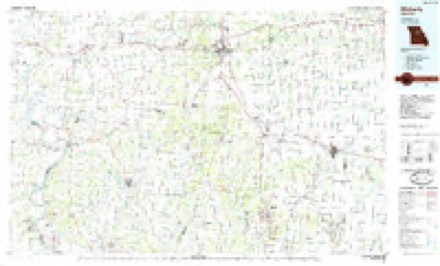
8 surveys from 18 printed sheetsMatched by testing this settlement's coordinate against the published boundary of every sheet in the United States Geological Survey's historical collection. Each opens the scanned sheet at the Survey.
- 1890 USGS Moberly quadrangle1:125000, 6 printings
- 1945 USGS Centralia quadrangle1:62500, 2 printings
- 1953 USGS Moberly quadrangle1:250000
- 1954 USGS Moberly quadrangle1:250000, 3 printings
- 1957 USGS Moberly quadrangle1:250000
- 1960 USGS Moberly quadrangle1:250000
- 1969 USGS Hallsville quadrangle1:24000, 2 printings
- 1985 USGS Moberly quadrangle1:100000, 2 printings




What happened here
An account from the chapter on Rocky Fork township. The inset identifies its exact source book and publication year.
History Op Boone Cottntt Miscellaneous
About twenty years since Mr. Wm. Watts was accidently shot and killed. The incident happened in the eastern part of this township. He and another man named Watkins were herding cattle, and while the two were carelessly handling a gun it was accidentally discharged and Watts was killed.
In the county-history sources
20,830 words on this townshipHistory of Boone County, Missouri, published 1882 names this settlement in its chapter on Rocky Fork Township. These are the passages that mention it, exactly as the scans read.
James Turner came from Kentucky in 1817, and located on a farm near Hallsville. He brought up a large family. His sons were Jesse, Tom and Enoch. Thomas Turner was the father of Mordecai, who lives east of Hallsville.
Passage source: History of Boone County, Missouri, published 1882.
Isaac Davis came from Christian county, Kentucky, to this part of Missouri in 1818, and settled two miles east of Hallsville. His sons were James, Henry, Isaac, Benjamin, John and Joseph. One of Isaac's sons, Joseph, now lives on the old Davis homestead.
Passage source: History of Boone County, Missouri, published 1882.
Other early settlers were J. D. Bratton, Dr. Points, Allen Rouse, Alfred Rouse, Mr. Carter, Wni. Thornton, Roily and Calvin Asbury and Abraham Waldou. Barney Dickerson was here as early as 1817. He lived on a farm east of Hallsville, He is still living, but is old
Passage source: History of Boone County, Missouri, published 1882.
Machine-read from a century-old scan, so expect the errors a machine makes: misspelled names, dropped words, stray characters.
Read the whole chapter on Rocky Fork Township - it names this place 14 more 14 times.
Mines and quarries near this place
2 within 5 milesRegional context, not property-specific evidence. The federal mineral resources record lists 2 workings within 5 miles of Hallsville: 2 past producers. None of them still produces. What was taken out: Stone, Crushed/Broken. Distance is straight-line from the map coordinates, so a quarry counted here may appear on a neighbouring settlement's page as well.
| Where | Site | Commodity | Status | Recorded |
|---|---|---|---|---|
| Unknown - Ls. | Stone, Crushed/Broken | Past Producer | ||
| Unknown - Ls. | Stone, Crushed/Broken | Past Producer |
Storms near this place
42 since 1995Regional context, not property-specific evidence. The National Weather Service names Hallsville in 42 storm reports between 1995 and 2025: 24 hail, 15 thunderstorm wind, 1 funnel cloud, 1 flash flood. No death or injury is recorded in these reports. Each account below is quoted exactly as the forecast office filed it, from the NOAA Storm Events Database, and each date opens the federal record of that event.
| When | Event | Place named | Harm | What the report says |
|---|---|---|---|---|
| June 2018 | Lightning | Hallsville | $50,000 | Two structures in town were struck by lightning. Both structures sustained damage from fires caused by the lightning strikes. No injuries were reported. |
| July 2008 | Thunderstorm Wind | Hallsville | $3,000 | A large section of roof was blown off of a storage building in Hallsville. The debris was deposited about 100 feet away. |
| July 2025 | Thunderstorm Wind | Hallsville | - | Thunderstorm winds knocked over a large tree. The tree blocked the roadway at Highway 124 and Barnes School Road. |
| June 2024 | Thunderstorm Wind | Hallsville | - | Thunderstorm winds knocked a tree onto a moving vehicle on Route B near Highway OO n Hallsville. Also in Hallsville, large tree branches snapped from a tree and a tree fell on a house, trapping occupants inside. No one was injured. Power was reportedly out for all of Hallsville. In Columbia, medium to large tree limbs were snapped and there were pockets of power outages in the City Utility District. |
| March 2017 | Thunderstorm Wind | Hallsville | - | Thunderstorm winds blew down numerous large tree limbs around town. |
| March 2011 | Thunderstorm Wind | Hallsville | - | Several power poles were blown down on Highway 124 between Hallsville and Centralia. |
| June 2011 | Thunderstorm Wind | Hallsville | - | Thunderstorm winds blew down several power lines. |
| June 2009 | Thunderstorm Wind | Hallsville | - | Several trees were blown down around town. |
| July 2008 | Thunderstorm Wind | Hallsville | - | Thunderstorm winds blew down several trees in Hallsville. |
| July 2008 | Flash Flood | Hallsville | - | Between 2 and 3 inches of rain fell in a short amount of time on already saturated soils causing flash flooding. Several roads in the Hallsville area were flooded. |
| July 2006 | Thunderstorm Wind | Hallsville | - | Several trees were blown down onto Hwy Z about half a mile south of the intersection of Hwy Z and Hwy OO. |
| May 2005 | Hail | Hallsville | - | Emergency management officials reported hail up to baseball size in Hallsville. Some roofs and automobiles were damaged. |
| June 2004 | Thunderstorm Wind | Hallsville | - | Thunderstorm wind gusts downed some large tree branches and power lines. |
| May 2003 | Funnel Cloud | Hallsville | - | A University of Missouri Storm Chaser reported a funnel cloud west of Hallsville. |
| May 2003 | Hail | Hallsville | - | The County Sheriff Department reported 1 inch hail. |
| June 2002 | Hail | Hallsville | - | The County Sheriff Department reported 3/4 inch hail. |
| February 2000 | Hail | Hallsville | - | Storm spotters reported 1 inch hail. |
| March 2000 | Thunderstorm Wind | Hallsville | - | Thunderstorm wind gusts caused damage from Hallsville east along Old Highway 124 to Highway Z. About 6 homes suffered minor roof damage. Several outbuildings were destroyed, some farm equipment damaged, and a couple cars were also damaged. Trees and powerlines were also downed. |
| June 2000 | Hail | Hallsville | - | Storm spotters reported 1 inch hail. |
| March 1998 | Thunderstorm Wind | Hallsville | - | A few trees and power lines were downed near Hallsville. |
| June 1995 | Hail | Hallsville | - | The Boone County Emergency Operations Center reported golf ball-size hail along the Boone-Randolph County line and in the Hallsville area. Hail reached two inches in diameter in Sturgeon, but most stones were smaller. Wind gusts to 60 mph were also reported north of Ashland with a roof damaged and trees down across northeast parts of the county. |
| May 1995 | Hail | Hallsville | - | Reported by the Boone County Emergency Operations Center. |
| June 2020 | Hail | Hallsville | - | no account filed |
| September 2014 | Hail | Hallsville | - | no account filed |
| April 2012 | Hail | Hallsville | - | no account filed |
| May 2011 | Hail | Hallsville | - | no account filed |
| May 2011 | Thunderstorm Wind | Hallsville | - | no account filed |
| May 2011 | Hail | Hallsville | - | no account filed |
| March 2011 | Hail | Hallsville | - | no account filed |
| June 2011 | Hail | Hallsville | - | no account filed |
| June 2009 | Hail | Hallsville | - | no account filed |
| March 2006 | Hail | Hallsville | - | no account filed |
| March 2006 | Hail | Hallsville | - | no account filed |
| March 2006 | Hail | Hallsville | - | no account filed |
| June 2006 | Hail | Hallsville | - | no account filed |
| July 2006 | Hail | Hallsville | - | no account filed |
| May 2003 | Hail | Hallsville | - | no account filed |
| May 2003 | Thunderstorm Wind | Hallsville | - | no account filed |
| September 2000 | Thunderstorm Wind | Hallsville | - | no account filed |
| January 1999 | Hail | Hallsville | - | no account filed |
| January 1999 | Hail | Hallsville | - | no account filed |
| May 1996 | Hail | Hallsville | - | no account filed |
Nearest settlements
The eight closest, with where each one stands in the county. Distances are straight-line, computed from the Geographic Names Information System coordinates.
| Map | Place | Distance | Sheets |
|---|---|---|---|
| Lebanon (historical) | 3.3 miles | 18 | |
| Points (historical) | 3.6 miles | 18 | |
| Middleton | 4.3 miles | 19 | |
| Browns | 5.1 miles | 19 | |
| Murry | 5.6 miles | 18 | |
| Petersburg (historical) | 5.7 miles | 19 | |
| Stephens | 6.5 miles | 19 | |
| Riggs | 7.6 miles | 19 |
Elsewhere
Matched on this settlement's Geographic Names Information System number rather than its name, so it cannot be a different place of the same name in another state.
| Wikipedia article on Hallsville | An encyclopaedic summary. Its text is share-alike, so it is linked here rather than copied. |
| Wikidata item Q968270 | The structured record the population and elevation above come from. Public domain (CC0). |
Provenance
This settlement is recorded in the Geographic Names Information System as feature 750202. The sheet list is computed by point-in-boundary test against the United States Geological Survey's historical topographic inventory. Both are works of the United States government and carry no copyright under 17 U.S.C. 105.
Mines and quarries. USGS Mineral Resources Data System (MRDS) https://mrdata.usgs.gov/mrds/ A work of the United States government, no copyright under 17 U.S.C. 105.
Storms. NOAA National Centers for Environmental Information, Storm Events Database https://www.ncei.noaa.gov/stormevents/ A work of the United States government, no copyright under 17 U.S.C. 105. Narratives are quoted verbatim from the National Weather Service report and are not edited or summarised.