 Block
Points, Missouri
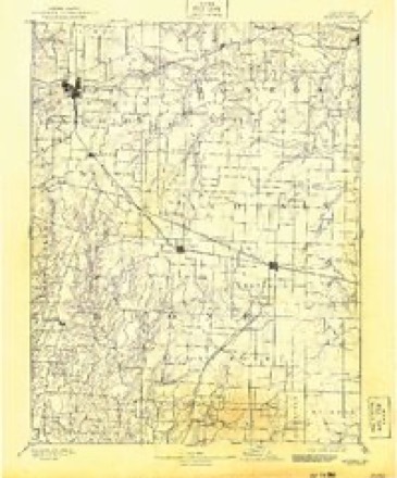
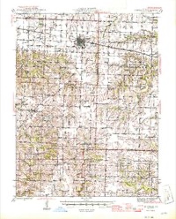
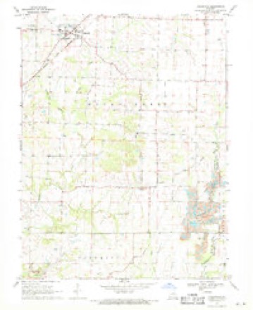
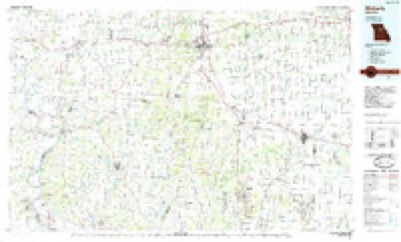
18 topographic sheets cover this place, the earliest surveyed in 1890 and the latest in 1985. It stands in Rocky Fork Township. It lies in ZIP code area 65255. The Survey maps it on the Hallsville quadrangle. The federal gazetteer marks this settlement historical: it is no longer a populated place, though the surveys that recorded it still are.
Topographic sheets covering this place
8 surveys from 18 printed sheetsMatched by testing this settlement's coordinate against the published boundary of every sheet in the United States Geological Survey's historical collection. Each opens the scanned sheet at the Survey.
- 1890 USGS Moberly quadrangle1:125000, 6 printings
- 1945 USGS Centralia quadrangle1:62500, 2 printings
- 1953 USGS Moberly quadrangle1:250000
- 1954 USGS Moberly quadrangle1:250000, 3 printings
- 1957 USGS Moberly quadrangle1:250000
- 1960 USGS Moberly quadrangle1:250000
- 1969 USGS Hallsville quadrangle1:24000, 2 printings
- 1985 USGS Moberly quadrangle1:100000, 2 printings




What happened here
An account from the chapter on Rocky Fork township. The inset identifies its exact source book and publication year.
History Op Boone Cottntt Miscellaneous
About twenty years since Mr. Wm. Watts was accidently shot and killed. The incident happened in the eastern part of this township. He and another man named Watkins were herding cattle, and while the two were carelessly handling a gun it was accidentally discharged and Watts was killed.
In the county-history sources
20,830 words on this townshipHistory of Boone County, Missouri, published 1882 names this settlement in its chapter on Rocky Fork Township. These are the passages that mention it, exactly as the scans read.
Other early settlers were J. D. Bratton, Dr. Points, Allen Rouse, Alfred Rouse, Mr. Carter, Wni. Thornton, Roily and Calvin Asbury and Abraham Waldou. Barney Dickerson was here as early as 1817. He lived on a farm east of Hallsville, He is still living, but is old
Passage source: History of Boone County, Missouri, published 1882.
This church is located on the south half of section 32, township 50, range 11. The first organization was in 1843, and some of the original members were John Reed, Sr., John Reed, Jr., Prudence Reed, Joseph Points, S. C. Points, Wilson Grady, M. A. Grady, R. A. Younger, Edith Younger, Thos. Karnes, Betsy Karnes, and A.* J. Younger. The first church building, a frame, was built in 1848, and stood until it was burned by a detachment of the Third Iowa cavalry, under a Lieutenant Hartman, September 22, 1863. The same soldiers also burned, at the same visit, a number of dwelling houses in the neighborhood. Lieut. Hartman said that the reason beburned the church was because it had ceased to be a church and had become a ** bushwhackers' nest." Another account, said to have been furnished by D. M. Finley, who claims to have been a sergeant of the Tenth Missouri State Militia, is to the effect that that regiment burned the church, but the reports of the adjutant-general of the State do not show that such a regiment ever existed. It was at this church where the battle between Gen. Prentiss's Federals and Col. Dorsey's Confederates took place, December 28, 1861, a full account of which engagement is to be found on other pages of this history. The present church was built in 1867 at a cost of $2,000, and dedicated by Rev. J. D. Vincil, in 1872. The first church was dedicated by A. Monroe, in 1848. The pastors of Mt. Zion church have been Anthony Scares, P. M. Pinkard, W. Toole, Wm. Sexton, Jesse Faubion, John F. Young, Preston Phillips, George Smith, Geo. Sexton, Wm. Sutton, Thos. DeMoss, Joseph Metcalf, Hiram Groves, D. H. Root, F. A. Savage, Wm. Rich, Walter Toole, and Robert White. The present membership is large for a country church, numbering 256. All of the original members of Mt. Zion are gone, except the following: John Reed (from whom much of this ^information has been obtained), S. C. Points, M. A. Grady and A. F. Younger and wife.
Passage source: History of Boone County, Missouri, published 1882.
The subject of this sketch is the son of Dr. Joseph Points, who was born in Bourbon county, Kentucky, January 7th, 1797. His father and mother, Arthur and Ellen Points, were old settlers of that State. Joseph studied medicine in Fayette county, under Doctors Witherspoon and Ennis, and subsequently practiced his profession in that locality, remaining in Fayette county until 1836, when he came to Bpone county, Missouri, and bought the farm where the subject of this sketch now resides. He continued the practice of medicine until his death, July 28th, 1875. There are now over forty physicians actively employed in the territory in which he once had the exclusive practice. He was married in Fayette county, Kentucky, September, 1819, to Miss Sallie, daughter of Joseph and Nancy Robinson. Eleven children, five sons and six daughters, were born of this marriage. Four of the children are now living. Mrs. Points was born December 28th, 1798, and is still living, at the advanced age of eighty-four years, retaining much of her former vigor and cheerfulness. Dr. J. W. Points, the subject of this sketch, was born in Fayette county, Kentucky, November 24th, 1834. When in his second year, his father removed to Boone county, Missouri. He was educated at the common schools, and read medicine under his father and Dr. Lee Brown. He made his home on the old Points' homes'tead and has succeeded to a largeportion of his father's practice. He was married, December 7th, 1855, to Miss Cordelia A., daughter of Samuel and Jane Huddeston, of Boone' county. They have two children, William H., and Mary Elizabeth, who is now the wife of J. W. Grady, of this county. The first wife dying in 1864, Dr. Points was again married in 1874, to Mrs. Elizabeth Schell, of Colo county, Missouri. They have no children by this marriage. Dr. Points has been a citizen of Boone county all his life, except about six years spent in Cole county, Missouri. He is a member of the Methodist Church South. His father was likewise a zealous member of the same church. His mother is also a Methodist.
Passage source: History of Boone County, Missouri, published 1882.
Machine-read from a century-old scan, so expect the errors a machine makes: misspelled names, dropped words, stray characters.
Fires near this place
2 since 2018Regional context, not property-specific evidence. The federal wildfire occurrence database lists 2 fires within 5 miles of Points (historical) in 2018, burning under an acre in total. None started naturally. None was recorded as arson. Distance is straight-line from the map coordinates, so a fire counted here may appear on a neighbouring settlement's page as well.
| Reported cause | Fires |
|---|---|
| Debris and open burning | 1 |
| Missing data/not specified/undetermined | 1 |
The most recent of them, most recent first, with the day each was reported and the service that recorded it.
| Date | Cause | Size | Reported by | Name on the report |
|---|---|---|---|---|
| 9 February 2018 | Debris and open burning | under an acre | Missouri Department of Conservation | 177390-01420-02092018-0809 |
| 6 February 2018 | Missing data/not specified/undetermined | under an acre | Missouri Department of Conservation | 177389-01420-02062018-1208 |
Settlements close enough to share some of these fires:
Nearest settlements
The eight closest, with where each one stands in the county. Distances are straight-line, computed from the Geographic Names Information System coordinates.
| Map | Place | Distance | Sheets |
|---|---|---|---|
| Hallsville | 3.6 miles | 18 | |
| Lebanon (historical) | 4.1 miles | 18 | |
| Murry | 4.3 miles | 18 | |
| Browns | 6.7 miles | 19 | |
| Centralia | 7.5 miles | 19 | |
| Stephens | 7.8 miles | 19 | |
| Middleton | 7.8 miles | 19 | |
| Boonesborough (historical) | 8.6 miles | 22 |
Provenance
This settlement is recorded in the Geographic Names Information System as feature 759383. The sheet list is computed by point-in-boundary test against the United States Geological Survey's historical topographic inventory. Both are works of the United States government and carry no copyright under 17 U.S.C. 105.
Wildfire. Short, Karen C. 2022. Spatial wildfire occurrence data for the United States, 1992-2020 [FPA_FOD_20221014]. 6th Edition. Fort Collins, CO: Forest Service Research Data Archive. https://doi.org/10.2737/RDS-2013-0009.6 Collected with United States Government funding and usable without additional permissions or fees.