 Block
Maitland, Missouri
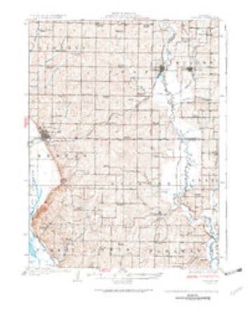
11 topographic sheets cover this place, the earliest surveyed in 1926 and the latest in 1986. It stands in Clay Township. It lies in ZIP code area 64466. The Survey maps it on the Maitland quadrangle. 276 people lived here at the 2020 count. It stands 945 feet above sea level.
Population over time
2 figuresMaitland fell from 343 to 276 between 2010 and 2020. These are the recorded population figures Wikidata holds for this place, reached through the Geographic Names Information System number this page is keyed on rather than by name, so they belong to this place and not to another of the same name. Most are census counts, but not all are: an early figure may be a founding or settlement estimate, and an estimate published within five years of a census is left out. The change column is computed, and is left blank where more than 20 years separate a figure from the one before it, because a gap that long is not a change between two counts.
| Year | People | Change |
|---|---|---|
| 2010 | 343 | |
| 2020 | 276 | -67 (-20%) |
Topographic sheets covering this place
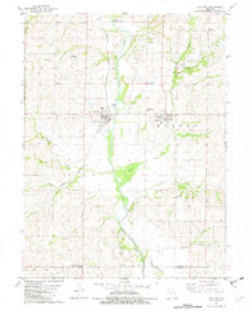
6 surveys from 11 printed sheetsMatched by testing this settlement's coordinate against the published boundary of every sheet in the United States Geological Survey's historical collection. Each opens the scanned sheet at the Survey.
- 1926 USGS Maitland quadrangle1:62500, 3 printings
- 1955 USGS Nebraska City quadrangle1:250000, 3 printings
- 1957 USGS Nebraska City quadrangle1:250000
- 1958 USGS Nebraska City quadrangle1:250000
- 1981 USGS Maitland quadrangle1:24000
- 1986 USGS Falls City quadrangle1:100000, 2 printings
In the county-history sources
3,339 words on this townshipHistory of Holt County, Missouri : from the Time of the Platte Purchase to the End of the Year 1916 : Preceded by a Short History of Missouri : Supplemented by Biographical Sketches of Prominent Citizens, published 1917 names this settlement in its chapter on Clay Township. These are the passages that mention it, exactly as the scans read.
Whig Valley was the name of the post office, and a town was laid out in the fall of 1876, and a store built. The first store in Whig Valley was established in 1870 by E. A. Burnett & Bro., and stood on section 9, of township 62, range 37. This was purchased by E. F. Weller, who, in 1876, built a store on the town site of Whig Valley. The business houses and their proprietors all moved from Whig Valley to the new town of Maitland when it was established.
Passage source: History of Holt County, Missouri : from the Time of the Platte Purchase to the End of the Year 1916 : Preceded by a Short History of Missouri : Supplemented by Biographical Sketches of Prominent Citizens, published 1917.
It is only about a third of a century since the site of the town of Maitland was a corn field and hazel brush patch. It was in the summer of 1880 that the Nodaway Valley Branch of what was then the Kansas City, St. Joseph & Council Bluffs Railroad (now the Chicago, Burlington & Quincy), was completed up the valley of the Nodaway River. It was on May 12, 1880, that the plat of the town of Maitland was filed in the recorder's office by the Maitland Town Company, composed of railroad officials, with J. F. Barnard, at its head.
Passage source: History of Holt County, Missouri : from the Time of the Platte Purchase to the End of the Year 1916 : Preceded by a Short History of Missouri : Supplemented by Biographical Sketches of Prominent Citizens, published 1917.
The land was bought by the company from John and Thomas Swope and the first lots were sold on June 14, 1880, to E. F. WTeller. There were three of them and they were located on the southwest corner of Main and Second streets. Mr. Weller had been in business in Whig Valley, two miles south. He moved his stock, building and all to the new town of Maitland, and located on the second lot south of the corner. This lot was later occupied by the McIntyre Block. It was the second business structure within the limits of Maitland. The first business house was erected a few weeks previous by J. W. Wensch. It was used as a lumber office.
Passage source: History of Holt County, Missouri : from the Time of the Platte Purchase to the End of the Year 1916 : Preceded by a Short History of Missouri : Supplemented by Biographical Sketches of Prominent Citizens, published 1917.
Machine-read from a century-old scan, so expect the errors a machine makes: misspelled names, dropped words, stray characters.
Read the whole chapter on Clay Township - it names this place 18 more 18 times.
Mines and quarries near this place
10 of 12 shownRegional context, not property-specific evidence. The federal mineral resources record lists 12 workings within 5 miles of Maitland: 9 past producers, 3 producers. 3 still produce. What was taken out: Sand and Gravel, Construction, Stone, Crushed/Broken. Distance is straight-line from the map coordinates, so a quarry counted here may appear on a neighbouring settlement's page as well.
| Where | Site | Commodity | Status | Recorded |
|---|---|---|---|---|
| Frank Quarry | Stone, Crushed/Broken | Past Producer | ||
| Graham Quarry | Stone, Crushed/Broken | Producer | ||
| Maitland Mill | Stone, Crushed/Broken | Producer | ||
| Maitland Quarry | Stone, Crushed/Broken | Producer | ||
| Unk | Stone, Crushed/Broken | Past Producer | ||
| Unk | Sand and Gravel, Construction | Past Producer | ||
| Unk | Sand and Gravel, Construction | Past Producer | ||
| Unk | Sand and Gravel, Construction | Past Producer | ||
| Unk | Sand and Gravel, Construction | Past Producer | ||
| Unk | Sand and Gravel, Construction | Past Producer |
Storms near this place
18 since 1993Regional context, not property-specific evidence. The National Weather Service names Maitland in 18 storm reports between 1993 and 2022: 13 hail, 3 tornado, 2 thunderstorm wind. No death or injury is recorded in these reports. Each account below is quoted exactly as the forecast office filed it, from the NOAA Storm Events Database, and each date opens the federal record of that event.
| When | Event | Place named | Harm | What the report says |
|---|---|---|---|---|
| July 1997 | Thunderstorm Wind | Maitland | $250,000 | Severe thunderstorm winds gusted to 80 MPH in Maitland. Many trees and powerlines were downed. Three outbuildings were destroyed and two grain silos were toppled. A large portion of Maitland lost power as a result of the storm. |
| July 1997 | Hail | Maitland | $25,000 | A severe thunderstorm over Maitland dropped golfball-sized hail. Gusty winds with the hail caused numerous reports of broken windows. Hail was reported to have covered the ground in parts of Maitland. |
| March 2020 | Hail | Maitland | - | This report came via social media. |
| September 2014 | Tornado (EF0) | Maitland | - | A weak and brief tornado formed near the city of Maitland. It only persisted for a minute or less and did not damage. |
| September 2014 | Tornado (EF0) | Maitland | - | A weak and brief tornado formed just southwest of Maitland, Missouri, but caused little to no damage. |
| September 2014 | Thunderstorm Wind | Maitland | - | Trees and powerlines were down in Maitland. A tornado was confirmed near Maitland, but it's unclear if the damage in town resulted from the tornado or other thunderstorm winds. |
| September 2014 | Tornado (EF0) | Maitland | - | A weak tornado formed near the city of Maitland and moved eastward over the Nodaway River into Nodaway County, where it dissipated east of Graham, MO. The tornado was witnessed by off duty NWS employee, and caused some minor tree and power line damage along its path. |
| September 1993 | Hail | Maitland | - | One-inch-diameter hail was reported by a cooperative observer north of Graham. |
| June 2022 | Hail | Maitland | - | no account filed |
| March 2020 | Hail | Maitland | - | no account filed |
| May 2014 | Hail | Maitland | - | no account filed |
| May 2002 | Hail | Maitland | - | no account filed |
| July 2002 | Hail | Maitland | - | no account filed |
| July 2002 | Hail | Maitland | - | no account filed |
| June 2002 | Hail | Maitland | - | no account filed |
| April 2001 | Hail | Maitland | - | no account filed |
| April 2001 | Hail | Maitland | - | no account filed |
| September 1993 | Hail | Maitland | - | no account filed |
Nearest settlements
The eight closest, with where each one stands in the county. Distances are straight-line, computed from the Geographic Names Information System coordinates.
| Map | Place | Distance | Sheets |
|---|---|---|---|
| Kings Grove (historical) | 4.1 miles | 11 | |
| Campbell Corner | 5.0 miles | 11 | |
| Mound City | 9.6 miles | 11 | |
| New Point | 10.1 miles | 11 | |
| Nichols Grove | 12.5 miles | 11 | |
| Bigelow | 13.0 miles | 13 | |
| Napier | 14.3 miles | 13 | |
| Richville | 14.6 miles | 24 |
Elsewhere
Matched on this settlement's Geographic Names Information System number rather than its name, so it cannot be a different place of the same name in another state.
| Wikipedia article on Maitland | An encyclopaedic summary. Its text is share-alike, so it is linked here rather than copied. |
| Wikidata item Q953818 | The structured record the population and elevation above come from. Public domain (CC0). |
Provenance
This settlement is recorded in the Geographic Names Information System as feature 730138. The sheet list is computed by point-in-boundary test against the United States Geological Survey's historical topographic inventory. Both are works of the United States government and carry no copyright under 17 U.S.C. 105.
Mines and quarries. USGS Mineral Resources Data System (MRDS) https://mrdata.usgs.gov/mrds/ A work of the United States government, no copyright under 17 U.S.C. 105.
Storms. NOAA National Centers for Environmental Information, Storm Events Database https://www.ncei.noaa.gov/stormevents/ A work of the United States government, no copyright under 17 U.S.C. 105. Narratives are quoted verbatim from the National Weather Service report and are not edited or summarised.