 Block
Richville, Missouri
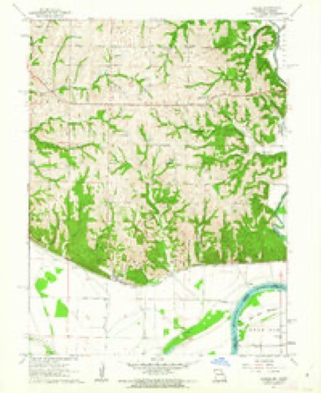
24 topographic sheets cover this place, the earliest surveyed in 1885 and the latest in 1990. It stands in Nodaway Township. It lies in ZIP code area 64473. The Survey maps it on the Forbes quadrangle.
On record in Richville
Buildings and businesses the archive holds for this place. Each opens its own page, with the source record it came from.
On the National Register within a mile 1 record
The National Register names another town for these. They stand within one mile of this settlement's coordinate.
- Carroll Stagecoach Innlisted 1983 · 0.5 miles away
Topographic sheets covering this place
11 surveys from 24 printed sheetsMatched by testing this settlement's coordinate against the published boundary of every sheet in the United States Geological Survey's historical collection. Each opens the scanned sheet at the Survey.
- 1885 USGS Atchison quadrangle1:125000
- 1888 USGS Atchison quadrangle1:125000
- 1893 USGS Atchison quadrangle1:125000, 5 printings
- 1926 USGS Oregon quadrangle1:62500, 3 printings
- 1950 USGS Kansas City quadrangle1:250000
- 1954 USGS Kansas City quadrangle1:250000
- 1956 USGS Kansas City quadrangle1:250000, 4 printings
- 1960 USGS Kansas City quadrangle1:250000, 3 printings
- 1961 USGS Forbes quadrangle1:24000, 3 printings
- 1985 USGS Atchison quadrangle1:100000
- 1990 USGS Atchison quadrangle1:100000




In the county-history sources
1,849 words on this townshipHistory of Holt County, Missouri : from the Time of the Platte Purchase to the End of the Year 1916 : Preceded by a Short History of Missouri : Supplemented by Biographical Sketches of Prominent Citizens, published 1917 names this settlement in its chapter on Nodaway Township. These are the passages that mention it, exactly as the scans read.
Gotlieb Meyer. David Templeton and family, also from Indiana, were among the very earliest settlers of Nodaway Township, as was also Colonel John W. Kelley, afterwards the first attorney admitted to the bar of Holt County. David Templeton arrived in the county with four sons. Monroe Templeton located near the site of what was afterwards the town of Richville. John Norvel, a native of Tennessee, but directly from Kentucky to this state, settled in Nodaway Township in 1847.
Passage source: History of Holt County, Missouri : from the Time of the Platte Purchase to the End of the Year 1916 : Preceded by a Short History of Missouri : Supplemented by Biographical Sketches of Prominent Citizens, published 1917.
One of the earliest religious organizations in Holt County, was effected in Nodaway Township, in 1840. This was a Missionary Baptist Church, of which the Rev. Ebo Tucker was first pastor. This church, at the period of its original organization, had thirteen male members, beside their families. Among these were John Norvel, Willis Brockman, Shelton Arterbury and Thomas Wickham, also Levi Ruhl, John Robinson, Lewis Jones, John McFadden and Preston Ham. The records of this primitive church are lost, and it is impossible to obtain much more extended information of the original membership. The first meetings of this church were in groves in the summer season, and, as the country advanced, in school houses, which the intelligent pioneers, lost but little time in erecting, after their arrival in the country. In 1860, they built a brick church, on land then owned by Francis Nickols, and donated by him for that purpose. This building stands near the south boundary of the southeast quarter of section 8, township 60, range 37, west, on an eighty acre tract, now owned by the Gotleib Meyer heirs. It was originally styled Nickol's Grove Church. At the breaking out of the Civil war, the church was not entirely completed. It was, however, occupied and used for religious purposes by the one hundred and fifty-two members who composed the organization. These members were nearly, if not all, southern sympathizers and, as a natural consesuence, the church, by the fortunes of war, went down. After the rebellion a number of emigrants, chiefly Germans from the State of Ohio, settled in the neighborhood, as the original settlers and members of the pioneer church moved away, or had failed to return after the proclamation of peace. The building stood for many years and verging upon dilapidation, a monument of the religious enterprise of the early days. It finally was torn down and the site on which it stood used for agricultural purposes. The congregation, greatly reduced in numbers after the Civil war, worshipped for a time in a school house in Richville.
Passage source: History of Holt County, Missouri : from the Time of the Platte Purchase to the End of the Year 1916 : Preceded by a Short History of Missouri : Supplemented by Biographical Sketches of Prominent Citizens, published 1917.
The Methodist Episcopal Church at Richville, was organized about the year 1840, shortly after the Baptists. The Templetons and Evanses were among the original organizers of this church. The building, a brick structure, 40x30 feet, was erected about 1855, some five years before the village of Richville, in which it now stands, was laid out. The first Methodist preacher to exercise his calling in this township was Rev. James Baker. About 1844 the Methodists held a camp meeting in section 27, township 60, range 27, on a farm at that time owned by David Templeton, one of the earliest settlers of the county, and the first county surveyor appointed.
Passage source: History of Holt County, Missouri : from the Time of the Platte Purchase to the End of the Year 1916 : Preceded by a Short History of Missouri : Supplemented by Biographical Sketches of Prominent Citizens, published 1917.
Machine-read from a century-old scan, so expect the errors a machine makes: misspelled names, dropped words, stray characters.
Read the whole chapter on Nodaway Township - it names this place 1 more 1 time.
Fires near this place
7 since 2000Regional context, not property-specific evidence. The federal wildfire occurrence database lists 7 fires within 5 miles of Richville between 2000 and 2020, burning about 97 acres in total. None started naturally. None was recorded as arson. Distance is straight-line from the map coordinates, so a fire counted here may appear on a neighbouring settlement's page as well.
| Reported cause | Fires |
|---|---|
| Debris and open burning | 4 |
| Missing data/not specified/undetermined | 3 |
The most recent of them, most recent first, with the day each was reported and the service that recorded it.
| Date | Cause | Size | Reported by | Name on the report |
|---|---|---|---|---|
| 28 September 2000 | Debris and open burning | 2.0 acres | Missouri Department of Conservation | not named |
| 14 September 2000 | Debris and open burning | 15 acres | Missouri Department of Conservation | not named |
| 27 March 2002 | Debris and open burning | 3.0 acres | Missouri Department of Conservation | not named |
| 14 March 2002 | Debris and open burning | 50 acres | Missouri Department of Conservation | not named |
| 22 February 2020 | Missing data/not specified/undetermined | 3.5 acres | Missouri Department of Conservation | 230830-00203-02222020-2015 |
| 22 February 2020 | Missing data/not specified/undetermined | 15 acres | Missouri Department of Conservation | 230829-00203-02222020-1550 |
| 17 February 2020 | Missing data/not specified/undetermined | 8.1 acres | Missouri Department of Conservation | 230828-00203-02172020-1640 |
Settlements close enough to share some of these fires:
Mines and quarries near this place
10 of 11 shownRegional context, not property-specific evidence. The federal mineral resources record lists 11 workings within 5 miles of Richville: 10 past producers, 1 producer. 1 still produces. What was taken out: Stone, Crushed/Broken. Distance is straight-line from the map coordinates, so a quarry counted here may appear on a neighbouring settlement's page as well.
| Where | Site | Commodity | Status | Recorded |
|---|---|---|---|---|
| Oregon Quarry | Stone, Crushed/Broken | Producer | ||
| Unk | Stone, Crushed/Broken | Past Producer | ||
| Unk | Stone, Crushed/Broken | Past Producer | ||
| Unk | Stone, Crushed/Broken | Past Producer | ||
| Unk | Stone, Crushed/Broken | Past Producer | ||
| Unk | Stone, Crushed/Broken | Past Producer | ||
| Unk | Stone, Crushed/Broken | Past Producer | ||
| Unk | Stone, Crushed/Broken | Past Producer | ||
| Unk | Stone, Crushed/Broken | Past Producer | ||
| Unk | Stone, Crushed/Broken | Past Producer |
Nearest settlements
The eight closest, with where each one stands in the county. Distances are straight-line, computed from the Geographic Names Information System coordinates.
| Map | Place | Distance | Sheets |
|---|---|---|---|
| Nichols Grove | 2.8 miles | 11 | |
| New Point | 4.8 miles | 11 | |
| Oregon | 5.2 miles | 23 | |
| Forbes | 6.3 miles | 24 | |
| Curzon | 6.6 miles | 23 | |
| Forest City | 7.7 miles | 23 | |
| Campbell Corner | 9.9 miles | 11 | |
| Napier | 11.9 miles | 13 |
Elsewhere
Matched on this settlement's Geographic Names Information System number rather than its name, so it cannot be a different place of the same name in another state.
| Wikipedia article on Richville | An encyclopaedic summary. Its text is share-alike, so it is linked here rather than copied. |
| Wikidata item Q27985301 | The structured record the population and elevation above come from. Public domain (CC0). |
Provenance
This settlement is recorded in the Geographic Names Information System as feature 741197. The sheet list is computed by point-in-boundary test against the United States Geological Survey's historical topographic inventory. Both are works of the United States government and carry no copyright under 17 U.S.C. 105.
Wildfire. Short, Karen C. 2022. Spatial wildfire occurrence data for the United States, 1992-2020 [FPA_FOD_20221014]. 6th Edition. Fort Collins, CO: Forest Service Research Data Archive. https://doi.org/10.2737/RDS-2013-0009.6 Collected with United States Government funding and usable without additional permissions or fees.
Mines and quarries. USGS Mineral Resources Data System (MRDS) https://mrdata.usgs.gov/mrds/ A work of the United States government, no copyright under 17 U.S.C. 105.