 Block
New Point, Missouri
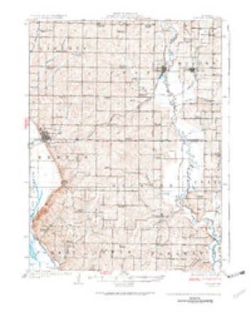
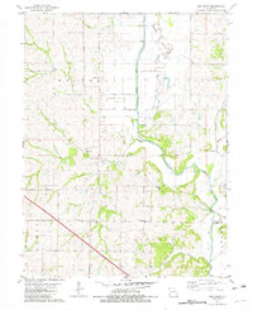
11 topographic sheets cover this place, the earliest surveyed in 1926 and the latest in 1986. It stands in Hickory Township. It lies in ZIP code area 64473. It stands on Nichols Creek. The Survey maps it on the New Point quadrangle.
Topographic sheets covering this place
6 surveys from 11 printed sheetsMatched by testing this settlement's coordinate against the published boundary of every sheet in the United States Geological Survey's historical collection. Each opens the scanned sheet at the Survey.
- 1926 USGS Maitland quadrangle1:62500, 3 printings
- 1955 USGS Nebraska City quadrangle1:250000, 3 printings
- 1957 USGS Nebraska City quadrangle1:250000
- 1958 USGS Nebraska City quadrangle1:250000
- 1981 USGS New Point quadrangle1:24000
- 1986 USGS Falls City quadrangle1:100000, 2 printings
In the county-history sources
3,675 words on this townshipHistory of Holt County, Missouri : from the Time of the Platte Purchase to the End of the Year 1916 : Preceded by a Short History of Missouri : Supplemented by Biographical Sketches of Prominent Citizens, published 1917 names this settlement in its chapter on Hickory Township. These are the passages that mention it, exactly as the scans read.
The first mill in the township was a small concern with one pair of burrs, built by John N. Blair, for Robert Nickols, about the year 1839 or 1840. It was a water power, and stood on the northwest quarter of section 34, township 61, range 37, about one-half mile east of the site of the present village of New Point. The only grain ground at this mill was corn. It continued to be operated till 1857. There is now no mill within the limits of Hickory Township.
Passage source: History of Holt County, Missouri : from the Time of the Platte Purchase to the End of the Year 1916 : Preceded by a Short History of Missouri : Supplemented by Biographical Sketches of Prominent Citizens, published 1917.
The first ferry on the Nodaway River which had a landing on the shore of what is now Hickory Township, was established and maintained for several years by a man by the name of Lackey, from Andrew County. The landing of this ferry was on a farm for many years owned by Samuel Praisewater, near the line between the southeast quarter of section 27, and the southwest quarter of section 26, township 61, range 37, about one and one-half miles northeast of the site of the present town of New Point. Henry DeBolt afterwards kept a ferry on the southwest quarter of section 27, township 61, range 37, about one-half mile above the old ferry, before 1860. Both have long passed out of existence.
Passage source: History of Holt County, Missouri : from the Time of the Platte Purchase to the End of the Year 1916 : Preceded by a Short History of Missouri : Supplemented by Biographical Sketches of Prominent Citizens, published 1917.
The first to plant fruit trees in Hickory Township was Thomas S. Bragg, who planted an apple orchard on his farm, which lies in section 32, township 61, range 37, in the immediate neighborhood of New Point. This pioneer orchard, which included about fifty trees, was planted about the year 1847. Some of the finest orchards in the county are now growing in Hickory Township.
Passage source: History of Holt County, Missouri : from the Time of the Platte Purchase to the End of the Year 1916 : Preceded by a Short History of Missouri : Supplemented by Biographical Sketches of Prominent Citizens, published 1917.
Machine-read from a century-old scan, so expect the errors a machine makes: misspelled names, dropped words, stray characters.
Read the whole chapter on Hickory Township - it names this place 14 more 14 times.
Fires near this place
3 since 2000Regional context, not property-specific evidence. The federal wildfire occurrence database lists 3 fires within 5 miles of New Point between 2000 and 2002, burning about 67 acres in total. None started naturally. None was recorded as arson. Distance is straight-line from the map coordinates, so a fire counted here may appear on a neighbouring settlement's page as well.
| Reported cause | Fires |
|---|---|
| Debris and open burning | 3 |
The most recent of them, most recent first, with the day each was reported and the service that recorded it.
| Date | Cause | Size | Reported by | Name on the report |
|---|---|---|---|---|
| 28 September 2000 | Debris and open burning | 2.0 acres | Missouri Department of Conservation | not named |
| 14 September 2000 | Debris and open burning | 15 acres | Missouri Department of Conservation | not named |
| 14 March 2002 | Debris and open burning | 50 acres | Missouri Department of Conservation | not named |
Settlements close enough to share some of these fires:
Mines and quarries near this place
6 within 5 milesRegional context, not property-specific evidence. The federal mineral resources record lists 6 workings within 5 miles of New Point: 6 past producers. None of them still produces. What was taken out: Stone, Crushed/Broken, Sand and Gravel, Construction. Distance is straight-line from the map coordinates, so a quarry counted here may appear on a neighbouring settlement's page as well.
Nearest settlements
The eight closest, with where each one stands in the county. Distances are straight-line, computed from the Geographic Names Information System coordinates.
| Map | Place | Distance | Sheets |
|---|---|---|---|
| Nichols Grove | 2.5 miles | 11 | |
| Richville | 4.8 miles | 24 | |
| Campbell Corner | 5.2 miles | 11 | |
| Oregon | 5.8 miles | 23 | |
| Forest City | 7.8 miles | 23 | |
| Curzon | 8.9 miles | 23 | |
| Napier | 9.5 miles | 13 | |
| Mound City | 9.6 miles | 11 |
Provenance
This settlement is recorded in the Geographic Names Information System as feature 740008. The sheet list is computed by point-in-boundary test against the United States Geological Survey's historical topographic inventory. Both are works of the United States government and carry no copyright under 17 U.S.C. 105.
Wildfire. Short, Karen C. 2022. Spatial wildfire occurrence data for the United States, 1992-2020 [FPA_FOD_20221014]. 6th Edition. Fort Collins, CO: Forest Service Research Data Archive. https://doi.org/10.2737/RDS-2013-0009.6 Collected with United States Government funding and usable without additional permissions or fees.
Mines and quarries. USGS Mineral Resources Data System (MRDS) https://mrdata.usgs.gov/mrds/ A work of the United States government, no copyright under 17 U.S.C. 105.