 Block
Higginsville, Missouri
15 topographic sheets cover this place, the earliest surveyed in 1889 and the latest in 1982. It stands in Davis Township. It lies in ZIP code area 64037. It stands on Arndt Creek. The Survey maps it on the Higginsville quadrangle. 4,817 people lived here at the 2020 count. It stands 817 feet above sea level.
On record in Higginsville
Buildings and businesses the archive holds for this place. Each opens its own page, with the source record it came from.
On the National Register 4 records
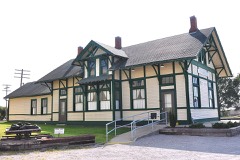 Chicago and Alton Railroad Depot at Higginsvillelisted 1987
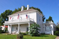 Houx-Hoefer-Rehkop Houselisted 1983
- Confederate Chapel, Cemetery and Cottagelisted 1981
- Douglass Schoollisted 2023
Population over time
2 figuresHigginsville grew from 4,797 to 4,817 between 2010 and 2020. These are the recorded population figures Wikidata holds for this place, reached through the Geographic Names Information System number this page is keyed on rather than by name, so they belong to this place and not to another of the same name. Most are census counts, but not all are: an early figure may be a founding or settlement estimate, and an estimate published within five years of a census is left out. The change column is computed, and is left blank where more than 20 years separate a figure from the one before it, because a gap that long is not a change between two counts.
| Year | People | Change |
|---|---|---|
| 2010 | 4,797 | |
| 2020 | 4,817 | +20 (+0%) |
Topographic sheets covering this place
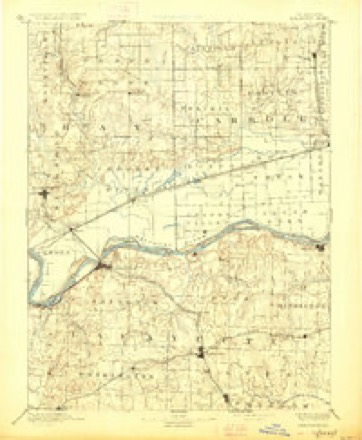
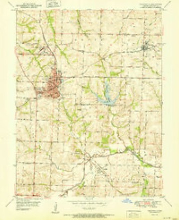
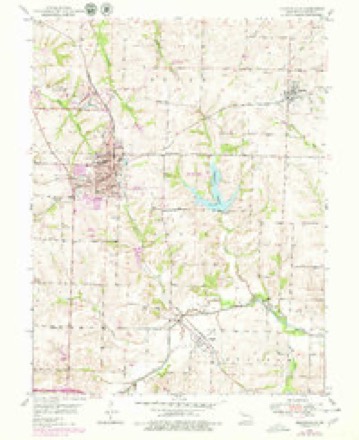
8 surveys from 15 printed sheetsMatched by testing this settlement's coordinate against the published boundary of every sheet in the United States Geological Survey's historical collection. Each opens the scanned sheet at the Survey.
- 1889 USGS Lexington quadrangle1:125000, 6 printings
- 1951 USGS Higginsville quadrangle1:24000
- 1953 USGS Moberly quadrangle1:250000
- 1954 USGS Moberly quadrangle1:250000, 3 printings
- 1957 USGS Moberly quadrangle1:250000
- 1959 USGS Higginsville quadrangle1:24000
- 1960 USGS Moberly quadrangle1:250000
- 1982 USGS Marshall quadrangle1:100000




What happened here
An account from the chapter on Davis township. The inset identifies its exact source book and publication year.
The Hospital Episode
The Federals had occupied as a hospital the then magnificent residence of Oliver Anderson, Esq., a two-and-a-half story brick building, down the slope about twenty rods west from the outer line of their intrenchments [See diagram,] and several hundred rods from the " Masonic College. " On top of this building there was a yellow flag displayed, marking it as a hospital, and in it were 24 sick and 96 wounded, according to Mulligan's report.
In the county-history sources
45,418 words on this townshipHistory of Lafayette County, Mo. , Carefully Written and Compiled from the Most Authentic Official and Private Sources, Including a History of Its Townships, Cities, Towns, and Villages, Together with a Condensed History of Missouri; the Constitution of the United States, and State of Missouri; a Military Record of Volunteers in Either Army of the Great Civil War .., published 1881 names this settlement in its chapter on Davis Township. These are the passages that mention it, exactly as the scans read.
In the final settlement and disposal of the funds in these tax-levy suits, the commissions and incidental expenses of the collector were overlooked and not allowed him. He brought suit in the circuit court to recover his claim from the county, but was defeated. He appealed to the state supreme court, and the case at this writing (August, 1881), still remains there unsettled. Wallace & Chiles are his attorneys.
In 1868-69-70, it was confidently believed by the railroad partisans that in two or three years there would be six railroads coming into Lexington, and a railroad bridge spanning the river here. Out of this faith grew the scheme for a grand railroad hotel worthy of the situation. The grade of the Lexington & St. Louis railroad (now Missouri Pacific) terminated at South street between Elm and Lynn streets, and here the great hotel was erected, the remains of which appear in desolate grandeur to this day. The building was erected in 1870-71, at a cost of ^85,000; it was a joint stock enterprise, and the county took $20,000 of stock in it. B. H. Wilson was the architect and builder; Geo. Farrar did the brick work, and manufactured all the bricks at his brick yard which is still in operation, on Graham's branch. The whole scheme proved a disastrous failure; and in 1879 the building was sold for delinquent taxes. Many car loads of the bricks have been shipped away to Sedalia and Kansas City, and enough still remain to build another small city - another child out of the loins of Lexington.
Wm. Collins, Senior, a soldier of the revolutionary war from Carolina, also his son and son-in-law and their families, amounting to eight persons, were among the first settlers of this township, settling here in 1825. The first marriage in the township was that of Martin D. Warren to Miss Dillingham. The first male child born »here was James Anderson, son of Wm. H. and D Anderson; the first female child was Nancy, daughter of Larkin and Sarah Graham. The first death occurred in the township in the latter part ot 1837, and was buried at Johnson's Grove, near Higginsville. The first Christian minister in this township was Rev. Thomas McBride, of the Christian church, in a log cabin south of where Higginsville now stands. "We had no roads in the early times of Davis township, but traveled by courses - our principal market place was Lexington. The boys would often have a big deer hunt, kill as many as eight deer, and get home to dinner."
Machine-read from a century-old scan, so expect the errors a machine makes: misspelled names, dropped words, stray characters.
Read the whole chapter on Davis Township - it names this place 54 more 54 times.
Fires near this place
37 since 2014Regional context, not property-specific evidence. The federal wildfire occurrence database lists 37 fires within 5 miles of Higginsville between 2014 and 2020, burning about 155 acres in total. None started naturally. None was recorded as arson. Distance is straight-line from the map coordinates, so a fire counted here may appear on a neighbouring settlement's page as well.
| Reported cause | Fires |
|---|---|
| Missing data/not specified/undetermined | 26 |
| Debris and open burning | 9 |
| Equipment and vehicle use | 2 |
The most recent of them, most recent first, with the day each was reported and the service that recorded it.
| Date | Cause | Size | Reported by | Name on the report |
|---|---|---|---|---|
| 22 September 2018 | Debris and open burning | 4.8 acres | Missouri Department of Conservation | 177731-05440-09222018-1823 |
| 22 August 2016 | Missing data/not specified/undetermined | 1.0 acres | Missouri Department of Conservation | 142911-02459-08222016-1040 |
| 13 August 2015 | Missing data/not specified/undetermined | 1.0 acres | Missouri Department of Conservation | 129856-05438-08132015-1915 |
| 12 August 2015 | Missing data/not specified/undetermined | 1.0 acres | Missouri Department of Conservation | 129855-05438-08122015-1300 |
| 4 July 2018 | Missing data/not specified/undetermined | under an acre | Missouri Department of Conservation | 178149-05438-07042018-1613 |
| 8 June 2018 | Debris and open burning | under an acre | Missouri Department of Conservation | 178152-05438-06082018-1707 |
| 24 June 2017 | Missing data/not specified/undetermined | 1.0 acres | Missouri Department of Conservation | not named |
| 8 May 2018 | Missing data/not specified/undetermined | under an acre | Missouri Department of Conservation | 178147-05438-05082018-1320 |
Settlements close enough to share some of these fires:
Mines and quarries near this place
3 within 5 milesRegional context, not property-specific evidence. The federal mineral resources record lists 3 workings within 5 miles of Higginsville: 3 past producers. None of them still produces. What was taken out: Stone, Crushed/Broken. Distance is straight-line from the map coordinates, so a quarry counted here may appear on a neighbouring settlement's page as well.
| Where | Site | Commodity | Status | Recorded |
|---|---|---|---|---|
| Hoefer Qsuarry | Stone, Crushed/Broken | Past Producer | ||
| Unknown | Stone, Crushed/Broken | Past Producer | ||
| Unknown | Stone, Crushed/Broken | Past Producer |
Storms near this place
53 since 1993Regional context, not property-specific evidence. The National Weather Service names Higginsville in 53 storm reports between 1993 and 2020: 27 thunderstorm wind, 22 hail, 3 tornado, 1 flash flood. No death or injury is recorded in these reports. Each account below is quoted exactly as the forecast office filed it, from the NOAA Storm Events Database, and each date opens the federal record of that event.
| When | Event | Place named | Harm | What the report says |
|---|---|---|---|---|
| May 1995 | Tornado (F0) | Higginsville | $25,000 | A severe thunderstorm dropped up to golfball size hail on Bates City, and then went on to develop 2 weak tornadoes. The first tornado touched down south of Bates City at 1820 CST and was crossing Interstate 70 3 miles west of Odessa at 1831 CST. Only minor tree damage was reported. It then lifted north of Odessa. A second touchdown occurred about 5 miles northwest of Higginsville at 1845 CST. The track took it across State Route 13 5 miles northwest of Higginsville near the Tabo Creek bridge at 1900 CST. At 1905 CST, the tornado crossed Route 213 3 miles southwest of Dover, and then lifted 1 mile southwest of Dover at 1906 CST. A house along state Route 13, 6 miles southeast of the junction with Route E, had shingles removed from the roof as the funnel apparently lifted as it passed overhead. Eyewitnesses reported that the tornado bounced up and down as it continued on a path about 4.5 miles to the east-northeast. The damage path varied from about 30 to 40 yards wide, with most of the path over cultivated farm fields. Most damage was minimal, but the most significant damage occurred at the Humfeldt farm 2.6 miles south of U.S. Route 24 along state Route 213. A corrugated steel equipment building was destroyed when the south and west walls were blown in, and the roof was partially peeled off. There was only minor damage to the equipment inside. The tornado passed to the south of the house and garage, missing them by 25 feet. Only one shutter was blown off of the upper floor of the house with no other damage. Mud was splattered on all four sides of both the house and garage. The tornado was photographed as it was dissipating, in its rope stage between 1901 and 1906 CST. In addition, tree damage occurred in Corder with the gust front ahead of the parent thunderstorm. |
| May 2002 | Thunderstorm Wind | Higginsville | $5,000 | Roof blown off car wash. |
| September 1993 | Thunderstorm Wind | Higginsville | $5,000 | Large trees were uprooted and dime-size hail fell. |
| July 2020 | Flash Flood | Higginsville | - | Water was flowing over Highway AA just east of Higginsville. |
| June 2019 | Thunderstorm Wind | Higginsville | - | COOP Observer reported 60 mph wind. |
| July 2019 | Thunderstorm Wind | Higginsville | - | A COOP observer reported a measured 71 mph wind gust. |
| August 2017 | Hail | Higginsville | - | Dime to quarter sized hail lasted at this location for about 15 minutes, starting at 9:15 PM CDT (8:15 CST). |
| April 2016 | Hail | Higginsville | - | There was minor vehicle damage. |
| April 2016 | Hail | Higginsville | - | This report was received via social media. |
| October 2016 | Thunderstorm Wind | Higginsville | - | Some structural damage occurred to a tractor company in Higginsville. A few sheds and an hoop building were blown down. |
| July 2015 | Thunderstorm Wind | Higginsville | - | A 4 apple tree was snapped and blown over. |
| April 2011 | Thunderstorm Wind | Higginsville | - | Thunderstorm wind gust was measured at 59 mph. |
| May 2011 | Tornado (EF0) | Higginsville | - | At 1425CST a brief EF0 tornado touchdown, was observed by television helicopter, a little over a half north of Higginsville. The tornado moved about a tenth of a mile to the east, and lifted at 1427CST. Touchdown was in an open field with no damage observed. |
| May 2011 | Tornado (EF0) | Higginsville | - | At 1207CST a brief EF0 tornado touchdown, was observed 1.9 miles south southwest of Higginsville. The tornado touched down and went right back up. No Damage was observed. |
| August 2011 | Thunderstorm Wind | Higginsville | - | Thunderstorm wind gust was measured at 95 mph, at the Higginsville water plant. |
| July 2010 | Thunderstorm Wind | Higginsville | - | Thunderstorm wind gusts were estimated up to 60 mph. |
| June 2010 | Thunderstorm Wind | Higginsville | - | Thunderstorm winds were estimated up to 60 mph. |
| May 2000 | Hail | Higginsville | - | The same supercell storm that produced the tornado southeast of Lexington also produced dime to quarter size hail, which covered the ground in Higginsville. |
| May 2000 | Thunderstorm Wind | Higginsville | - | Highway Patrol officers estimated wind gusts up to 70 mph near mile marker 46 on Interstate 70. |
| June 2000 | Thunderstorm Wind | Higginsville | - | A wind gust of 76 mph was measured at the Higginsville Water Plant. Tree limbs 6 inches in diameter were downed. |
| September 2000 | Thunderstorm Wind | Higginsville | - | A 75 mph wind gust was recorded by the NWS co-op observer at the Higginsville Water Plant. |
| August 2000 | Thunderstorm Wind | Higginsville | - | The NWS co-op observer at Higginsville recorded a 61 mph wind gust. |
| April 1998 | Hail | Higginsville | - | Dime-size hail was reported during a severe thunderstorm in Higginsville. |
| August 1997 | Thunderstorm Wind | Higginsville | - | A Higginsville spotter measured 62 MPH winds during a severe thunderstorm. |
| September 1993 | Thunderstorm Wind | Higginsville | - | A wind gust to 63 mph was recorded at the Higginsville Water Plant. |
| September 1993 | Hail | Higginsville | - | Large trees were uprooted and dime-size hail fell. |
| April 2014 | Hail | Higginsville | - | no account filed |
| April 2014 | Thunderstorm Wind | Higginsville | - | no account filed |
| May 2011 | Hail | Higginsville | - | no account filed |
| May 2011 | Hail | Higginsville | - | no account filed |
| May 2011 | Hail | Higginsville | - | no account filed |
| June 2008 | Thunderstorm Wind | Higginsville | - | no account filed |
| April 2006 | Hail | Higginsville | - | no account filed |
| June 2006 | Hail | Higginsville | - | no account filed |
| April 2005 | Hail | Higginsville | - | no account filed |
| April 2005 | Hail | Higginsville | - | no account filed |
| April 2005 | Hail | Higginsville | - | no account filed |
| July 2005 | Thunderstorm Wind | Higginsville | - | no account filed |
| April 2003 | Hail | Higginsville | - | no account filed |
| May 2003 | Thunderstorm Wind | Higginsville | - | no account filed |
| May 2003 | Hail | Higginsville | - | no account filed |
| May 2002 | Thunderstorm Wind | Higginsville | - | no account filed |
| April 2001 | Thunderstorm Wind | Higginsville | - | no account filed |
| April 2001 | Hail | Higginsville | - | no account filed |
| July 2001 | Thunderstorm Wind | Higginsville | - | no account filed |
| September 2001 | Thunderstorm Wind | Higginsville | - | no account filed |
| February 2000 | Thunderstorm Wind | Higginsville | - | no account filed |
| May 2000 | Hail | Higginsville | - | no account filed |
| August 1999 | Thunderstorm Wind | Higginsville | - | no account filed |
| October 1998 | Hail | Higginsville | - | no account filed |
| May 1996 | Hail | Higginsville | - | no account filed |
| June 1995 | Hail | Higginsville | - | no account filed |
| March 1993 | Thunderstorm Wind | Higginsville | - | no account filed |
Nearest settlements
The eight closest, with where each one stands in the county. Distances are straight-line, computed from the Geographic Names Information System coordinates.
Elsewhere
Matched on this settlement's Geographic Names Information System number rather than its name, so it cannot be a different place of the same name in another state.
| Wikipedia article on Higginsville | An encyclopaedic summary. Its text is share-alike, so it is linked here rather than copied. |
| Wikidata item Q958422 | The structured record the population and elevation above come from. Public domain (CC0). |
Provenance
This settlement is recorded in the Geographic Names Information System as feature 719513. The sheet list is computed by point-in-boundary test against the United States Geological Survey's historical topographic inventory. Both are works of the United States government and carry no copyright under 17 U.S.C. 105.
Wildfire. Short, Karen C. 2022. Spatial wildfire occurrence data for the United States, 1992-2020 [FPA_FOD_20221014]. 6th Edition. Fort Collins, CO: Forest Service Research Data Archive. https://doi.org/10.2737/RDS-2013-0009.6 Collected with United States Government funding and usable without additional permissions or fees.
Mines and quarries. USGS Mineral Resources Data System (MRDS) https://mrdata.usgs.gov/mrds/ A work of the United States government, no copyright under 17 U.S.C. 105.
Storms. NOAA National Centers for Environmental Information, Storm Events Database https://www.ncei.noaa.gov/stormevents/ A work of the United States government, no copyright under 17 U.S.C. 105. Narratives are quoted verbatim from the National Weather Service report and are not edited or summarised.