 Block
Page City, Missouri
17 topographic sheets cover this place, the earliest surveyed in 1889 and the latest in 1982. It stands in Dover Township. It lies in ZIP code area 64037. It stands on Rocky Ford Branch. The Survey maps it on the Dover quadrangle. It stands 778 feet above sea level.
Topographic sheets covering this place
8 surveys from 17 printed sheetsMatched by testing this settlement's coordinate against the published boundary of every sheet in the United States Geological Survey's historical collection. Each opens the scanned sheet at the Survey.
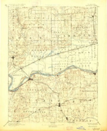
- 1889 USGS Lexington quadrangle1:125000, 6 printings
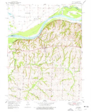
- 1950 USGS Dover quadrangle1:24000, 2 printings
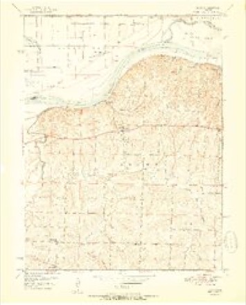
- 1951 USGS Dover quadrangle1:24000, 2 printings
- 1953 USGS Moberly quadrangle1:250000
- 1954 USGS Moberly quadrangle1:250000, 3 printings
- 1957 USGS Moberly quadrangle1:250000
- 1960 USGS Moberly quadrangle1:250000
- 1982 USGS Marshall quadrangle1:100000




In the county-history sources
19,492 words on this townshipHistory of Lafayette County, Mo. , Carefully Written and Compiled from the Most Authentic Official and Private Sources, Including a History of Its Townships, Cities, Towns, and Villages, Together with a Condensed History of Missouri; the Constitution of the United States, and State of Missouri; a Military Record of Volunteers in Either Army of the Great Civil War .., published 1881 names this settlement in its chapter on Dover Township. These are the passages that mention it, exactly as the scans read.
P. O. Page City, Mo. The young gentleman whose name heads this sketch, and who is one of the enterprising farmers of the vicinity of Page City, was born in Lexington, Ky., May 3, 1849. He is the son of Samuel Downing, Sr., who died in this county in 1876. His mother was Miss Amanda Offatt, a native of Kentucky, where she also died. His father then, in 1856, married Miss Margaret Combs, of Lexington, Ky., his second wife, who, after his death, married Judge Walker, of Lexington, Mo. In 1857, when between seven and eight years old, Alfred moved with his father to Boonville, Mo., and after a year's residence there, they moved to this county, and settled on a tract of 440 acres of land in Dover township, upon part of which Alfred now lives. He was educated at White's Seminary at Dover. He was too young to take any part in the civil war, though his sympathies were with the South, and a brother served four years under Shelby. On the 22d of September, 18S0, he was married to Miss Lura Logan, daughter of Henry Logan, deceased, of Parkersburg, Va. They have one child, a daughter named Mary, born June 27, 1881.
farmer, P. O. Page City. Born in Warren County, Ky., April 16, 1813. Came with his father and family to Lafayette County in 1827. They traveled the whole distance in wagons, which contained all their worldly possessions. Lived in the wagons until they succeeded in erecting some cabins sufficient for their protection, which were located within a few rods of his present residence. Here he lived the life of a pioneer in the full sense of the word. In 1830 he went to Fort Gibson, in Cherokee Nation, where he worked eleven months, clothing himself, and saving the sum of $60 out of his wages, which he sent to his father. In 1835 he again went to the Cherokee Nation, and returned at the end of six months after experiencing many privations, with $150. In 1836, January 7, he was united in marriage to Miss Elizabeth Couts, a native of Kentucky, born September 5, 1819, and who is still enjoying gook health; able to do her own work. When first married they commenced housekeeping in a manner consistent with their means, thereby escaping the trials incident to the lives of young married couples, who desire to make a showing which their income will not warrant. They lived in a little cabin with simple furniture, Mr. Page making his own table out of a plank, caught in a drift, in Little Tebo. Mrs. Page's dowry consisted of a cow, a calf, and a bedstead. Comfortably situated as they are now, surrounded by all of the comforts and many of the luxuries of life, the aged couple may review their past experiences with complacency, and point with pride to their luxurious home, acquired by their own unaided efforts and unremitting economy. They are parents of fifteen children, twelve of whom are now living. Two died in infancy, and the other at the age of 22. All live in this state. Mr. and Mrs. Page are members of the Reformed church. Mr, P. is a member of the A. F. and A. M. Lexington Lodge. The farm upon which Mr. P. resides is a fine one, with all the necessary improvements in the way of buildings, machinery, orchards, etc. One apple tree in his orchard measures nine feet in circumference. Probably Mr. Page has done more than any other one man, towards developing the resources of this county. Active and energetic, he is always on the alert and ready to put his shoulder to the wheel in the prosecution of any enterprise which meets with the approbation of his well matured judgment.
Machine-read from a century-old scan, so expect the errors a machine makes: misspelled names, dropped words, stray characters.
Read the whole chapter on Dover Township - it names this place 2 more 2 times.
Fires near this place
27 since 2014Regional context, not property-specific evidence. The federal wildfire occurrence database lists 27 fires within 5 miles of Page City between 2014 and 2020, burning about 180 acres in total. None started naturally. None was recorded as arson. Distance is straight-line from the map coordinates, so a fire counted here may appear on a neighbouring settlement's page as well.
| Reported cause | Fires |
|---|---|
| Missing data/not specified/undetermined | 18 |
| Debris and open burning | 9 |
The most recent of them, most recent first, with the day each was reported and the service that recorded it.
| Date | Cause | Size | Reported by | Name on the report |
|---|---|---|---|---|
| 22 September 2018 | Debris and open burning | 4.8 acres | Missouri Department of Conservation | 177731-05440-09222018-1823 |
| 22 August 2016 | Missing data/not specified/undetermined | 1.0 acres | Missouri Department of Conservation | 142911-02459-08222016-1040 |
| 12 August 2015 | Missing data/not specified/undetermined | 1.0 acres | Missouri Department of Conservation | 129855-05438-08122015-1300 |
| 4 July 2018 | Missing data/not specified/undetermined | under an acre | Missouri Department of Conservation | 178149-05438-07042018-1613 |
| 8 June 2018 | Debris and open burning | under an acre | Missouri Department of Conservation | 178152-05438-06082018-1707 |
| 24 June 2017 | Missing data/not specified/undetermined | 1.0 acres | Missouri Department of Conservation | not named |
| 11 May 2018 | Missing data/not specified/undetermined | under an acre | Missouri Department of Conservation | 178153-05438-05112018-1935 |
| 21 April 2018 | Debris and open burning | 2.1 acres | Missouri Department of Conservation | 178146-05438-04212018-1415 |
Settlements close enough to share some of these fires:
Mines and quarries near this place
3 within 5 milesRegional context, not property-specific evidence. The federal mineral resources record lists 3 workings within 5 miles of Page City: 3 past producers. None of them still produces. What was taken out: Stone, Crushed/Broken. Distance is straight-line from the map coordinates, so a quarry counted here may appear on a neighbouring settlement's page as well.
| Where | Site | Commodity | Status | Recorded |
|---|---|---|---|---|
| Hoefer Qsuarry | Stone, Crushed/Broken | Past Producer | ||
| Unknown | Stone, Crushed/Broken | Past Producer | ||
| Unknown | Stone, Crushed/Broken | Past Producer |
Storms near this place
3 since 2016Regional context, not property-specific evidence. The National Weather Service names Page City in 3 storm reports between 2016 and 2025: 2 thunderstorm wind, 1 flood. No death or injury is recorded in these reports. Each account below is quoted exactly as the forecast office filed it, from the NOAA Storm Events Database, and each date opens the federal record of that event.
| When | Event | Place named | Harm | What the report says |
|---|---|---|---|---|
| June 2025 | Thunderstorm Wind | Page City | - | Large tree uprooted and split. Cornfield debris strewn across property. Heavy fire pit lifted and moved 10 feet. Metal framing twisted and bent. Metal chairs lifted and moved. |
| June 2025 | Thunderstorm Wind | Page City | - | Downed tree limbs near U.S. Highway 24 east of Lexington. |
| July 2016 | Flood | Page City | - | There was a water rescue just north of Higginsville. The road was closed, but the victim may have driven around the barrier before the vehicle stalled in the middle of standing water. No injury was reported from this incident. |
Nearest settlements
The eight closest, with where each one stands in the county. Distances are straight-line, computed from the Geographic Names Information System coordinates.
| Map | Place | Distance | Sheets |
|---|---|---|---|
| Simpson | 3.2 miles | 15 | |
| Higginsville | 3.8 miles | 15 | |
| Dover | 5.1 miles | 17 | |
| Corder | 5.2 miles | 15 | |
| Tabeau | 5.4 miles | 17 | |
| Dover Station | 5.8 miles | 17 | |
| Mayview | 7.3 miles | 16 | |
| Aullville | 8.0 miles | 15 |
Elsewhere
Matched on this settlement's Geographic Names Information System number rather than its name, so it cannot be a different place of the same name in another state.
| Wikipedia article on Page City | An encyclopaedic summary. Its text is share-alike, so it is linked here rather than copied. |
| Wikidata item Q27985654 | The structured record the population and elevation above come from. Public domain (CC0). |
Provenance
This settlement is recorded in the Geographic Names Information System as feature 741134. The sheet list is computed by point-in-boundary test against the United States Geological Survey's historical topographic inventory. Both are works of the United States government and carry no copyright under 17 U.S.C. 105.
Wildfire. Short, Karen C. 2022. Spatial wildfire occurrence data for the United States, 1992-2020 [FPA_FOD_20221014]. 6th Edition. Fort Collins, CO: Forest Service Research Data Archive. https://doi.org/10.2737/RDS-2013-0009.6 Collected with United States Government funding and usable without additional permissions or fees.
Mines and quarries. USGS Mineral Resources Data System (MRDS) https://mrdata.usgs.gov/mrds/ A work of the United States government, no copyright under 17 U.S.C. 105.
Storms. NOAA National Centers for Environmental Information, Storm Events Database https://www.ncei.noaa.gov/stormevents/ A work of the United States government, no copyright under 17 U.S.C. 105. Narratives are quoted verbatim from the National Weather Service report and are not edited or summarised.