 Block
Plano, Missouri
19 topographic sheets cover this place, the earliest surveyed in 1886 and the latest in 1982. It stands in Pond Creek Township. It lies in ZIP code area 65612. It stands on Dry Branch. The Survey maps it on the Halltown NE quadrangle.
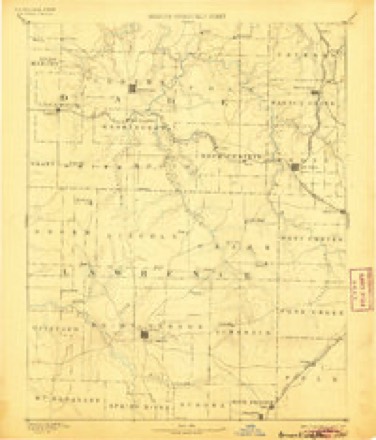
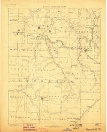
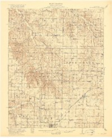
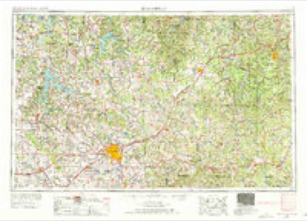
Topographic sheets covering this place
8 surveys from 19 printed sheetsMatched by testing this settlement's coordinate against the published boundary of every sheet in the United States Geological Survey's historical collection. Each opens the scanned sheet at the Survey.
- 1886 USGS Greenfield quadrangle1:125000, 4 printings
- 1888 USGS Greenfield quadrangle1:125000
- 1919 USGS Halltown quadrangle1:62500, 3 printings
- 1954 USGS Springfield quadrangle1:250000, 6 printings
- 1958 USGS Springfield quadrangle1:250000
- 1959 USGS Springfield quadrangle1:250000
- 1969 USGS Halltown NE quadrangle1:24000, 2 printings
- 1982 USGS Springfield quadrangle1:100000
In the county-history sources
3,968 words on this townshipHistory of Greene County, Missouri .., published 1883 has no passage naming this settlement, which was common for smaller places. Its township is covered in full.
The chapter on Pond Creek Township covers description, early settlers and settlements, tragedies of the civil war, m. e. church, hopewell baptist church, christian church.
Read the chapter on Pond Creek Township - 3,968 words.
Fires near this place
13 since 1997Regional context, not property-specific evidence. The federal wildfire occurrence database lists 13 fires within 5 miles of Plano between 1997 and 2014, burning about 141 acres in total. None started naturally. None was recorded as arson. Distance is straight-line from the map coordinates, so a fire counted here may appear on a neighbouring settlement's page as well.
| Reported cause | Fires |
|---|---|
| Missing data/not specified/undetermined | 6 |
| Debris and open burning | 5 |
| Equipment and vehicle use | 1 |
| Smoking | 1 |
The most recent of them, most recent first, with the day each was reported and the service that recorded it.
| Date | Cause | Size | Reported by | Name on the report |
|---|---|---|---|---|
| 6 August 2014 | Debris and open burning | 1.0 acres | Missouri Department of Conservation | not named |
| 5 April 2014 | Missing data/not specified/undetermined | 1.0 acres | Missouri Department of Conservation | not named |
| 30 March 2014 | Missing data/not specified/undetermined | 20 acres | Missouri Department of Conservation | not named |
| 14 March 2014 | Missing data/not specified/undetermined | 2.0 acres | Missouri Department of Conservation | not named |
| 12 March 2014 | Debris and open burning | 4.0 acres | Missouri Department of Conservation | not named |
| 11 March 2014 | Missing data/not specified/undetermined | 80 acres | Missouri Department of Conservation | not named |
| 10 March 2014 | Missing data/not specified/undetermined | 25 acres | Missouri Department of Conservation | not named |
| 27 February 2014 | Smoking | 1.0 acres | Missouri Department of Conservation | not named |
Settlements close enough to share some of these fires:
Mines and quarries near this place
10 of 22 shownRegional context, not property-specific evidence. The federal mineral resources record lists 22 workings within 5 miles of Plano: 22 past producers. None of them still produces. What was taken out: Iron, Stone, Crushed/Broken, Lead, Zinc, Copper. Distance is straight-line from the map coordinates, so a quarry counted here may appear on a neighbouring settlement's page as well.
| Where | Site | Commodity | Status | Recorded |
|---|---|---|---|---|
| Unknown | Copper | Past Producer | ||
| Unknown | Copper | Past Producer | ||
| Pickerel Creek Diggings | Lead, Zinc | Past Producer | ||
| Unknown | Lead, Zinc | Past Producer | ||
| Unknown | Lead, Zinc | Past Producer | ||
| Lovette Quarry | Stone, Crushed/Broken | Past Producer | ||
| Rose and Son Quarry | Stone, Crushed/Broken | Past Producer | ||
| Unknown | Stone, Crushed/Broken | Past Producer | ||
| Unknown | Stone, Crushed/Broken | Past Producer | ||
| Unknown | Stone, Crushed/Broken | Past Producer |
Storms near this place
14 since 2009Regional context, not property-specific evidence. The National Weather Service names Plano in 14 storm reports between 2009 and 2025: 10 thunderstorm wind, 2 hail, 1 flash flood, 1 flood. The reports record 4 injuries. Each account below is quoted exactly as the forecast office filed it, from the NOAA Storm Events Database, and each date opens the federal record of that event.
| When | Event | Place named | Harm | What the report says |
|---|---|---|---|---|
| May 2009 | Thunderstorm Wind | Plano | 4 hurt, $15,000,000 | Sixty to 90 mph winds caused widespread tree, power pole, and structural damage across much of Greene County. Major roof damage to schools included Willard North Elementary, Fair Grove High School, Ash Grove High School, Bois D' Arc Elementary, and Glendale High School. Four students were injured at Fair Grove High School as debris fell into the school while the roof was peeling off. Portions of the elementary and middle school were completely destroyed, along with some light poles on the baseball field. The Ebenezer fire station and fire trucks sustained major damage. Several billboards west of Springfield along Interstate 44 were destroyed. The Sam's Club on Highway 65 and Sunshine had a temporary wall that was peeled off of the building. The Willard High School baseball field had major damage to the press box and dugouts. At Fellows Lake, the marina was broken into three pieces, and jammed the boat docks up onto the boat ramp. Thousands of residences across Greene County lost power up to three days. |
| May 2023 | Hail | Plano | $80,000 | Hail at least to golf ball in size was reported with damage to several vehicles. |
| April 2025 | Thunderstorm Wind | Plano | $25,000 | A large sign was blown over at the Hoods Truck stop on I-44. |
| October 2012 | Thunderstorm Wind | Plano | $10,000 | Small shed and two greenhouses were destroyed. |
| October 2012 | Thunderstorm Wind | Plano | $10,000 | A poorly constructed barn and outbuildings were destroyed and debris was scattered in a southwest to northeast direction about 200 yards away. |
| July 2018 | Thunderstorm Wind | Plano | $5,000 | Received reports of power lines down in the Ash Grove area near Lawrence County Roads 1240 and 2020. |
| June 2015 | Thunderstorm Wind | Plano | $5,000 | Several trees and power lines were blown down north and south of Highway 174. |
| May 2022 | Flood | Plano | - | The Outer Road was closed a a low water area due to flooding. |
| August 2019 | Thunderstorm Wind | Plano | - | Several trees were uprooted northwest of Billings. |
| June 2018 | Thunderstorm Wind | Plano | - | A trained weather spotter reported a large 27 inch diameter tree down at the intersection of Farm Road 136 and Highway F. |
| June 2018 | Thunderstorm Wind | Plano | - | Large trees with diameters in excess of 2 feet were reported down at Farm Road 128 and F highway and Farm Roads 25 and 136. |
| June 2014 | Hail | Plano | - | Dime to quarter size hail was reported. |
| June 2010 | Thunderstorm Wind | Plano | - | Thunderstorm winds blew down numerous tree limbs up to a foot in diameter in the Halltown and Bois D Arc area. Many roads were blocked with tree debris. |
| September 2010 | Flash Flood | Plano | - | One foot of flowing water was reported across County Road 168 near the intersection of Highway PP. Ponding of water, up to four inches deep, was also reported on Highway PP. |
Nearest settlements
The eight closest, with where each one stands in the county. Distances are straight-line, computed from the Geographic Names Information System coordinates.
| Map | Place | Distance | Sheets |
|---|---|---|---|
| Yeakley | 2.4 miles | 19 | |
| Yeakley (historical) | 3.6 miles | 21 | |
| Bois D'Arc | 5.0 miles | 16 | |
| Republic | 6.3 miles | 20 | |
| Elwood | 6.8 miles | 21 | |
| Brookline | 7.2 miles | 21 | |
| Ash Grove | 8.6 miles | 16 | |
| Haseltine | 8.8 miles | 21 |
Provenance
This settlement is recorded in the Geographic Names Information System as feature 741158. The sheet list is computed by point-in-boundary test against the United States Geological Survey's historical topographic inventory. Both are works of the United States government and carry no copyright under 17 U.S.C. 105.
Wildfire. Short, Karen C. 2022. Spatial wildfire occurrence data for the United States, 1992-2020 [FPA_FOD_20221014]. 6th Edition. Fort Collins, CO: Forest Service Research Data Archive. https://doi.org/10.2737/RDS-2013-0009.6 Collected with United States Government funding and usable without additional permissions or fees.
Mines and quarries. USGS Mineral Resources Data System (MRDS) https://mrdata.usgs.gov/mrds/ A work of the United States government, no copyright under 17 U.S.C. 105.
Storms. NOAA National Centers for Environmental Information, Storm Events Database https://www.ncei.noaa.gov/stormevents/ A work of the United States government, no copyright under 17 U.S.C. 105. Narratives are quoted verbatim from the National Weather Service report and are not edited or summarised.