 Block
Republic, Missouri
20 topographic sheets cover this place, the earliest surveyed in 1884 and the latest in 1982. It stands in Republic North Township. It lies in ZIP code area 65738. The Survey maps it on the Republic quadrangle.
On record in Republic
Buildings and businesses the archive holds for this place. Each opens its own page, with the source record it came from.
On the National Register 1 record
 Elijah Teague Anderson Houselisted 1980
Topographic sheets covering this place
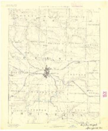
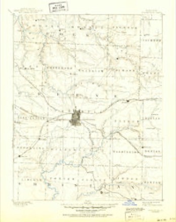
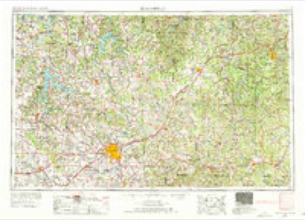
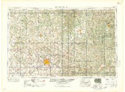
8 surveys from 20 printed sheetsMatched by testing this settlement's coordinate against the published boundary of every sheet in the United States Geological Survey's historical collection. Each opens the scanned sheet at the Survey.
- 1884 USGS Springfield quadrangle1:125000
- 1886 USGS Springfield quadrangle1:125000, 5 printings
- 1954 USGS Springfield quadrangle1:250000, 6 printings
- 1958 USGS Springfield quadrangle1:250000
- 1959 USGS Springfield quadrangle1:250000
- 1960 USGS Republic quadrangle1:24000, 4 printings
- 1979 USGS Republic quadrangle1:24000
- 1982 USGS Springfield quadrangle1:100000
Fires near this place
11 since 1992Regional context, not property-specific evidence. The federal wildfire occurrence database lists 11 fires within 5 miles of Republic between 1992 and 2011, burning about 132 acres in total. None started naturally. 5 were recorded as arson. Distance is straight-line from the map coordinates, so a fire counted here may appear on a neighbouring settlement's page as well.
| Reported cause | Fires |
|---|---|
| Arson/incendiarism | 5 |
| Debris and open burning | 3 |
| Equipment and vehicle use | 1 |
| Missing data/not specified/undetermined | 1 |
| Smoking | 1 |
The most recent of them, most recent first, with the day each was reported and the service that recorded it.
| Date | Cause | Size | Reported by | Name on the report |
|---|---|---|---|---|
| 7 July 2005 | Missing data/not specified/undetermined | under an acre | Wilson's Creek National Battlefield | WELDON 05 |
| 27 July 2011 | Equipment and vehicle use | 30 acres | Wilson's Creek National Battlefield | DRAGGER |
| 9 April 2000 | Arson/incendiarism | under an acre | Wilson's Creek National Battlefield | ROAD 182 |
| 5 April 1994 | Arson/incendiarism | 90 acres | Missouri Department of Conservation | not named |
| 14 March 1996 | Arson/incendiarism | 1.1 acres | Wilson's Creek National Battlefield | BEETLE |
| 1 March 1994 | Arson/incendiarism | 2.0 acres | Missouri Department of Conservation | not named |
| 26 February 2006 | Debris and open burning | 1.5 acres | Wilson's Creek National Battlefield | LOGAN 06 |
| 2 February 1992 | Smoking | 2.0 acres | Missouri Department of Conservation | not named |
Settlements close enough to share some of these fires:
Mines and quarries near this place
10 of 17 shownRegional context, not property-specific evidence. The federal mineral resources record lists 17 workings within 5 miles of Republic: 16 past producers, 1 producer. 1 still produces. What was taken out: Iron, Stone, Crushed/Broken, Lead, Zinc, Clay. Distance is straight-line from the map coordinates, so a quarry counted here may appear on a neighbouring settlement's page as well.
| Where | Site | Commodity | Status | Recorded |
|---|---|---|---|---|
| Unknown - Clay | Clay | Past Producer | ||
| Unknown | Lead, Zinc | Past Producer | ||
| Unknown | Lead, Zinc | Past Producer | ||
| Clever Quarry & Plant | Stone, Crushed/Broken | Producer | ||
| Lovette Quarry | Stone, Crushed/Broken | Past Producer | ||
| Unknown | Stone, Crushed/Broken | Past Producer | ||
| Unknown | Stone, Crushed/Broken | Past Producer | ||
| Bayliss Land | Iron | Past Producer | ||
| Jackson Bank | Iron | Past Producer | ||
| John Jackson Mine | Iron | Past Producer |
Storms near this place
60 of 157 shownRegional context, not property-specific evidence. The National Weather Service names Republic in 157 storm reports between 1994 and 2026: 69 hail, 68 thunderstorm wind, 8 heavy rain, 7 flash flood. No death or injury is recorded in these reports. Each account below is quoted exactly as the forecast office filed it, from the NOAA Storm Events Database, and each date opens the federal record of that event.
| When | Event | Place named | Harm | What the report says |
|---|---|---|---|---|
| April 2026 | Hail | Republic | $314,900,000 | A hail swath from a mile to 3 miles wide began southwest of Republic and continued to the northeast across Greene County. Hail from quarters to 4.75 inches in size fell along a path from Republic to northwestern Springfield to Fair Grove as an intensifying left moving supercell moved to the northeast across the County. Along the storms path, numerous homes, vehicles, businesses, equipment, crops, livestock and other structures were damaged by hail before the storm passed into northwestern Webster County. ||As the storm moved across northwestern Springfield, it moved over the Springfield-Branson National Airport where 4 commuter jets, two cargo jets and up to 25 general aviation aircraft were on the TARMAC. Over 1200 vehicles were in the short and long term parking lot. The storm them moved over the Springfield Zoo killing an Emu and injuring another. At least two dozen people were injured by hail by being outside during the hail. |
| April 2023 | Hail | Republic | $4,000,000 | Tennis ball sized hail was reported in the western portion of Greene County stretching from northern sections of Republic into west Springfield and northward into Willard. More than 100 homes and dozens of cars suffered damage. This entry will include damages for all entries for Greene County for this event. |
| January 2008 | Tornado (EF2) | Republic | $2,000,000 | A National Weather Service storm survey revealed that an EF-2 tornado impacted northern sections of Republic. Numerous buildings and houses sustained damage. Nearly 15 houses were severly damaged or destroyed. The E3 elementary school in Republic experienced a direct hit causing major damage to the roof, which led to water damage on the west wing of the school. The contracter responsible for rebuilding the roof stated that in order for this type of damage to occur, wind speeds were in excess of 100 mph. |
| May 2009 | Tornado (EF1) | Republic | $1,000,000 | The Republic Emergency Management Director visually spotted and tracked a tornado that touched down southwest of Republic and moved across the city. Approximately 50 structures were damaged. The heaviest damage appeared to be concentrated on Kristopher Street. |
| May 2015 | Lightning | Republic | $300,000 | A large home near Republic was destroyed by a fire which was started by a lightning strike. Time was estimated. |
| June 2013 | Thunderstorm Wind | Republic | $250,000 | A tree was down on a house at Grant and Web Street causing significant roof damage. Several trees fell on cars. Several yard fences were blown down. Several area firework vendors had their tents destroyed and lost of firework inventory. The estimated cost of damages for the entire Republic area including trees down, power lines, and structures will be estimated in this storm report. |
| June 2025 | Thunderstorm Wind | Republic | $200,000 | Extensive tree damage on the north side of Republic. Estimated 40 percent of the city without power. |
| December 2018 | Tornado (EF1) | Republic | $175,000 | An EF-1 tornado developed approximately 3 miles west of Republic and tracked northeast and dissipated within the city limits of Republic. Two large barns were destroyed and numerous trees were uprooted. Several homes sustained minor roof damage. |
| April 2026 | Thunderstorm Wind | Republic | $50,000 | A measured 67mph gust was recorded on the south side of Republic. Several trees were reported down with two on homes. |
| August 2002 | Thunderstorm Wind | Republic | $50,000 | no account filed |
| December 2018 | Thunderstorm Wind | Republic | $45,000 | Thunderstorm winds rolled a camper multiple times into the wall of a home. Multiple outbuildings were also damaged. |
| December 2018 | Thunderstorm Wind | Republic | $40,000 | Roof damage occurred to the Meek's Building Supply Company. |
| December 2018 | Thunderstorm Wind | Republic | $25,000 | Winds measured at 83 mph removed shingles from several homes. |
| June 2009 | Thunderstorm Wind | Republic | $25,000 | Several road and business signs in Republic were damaged from downburst wind gusts. |
| January 2008 | Thunderstorm Wind | Republic | $25,000 | Severe straight line winds moved a mobile home and removed the roof from a home which had been damaged from storms an hour earlier. |
| December 2018 | Thunderstorm Wind | Republic | $20,000 | Several trees were reported down and shingle were blown of several homes. |
| August 1997 | Thunderstorm Wind | Republic | $15,000 | Thunderstorm winds downed numerous trees and damaged a storage shed along Highway 60. |
| June 1997 | Thunderstorm Wind | Republic | $15,000 | no account filed |
| July 2023 | Thunderstorm Wind | Republic | $10,000 | High winds downed tree limbs blew shingles off a home. |
| May 2019 | Thunderstorm Wind | Republic | $10,000 | The Brookline Fire Department reported that the Rapid Roberts at Highway 60 and Hamilton Street had significant sign damage. |
| January 2008 | Thunderstorm Wind | Republic | $10,000 | Severe winds associated with a squall line produced widespread minor damage across the city including downed limbs and windows blown out. |
| November 2005 | Thunderstorm Wind | Republic | $10,000 | State trooper reported several outbuildings uplifted and destroyed. |
| July 1995 | Thunderstorm Wind | Republic | $10,000 | no account filed |
| December 2021 | Thunderstorm Wind | Republic | $6,000 | A home suffered minor roof damage and a utility shed was moved off its foundation. |
| July 2014 | Thunderstorm Wind | Republic | $5,000 | Several pictures on social media showed large trees blown down around Republic. |
| May 2011 | Thunderstorm Wind | Republic | $5,000 | A barn was damaged. |
| August 2005 | Thunderstorm Wind | Republic | $5,000 | Severe thunderstorm wind gusts downed trees and playground equipment. A roof was also damaged as numerous shingles were blown off. |
| February 2019 | Thunderstorm Wind | Republic | $2,000 | An off duty NWS employee reported shingle damage to a home. |
| May 2015 | Thunderstorm Wind | Republic | $2,000 | Several trees were blown down and one power line down. |
| April 2011 | Thunderstorm Wind | Republic | $2,000 | A few sheds were damaged at the Lowes in Republic. The winds were estimated at 50 mph. |
| August 2024 | Thunderstorm Wind | Republic | $1,000 | A NWS employee reported a downed tree. |
| August 2018 | Thunderstorm Wind | Republic | $1,000 | Multiple large tree limbs were reported down with minor damage to a few outbuildings. |
| June 2024 | Thunderstorm Wind | Republic | $500 | A large tree limb was down near Republic. |
| April 1994 | Hail | Republic | $500 | Numerous reports of three-quarter-inch hail in Republic. Skywarn spotters reported one-inch hail covering the ground in Springfield. |
| April 1994 | Hail | Republic | $500 | no account filed |
| April 2026 | Thunderstorm Wind | Republic | - | A large tree was reported down. |
| April 2026 | Hail | Republic | - | Quarter sized hail was reported. |
| April 2026 | Hail | Republic | - | Hail up to the size of Ping pong balls was reported. |
| April 2025 | Flash Flood | Republic | - | Several city streets including East Hadley and Grace Streets were flooded with 6 to 8 inches of water on the road. |
| April 2025 | Thunderstorm Wind | Republic | - | A large tree was reported down on County Line Road blocking the west bound lane of traffic. |
| April 2025 | Hail | Republic | - | Half dollar sized hail was reported. |
| June 2025 | Thunderstorm Wind | Republic | - | The weather station at Republic Emergency Management measured a 68mph wind gust. |
| September 2025 | Hail | Republic | - | Hail to the size of quarters fell east of Republic. |
| May 2024 | Hail | Republic | - | Quarter size hail report from a NWS employee. |
| May 2024 | Hail | Republic | - | Report of half dollar size hail. |
| May 2024 | Hail | Republic | - | Report of half dollar size hail. |
| May 2024 | Hail | Republic | - | Report of half dollar size hail. |
| May 2024 | Hail | Republic | - | Report of quarter size hail. |
| August 2024 | Thunderstorm Wind | Republic | - | Multiple reports of 60 mph winds were reported in Republic. |
| April 2023 | Hail | Republic | - | Golf ball sized hail was reported via MPing. |
| May 2023 | Hail | Republic | - | Half dollar sized hail was reported. |
| May 2023 | Hail | Republic | - | Golf ball sized hail was reported in a mainly rural area. |
| May 2023 | Hail | Republic | - | Quarter sized hail was reported. |
| August 2023 | Flash Flood | Republic | - | Street and yard flooding occurred in town due to heavy rainfall. |
| August 2022 | Flash Flood | Republic | - | Street flooding was reported causing traffic issues. |
| August 2022 | Thunderstorm Wind | Republic | - | A large tree was reported down. |
| March 2020 | Hail | Republic | - | Half dollar to golf ball sized hail was reported via social media in a rural area southeast of Republic off of Farm Road 194. |
| March 2020 | Hail | Republic | - | Hail from dime to ping pong ball sized was reported by an off duty NWS employee just southeast of Republic. |
| March 2020 | Hail | Republic | - | Quarter Sized hail was reported. |
| April 2020 | Hail | Republic | - | Penny sized hail was reported via MPing. |
Nearest settlements
The eight closest, with where each one stands in the county. Distances are straight-line, computed from the Geographic Names Information System coordinates.
| Map | Place | Distance | Sheets |
|---|---|---|---|
| Wilsons Creek | 4.3 miles | 20 | |
| Brookline | 4.4 miles | 21 | |
| Yeakley (historical) | 6.0 miles | 21 | |
| Battlefield | 6.0 miles | 22 | |
| Yeakley | 6.1 miles | 19 | |
| Plano | 6.3 miles | 19 | |
| Elwood | 7.9 miles | 21 | |
| Haseltine | 7.9 miles | 21 |
Provenance
This settlement is recorded in the Geographic Names Information System as feature 725224. The sheet list is computed by point-in-boundary test against the United States Geological Survey's historical topographic inventory. Both are works of the United States government and carry no copyright under 17 U.S.C. 105.
Wildfire. Short, Karen C. 2022. Spatial wildfire occurrence data for the United States, 1992-2020 [FPA_FOD_20221014]. 6th Edition. Fort Collins, CO: Forest Service Research Data Archive. https://doi.org/10.2737/RDS-2013-0009.6 Collected with United States Government funding and usable without additional permissions or fees.
Mines and quarries. USGS Mineral Resources Data System (MRDS) https://mrdata.usgs.gov/mrds/ A work of the United States government, no copyright under 17 U.S.C. 105.
Storms. NOAA National Centers for Environmental Information, Storm Events Database https://www.ncei.noaa.gov/stormevents/ A work of the United States government, no copyright under 17 U.S.C. 105. Narratives are quoted verbatim from the National Weather Service report and are not edited or summarised.