 Block
Sequiota, Missouri
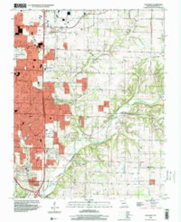
28 topographic sheets cover this place, the earliest surveyed in 1884 and the latest in 1996. It stands in Springfield Township. It lies in ZIP code area 65804. It stands on Sequiota Spring Branch. The Survey maps it on the Galloway quadrangle.
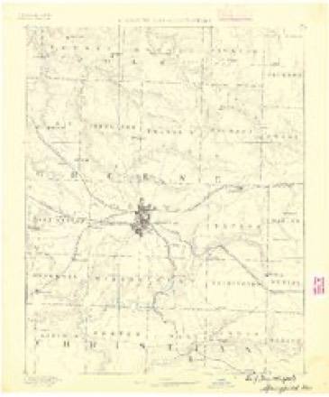
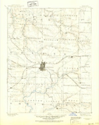
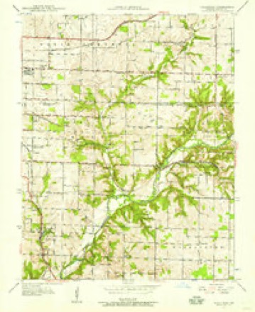
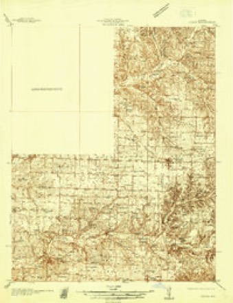
Topographic sheets covering this place
13 surveys from 28 printed sheetsMatched by testing this settlement's coordinate against the published boundary of every sheet in the United States Geological Survey's historical collection. Each opens the scanned sheet at the Survey.
- 1884 USGS Springfield quadrangle1:125000
- 1886 USGS Springfield quadrangle1:125000, 5 printings
- 1937 USGS Galloway quadrangle1:24000, 2 printings
- 1937 USGS Ozark quadrangle1:48000
- 1943 USGS Ozark quadrangle1:62500
- 1945 USGS Ozark quadrangle1:62500, 2 printings
- 1948 USGS Galloway quadrangle1:24000, 2 printings
- 1954 USGS Springfield quadrangle1:250000, 6 printings
- 1958 USGS Springfield quadrangle1:250000
- 1959 USGS Springfield quadrangle1:250000
- 1960 USGS Galloway quadrangle1:24000, 4 printings
- 1982 USGS Springfield quadrangle1:100000
- 1996 USGS Galloway quadrangle1:24000
In the county-history sources
41,758 words on this townshipPersonal Reminiscences and Fragments of the Early History of Springfield and Greene County, Missouri : Related by Pioneers and Their Descendants at Old Settlers' Dinners Given at the Home of Capt. Martin J. Hubble, March 31, 1907, 1908, 1909, 1910, 1911, published 1914; Greene County, Missouri : 1916, published 1916 has no passage naming this settlement, which was common for smaller places. Its township is covered in full.
The chapter on Springfield Township covers the township.
Read the chapter on Springfield Township - 41,758 words.
Fires near this place
68 since 1992Regional context, not property-specific evidence. The federal wildfire occurrence database lists 68 fires within 5 miles of Sequiota between 1992 and 2017, burning about 118 acres in total. 1 started naturally. 1 was recorded as arson. Distance is straight-line from the map coordinates, so a fire counted here may appear on a neighbouring settlement's page as well.
| Reported cause | Fires |
|---|---|
| Debris and open burning | 41 |
| Missing data/not specified/undetermined | 14 |
| Equipment and vehicle use | 7 |
| Smoking | 3 |
| Recreation and ceremony | 1 |
| Arson/incendiarism | 1 |
| Natural | 1 |
The most recent of them, most recent first, with the day each was reported and the service that recorded it.
| Date | Cause | Size | Reported by | Name on the report |
|---|---|---|---|---|
| 10 September 1999 | Smoking | 1.0 acres | Missouri Department of Conservation | not named |
| 1 September 2011 | Debris and open burning | 1.0 acres | Missouri Department of Conservation | not named |
| 28 August 1995 | Smoking | 1.0 acres | Missouri Department of Conservation | not named |
| 24 August 2003 | Missing data/not specified/undetermined | under an acre | Missouri State Fire Marshal's Office | not named |
| 23 August 1995 | Debris and open burning | 1.0 acres | Missouri Department of Conservation | not named |
| 21 August 1999 | Debris and open burning | 10 acres | Missouri Department of Conservation | not named |
| 21 August 1999 | Debris and open burning | 1.0 acres | Missouri Department of Conservation | not named |
| 8 July 1997 | Missing data/not specified/undetermined | 1.0 acres | Missouri Department of Conservation | not named |
Settlements close enough to share some of these fires:
Mines and quarries near this place
10 of 46 shownRegional context, not property-specific evidence. The federal mineral resources record lists 46 workings within 5 miles of Sequiota: 40 past producers, 4 producers, 2 prospects. 4 still produce. What was taken out: Zinc, Stone, Crushed/Broken, Lead, Zinc. Distance is straight-line from the map coordinates, so a quarry counted here may appear on a neighbouring settlement's page as well.
| Where | Site | Commodity | Status | Recorded |
|---|---|---|---|---|
| Gem Mine | Lead, Zinc | Past Producer | ||
| Phelps Mines | Lead, Zinc | Past Producer | ||
| Unknown | Lead, Zinc | Past Producer | ||
| Unknown | Lead, Zinc | Past Producer | ||
| Wolverine Shaft Number Three | Lead, Zinc | Past Producer | ||
| Ash Grove Cement Co - Plant | Stone, Crushed/Broken | Producer | Surface | |
| Ash Grove Mine | Stone, Crushed/Broken | Producer | ||
| Ash Grove Quarry | Stone, Crushed/Broken | Producer | ||
| Bennett Quarry | Stone, Crushed/Broken | Past Producer | ||
| Marblehead Quarry | Stone, Crushed/Broken | Past Producer |
Storms near this place
46 since 2008Regional context, not property-specific evidence. The National Weather Service names Sequiota in 46 storm reports between 2008 and 2025: 13 flash flood, 10 thunderstorm wind, 10 flood, 6 hail. No death or injury is recorded in these reports. Each account below is quoted exactly as the forecast office filed it, from the NOAA Storm Events Database, and each date opens the federal record of that event.
| When | Event | Place named | Harm | What the report says |
|---|---|---|---|---|
| April 2025 | Thunderstorm Wind | Sequiota | $25,000 | A 65 foot radio tower collapses after a Gill Windmaster Anemometer mounted 20 up on the tower measures a 91 mph wind gust. |
| October 2019 | Tornado (EF0) | Sequiota | $15,000 | A National Weather Service Storm survey determined that an intermittent tornado touched down in southeast Springfield, just east of Highway 65 and south of Battlefield Road. The tornado then tracked to the northeast where it crossed Battlefield Road and south Blackman Road. The tornado snapped and broke large tree limbs, bent a few street signs and damaged an aluminum fence. The intermittent path then continued to the northeast where it caused minor roof damage to a home south of Sunset Street. This was the end point of the intermittent tornado path. The maximum winds were estimated at 70mph, with a width of 20 yards and a total distance traveled of 1.5 miles. The tornado started at 1:11 am and ended at 1:15am. |
| July 2023 | Flash Flood | Sequiota | $10,000 | Several intersections along Battlefield Road had cars stalled in high water. |
| July 2024 | Thunderstorm Wind | Sequiota | $9,000 | Multiple large 1 to 3 inch tree limbs were reported down. A few shingles were blown off a roof. |
| July 2023 | Thunderstorm Wind | Sequiota | $5,000 | Tree limbs of at least 1 inches in diameter and some shingles were damaged by high winds. |
| April 2025 | Thunderstorm Wind | Sequiota | $2,000 | Multiple large tree branches were downed by high winds with on puncturing the roof of a home. |
| May 2011 | Thunderstorm Wind | Sequiota | $2,000 | A power line was blown down near Rogers and Fremont streets. |
| October 2010 | Thunderstorm Wind | Sequiota | $2,000 | A traffic signal was blown over blocking traffic at the intersection of Battlefield and Freemont. There were scattered power outages reported around town. |
| April 2024 | Flash Flood | Sequiota | - | Significant flooding occurred along Lone Pine Avenue near Pearson Creek. |
| April 2023 | Hail | Sequiota | - | Penny sized hail was reported via MPing. |
| April 2023 | Hail | Sequiota | - | Penny sized hail was reported via MPing. |
| July 2023 | Flash Flood | Sequiota | - | Several roads were reported as impassable due to high water in the Galloway area. |
| July 2023 | Hail | Sequiota | - | Quarter sized hail was reported. |
| April 2022 | Hail | Sequiota | - | Penny sized hail was reported via MPing. |
| May 2022 | Flood | Sequiota | - | County Road 193 was flooded and impassable along the upper James River. |
| August 2022 | Flash Flood | Sequiota | - | Street flooding was reported via MPing. |
| March 2021 | Flood | Sequiota | - | The James River reached flood stage and began impacting low water areas along the river and was continuing to rise. |
| March 2021 | Flood | Sequiota | - | The river gauge on the James River on South Farm Road 193 reached moderate flood stage. Areas along the river were reported as underwater. |
| March 2020 | Flood | Sequiota | - | The James River east of Springfield was flooding portions of S Farm Road 193. Minor flood stage was recorded at the river gauge at that location. |
| May 2020 | Flood | Sequiota | - | The Crighton Access on Farm Road 193 at the James River was closed due to flooding. |
| October 2019 | Heavy Rain | Sequiota | - | The CoCoRaHS station mo-gr-52 near Springfield reported 2.52 inches of rainfall. |
| October 2019 | Heavy Rain | Sequiota | - | The CoCoRaHS station mo-gr-117 near Springfield reported 2.25 inches of rainfall . |
| May 2019 | Thunderstorm Wind | Sequiota | - | Multiple reports of large tree limbs down in a neighborhood near the Battlefield Mall were received. |
| September 2018 | Heavy Rain | Sequiota | - | COCORAHS Station MO-GR-52, reported a 24 rain total of 3.31 inches. |
| September 2018 | Heavy Rain | Sequiota | - | The Mesonet station SEQM7, reported a 24 rain total of 2.74 inches. |
| September 2018 | Heavy Rain | Sequiota | - | The Mesonet station SGFM7, reported a 24 rain total of 2.37 inches. |
| August 2018 | Thunderstorm Wind | Sequiota | - | Multiple reports of 4 to 6 inch tree branches down were received near the intersection of East Guinevere Street and South King Avenue. |
| April 2017 | Flash Flood | Sequiota | - | The intersection of Battlefield and Luster Road was impassable. |
| April 2017 | Flash Flood | Sequiota | - | Flood water was over the roadway near Lone Pine and East Republic Road. |
| July 2015 | Flash Flood | Sequiota | - | Water was over the road at the intersection of Battlefield and Maryland Roads. Fire department assisted with stranded motorist in high water. |
| December 2015 | Heavy Rain | Sequiota | - | There was a report of 4.96 inches of rainfall in 24 hours. |
| June 2013 | Flash Flood | Sequiota | - | There was a foot of flowing water over the roadway at Battlefield and Lone Pine. |
| June 2013 | Flash Flood | Sequiota | - | There was high water flowing through neighborhoods along Lone Pine Road near Battlefield. Galloway Creek was out of its banks and flooding several streets. |
| July 2013 | Flash Flood | Sequiota | - | Lone Pine Road near Republic Road was closed due to flooding from Galloway Creek. |
| October 2012 | Flood | Sequiota | - | The James River Gauge on the southeast side of Springfield briefly reached minor flood stage at 12.0 feet. |
| September 2012 | Flood | Sequiota | - | The low water crossing on Convington Road near Galloway Creek was flooded. |
| April 2011 | Flood | Sequiota | - | Two to three inches of water was over the road in the area of Battlefield and Highway 65 in southeast Springfield. |
| January 2010 | Flood | Sequiota | - | A low water crossing, at the Kinser Bridge on the James River, was flooded and impassable. |
| July 2010 | Flash Flood | Sequiota | - | Two feet of water was reported flowing over Marlin and Edgewood Roads. |
| July 2010 | Flash Flood | Sequiota | - | A foot of water over was reported covering the intersection of Battlefield and Lone Pine Roads. |
| July 2009 | Flood | Sequiota | - | Heavy rainfall from a slow moving thunderstorm caused street flooding to occur across portions of southeast Springfield. |
| October 2009 | Flash Flood | Sequiota | - | Significant street flooding occurred at the intersection of National and Battlefield Streets. |
| June 2008 | Thunderstorm Wind | Sequiota | - | Several trees were blown down across the east side of Springfield. |
| June 2013 | Hail | Sequiota | - | no account filed |
| April 2010 | Hail | Sequiota | - | no account filed |
| June 2008 | Thunderstorm Wind | Sequiota | - | no account filed |
Nearest settlements
The eight closest, with where each one stands in the county. Distances are straight-line, computed from the Geographic Names Information System coordinates.
Elsewhere
Matched on this settlement's Geographic Names Information System number rather than its name, so it cannot be a different place of the same name in another state.
| Wikidata item Q122569344 | The structured record the population and elevation above come from. Public domain (CC0). |
Provenance
This settlement is recorded in the Geographic Names Information System as feature 726207. The sheet list is computed by point-in-boundary test against the United States Geological Survey's historical topographic inventory. Both are works of the United States government and carry no copyright under 17 U.S.C. 105.
Wildfire. Short, Karen C. 2022. Spatial wildfire occurrence data for the United States, 1992-2020 [FPA_FOD_20221014]. 6th Edition. Fort Collins, CO: Forest Service Research Data Archive. https://doi.org/10.2737/RDS-2013-0009.6 Collected with United States Government funding and usable without additional permissions or fees.
Mines and quarries. USGS Mineral Resources Data System (MRDS) https://mrdata.usgs.gov/mrds/ A work of the United States government, no copyright under 17 U.S.C. 105.
Storms. NOAA National Centers for Environmental Information, Storm Events Database https://www.ncei.noaa.gov/stormevents/ A work of the United States government, no copyright under 17 U.S.C. 105. Narratives are quoted verbatim from the National Weather Service report and are not edited or summarised.