 Block
Clatonia, Nebraska
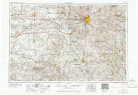
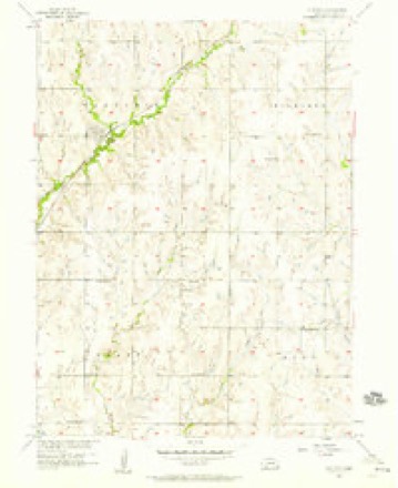
11 topographic sheets cover this place, the earliest surveyed in 1955 and the latest in 1986. It stands in Clatonia Township. It lies in ZIP code area 68328. The Survey maps it on the Clatonia quadrangle. 263 people lived here at the 2020 count. It stands 1,378 feet above sea level.
Population over time
2 figuresClatonia grew from 231 to 263 between 2010 and 2020. These are the recorded population figures Wikidata holds for this place, reached through the Geographic Names Information System number this page is keyed on rather than by name, so they belong to this place and not to another of the same name. Most are census counts, but not all are: an early figure may be a founding or settlement estimate, and an estimate published within five years of a census is left out. The change column is computed, and is left blank where more than 20 years separate a figure from the one before it, because a gap that long is not a change between two counts.
| Year | People | Change |
|---|---|---|
| 2010 | 231 | |
| 2020 | 263 | +32 (+14%) |
Topographic sheets covering this place
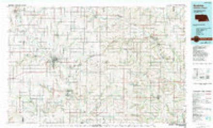
5 surveys from 11 printed sheetsMatched by testing this settlement's coordinate against the published boundary of every sheet in the United States Geological Survey's historical collection. Each opens the scanned sheet at the Survey.
- 1955 USGS Lincoln quadrangle1:250000, 5 printings
- 1957 USGS Clatonia quadrangle1:24000, 2 printings
- 1957 USGS Lincoln quadrangle1:250000
- 1958 USGS Lincoln quadrangle1:250000
- 1986 USGS Beatrice quadrangle1:100000, 2 printings
In the county-history sources
1,519 words on this townshipHistory of Gage County, Nebraska; a Narrative of the Past, with Special Emphasis Upon the Pioneer Period of the County's History, Its Social, Commercial, Educational, Religious, and Civic Development from the Early Days to the Present Time, published 1918 names this settlement in its chapter on Clatonia Township. These are the passages that mention it, exactly as the scans read.
Tucked away in the northwest corner of the county is the substantial village of Clatonia, located on a creek of that name, in Clatonia township. The original townsite comprises a forty-acre tract, in sections 22 and 27. Henry Albert and J. PI. Steinmeyer, both highly esteemed pioneer residents of the county, were the proprietors of Clatonia, and having caused the townsite to be surveyed and platted in the spring of 1892, they filed the plat for record in the office of the register of deeds, December 3, 1893. Some additions have been made to Clatonia and the townsite now includes about eighty acres of land. It is a station on the main line of the Rock Island Railway from Chicago to Denver, via Omaha, Lincoln, and Jansen. It is about twenty miles northwest of Beatrice and about the same distance southwest of Lincoln. Prior to the construction of this line of railroad and the founding of Clatonia the farmers of this section were without immediate market facilities for the produce of their lands, and Clatonia township and other portions of the northwest corner of the county divided their trade with Cortland, DeWitt, Wilber, and Crete; but since the founding of the village, that scope of country has been given an excellent market.
Passage source: History of Gage County, Nebraska; a Narrative of the Past, with Special Emphasis Upon the Pioneer Period of the County's History, Its Social, Commercial, Educational, Religious, and Civic Development from the Early Days to the Present Time, published 1918.
Trains began operating on the railway line in May, 1903, and Clatonia quickly grew into a thriving country village. It was incorporated as a village about 1893, with one of its founders, J. H. Steinmeyer, as chairman of the village board, and J. I. Moore as clerk. At present the village board is composed of the following well known Clatonians : E. J. Chittenden, president; J. E. McCormick, clerk ; and C. A. Miller, J. H. Meyer, and H. Suders.
Passage source: History of Gage County, Nebraska; a Narrative of the Past, with Special Emphasis Upon the Pioneer Period of the County's History, Its Social, Commercial, Educational, Religious, and Civic Development from the Early Days to the Present Time, published 1918.
The first family to establish a residence in the village was that of Frank W. Jones, and Mr. Jones was also Clatonia's first postmaster. The first merchant in Clatonia was a Mr. Jacquith. The first child born in the village was Gladys Berkheimer. The first church was the German Methodist Episcopal, an organization which as early as 1871 had erected a church building on the tract of land which afterward became Clatonia. In 1903 the English-speaking Methodists organized a church and erected a house of worship.
Passage source: History of Gage County, Nebraska; a Narrative of the Past, with Special Emphasis Upon the Pioneer Period of the County's History, Its Social, Commercial, Educational, Religious, and Civic Development from the Early Days to the Present Time, published 1918.
Machine-read from a century-old scan, so expect the errors a machine makes: misspelled names, dropped words, stray characters.
Read the whole chapter on Clatonia Township - it names this place 5 more 5 times.
Fires near this place
11 since 2009Regional context, not property-specific evidence. The federal wildfire occurrence database lists 11 fires within 5 miles of Clatonia between 2009 and 2014, burning about 330 acres in total. None started naturally. 1 was recorded as arson. Distance is straight-line from the map coordinates, so a fire counted here may appear on a neighbouring settlement's page as well.
| Reported cause | Fires |
|---|---|
| Debris and open burning | 9 |
| Smoking | 1 |
| Arson/incendiarism | 1 |
The most recent of them, most recent first, with the day each was reported and the service that recorded it.
| Date | Cause | Size | Reported by | Name on the report |
|---|---|---|---|---|
| 4 April 2010 | Debris and open burning | 81 acres | Nebraska Forest Service | not named |
| 3 April 2011 | Debris and open burning | under an acre | Nebraska Forest Service | not named |
| 22 April 2009 | Debris and open burning | 50 acres | Nebraska Forest Service | not named |
| 2 April 2011 | Debris and open burning | 35 acres | Nebraska Forest Service | not named |
| 2 April 2011 | Debris and open burning | 24 acres | Nebraska Forest Service | not named |
| 13 April 2010 | Debris and open burning | 2.0 acres | Nebraska Forest Service | not named |
| 6 March 2009 | Debris and open burning | 80 acres | Nebraska Forest Service | not named |
| 31 March 2014 | Smoking | 25 acres | Nebraska Forest Service | not named |
Settlements close enough to share some of these fires:
Storms near this place
34 since 1997Regional context, not property-specific evidence. The National Weather Service names Clatonia in 34 storm reports between 1997 and 2026: 16 hail, 10 thunderstorm wind, 3 flash flood, 3 flood. No death or injury is recorded in these reports. Each account below is quoted exactly as the forecast office filed it, from the NOAA Storm Events Database, and each date opens the federal record of that event.
| When | Event | Place named | Harm | What the report says |
|---|---|---|---|---|
| May 2004 | Tornado (F4) | Clatonia | $20,000,000 | See description below. |
| May 2015 | Flood | Clatonia | $750,000 | Moderate flooding occurred along the Big Blue River through northern and central Gage County. The flooding was extensive over the western and southern side of the city of Beatrice leading to many local streets to be closed, in addition to U.S. Highway 77 and U.S. 136. The Big Blue River at Beatrice crested at 30.11 feet, or 12.11 feet above flood stage late in the evening on the 7th. |
| March 2006 | Thunderstorm Wind | Clatonia | $100,000 | Thunderstorm winds estimated at 60 mph damaged a 70 foot machine shed. |
| March 2009 | Thunderstorm Wind | Clatonia | $500 | Thunderstorm wind gusts estimated at over 60 mph damaged a metal outbuilding south of Claytonia. |
| March 2026 | Hail | Clatonia | - | Trained spotter report of hail estimated at 1.75 inch in diameter. |
| May 2022 | Hail | Clatonia | - | Public reported via social media 1.75 inch hail. |
| May 2022 | Hail | Clatonia | - | Public reported 1 inch hail and an overturned irrigation pivot. |
| June 2020 | Thunderstorm Wind | Clatonia | - | Public reported a 4 inch diameter tree limb down. |
| June 2020 | Thunderstorm Wind | Clatonia | - | Gage county emergency manager reported center pivot blown over. |
| June 2020 | Flash Flood | Clatonia | - | Gage County emergency manager reported significant lowland, field, and ditch flooding. |
| June 2020 | Flash Flood | Clatonia | - | Gage County emergency manager reported a culvert washed out with water over the road. |
| March 2019 | Flood | Clatonia | - | Water from the Big Blue River is entering storm drains and filling streets with water. |
| May 2017 | Thunderstorm Wind | Clatonia | - | Several trees were damaged by damaging winds that created power outages. |
| June 2017 | Thunderstorm Wind | Clatonia | - | A mobile home lost it's roof on the north side of Clatonia. |
| September 2015 | Thunderstorm Wind | Clatonia | - | A trained spotter estimated winds to near 60 mph. |
| September 2015 | Thunderstorm Wind | Clatonia | - | Reports from social media indicated some structural damage in the city of Clatonia including damage to the grain elevator, as well as tree damage. |
| July 2014 | Hail | Clatonia | - | The report was received from Facebook. |
| May 2014 | Thunderstorm Wind | Clatonia | - | Thunderstorm wind gusts estimated at around 70 mph damaged grain bins and outbuildings northeast of Clatonia. |
| November 2013 | Hail | Clatonia | - | Accompanied by gusty winds of unknown strength. |
| May 2013 | Flood | Clatonia | - | Repeated heavy rainfall over the Big Blue River basin lead to the river going into flood across parts of Gage County. This was most prevalent from Beatrice and to the north. The river crested at Beatrice on the morning of June 1st at 17.98 feet. This created lowland flooding, but few impacts to the city of Beatrice. |
| June 2010 | Thunderstorm Wind | Clatonia | - | Thunderstorm wind gusts estimated at 70 mph downed multiple branches in the area. |
| March 2009 | Hail | Clatonia | - | Hail between 1 inch and golf ball-size was reported from 1 mile south of Clatonia to 1 mile south of Cortland. |
| August 2009 | Hail | Clatonia | - | The hail was mostly nickel to quarter-size but a few stones reached golf ball-size. |
| July 2008 | Flash Flood | Clatonia | - | Between 2.5 and 5 inches of rain was reported over much of Gage county centered on Beatrice. The heavy rain caused flash flooding across numerous county roads prompting their closure. |
| August 2010 | Hail | Clatonia | - | no account filed |
| June 2009 | Hail | Clatonia | - | no account filed |
| June 2005 | Hail | Clatonia | - | no account filed |
| June 2005 | Hail | Clatonia | - | no account filed |
| March 2004 | Hail | Clatonia | - | no account filed |
| November 2003 | Hail | Clatonia | - | no account filed |
| April 2001 | Hail | Clatonia | - | no account filed |
| August 2000 | Hail | Clatonia | - | no account filed |
| June 1998 | Hail | Clatonia | - | no account filed |
| May 1997 | Funnel Cloud | Clatonia | - | no account filed |
Nearest settlements
The eight closest, with where each one stands in the county. Distances are straight-line, computed from the Geographic Names Information System coordinates.
Elsewhere
Matched on this settlement's Geographic Names Information System number rather than its name, so it cannot be a different place of the same name in another state.
| Wikipedia article on Clatonia | An encyclopaedic summary. Its text is share-alike, so it is linked here rather than copied. |
| Wikidata item Q2531959 | The structured record the population and elevation above come from. Public domain (CC0). |
Provenance
This settlement is recorded in the Geographic Names Information System as feature 828165. The sheet list is computed by point-in-boundary test against the United States Geological Survey's historical topographic inventory. Both are works of the United States government and carry no copyright under 17 U.S.C. 105.
Wildfire. Short, Karen C. 2022. Spatial wildfire occurrence data for the United States, 1992-2020 [FPA_FOD_20221014]. 6th Edition. Fort Collins, CO: Forest Service Research Data Archive. https://doi.org/10.2737/RDS-2013-0009.6 Collected with United States Government funding and usable without additional permissions or fees.
Storms. NOAA National Centers for Environmental Information, Storm Events Database https://www.ncei.noaa.gov/stormevents/ A work of the United States government, no copyright under 17 U.S.C. 105. Narratives are quoted verbatim from the National Weather Service report and are not edited or summarised.