 Block
Barneston, Nebraska
10 topographic sheets cover this place, the earliest surveyed in 1955 and the latest in 1986. It stands in Barneston Township. It lies in ZIP code area 68466. The Survey maps it on the Barneston quadrangle. 90 people lived here at the 2020 count. It stands 1,201 feet above sea level.
On record in Barneston
Buildings and businesses the archive holds for this place. Each opens its own page, with the source record it came from.
On the National Register 1 record
- Mission Creek Bridgelisted 1992
Population over time
2 figuresBarneston fell from 116 to 90 between 2010 and 2020. These are the recorded population figures Wikidata holds for this place, reached through the Geographic Names Information System number this page is keyed on rather than by name, so they belong to this place and not to another of the same name. Most are census counts, but not all are: an early figure may be a founding or settlement estimate, and an estimate published within five years of a census is left out. The change column is computed, and is left blank where more than 20 years separate a figure from the one before it, because a gap that long is not a change between two counts.
| Year | People | Change |
|---|---|---|
| 2010 | 116 | |
| 2020 | 90 | -26 (-22%) |
Topographic sheets covering this place
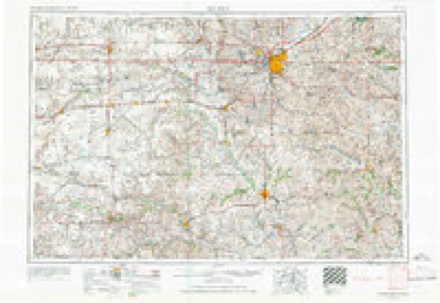
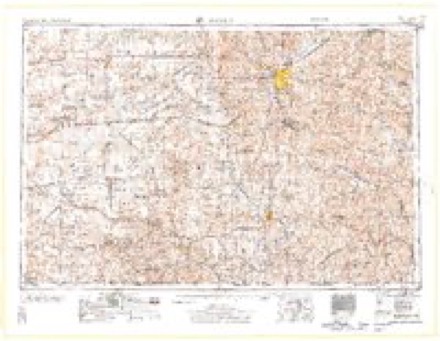
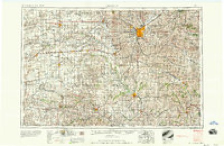
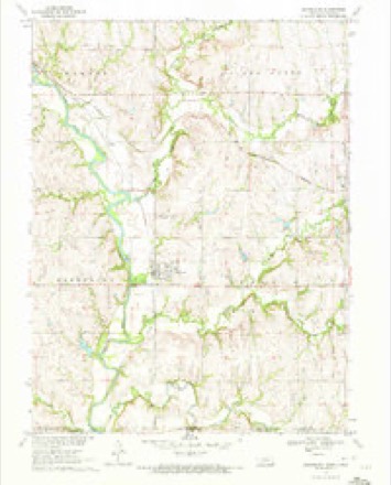
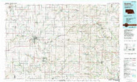
5 surveys from 10 printed sheetsMatched by testing this settlement's coordinate against the published boundary of every sheet in the United States Geological Survey's historical collection. Each opens the scanned sheet at the Survey.
- 1955 USGS Lincoln quadrangle1:250000, 5 printings
- 1957 USGS Lincoln quadrangle1:250000
- 1958 USGS Lincoln quadrangle1:250000
- 1970 USGS Barneston quadrangle1:24000
- 1986 USGS Beatrice quadrangle1:100000, 2 printings
In the county-history sources
1,367 words on this townshipHistory of Gage County, Nebraska; a Narrative of the Past, with Special Emphasis Upon the Pioneer Period of the County's History, Its Social, Commercial, Educational, Religious, and Civic Development from the Early Days to the Present Time, published 1918 names this settlement in its chapter on Barneston Township. These are the passages that mention it, exactly as the scans read.
The village of Barneston, one of the interesting and pretty villages of southern Gage county, stands on historic ground. It embraces within its boundaries the site of the ancient village of the Otoe Indians and their agency buildings, a location which serves as a perpetual reminder to the old settlers and their descendants of the original inhabitants of
Passage source: History of Gage County, Nebraska; a Narrative of the Past, with Special Emphasis Upon the Pioneer Period of the County's History, Its Social, Commercial, Educational, Religious, and Civic Development from the Early Days to the Present Time, published 1918.
Gage county. Barneston is located on the Union Pacific Railway line from Valley, Nebraska, to Manhattan, Kansas, via Lincoln and Beatrice. It is named for Francis M. Barnes, who was a member of the original townsite company and who was affiliated by marriage with the Otoe Indian tribe, his wife being a half-blood Indian woman, a daughter of Andrew Drips. Mrs. Barnes was born November 15, 1827, in Bellevue, Nebraska, where her father was stationed as a repre- .sentative of the American Fur Company. She was educated at the Convent of the Visitation, at Kaskaskia, Illinois, and in 1856, at Kansas City, Missouri, she became the wife of Francis M. Barnes. In 1859 they moved to the Territory of Nebraska, and later they settled near the Otoe and Missouri Indians in Gage county. As far as known, Mrs. Barnes is the oldest living native born Nebraskan.
Passage source: History of Gage County, Nebraska; a Narrative of the Past, with Special Emphasis Upon the Pioneer Period of the County's History, Its Social, Commercial, Educational, Religious, and Civic Development from the Early Days to the Present Time, published 1918.
The townsite of Barneston comprises the greater portion of the northwest quarter of section 18, township 1 north, range 8 east, while West Barneston, an addition to the original town, lies in the northeast quarter of section 13, township 1 north, range 7 east, where the railway line, sidetracks and station are located. The owners of the original- townsite were F. M. Barnes, of Barneston; H. R. W. Hartwig, of St. Joseph, Missouri; I. N. Speer, of Hiawatha, Kansas ; and H. L. Ewing, John Ellis, Charles O. Bates, and Alfred Hazlett, of Beatrice, Nebraska. The plat of the town of Barneston was filed in the office of the register of deeds of Gage county. May 17, 1884. The plat of West Barneston was filed on August 3, 1883. The larger portion of the business establishments of the village and nearly the entire residence district are in the original town of Barneston, which is a part of Liberty township. Some years ago, however, the county board annexed the quarter section on which the town is located to Barneston township for voting and other administrative purposes.
Passage source: History of Gage County, Nebraska; a Narrative of the Past, with Special Emphasis Upon the Pioneer Period of the County's History, Its Social, Commercial, Educational, Religious, and Civic Development from the Early Days to the Present Time, published 1918.
Machine-read from a century-old scan, so expect the errors a machine makes: misspelled names, dropped words, stray characters.
Read the whole chapter on Barneston Township - it names this place 8 more 8 times.
Fires near this place
4 since 2009Regional context, not property-specific evidence. The federal wildfire occurrence database lists 4 fires within 5 miles of Barneston between 2009 and 2012, burning about 59 acres in total. None started naturally. None was recorded as arson. Distance is straight-line from the map coordinates, so a fire counted here may appear on a neighbouring settlement's page as well.
| Reported cause | Fires |
|---|---|
| Debris and open burning | 3 |
| Equipment and vehicle use | 1 |
The most recent of them, most recent first, with the day each was reported and the service that recorded it.
| Date | Cause | Size | Reported by | Name on the report |
|---|---|---|---|---|
| 7 May 2009 | Debris and open burning | under an acre | Nebraska Forest Service | not named |
| 2 April 2011 | Debris and open burning | 55 acres | Nebraska Forest Service | not named |
| 15 March 2012 | Equipment and vehicle use | 4.0 acres | Nebraska Forest Service | not named |
| 22 January 2009 | Debris and open burning | under an acre | Nebraska Forest Service | not named |
Settlements close enough to share some of these fires:
Storms near this place
20 since 1995Regional context, not property-specific evidence. The National Weather Service names Barneston in 20 storm reports between 1995 and 2020: 9 hail, 5 thunderstorm wind, 4 flood, 1 funnel cloud. No death or injury is recorded in these reports. Each account below is quoted exactly as the forecast office filed it, from the NOAA Storm Events Database, and each date opens the federal record of that event.
| When | Event | Place named | Harm | What the report says |
|---|---|---|---|---|
| May 2015 | Flood | Barneston | $100,000 | Very heavy rainfall of 3 to 7 inches feel upstream of the river gauge and allowed for the river to rise into moderate flooding near Barneston. This resulted in significant low-land flooding along the river. In addition, small streams near Wymore and Blue Springs backed up causing local flood problems in these areas. The Big Blue River near Barneston crested at 28.93 feet or 8.93 feet above flood stage during the morning on the 8th. |
| April 2008 | Flood | Barneston | $25,000 | Rainfall of 2 to 4 inches over a several hour period across a section of the lower Big Blue River basin in southeast Nebraska caused the Big Blue River near Barneston to flood. The river near Barneston reached 20.8 feet at 1115 am CDT on April 25th, flood stage is 20 feet. The river was above flood stage near Barneston from around 1015 am through 215 pm. The flooding caused some road and culvert damage in addition to flooding agricultural lowlands. |
| May 2020 | Funnel Cloud | Barneston | - | Storm chaser reported funnel cloud via social media. |
| May 2020 | Tornado (EFU) | Barneston | - | Broadcast media had video from an employee who was storm chasing of a brief touch down of a tornado. |
| June 2020 | Flood | Barneston | - | River gage at Barneston operated by the USGS was above the rated flood stage for approximately 30 hours. |
| March 2019 | Hail | Barneston | - | The public reported ping pong to golf ball size hail. |
| June 2015 | Flood | Barneston | - | Significant agricultural flooding was observed along the Big Blue River near Barneston as the river crested 6.59 feet above flood stage. |
| September 2015 | Thunderstorm Wind | Barneston | - | A trained spotter reported tree damage at the intersection of State Highways 77 and 8. |
| June 2010 | Hail | Barneston | - | Hail of nickel to quarter-size fell west of Barneston. |
| August 2010 | Thunderstorm Wind | Barneston | - | Thunderstorm wind gusts estimated at around 60 mph downed large tree limbs in the area. The winds were accompanied by hail around an inch in diameter. |
| August 2010 | Hail | Barneston | - | The thunderstorm also produced wind gusts estimated at 60 mph which downed large tree limbs in the area. |
| April 2008 | Hail | Barneston | - | Reported 6 miles south of Wymore. |
| August 2003 | Thunderstorm Wind | Barneston | - | Thunderstorm winds estimated at 60 mph by a cooperative observer removed the roof from a porch and part of a shed. Large tree limbs were also downed and a window of a farm building was blown out. The winds were accompanied by 3/4 inch hail. |
| May 1998 | Thunderstorm Wind | Barneston | - | Many trees and power poles downed. Windows blown out of a house. A few trees fell on cars causing severe damage. |
| October 1997 | Thunderstorm Wind | Barneston | - | Large tree limbs downed. |
| October 2007 | Hail | Barneston | - | no account filed |
| June 2006 | Hail | Barneston | - | no account filed |
| July 2001 | Hail | Barneston | - | no account filed |
| May 1997 | Hail | Barneston | - | no account filed |
| April 1995 | Hail | Barneston | - | no account filed |
Nearest settlements
The eight closest, with where each one stands in the county. Distances are straight-line, computed from the Geographic Names Information System coordinates.
| Map | Place | Distance | Sheets |
|---|---|---|---|
| Badger | 2.9 miles | 10 | |
| Liberty | 5.6 miles | 11 | |
| Wymore | 6.8 miles | 10 | |
| Blue Springs | 7.6 miles | 10 | |
| Krider | 9.1 miles | 10 | |
| Holmesville | 11.4 miles | 10 | |
| Odell | 12.0 miles | 10 | |
| Rockford | 14.1 miles | 11 |
Elsewhere
Matched on this settlement's Geographic Names Information System number rather than its name, so it cannot be a different place of the same name in another state.
| Wikipedia article on Barneston | An encyclopaedic summary. Its text is share-alike, so it is linked here rather than copied. |
| Wikidata item Q2609392 | The structured record the population and elevation above come from. Public domain (CC0). |
Provenance
This settlement is recorded in the Geographic Names Information System as feature 827191. The sheet list is computed by point-in-boundary test against the United States Geological Survey's historical topographic inventory. Both are works of the United States government and carry no copyright under 17 U.S.C. 105.
Wildfire. Short, Karen C. 2022. Spatial wildfire occurrence data for the United States, 1992-2020 [FPA_FOD_20221014]. 6th Edition. Fort Collins, CO: Forest Service Research Data Archive. https://doi.org/10.2737/RDS-2013-0009.6 Collected with United States Government funding and usable without additional permissions or fees.
Storms. NOAA National Centers for Environmental Information, Storm Events Database https://www.ncei.noaa.gov/stormevents/ A work of the United States government, no copyright under 17 U.S.C. 105. Narratives are quoted verbatim from the National Weather Service report and are not edited or summarised.