 Block
Liberty, Nebraska
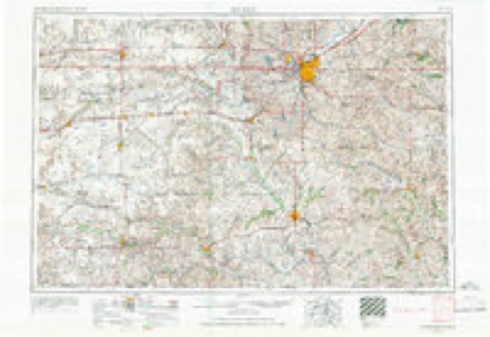
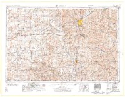
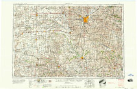
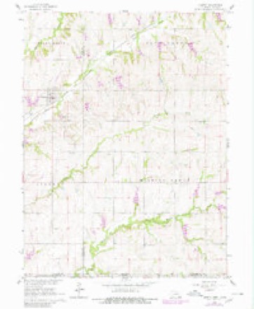
11 topographic sheets cover this place, the earliest surveyed in 1955 and the latest in 1986. It stands in Liberty Township. It lies in ZIP code area 68381. The Survey maps it on the Liberty quadrangle. 37 people lived here at the 2020 count. It stands 1,302 feet above sea level.
Population over time
2 figuresLiberty fell from 76 to 37 between 2010 and 2020. These are the recorded population figures Wikidata holds for this place, reached through the Geographic Names Information System number this page is keyed on rather than by name, so they belong to this place and not to another of the same name. Most are census counts, but not all are: an early figure may be a founding or settlement estimate, and an estimate published within five years of a census is left out. The change column is computed, and is left blank where more than 20 years separate a figure from the one before it, because a gap that long is not a change between two counts.
| Year | People | Change |
|---|---|---|
| 2010 | 76 | |
| 2020 | 37 | -39 (-51%) |
Topographic sheets covering this place
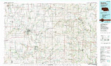
5 surveys from 11 printed sheetsMatched by testing this settlement's coordinate against the published boundary of every sheet in the United States Geological Survey's historical collection. Each opens the scanned sheet at the Survey.
- 1955 USGS Lincoln quadrangle1:250000, 5 printings
- 1957 USGS Lincoln quadrangle1:250000
- 1958 USGS Lincoln quadrangle1:250000
- 1965 USGS Liberty quadrangle1:24000, 2 printings
- 1986 USGS Beatrice quadrangle1:100000, 2 printings
In the county-history sources
4,833 words on this townshipHistory of Gage County, Nebraska; a Narrative of the Past, with Special Emphasis Upon the Pioneer Period of the County's History, Its Social, Commercial, Educational, Religious, and Civic Development from the Early Days to the Present Time, published 1918 names this settlement in its chapter on Liberty Township. These are the passages that mention it, exactly as the scans read.
The village of Liberty is located on the main line of the Chicago, Burlington & Quincy Railroad between Chicago and Denver, by way of St. Joseph. The townsite comprises a part of the southeast quarter of section 35, a part of the southwest quarter of section 36, in Island Grove township, besides a part of the northwest quarter of section 1 and part of the northeast quarter of section 2 in Liberty township ; it lies within a mile of the east line of Gage county. It is the trade center of quite a scope of rich farming land in both Gage and Pawnee counties. The original townsite was owned by Nathaniel Cain, Frank Muchmore, and Allen B. Jimmerson. It was deeded by them to the Lincoln Land Company and the plat of the town was filed in the office of the register of deeds in Gage county on the 19th day of June, 1881. The railroad was built through the county in 1881 and trains began running in the fall of that year.
Passage source: History of Gage County, Nebraska; a Narrative of the Past, with Special Emphasis Upon the Pioneer Period of the County's History, Its Social, Commercial, Educational, Religious, and Civic Development from the Early Days to the Present Time, published 1918.
In the early '70s Cornelius S. Wymore had been appointed postmaster for this community and the office was called Liberty. It was on his farm, half a mile west of the present town. In 1879 he opened a drug store in connection with the postoffice. At that time the mails were carried twice a week between Pawnee City and Blue Springs. When the village was laid out, its founders adopted the name of Mr. Wymore's postoffice as a suitable cognomen for the prospective town.
Passage source: History of Gage County, Nebraska; a Narrative of the Past, with Special Emphasis Upon the Pioneer Period of the County's History, Its Social, Commercial, Educational, Religious, and Civic Development from the Early Days to the Present Time, published 1918.
The little village built up rapidly. The first merchant was E. W. Lane, who, as early as 1882, had a general merchandise store. Mr. Lane's venture was soon followed by others, and in a short time Liberty was a town of several hundred people, in which every class of business was represented, - general stores, restaurants, drug store, hardware stores, lumber yard, elevators, barber shops, meat markets and the like.
Passage source: History of Gage County, Nebraska; a Narrative of the Past, with Special Emphasis Upon the Pioneer Period of the County's History, Its Social, Commercial, Educational, Religious, and Civic Development from the Early Days to the Present Time, published 1918.
Machine-read from a century-old scan, so expect the errors a machine makes: misspelled names, dropped words, stray characters.
Read the whole chapter on Liberty Township - it names this place 10 more 10 times.
Fires near this place
6 since 2008Regional context, not property-specific evidence. The federal wildfire occurrence database lists 6 fires within 5 miles of Liberty between 2008 and 2016, burning about 226 acres in total. None started naturally. 1 was recorded as arson. Distance is straight-line from the map coordinates, so a fire counted here may appear on a neighbouring settlement's page as well.
| Reported cause | Fires |
|---|---|
| Debris and open burning | 4 |
| Equipment and vehicle use | 1 |
| Arson/incendiarism | 1 |
The most recent of them, most recent first, with the day each was reported and the service that recorded it.
| Date | Cause | Size | Reported by | Name on the report |
|---|---|---|---|---|
| 4 May 2008 | Debris and open burning | 2.0 acres | Nebraska Forest Service | not named |
| 3 April 2009 | Debris and open burning | 170 acres | Nebraska Forest Service | not named |
| 2 April 2011 | Arson/incendiarism | under an acre | Nebraska Forest Service | not named |
| 5 March 2016 | Debris and open burning | 50 acres | Kansas Forest Service | 98 |
| 15 March 2012 | Equipment and vehicle use | 4.0 acres | Nebraska Forest Service | not named |
| 22 January 2009 | Debris and open burning | under an acre | Nebraska Forest Service | not named |
Settlements close enough to share some of these fires:
Storms near this place
18 since 1994Regional context, not property-specific evidence. The National Weather Service names Liberty in 18 storm reports between 1994 and 2023: 9 hail, 5 thunderstorm wind, 2 flash flood, 1 tornado. No death or injury is recorded in these reports. Each account below is quoted exactly as the forecast office filed it, from the NOAA Storm Events Database, and each date opens the federal record of that event.
| When | Event | Place named | Harm | What the report says |
|---|---|---|---|---|
| July 1994 | Tornado (F0) | Liberty | $5,000,000 | A tornado touched down on the north side of Liberty, then proceeded to lift and touch down through the east side of town. It caused extensive structural damage to outbuildings and mobile homes. Some trees were also uprooted. |
| August 2023 | Hail | Liberty | - | Public reported quarter to ping pong sized hail. |
| April 2023 | Thunderstorm Wind | Liberty | - | Fire Department reported tree trunks snapped and sheds destroyed on Plum Road near S 108 Road. |
| July 2020 | Flash Flood | Liberty | - | Public called in with report of 5.3 inches of rain at that it was still raining. There was significant flooding of Wolf Creek. |
| July 2020 | Thunderstorm Wind | Liberty | - | Public reported tree limbs down. |
| July 2020 | Flash Flood | Liberty | - | Public reported water over the road at current location and that other county roads in the area are flooding. |
| March 2019 | Hail | Liberty | - | The public reported nickel size hail covering the ground. |
| May 2013 | Hail | Liberty | - | The hail was mostly nickel-size but a few reached quarter-size. |
| June 2010 | Heavy Rain | Liberty | - | The cooperative observer near Liberty measured a 24 hour storm total of 3.5 inches (although most fell in less than 6 hours). Some lowland flooding of farm fields was noted around the area. |
| August 2010 | Thunderstorm Wind | Liberty | - | Thunderstorm winds estimated at over 60 mph blew a 20 by 40 foot metal sheet from a farm shop building onto a neighbors tree. The time was estimated by radar but it was probably from the same storm that caused some tree damage just to the southwest near Barneston. |
| August 2006 | Thunderstorm Wind | Liberty | - | Thunderstorm wind gusts estimated at 60 mph downed tree limbs near Liberty. |
| October 1997 | Thunderstorm Wind | Liberty | - | Trees blown down. |
| June 2009 | Hail | Liberty | - | no account filed |
| May 2008 | Hail | Liberty | - | no account filed |
| June 2008 | Hail | Liberty | - | no account filed |
| July 2006 | Hail | Liberty | - | no account filed |
| June 1998 | Hail | Liberty | - | no account filed |
| June 1997 | Hail | Liberty | - | no account filed |
Nearest settlements
The eight closest, with where each one stands in the county. Distances are straight-line, computed from the Geographic Names Information System coordinates.
| Map | Place | Distance | Sheets |
|---|---|---|---|
| Barneston | 5.6 miles | 10 | |
| Badger | 6.0 miles | 10 | |
| Wymore | 9.9 miles | 10 | |
| Blue Springs | 10.1 miles | 10 | |
| Virginia | 11.1 miles | 10 | |
| Holmesville | 12.3 miles | 10 | |
| Rockford | 13.1 miles | 11 | |
| Krider | 14.0 miles | 10 |
Elsewhere
Matched on this settlement's Geographic Names Information System number rather than its name, so it cannot be a different place of the same name in another state.
| Wikipedia article on Liberty | An encyclopaedic summary. Its text is share-alike, so it is linked here rather than copied. |
| Wikidata item Q2363569 | The structured record the population and elevation above come from. Public domain (CC0). |
Provenance
This settlement is recorded in the Geographic Names Information System as feature 830697. The sheet list is computed by point-in-boundary test against the United States Geological Survey's historical topographic inventory. Both are works of the United States government and carry no copyright under 17 U.S.C. 105.
Wildfire. Short, Karen C. 2022. Spatial wildfire occurrence data for the United States, 1992-2020 [FPA_FOD_20221014]. 6th Edition. Fort Collins, CO: Forest Service Research Data Archive. https://doi.org/10.2737/RDS-2013-0009.6 Collected with United States Government funding and usable without additional permissions or fees.
Storms. NOAA National Centers for Environmental Information, Storm Events Database https://www.ncei.noaa.gov/stormevents/ A work of the United States government, no copyright under 17 U.S.C. 105. Narratives are quoted verbatim from the National Weather Service report and are not edited or summarised.