 Block
Block
Forest, Ohio
12 topographic sheets cover this place, the earliest surveyed in 1905 and the latest in 1986. It stands in Jackson Township. It lies in ZIP code area 45843. The Survey maps it on the Forest quadrangle. 1,350 people lived here at the 2020 count. It stands 932 feet above sea level.
Population over time
2 figuresForest fell from 1,461 to 1,350 between 2010 and 2020. These are the recorded population figures Wikidata holds for this place, reached through the Geographic Names Information System number this page is keyed on rather than by name, so they belong to this place and not to another of the same name. Most are census counts, but not all are: an early figure may be a founding or settlement estimate. The change column is computed, and is left blank where more than 20 years separate a figure from the one before it, because a gap that long is not a change between two counts.
| Year | People | Change |
|---|---|---|
| 2010 | 1,461 | |
| 2020 | 1,350 | -111 (-8%) |
Then and now
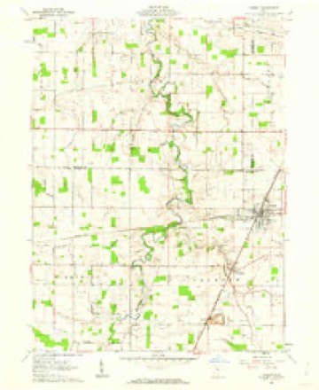
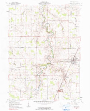
1905 to 1986The same ground, surveyed 81 years apart. Drag the handle to wipe between them. Both sheets are United States Geological Survey originals; neither has been altered.

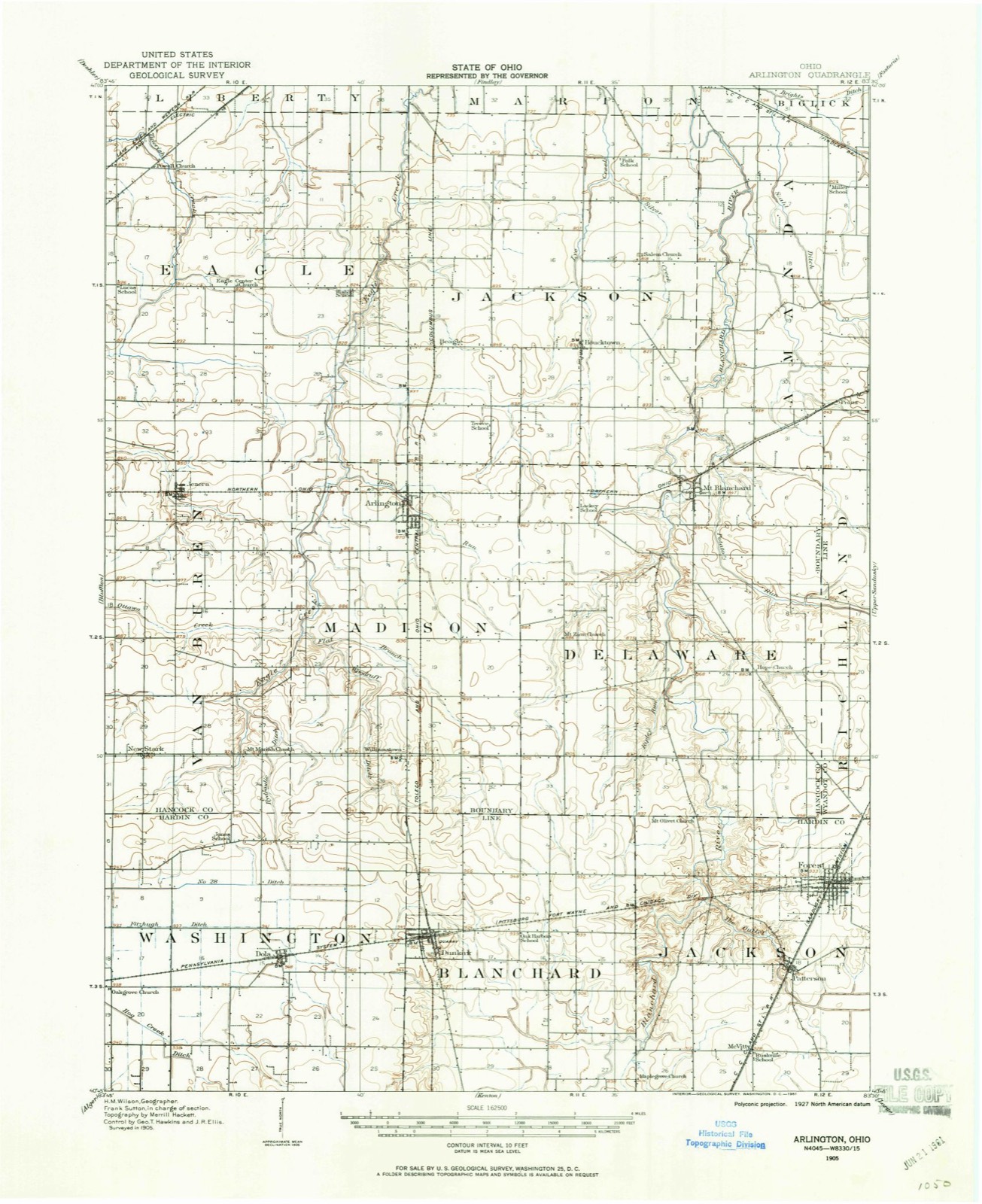
Topographic sheets covering this place
12 sheetsMatched by testing this settlement's coordinate against the published boundary of every sheet in the United States Geological Survey's historical collection. Each opens the scanned sheet at the Survey.
- 1905 USGS Arlington quadrangle1:62500
- 1907 USGS Arlington quadrangle1:62500
- 1907 USGS Arlington quadrangle1:24000
- 1950 USGS Marion quadrangle1:250000
- 1961 USGS Forest quadrangle1:24000
- 1961 USGS Forest quadrangle1:24000
- 1962 USGS Marion quadrangle1:250000
- 1966 USGS Marion quadrangle1:250000
- 1966 USGS Marion quadrangle1:250000
- 1966 USGS Marion quadrangle1:250000
- 1986 USGS Marion quadrangle1:100000
- 1986 USGS Marion quadrangle1:100000







In the county-history sources
15,061 words on this townshipThe History of Hardin County, Ohio, published 1883 names this settlement in its chapter on Jackson Township. These are the passages that mention it, exactly as the scans read.
Robert S. Wilson was born in Medina County, Ohio, and in 1833 came to Marion Township, Hardin County, a poor bo3^ He succeeded in obtaining employment in clearing land and assisting the inexperienced early settlers in erecting their log cabins. Game of all kinds was very plentiful, and one fair he sold coon skins enough, at 12 J cents each, to purchase a barrel of flour at $6.50, which was quite a treat in those days. In this manner he worked, and by strict economy until be had reached manhood, he had saved money enough to purchase forty acres of land in the dense forests of Jackson Township. He then married, and commenced to clear a spot for his cabin, while his young wife sat close by on a log with her knitting. He says that, while a hired young man, he cleared more than one hundred acres of land. After settling upon his own land and getting a good start in life, he commenced adding to his first piece more land, from time to time, till his farm contains 160 acres with good improvements. He is now living in Forest, where he has retired to spend the balance of his life in the enjoyment of the comforts of a competence which his own industry and energy has accumulated, an honored and respected citizen.
Passage source: The History of Hardin County, Ohio, published 1883.
Thomas Ketch, from Columbiana County, settled on land two miles west of Forest in 1834. After several years' residence here he removed to Hancock County, and thence to Nebraska. He married Miss Sarah Yerian, who died, and he subsequently married Rachel Mansfield. All his children moved to the West but one - Mary Ann, who married John Nous and resides in this township.
Passage source: The History of Hardin County, Ohio, published 1883.
Robert Briggs was born in Lincolnshire, England, where he married Mary Pickett, with whom he lived but a short time when, about 1834 - or about one year after their arrival in this country and locating in Richland County, Ohio - she died, she, however, having borne him five children. In 1836, he removed to this county and purchased eighty acres of land in Section 2, in Jackson Township. He married, for his second wife, Mary Aldrich. She died, having borne him four children. Mr. Briggs died February 17, 1879, aged eighty years. He was a man of great moral worth, giving of his means freely for all educational and religious purposes and the general public good. Henry Zimmerman was a native of Mahoning County, Ohio, and married Elizabeth Bilger, of Columbiana County, and in the fall of 1836 removed to this county and settled south of Forest, on land now owned by Aaron Chance, in Section 18, where he remained till his death. He died November 22, 1870, aged sixty-five years. His children were John, George W. , Kebecca A., Mary, Elizabeth, Franklin, Isabell, Samuel and Sarah (twins), Stanley and Jennie.
Passage source: The History of Hardin County, Ohio, published 1883.
Machine-read from a century-old scan, so expect the errors a machine makes: misspelled names, dropped words, stray characters.
Read the whole chapter on Jackson Township - it names this place 44 more 44 times.
Specimens collected near this place
12 of 18 shownRegional context, not property-specific evidence. Museums hold 18 specimens collected within 10 miles of Forest between 1931 and 1973: 17 Animalia, 1 Fungi. 12 distinct Species records are shown. Collected by C.R. Neiswander, Curtis May, Eric H. Metzler and others. Each is a physical object with a catalogue number, and each entry opens the museum's record. This is what was collected and kept, not a survey of what lives here - nothing can be concluded from a species being absent.
| Image | Species | Year | Collected by | Where, as recorded |
|---|---|---|---|---|
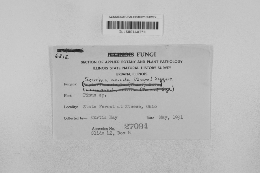 | Mycosphaerella dearnessii M.E.Barr | 1931 | Curtis May | State Forest at Steece |
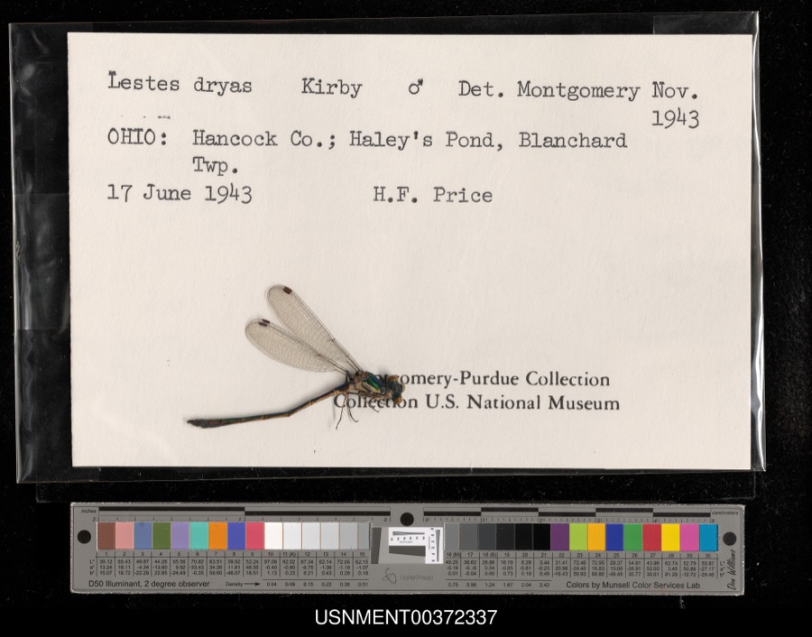 | Lestes dryas Kirby, 1890 | 1943 | H. Price | Blanchard Township, Haley's Pond |
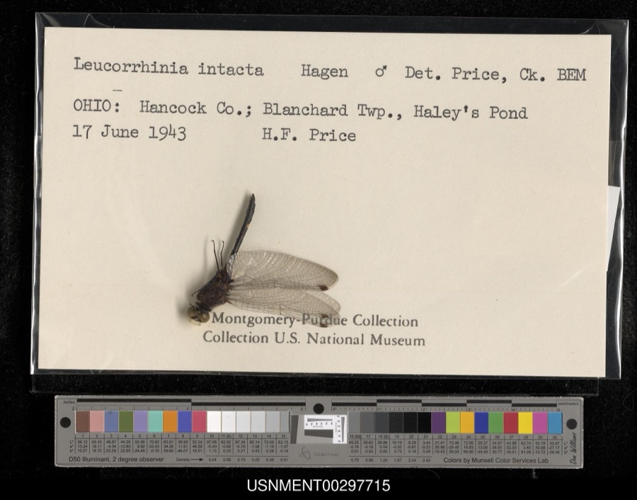 | Leucorrhinia intacta (Hagen, 1861) | 1943 | H. Price | Blanchard Township, Haley's Pond |
 | Cheumatopsyche campyla Ross, 1938 | 1939 | C.R. Neiswander | |
 | Acris crepitans Baird, 1854 | 1960 | FREDERICH R GEHLBACK | BLANCHARD TOWNSHIP SEC 9 BRUMLEYS WOODS |
 | Plethodon cinereus (Green, 1818) | 1960 | FREDERICH R GEHLBACK | BLANCHARD TOWNSHIP SEC 9 BRUMLEYS WOODS |
 | Pseudacris crucifer (Wied-Neuwied, 1838) | 1960 | FREDERICH R GEHLBACK | BLANCHARD TOWNSHIP SEC 9 BRUMLEYS WOODS |
 | Nerodia sipedon (Linnaeus, 1758) | 1965 | not recorded | [4.8 mi. W Forest] |
 | Regina septemvittata (Say, 1825) | 1965 | not recorded | [ca. 2.6 airmi. SSE Forest] |
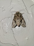 | Heterocampa Doubleday, 1841 | 1973 | Eric H. Metzler | Washington Township || 40.7667 -83.6833 |
| Lochmaeus bilineata Packard, 1864 | 1973 | Eric H. Metzler | Washington Township | |
| Macrurocampa marthesia Cramer | 1973 | Eric H. Metzler | Washington Township || 40.7667 -83.6833 |
All 18 specimens within 10 miles, at the Global Biodiversity Information Facility.
Mines and quarries near this place
3 within 5 milesRegional context, not property-specific evidence. The federal mineral resources record lists 3 workings within 5 miles of Forest: 2 past producers, 1 producer. 1 still produces. What was taken out: Limestone, General, Stone, Stone, Crushed/Broken. Distance is straight-line from the map coordinates, so a quarry counted here may appear on a neighbouring settlement's page as well.
| Where | Site | Commodity | Status | Recorded |
|---|---|---|---|---|
| Boich Lime and Coal Quarry | Limestone, General | Past Producer | Sedimentary | |
| Boich Lime and Coal Quarry | Stone, Crushed/Broken | Past Producer | ||
| Standard Pit | Stone | Producer |
Storms near this place
4 since 2007Regional context, not property-specific evidence. The National Weather Service names Forest in 4 storm reports between 2007 and 2020: 3 thunderstorm wind, 1 flash flood. No death or injury is recorded in these reports. Each account below is quoted exactly as the forecast office filed it, from the NOAA Storm Events Database, and each date opens the federal record of that event.
| When | Event | Place named | Harm | What the report says |
|---|---|---|---|---|
| July 2020 | Thunderstorm Wind | Forest | $5,000 | A few trees and power lines were downed near the intersection of North Martin Street and Smith Street. |
| August 2007 | Flash Flood | Forest | $5,000 | Numerous roads throughout the northern part of the county were submerged in three to four feet of water. A vehicle was stranded and floating in high water in Forest. |
| June 2012 | Thunderstorm Wind | Forest | $3,000 | Trees were downed due to damaging thunderstorm winds. |
| June 2020 | Thunderstorm Wind | Forest | $1,000 | A large tree and other large limbs were knocked down on South Gormley Street. |
Nearest settlements
The eight closest, with where each one stands in the county. Distances are straight-line, computed from the Geographic Names Information System coordinates.
| Map | Place | Distance | Sheets |
|---|---|---|---|
| Patterson | 1.7 miles | 12 | |
| McVitty | 3.1 miles | 12 | |
| Bridgeport | 6.2 miles | 12 | |
| Grant | 7.0 miles | 12 | |
| Dunkirk | 7.1 miles | 12 | |
| Walnut Grove | 8.3 miles | 12 | |
| Blanchard | 8.5 miles | 11 | |
| Dola | 9.7 miles | 12 |
Elsewhere
Matched on this settlement's Geographic Names Information System number rather than its name, so it cannot be a different place of the same name in another state.
| Wikipedia article on Forest | An encyclopaedic summary. Its text is share-alike, so it is linked here rather than copied. |
| Wikidata item Q2668796 | The structured record the population and elevation above come from. Public domain (CC0). |
Provenance
This settlement is recorded in the Geographic Names Information System as feature 1048744. The sheet list is computed by point-in-boundary test against the United States Geological Survey's historical topographic inventory. Both are works of the United States government and carry no copyright under 17 U.S.C. 105.
Specimens. Global Biodiversity Information Facility (GBIF), https://www.gbif.org/. Only records licensed CC0 or CC BY are used. Records licensed CC BY-NC are excluded because this site carries advertising. Images are checked individually and any whose licence is non-commercial, no-derivatives or unreadable is refused.
Mines and quarries. USGS Mineral Resources Data System (MRDS) https://mrdata.usgs.gov/mrds/ A work of the United States government, no copyright under 17 U.S.C. 105.
Storms. NOAA National Centers for Environmental Information, Storm Events Database https://www.ncei.noaa.gov/stormevents/ A work of the United States government, no copyright under 17 U.S.C. 105. Narratives are quoted verbatim from the National Weather Service report and are not edited or summarised.