 Block
Block
Kenton, Ohio
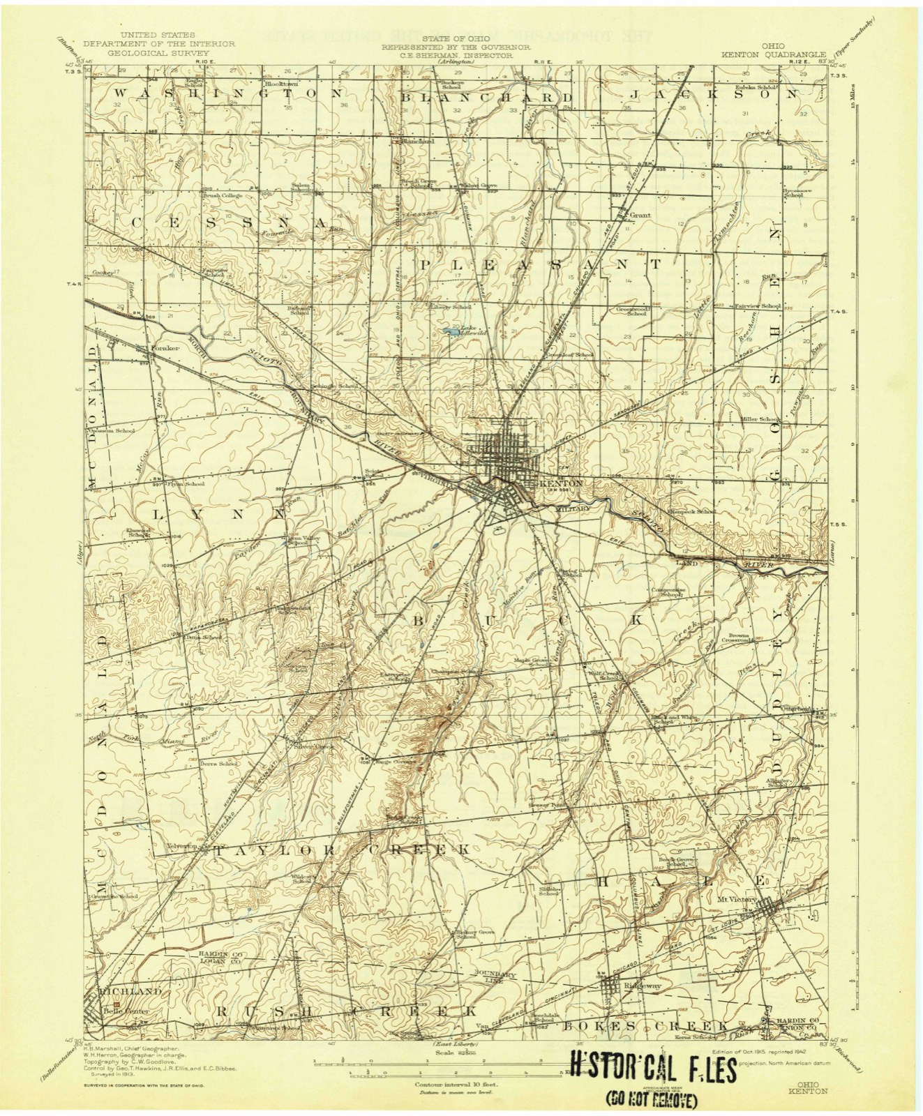
12 topographic sheets cover this place, the earliest surveyed in 1915 and the latest in 1986. It stands in Pleasant Township. It lies in ZIP code area 43326. It stands on Taylor Creek. The Survey maps it on the Kenton quadrangle. 7,947 people lived here at the 2020 count. It stands 991 feet above sea level.
Research this city
This curated hub for Hardin County, Ohio brings together the page's documented record links, visible map or image evidence where published, and routes to related local records.
What is documented here?
Use the page's provenance and linked records to distinguish the source material from the site's navigation and summaries.
How should I cite it?
Open the original record, preserve its repository and identifier, then use the citation tool for this page as a path back to the source.
Where should I go next?
Follow the county or state hub for related places and records, then use the guide for a source-aware research sequence.
Population over time
2 figuresKenton fell from 8,262 to 7,947 between 2010 and 2020. These are the recorded population figures Wikidata holds for this place, reached through the Geographic Names Information System number this page is keyed on rather than by name, so they belong to this place and not to another of the same name. Most are census counts, but not all are: an early figure may be a founding or settlement estimate. The change column is computed, and is left blank where more than 20 years separate a figure from the one before it, because a gap that long is not a change between two counts.
| Year | People | Change |
|---|---|---|
| 2010 | 8,262 | |
| 2020 | 7,947 | -315 (-4%) |
Then and now
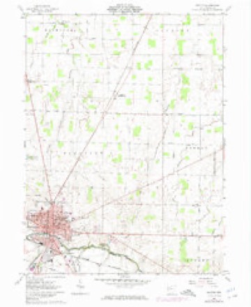
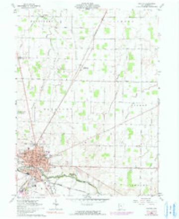
1915 to 1986The same ground, surveyed 71 years apart. Drag the handle to wipe between them. Both sheets are United States Geological Survey originals; neither has been altered.

Topographic sheets covering this place
12 sheetsMatched by testing this settlement's coordinate against the published boundary of every sheet in the United States Geological Survey's historical collection. Each opens the scanned sheet at the Survey.
- 1915 USGS Kenton quadrangle1:62500
- 1944 USGS Kenton quadrangle1:62500
- 1950 USGS Marion quadrangle1:250000
- 1961 USGS Kenton quadrangle1:24000
- 1961 USGS Kenton quadrangle1:24000
- 1961 USGS Kenton quadrangle1:24000
- 1962 USGS Marion quadrangle1:250000
- 1966 USGS Marion quadrangle1:250000
- 1966 USGS Marion quadrangle1:250000
- 1966 USGS Marion quadrangle1:250000
- 1986 USGS Marion quadrangle1:100000
- 1986 USGS Marion quadrangle1:100000







In the county-history sources
23,391 words on this townshipThe History of Hardin County, Ohio, published 1883 names this settlement in its chapter on Pleasant Township. These are the passages that mention it, exactly as the scans read.
JACOB FOBBING, manufacturer, Kenton, was born near Fort Wayne, Ind., September 19, 1841. He lived in his birthplace until the breakingout of the war, when, in September, 1881, he enlisted in Company E, Tliirtieth Indiana Volunteer Infantry. He enlisted as Sergeant and seiwed three years, participating in the engagements at Pittsburg Landing, Shiloh, Triune, Stone River and Chickamauga, in which latter battle he was wounded and confined for six weeks in a hospital at Nashville, Tenn. After a furlough of sixty days, he rejoined his troops and was in the battles of Chattanooga, Atlanta, Resaca and all the engagements of the Atlanta campaign. Returning to Indiana, he followed his trade of carpenter and builder in Fort Wayne, coming to Ada, Ohio, in 1869. The same year he became associated with the Young Brothers in the scroll and lumber business, the firm dissolving in 1873, after which he came to Kenton and built a mill, carrying it on in partnership with his brother Peter for three years. The building was destroyed by fire, and Mr. Forbing then erected his present mill, in which he has since been successfully engaged. He employs on an average a force of twenty men, the work all being sawed from black walnut, for chair stock, and shipped wholly to the Eastern markets. Mr. Forbing was married in Fort Wayne, Ind. , February 14, 1865, to Miss Anna M., daughter of George J. find Anna M. Young. She was born in Allen County, Ind., and has reared a family of six children, viz. : Irvin, Cecilia, Earl B, A., Guy, John W. and Leo V. Mr. Forbing has also an adopted daughter, Addie. The family belong to the Catholic Church. Mr. Forbing has filled the office of City Councilman for two terms, and is one of the progressive citizens of Kenton, thoroughly identified with the interests of Hardin County.
Passage source: The History of Hardin County, Ohio, published 1883.
E. K. GEAVELL, carriage manufacturer, Kenton, was born in Upper Sandusky, Ohio, in 1848. He is a son of Thomas and Mary (Keyes) Gravell (both deceased), natives of Pennsylvania, who came to Ohio in 1842, settling in Upper Sandusky. In 1864, when fifteen years of age, our subject enlisted in the ranks of the Union army as private in Company A, One Hundred and Forty- fourth Ohio Volunteer Infantry, in the four months' service. Serving this call, he again enlisted in Company I, of the One Hundred and Ninety-first Eegiment, serving to the close of the war. He participated only in the engagement at Perry vi lie, the regiment prefer-, ring detailed service most of the time. At the close of the war, our subject learned the trade of blacksmith. In 1871, he established business in Kenton, under the firm name of Schrader & Gravel 1, and was located on the corner of Ohio and Maine streets. This firm built up a large trade, and were the most extensive manufacturers of light work, but were obliged to succumb to the hard times of ' 1874, when they dissolved. Mr. Gravell, by dint of energy and perseverance, rented a fire of Magoy and began ironing some work, commencing at the forge himself. His brother O. E. came to Kenton at this time and assisted him in his work, soon becoming proprietor of a new establishment, our subject continuing in work for him. O. E. Gravell subsequently removed to Bucyrus, and E. K. Gravell succeeded him in the business. He occupied his present premises in 1875, which was then an old livery stable, occupying one -half of the present building, which was erected in 1880. The building is two stories high, the upper floor being used for painting and trimming. Here he carefully superintends all the work, and is making a specialty of spring wagons. In 1876, Mr. Gravell was married to Miss Letty Einehart, a native of Hardin County, and who died in 1878, after one year and a half of wedded life. She was a daughter of Adam E. Einehart, who was a pioneer of Hardin County. Mr. Gravell chose for his second wife Miss Jennie Maddux, to whom he was married June 6, 1883. She is a native of Upper Sandusky, Ohio, and only child of the late Henry Maddux, who, in his lifetime, was a prominent attorney of Upper Sandusky, and one of the most substantial business men of that State. Mr. Gravell is among the active business men of Kenton.
Passage source: The History of Hardin County, Ohio, published 1883.
JOHN McGUIGIN, liveryman, Kenton, was born in Goshen Township, Hardin County, Ohio, May 20, 1837. He is the oldest and only living son of Edward and Ellen (Tally) McGuigin, natives of County Tyrone, Ireland, who emigrated to Hardin County in July of 1834, settling in Goshen Township. Edward McGuigin entered 160 acres of land, where he passed the remainder of his life, dying in 1864. He was among the early pioneers of the county. He had two sons, our subject and Edward. The latter died in 1863. Mrs. McGuigin died in 1849. The subject of this sketch was reared on the homestead, where he lived until 1875, when he sold the place and removed to Kenton. He is proprietor of the livery stable purchased from Mr. Vance, whom he succeeded in the spring of 1883. He was married in this county in 1873 to Miss Mollie A. Toner, a native of Goshen Township and a daughter of Michael and Mary Toner, pioneers of this county. To this union has been born one child - Ellen M. Mr. McGuigin is a member of the Catholic Church of Kenton, and is one of the oldest citizens here.
Passage source: The History of Hardin County, Ohio, published 1883.
Machine-read from a century-old scan, so expect the errors a machine makes: misspelled names, dropped words, stray characters.
Read the whole chapter on Pleasant Township - it names this place 69 more 69 times.
Fires near this place
7 since 2002Regional context, not property-specific evidence. The federal wildfire occurrence database lists 7 fires within 5 miles of Kenton between 2002 and 2002, burning about 3 acres in total. None started naturally. None was recorded as arson. Distance is straight-line from the map coordinates, so a fire counted here may appear on a neighbouring settlement's page as well.
| Reported cause | Fires |
|---|---|
| Recreation and ceremony | 3 |
| Missing data/not specified/undetermined | 2 |
| Debris and open burning | 1 |
| Equipment and vehicle use | 1 |
The most recent of them, most recent first, with the day each was reported and the service that recorded it.
| Date | Cause | Size | Reported by | Name on the report |
|---|---|---|---|---|
| 10 September 2002 | Equipment and vehicle use | under an acre | Ohio State Fire Marshal's Office | not named |
| 31 August 2002 | Recreation and ceremony | 1.0 acres | Ohio State Fire Marshal's Office | not named |
| 5 July 2002 | Missing data/not specified/undetermined | under an acre | Ohio State Fire Marshal's Office | not named |
| 15 July 2002 | Recreation and ceremony | 1.0 acres | Ohio State Fire Marshal's Office | not named |
| 12 July 2002 | Recreation and ceremony | under an acre | Ohio State Fire Marshal's Office | not named |
| 23 March 2002 | Missing data/not specified/undetermined | under an acre | Ohio State Fire Marshal's Office | not named |
| 21 November 2002 | Debris and open burning | under an acre | Ohio State Fire Marshal's Office | not named |
Settlements close enough to share some of these fires:
Specimens collected near this place
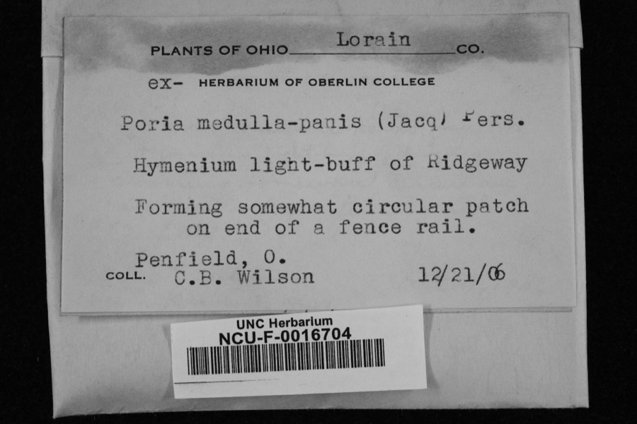
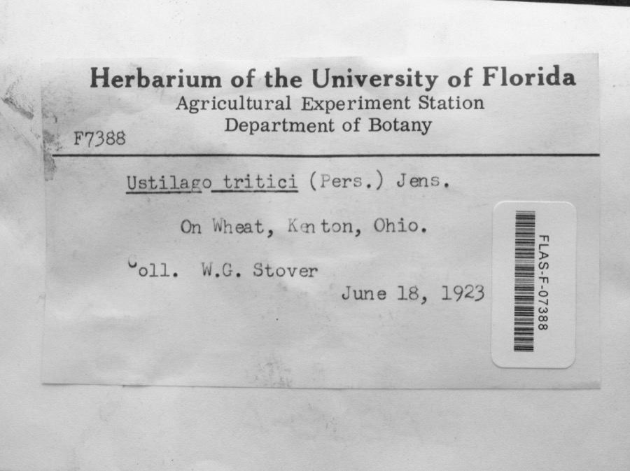
12 of 150 shownRegional context, not property-specific evidence. Museums hold 150 specimens collected within 10 miles of Kenton between 1882 and 1973: 129 Animalia, 20 Fungi, 1 Plantae. 12 distinct Species records are shown. Collected by ?, Angle, E. (Eric), Anson A. Hinkley and others. Each is a physical object with a catalogue number, and each entry opens the museum's record. This is what was collected and kept, not a survey of what lives here - nothing can be concluded from a species being absent.
| Image | Species | Year | Collected by | Where, as recorded |
|---|---|---|---|---|
 | Poria medulla-panis (Jacq.) Cooke | 1906 | Penfield, O.; C. B. Wilson | Ridgeway |
 | Ustilago tritici (Bjerk.) Rostr. | 1923 | W.G. Stover | Kenton |
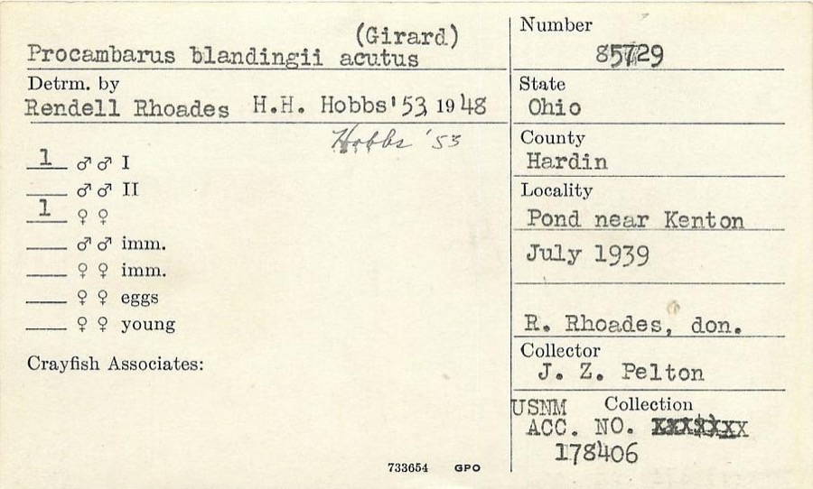 | Procambarus blandingii (Harlan, 1830) | 1939 | J. Pelton | Pond near Kenton |
 | Meleagris gallopavo silvestris Vieillot, 1817 | 1882 | W.C. Hampton | Mt. Victory |
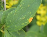 | Puccinia graminis var. phlei-pratensis (Erikss. & Henn.) Stakman & Piem. | 1908 | Clinton; Bird | Mt. Victory |
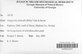 | Guignardia bidwellii (Ellis) Viala & Ravaz | 1910 | Heckathorne H. E. | Kenton |
 | Laestadia bidwellii (Ellis) Viala & Ravaz | 1910 | Heckathorne H. E. | Kenton |
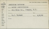 | Puccinia asterum (Schwein.) F.Kern | 1913 | Bartholomew E. | Kenton |
 | Puccinia caricis-solidaginis Arthur | 1913 | E. Bartholomew | Kenton |
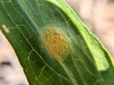 | Puccinia dioicae Magnus | 1913 | Bartholomew, Elam T | Kenton |
 | Puccinia extensicola Plowr. | 1913 | E. Bartholomew | Kenton. |
| Elimia semicarinata (Say, 1829) | 1914 | Anson A. Hinkley | Scioto River, Kenton, near headwaters, North America |
All 150 specimens within 10 miles, at the Global Biodiversity Information Facility.
Mines and quarries near this place
1 within 5 milesRegional context, not property-specific evidence. The federal mineral resources record lists 1 working within 5 miles of Kenton: 1 past producer. None of them still produces. What was taken out: Limestone, General. Distance is straight-line from the map coordinates, so a quarry counted here may appear on a neighbouring settlement's page as well.
| Where | Site | Commodity | Status | Recorded |
|---|---|---|---|---|
| Hardin Quarry | Limestone, General | Past Producer | Sedimentary |
Storms near this place
58 since 1994Regional context, not property-specific evidence. The National Weather Service names Kenton in 58 storm reports between 1994 and 2026: 29 thunderstorm wind, 11 flood, 10 hail, 3 flash flood. The reports record 1 death. Each account below is quoted exactly as the forecast office filed it, from the NOAA Storm Events Database, and each date opens the federal record of that event.
| When | Event | Place named | Harm | What the report says |
|---|---|---|---|---|
| June 2005 | Lightning | Kenton | 1 killed | An Amish boy was killed when lightning struck the tree he was leaning against. He had taken shelter under the tree from the thunderstorm. |
| August 2023 | Tornado (EF1) | Kenton | $250,000 | The tornado first touched down in the vicinity of west Espy Street and Robinson Avenue. Some minor tree limb damage was noted, with some sheet metal damage to buildings in this area, including roof damage to one structure between west Espy Street and U.S. Route 68. Damage was more significant and concentrated in a neighborhood near Detroit Street and Main Street, especially between Railroad Street and Letson Street. Numerous trees and large limbs were downed and numerous homes and garages had at least some minor roof or fascia damage. The winds were likely the strongest just north of Letson Street, where one garage was flattened and another outbuilding had its roof and second floor removed. Debris from these structures could be found at least a quarter mile downstream. Winds at this location were estimated to be about 90 mph. Additional tree damage and minor structural damage was noted on the east side of Main Street, extending from near the Hardin County Sheriff's Office through Brumm Street.||Additional tree damage was observed on the north side of the Scioto River, near and south of Lick Street. This includes one grove of trees south of the end of Stevens Street, with several tree tops snapped off. The tornado then traversed an uninhabited area but minor tree damage was noted near the intersection of Bales Road and County Road 175. In addition, small pieces of insulation were found near this intersection and in the field to the east. This is where the tornado ended. |
| March 2026 | Tornado (EF1) | Kenton | $65,000 | The first tornadic damage was observed at the Hardin County Fairgrounds, just south of County Road 140, where minor roof damage occurred. Several wooden power poles were damaged and snapped in half. On the northern side of the fairgrounds, a hardwood tree was snapped and a building sustained a major loss of its metal roofing panels. An additional building had its concrete block siding blown out, which caused a partial roof collapse. An open-ended barn structure was lifted, causing the support poles to be lifted and shifted. The final damage associated with this tornado was on the eastern side of the fairgrounds, where additional power poles were snapped and minor roof damage was observed to fairground buildings. |
| June 2022 | Thunderstorm Wind | Kenton | $50,000 | Numerous trees were downed throughout Hardin County, especially in the Ada, Kenton and McGuffy areas. |
| June 2012 | Thunderstorm Wind | Kenton | $50,000 | Numerous trees and large trees were downed due to damaging thunderstorm winds. Some of the trees fell on cars. Siding was reported off some of the homes in the area. |
| June 1994 | Thunderstorm Wind | Kenton | $50,000 | A home and outbuildigs suffered roof damage. |
| October 2013 | Thunderstorm Wind | Kenton | $25,000 | Numerous trees and power poles were downed on the northeast side of Kenton due to thunderstorm winds. Shingle and other roof damage occurred to a church. |
| December 2013 | Thunderstorm Wind | Kenton | $10,000 | A couple of trees and power lines were reported down in the area due to thunderstorm winds. A power pole was also blown over along State Route 31 south of Route 190. |
| July 2006 | Flash Flood | Kenton | $10,000 | Streets were flooded throughout town. A few school buildings sustained minor water damage. |
| August 2003 | Thunderstorm Wind | Kenton | $10,000 | Numerous trees and powerlines were downed across the town, including several that fell on houses and vehicles. Seventeen streets were blocked by fallen trees. |
| February 1999 | Thunderstorm Wind | Kenton | $10,000 | Storms knocked a roof off a house, knocked trees down, and caused damage at the county fair. |
| August 1998 | Thunderstorm Wind | Kenton | $10,000 | Numerous trees knocked down. |
| June 2020 | Thunderstorm Wind | Kenton | $6,000 | Multiple trees were reported down in Kenton; including on Market Street, Kohler Street and North Ida Street. |
| June 2013 | Thunderstorm Wind | Kenton | $6,000 | Trees and power poles were downed in Kenton due to thunderstorm winds. |
| March 2011 | Flood | Kenton | $5,000 | Several roads were flooded due to heavy rainfall. |
| March 2011 | Flood | Kenton | $5,000 | Numerous roads were underwater during the event due to heavy rain and previous snow melt. Flooding began around 0811 EST on February 28th and ended around 1100 EST on March 1st. Damages estimates from February were around five-thousand dollars. |
| February 2011 | Flood | Kenton | $5,000 | Numerous roads were underwater during the event due to heavy rain and previous snow melt. Flooding began around 0811 EST on February 28th and ended around 1100 EST on March 1st. Damage estimates from March were around five-thousand dollars. |
| March 2007 | Flood | Kenton | $5,000 | A couple roads were flooded across the county. |
| June 2003 | Thunderstorm Wind | Kenton | $5,000 | Several trees were knocked down, and a barn was damaged. |
| June 2002 | Thunderstorm Wind | Kenton | $5,000 | A large limb fell on an automobile, causing extensive damage to the windshield. |
| July 1998 | Thunderstorm Wind | Kenton | $5,000 | Numerous trees downed. |
| July 1997 | Thunderstorm Wind | Kenton | $5,000 | Trees downed. |
| July 2017 | Thunderstorm Wind | Kenton | $4,000 | Several large branches and power lines were downed throughout the city of Kenton. |
| July 2007 | Thunderstorm Wind | Kenton | $3,000 | Three trees were knocked down on power lines, causing a power outage. |
| March 2007 | Flood | Kenton | $3,000 | A few roads were flooded across the county. |
| July 2006 | Thunderstorm Wind | Kenton | $3,000 | Power poles were knocked down along County Road 60. |
| June 2005 | Thunderstorm Wind | Kenton | $3,000 | Several large limbs were knocked down. |
| June 2004 | Thunderstorm Wind | Kenton | $3,000 | Trees were knocked down. |
| July 2001 | Thunderstorm Wind | Kenton | $3,000 | Trees knocked down. |
| October 1996 | Thunderstorm Wind | Kenton | $3,000 | no account filed |
| August 2010 | Thunderstorm Wind | Kenton | $2,000 | Numerous trees were reported down in the southern half of the county. |
| November 2020 | Thunderstorm Wind | Kenton | $1,000 | A pine tree was downed near the Eagles Point Apartment complex. |
| June 2016 | Flash Flood | Kenton | $1,000 | Water was reported up to the door of a business and various county roads were covered by water. |
| July 2012 | Thunderstorm Wind | Kenton | $1,000 | A large tree was downed on the south side of Kenton due to damaging thunderstorm winds. |
| August 2010 | Thunderstorm Wind | Kenton | $1,000 | A few large branches were reported down due to damaging thunderstorm winds. |
| August 2008 | Hail | Kenton | $1,000 | no account filed |
| March 2026 | Thunderstorm Wind | Kenton | $500 | A metal roof awning blew off of a home and onto State Route 68. |
| May 2020 | Flash Flood | Kenton | - | A bridge in Kenton was impassable due to high water. |
| June 2019 | Flood | Kenton | - | High water was reported on State Route 53 near Kenton. |
| June 2019 | Flood | Kenton | - | A couple of roads, including Route 67 and Route 53, still had water on them. |
| July 2019 | Flood | Kenton | - | Some roads were flooded just west of U.S. 68. |
| June 2018 | Flood | Kenton | - | Street flooding was reported on the north side of Kenton. A weather spotter received 2.10 inches of rain in a little less than an hour. |
| June 2015 | Flood | Kenton | - | Several roads, scattered across the county, were closed due to high water. |
| July 2015 | Flood | Kenton | - | Several roads were closed in the Kenton area due to high water. |
| July 2013 | Heavy Rain | Kenton | - | Backyard flooding was occurring due to poor drainage during heavy rainfall. |
| November 2011 | Thunderstorm Wind | Kenton | - | The public estimated the gust. |
| November 2011 | Heavy Rain | Kenton | - | Some streets were reported to have 2 to 3 inches of water on them due to heavy rain. |
| June 1994 | Thunderstorm Wind | Kenton | - | Two large trees downed. |
| July 2018 | Hail | Kenton | - | no account filed |
| June 2012 | Thunderstorm Wind | Kenton | - | no account filed |
| March 2012 | Hail | Kenton | - | no account filed |
| June 2011 | Hail | Kenton | - | no account filed |
| May 2011 | Hail | Kenton | - | no account filed |
| June 2010 | Hail | Kenton | - | no account filed |
| May 2006 | Hail | Kenton | - | no account filed |
| May 2004 | Hail | Kenton | - | no account filed |
| April 2001 | Hail | Kenton | - | no account filed |
| April 1998 | Hail | Kenton | - | no account filed |
Nearest settlements
The eight closest, with where each one stands in the county. Distances are straight-line, computed from the Geographic Names Information System coordinates.
| Map | Place | Distance | Sheets |
|---|---|---|---|
| Westview Estates | 0.8 miles | 12 | |
| Mentzer | 3.8 miles | 11 | |
| Grant | 4.9 miles | 12 | |
| Walnut Grove | 5.0 miles | 12 | |
| Browns Crossroads | 5.5 miles | 11 | |
| Silver Creek | 6.1 miles | 11 | |
| Blanchard | 6.1 miles | 11 | |
| Pfeiffer | 6.2 miles | 10 |
Elsewhere
Matched on this settlement's Geographic Names Information System number rather than its name, so it cannot be a different place of the same name in another state.
| Wikipedia article on Kenton | An encyclopaedic summary. Its text is share-alike, so it is linked here rather than copied. |
| Wikidata item Q1007046 | The structured record the population and elevation above come from. Public domain (CC0). |
Provenance
This settlement is recorded in the Geographic Names Information System as feature 1064929. The sheet list is computed by point-in-boundary test against the United States Geological Survey's historical topographic inventory. Both are works of the United States government and carry no copyright under 17 U.S.C. 105.
Wildfire. Short, Karen C. 2022. Spatial wildfire occurrence data for the United States, 1992-2020 [FPA_FOD_20221014]. 6th Edition. Fort Collins, CO: Forest Service Research Data Archive. https://doi.org/10.2737/RDS-2013-0009.6 Collected with United States Government funding and usable without additional permissions or fees.
Specimens. Global Biodiversity Information Facility (GBIF), https://www.gbif.org/. Only records licensed CC0 or CC BY are used. Records licensed CC BY-NC are excluded because this site carries advertising. Images are checked individually and any whose licence is non-commercial, no-derivatives or unreadable is refused.
Mines and quarries. USGS Mineral Resources Data System (MRDS) https://mrdata.usgs.gov/mrds/ A work of the United States government, no copyright under 17 U.S.C. 105.
Storms. NOAA National Centers for Environmental Information, Storm Events Database https://www.ncei.noaa.gov/stormevents/ A work of the United States government, no copyright under 17 U.S.C. 105. Narratives are quoted verbatim from the National Weather Service report and are not edited or summarised.