 Block
Block
Mexico, Ohio
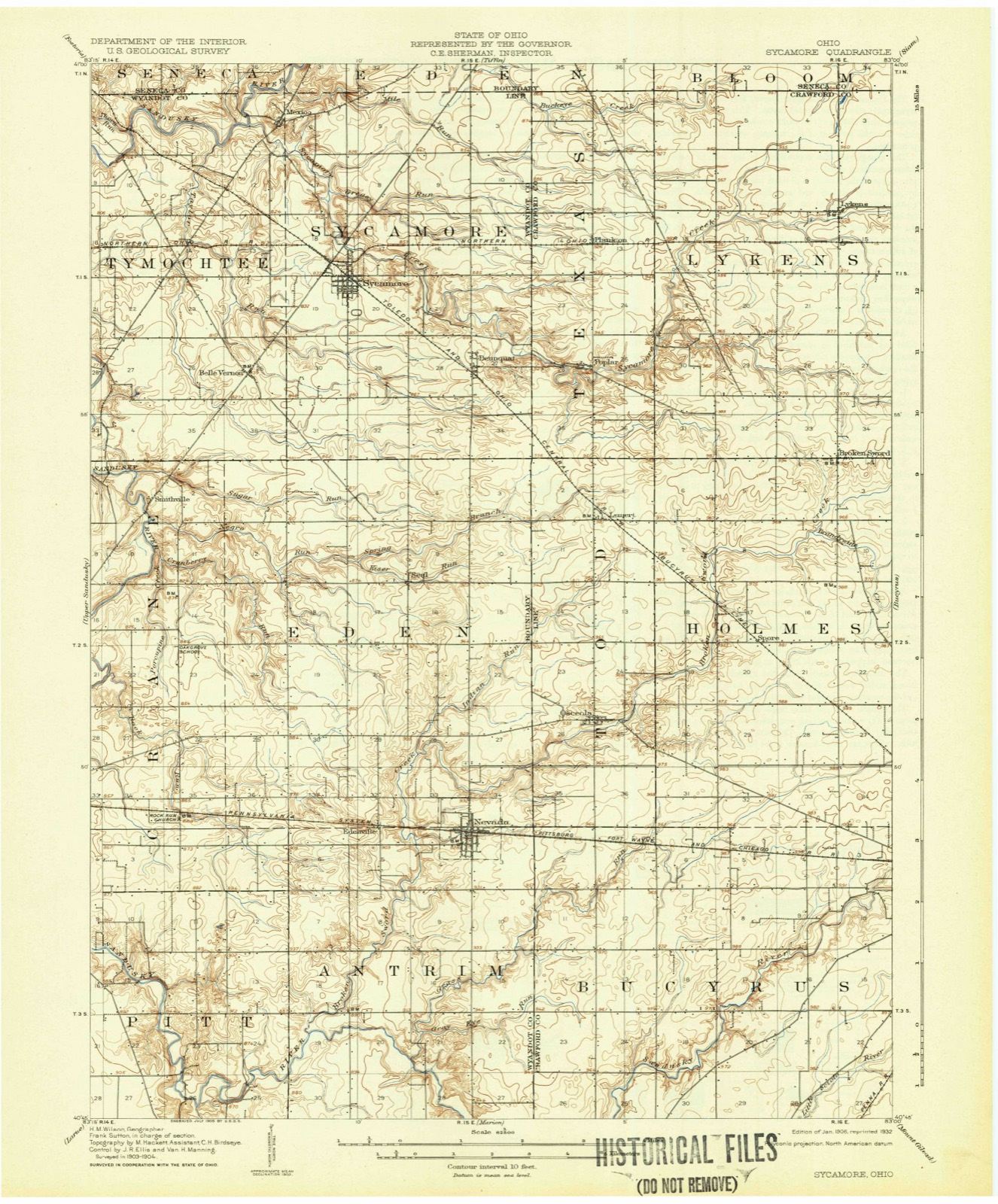
11 topographic sheets cover this place, the earliest surveyed in 1906 and the latest in 1986. It stands in Tymochtee Township. It lies in ZIP code area 44882. It stands on Sycamore Creek. The Survey maps it on the Sycamore quadrangle. It stands 2,657 feet above sea level.
Then and now
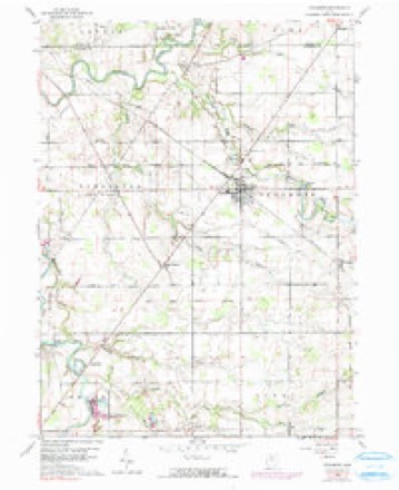
1906 to 1986The same ground, surveyed 80 years apart. Drag the handle to wipe between them. Both sheets are United States Geological Survey originals; neither has been altered.

Topographic sheets covering this place
11 sheetsMatched by testing this settlement's coordinate against the published boundary of every sheet in the United States Geological Survey's historical collection. Each opens the scanned sheet at the Survey.
- 1906 USGS Sycamore quadrangle1:62500
- 1950 USGS Marion quadrangle1:250000
- 1960 USGS Sycamore quadrangle1:24000
- 1960 USGS Sycamore quadrangle1:24000
- 1960 USGS Sycamore quadrangle1:24000
- 1962 USGS Marion quadrangle1:250000
- 1966 USGS Marion quadrangle1:250000
- 1966 USGS Marion quadrangle1:250000
- 1966 USGS Marion quadrangle1:250000
- 1986 USGS Marion quadrangle1:100000
- 1986 USGS Marion quadrangle1:100000







In the county-history sources
28,922 words on this townshipThe History of Wyandot County, Ohio, Containing a History of the County: Its Townships, Towns, Churches, Schools, Etc.;, published 1884 names this settlement in its chapter on Tymochtee Township. These are the passages that mention it, exactly as the scans read.
Tymochtee is one of the choicest townships in the county, and is admirably adapted for the labors of the agriculturist and stock-raiser. It is truly a land of plenty, fertile in soil, well watered, with good roads and in near proximity to railways a few miles in every direction. The Sandusky River meanders gently across this township in a generally northern course, when, after traversing nearly the whole township, it turns sharply to the east and waters all the north end of the township. In addition to this river which, like the old Nile in Egypt, is the chief factor in fertilizing the land, there comes from the west across Sections 18 and 17, the historic Tymochtee Creek debouching into the Sandusky about the center of the east side of the latter section. Taylor Run drains all the eastern side of the township with its long and numerous branches. Sycamore Creek crosses the northeast corner of Tychmotee from the township of Sycamore, entering the Sandusky near Mexico. Beside this, numei'oas rivulets babble through the township in every direction, making it a land of streams.
Passage source: The History of Wyandot County, Ohio, Containing a History of the County: Its Townships, Towns, Churches, Schools, Etc.;, published 1884.
Good substantial roads traverse the township in every direction, one of the chief of these is on the west side of the Sandusky, crossing the northern county boundary at McCutchenville; there it meets with a road from the southeast, crossing Belle Vernon. Another leading road enters Section 34 from the south, and passing north for about a mile and a half, it meets a road from the west crossing the Sandusky, when they turn abruptly to the northeast, crossing the township toward Mexico. The only railroad in the township, is the Ohio Central, which crosses the northeast corner, coming out near McCutchenville.
Passage source: The History of Wyandot County, Ohio, Containing a History of the County: Its Townships, Towns, Churches, Schools, Etc.;, published 1884.
John S. Wagner, a very early settler, was a native of Pickaway County, and settled near Mexico. Abraham Corfman was born in this township in 1830, and was son of Joseph and Susanna Corfman, of Pennsylvania. The father died November, 1855: his widow resides at Belle Vernon. Christopher Hufford came here in 1825, and is still living here, aged eighty-one; Trvin Walton, born in Ross County in 1828, was brought the same year to this township by his parents, Mathew and Catharine Walton, and still resides here. Daniel Walker, formerly a tailor, came here in 1833, and brought with him his son, Edward, who was born in Lancaster, May 24, 1833, and who is still a resident of Tymochtee. William Walton was here before 1838; his son Benjamin, born in December 4, 1838, in this township, still resides here; Nelson Wood, born in Tymochtee, May
Passage source: The History of Wyandot County, Ohio, Containing a History of the County: Its Townships, Towns, Churches, Schools, Etc.;, published 1884.
Machine-read from a century-old scan, so expect the errors a machine makes: misspelled names, dropped words, stray characters.
Read the whole chapter on Tymochtee Township - it names this place 7 more 7 times.
Specimens collected near this place
12 of 93 shownRegional context, not property-specific evidence. Museums hold 93 specimens collected within 10 miles of Mexico between 1893 and 1968: 92 Animalia, 1 Plantae. 12 distinct Species records are shown. Collected by CALVIN GOODRICH AND PARTY, Cindy Peacock, D.C. Eades and others. Each is a physical object with a catalogue number, and each entry opens the museum's record. This is what was collected and kept, not a survey of what lives here - nothing can be concluded from a species being absent.
| Image | Species | Year | Collected by | Where, as recorded |
|---|---|---|---|---|
 | Cambarus rusticus Girard, 1852 | 1893 | United States Fish Commission | McCutchenville, Sandusky River |
 | Notropis cornutus (Mitchill, 1817) | 1893 | not recorded | Sandusky River, Mccutchenville, Ohio |
 | Notropis rubellus (Agassiz, 1850) | 1893 | not recorded | Sandusky River, Mccutchenville, Ohio |
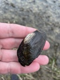 | Lasmigona costata (Rafinesque, 1820) | 1906 | Sterki, Victor | Tiffin |
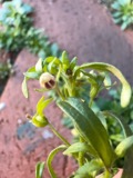 | Chaenorhinum minus (L.) Lange | 1924 | Moseley, E.L. | N of Carey |
 | Ammocrypta pellucida (Putnam, 1863) | 1930 | Trautman, M. B. (Milton Bernard) | Tymochtee Creek, within Tymochtee township, near McCutchenville, Tymochtee township |
 | Etheostoma nigrum Rafinesque, 1820 | 1930 | Trautman, M. B. (Milton Bernard) | Tymochtee Creek, within Tymochtee township, near McCutchenville, Tymochtee township |
 | Micropterus dolomieu dolomieu Lacepède, 1802 | 1930 | Trautman, M. B. (Milton Bernard) & Foster, R. (Robert) | Tymochtee Creek, within southeast Crawford township, near Carey, Crawford township |
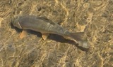 | Moxostoma anisurum (Rafinesque, 1820) | 1930 | Trautman, M. B. (Milton Bernard) | Tymochtee Creek, within Tymochtee township, near McCutchenville, Tymochtee township |
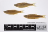 | Notropis spilopterus (Cope, 1867) | 1930 | Trautman, M. B. (Milton Bernard) & Foster, R. (Robert) | Tymochtee Creek, within southeast Crawford township, near Carey, Crawford township |
 | Etheostoma blennioides Rafinesque, 1819 | 1931 | Murphy, M K | Tymochtee Creek, 2.5 miles NE of Crawford |
 | Lepomis cyanellus Rafinesque, 1819 | 1931 | Murphy, M K | Tymochtee Creek, 2.5 miles NE of Crawford |
All 93 specimens within 10 miles, at the Global Biodiversity Information Facility.
Nearest settlements
The eight closest, with where each one stands in the county. Distances are straight-line, computed from the Geographic Names Information System coordinates.
| Map | Place | Distance | Sheets |
|---|---|---|---|
| Sycamore | 2.8 miles | 11 | |
| McCutchenville | 3.5 miles | 10 | |
| Belle Vernon | 4.2 miles | 11 | |
| Tymochtee | 4.8 miles | 10 | |
| Deunquat | 5.2 miles | 11 | |
| Smithville | 6.5 miles | 11 | |
| Seal | 7.9 miles | 11 | |
| Crawford | 9.1 miles | 10 |
Elsewhere
Matched on this settlement's Geographic Names Information System number rather than its name, so it cannot be a different place of the same name in another state.
| Wikipedia article on Mexico | An encyclopaedic summary. Its text is share-alike, so it is linked here rather than copied. |
| Wikidata item Q6826163 | The structured record the population and elevation above come from. Public domain (CC0). |
Provenance
This settlement is recorded in the Geographic Names Information System as feature 1048970. The sheet list is computed by point-in-boundary test against the United States Geological Survey's historical topographic inventory. Both are works of the United States government and carry no copyright under 17 U.S.C. 105.
Specimens. Global Biodiversity Information Facility (GBIF), https://www.gbif.org/. Only records licensed CC0 or CC BY are used. Records licensed CC BY-NC are excluded because this site carries advertising. Images are checked individually and any whose licence is non-commercial, no-derivatives or unreadable is refused.