 Block
Block
Sycamore, Ohio
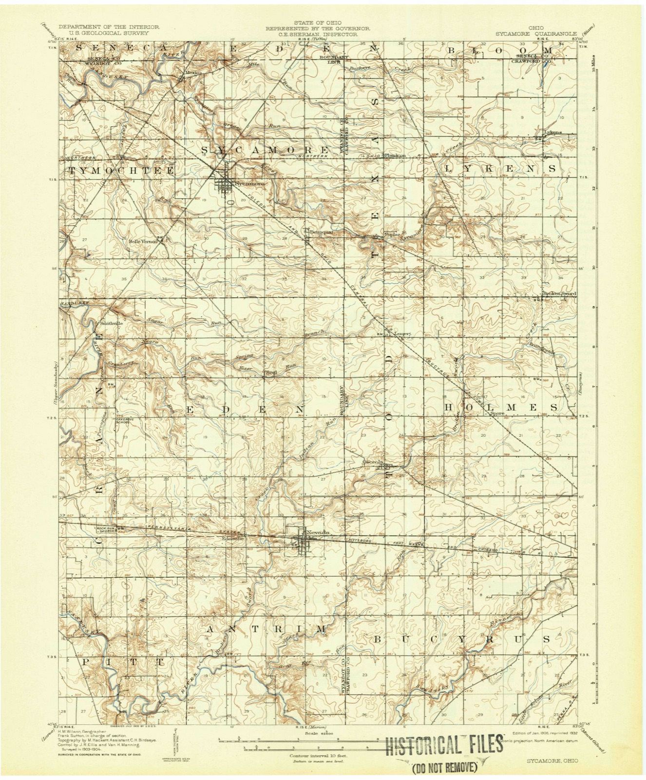
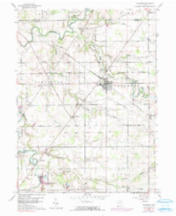
11 topographic sheets cover this place, the earliest surveyed in 1906 and the latest in 1986. It stands in Sycamore Township. It lies in ZIP code area 44882. It stands on Greasy Run. The Survey maps it on the Sycamore quadrangle.
Then and now
1906 to 1986The same ground, surveyed 80 years apart. Drag the handle to wipe between them. Both sheets are United States Geological Survey originals; neither has been altered.

Topographic sheets covering this place
11 sheetsMatched by testing this settlement's coordinate against the published boundary of every sheet in the United States Geological Survey's historical collection. Each opens the scanned sheet at the Survey.
- 1906 USGS Sycamore quadrangle1:62500
- 1950 USGS Marion quadrangle1:250000
- 1960 USGS Sycamore quadrangle1:24000
- 1960 USGS Sycamore quadrangle1:24000
- 1960 USGS Sycamore quadrangle1:24000
- 1962 USGS Marion quadrangle1:250000
- 1966 USGS Marion quadrangle1:250000
- 1966 USGS Marion quadrangle1:250000
- 1966 USGS Marion quadrangle1:250000
- 1986 USGS Marion quadrangle1:100000
- 1986 USGS Marion quadrangle1:100000







In the county-history sources
22,609 words on this townshipThe History of Wyandot County, Ohio, Containing a History of the County: Its Townships, Towns, Churches, Schools, Etc.;, published 1884 names this settlement in its chapter on Sycamore Township. These are the passages that mention it, exactly as the scans read.
Of the streams in Sycamore Township (which all flow east or northeast), the creek that gave it its name is the most notable. Sycamore Creek takes its rise partly in Crawford County and partly in Sections 22 and 27, this township. It flows nearly due northwest and " glideth at his own sweet will" through Sections 21, 16, 17, 18, 7 and a small portion of 6, when it enters Tymochtee Township and finally pours its waters into the Sandusky River near Mexico, in the latter township. Mile Creek, the most northerly stream, which finds its source in Crawford County, flows in a northwesterly direction through Sections 10, 3, 4, 5 and northeast corner of 6, where it enters Seneca County by the farm of Peter Pennington, ultimately finding its way to the Sandusky River. A stream, which enjoys the oleaginous and euphonious title, Greasy Creek, contributes its measure to Sycamore Creek; it rises in Crawford County, although one of its tributaries has its birth in Section 16, this township, and passes through Sections 15, 10, 16, 9, 17 and 8, uniting with Sycamore Creek in the northwest quarter of Section 7. Taylor Creek has its main springs in Section 34, and after flowing through 33, 27 and 30, penetrates Tymochtee Township by the farm of J. Lease, and falls into the Sandusky River about a mile west of the township line. Its smallest tributary rises in Section 28, courses through Section 29 and conjoins with Taylor Creek on Section 30, and a larger tributary rises in Section 34, traversing Sections 33, 32 and 31, entering Tymochtee Township by the farm of P. Smith and flows into Taylor Creek on Section 14, latter township. There are to be found some other smaller creeks in various parts of the township. The Wyandot Reservation line runs from Tymochtee Township eastward through the northern part of Sections 31, 32, 33 and 34 for a quarter of a mile, thence south into Eden.
Passage source: The History of Wyandot County, Ohio, Containing a History of the County: Its Townships, Towns, Churches, Schools, Etc.;, published 1884.
The first white settler in Sycamore Township was Samuel Harper, who, with his wife and seven children, four sons, William, James, Samuel and George, and three daughters, moved into the township March 1. 1821, where he entered 160 acres in Section 18, and another 160 acres in Section
Passage source: The History of Wyandot County, Ohio, Containing a History of the County: Its Townships, Towns, Churches, Schools, Etc.;, published 1884.
Peter Baum, Sr., came about fifteen days after Samuel Harper, accompanied by Daniel Walters, who afterward married Susanna Baum, daughter of Peter Baum, Sr. He entered ten acres of land on Section 18, and died there. Ichabod Myron and Rufus Merriman, came about the same period. John Eyestone came from Ross County, entered 160 acres of land in Section
Passage source: The History of Wyandot County, Ohio, Containing a History of the County: Its Townships, Towns, Churches, Schools, Etc.;, published 1884.
Machine-read from a century-old scan, so expect the errors a machine makes: misspelled names, dropped words, stray characters.
Read the whole chapter on Sycamore Township - it names this place 39 more 39 times.
Specimens collected near this place
12 of 201 shownRegional context, not property-specific evidence. Museums hold 201 specimens collected within 10 miles of Sycamore between 1885 and 1975: 200 Animalia, 1 Plantae. 12 distinct Species records are shown. Collected by Allen, J. M., Blyth & Katz, Blyth, D. (David) & Katz, D. (David) and others. Each is a physical object with a catalogue number, and each entry opens the museum's record. This is what was collected and kept, not a survey of what lives here - nothing can be concluded from a species being absent.
| Image | Species | Year | Collected by | Where, as recorded |
|---|---|---|---|---|
 | Hister abbreviatus Fabricius, 1775 | 1885 | not recorded | Crane |
 | Margarinotus faedatus (J.E.LeConte, 1845) | 1885 | not recorded | Crane |
 | Cambarus rusticus Girard, 1852 | 1893 | United States Fish Commission | McCutchenville, Sandusky River |
 | Notropis cornutus (Mitchill, 1817) | 1893 | not recorded | Sandusky River, Mccutchenville, Ohio |
 | Notropis rubellus (Agassiz, 1850) | 1893 | not recorded | Sandusky River, Mccutchenville, Ohio |
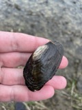 | Lasmigona costata (Rafinesque, 1820) | 1906 | Sterki, Victor | Tiffin |
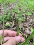 | Carex typhina Michx. | 1924 | Moseley, E.L. | Nevada |
 | Acris crepitans Baird, 1854 | 1929 | Trautman, M. B. (Milton Bernard) | Tymochtee Cr: Marseilles Twp, Wyandot Co., Ohio |
 | Ammocrypta pellucida (Putnam, 1863) | 1930 | Trautman, M. B. (Milton Bernard) | Tymochtee Creek, within Tymochtee township, near McCutchenville, Tymochtee township |
 | Coluber constrictor foxii (Baird & Girard, 1853) | 1930 | Hine, J. S. (James Stewart) | near Tymochtee, Wyandot Co., Ohio |
 | Etheostoma nigrum Rafinesque, 1820 | 1930 | Trautman, M. B. (Milton Bernard) | Tymochtee Creek, within Tymochtee township, near McCutchenville, Tymochtee township |
 | Micropterus dolomieu dolomieu Lacepède, 1802 | 1930 | Trautman, M. B. (Milton Bernard) & Foster, R. (Robert) | Tymochtee Creek, within southeast Crawford township, near Carey, Crawford township |
All 201 specimens within 10 miles, at the Global Biodiversity Information Facility.
Mines and quarries near this place
2 within 5 milesRegional context, not property-specific evidence. The federal mineral resources record lists 2 workings within 5 miles of Sycamore: 2 producers. All of them still produce. What was taken out: Sand and Gravel, Construction. Distance is straight-line from the map coordinates, so a quarry counted here may appear on a neighbouring settlement's page as well.
| Where | Site | Commodity | Status | Recorded |
|---|---|---|---|---|
| Amert Pit & Plant | Sand and Gravel, Construction | Producer | ||
| Kirby and Sons, Inc. | Sand and Gravel, Construction | Producer |
Storms near this place
7 since 2005Regional context, not property-specific evidence. The National Weather Service names Sycamore in 7 storm reports between 2005 and 2020: 6 thunderstorm wind, 1 hail. No death or injury is recorded in these reports. Each account below is quoted exactly as the forecast office filed it, from the NOAA Storm Events Database, and each date opens the federal record of that event.
| When | Event | Place named | Harm | What the report says |
|---|---|---|---|---|
| June 2005 | Thunderstorm Wind | Sycamore | $30,000 | Several trees and power poles knocked down. |
| August 2005 | Thunderstorm Wind | Sycamore | $2,000 | A tree and large limb were reported down. |
| November 2005 | Thunderstorm Wind | Sycamore | $1,000 | A few large limbs were reported down. |
| June 2020 | Thunderstorm Wind | Sycamore | - | A small walking bridge across a culvert was lifted and flipped over. Person who tweeted report noted the bridge was heavily anchored into the ground. |
| February 2017 | Thunderstorm Wind | Sycamore | - | Trained spotters estimated thunderstorm wind gusts at 60 mph. |
| October 2016 | Hail | Sycamore | - | Penny to nickel sized hail lasted several minutes. |
| June 2007 | Thunderstorm Wind | Sycamore | - | Wind gusts of around 60 mph were estimated as the thunderstorm passed through the area. |
Nearest settlements
The eight closest, with where each one stands in the county. Distances are straight-line, computed from the Geographic Names Information System coordinates.
| Map | Place | Distance | Sheets |
|---|---|---|---|
| Belle Vernon | 2.3 miles | 11 | |
| Deunquat | 2.6 miles | 11 | |
| Mexico | 2.8 miles | 11 | |
| Smithville | 4.9 miles | 11 | |
| Seal | 5.1 miles | 11 | |
| Tymochtee | 5.3 miles | 10 | |
| McCutchenville | 5.5 miles | 10 | |
| Edenville | 9.0 miles | 12 |
Provenance
This settlement is recorded in the Geographic Names Information System as feature 1049237. The sheet list is computed by point-in-boundary test against the United States Geological Survey's historical topographic inventory. Both are works of the United States government and carry no copyright under 17 U.S.C. 105.
Specimens. Global Biodiversity Information Facility (GBIF), https://www.gbif.org/. Only records licensed CC0 or CC BY are used. Records licensed CC BY-NC are excluded because this site carries advertising. Images are checked individually and any whose licence is non-commercial, no-derivatives or unreadable is refused.
Mines and quarries. USGS Mineral Resources Data System (MRDS) https://mrdata.usgs.gov/mrds/ A work of the United States government, no copyright under 17 U.S.C. 105.
Storms. NOAA National Centers for Environmental Information, Storm Events Database https://www.ncei.noaa.gov/stormevents/ A work of the United States government, no copyright under 17 U.S.C. 105. Narratives are quoted verbatim from the National Weather Service report and are not edited or summarised.