 Block
Block
Moulton, Ohio
14 topographic sheets cover this place, the earliest surveyed in 1911 and the latest in 1986. It stands in Moulton Township. It lies in ZIP code area 45895. It stands on Clear Creek. The Survey maps it on the Moulton quadrangle.
Then and now
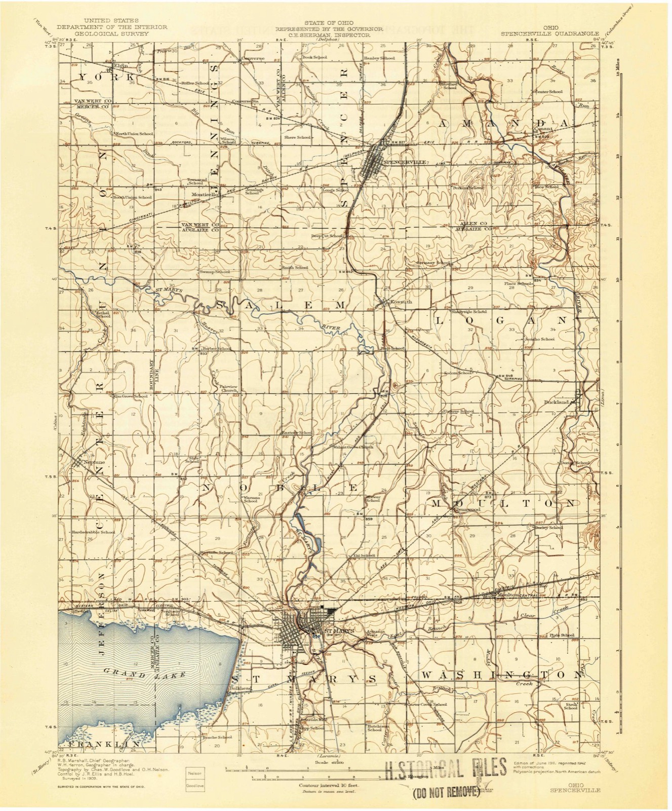
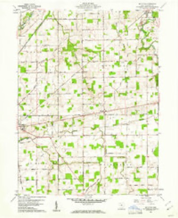
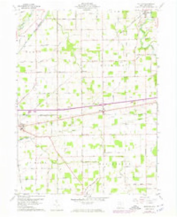
1911 to 1986The same ground, surveyed 75 years apart. Drag the handle to wipe between them. Both sheets are United States Geological Survey originals; neither has been altered.

Topographic sheets covering this place
14 sheetsMatched by testing this settlement's coordinate against the published boundary of every sheet in the United States Geological Survey's historical collection. Each opens the scanned sheet at the Survey.
- 1911 USGS Spencerville quadrangle1:62500
- 1944 USGS Spencerville quadrangle1:62500
- 1953 USGS Muncie quadrangle1:250000
- 1953 USGS Muncie quadrangle1:250000
- 1953 USGS Muncie quadrangle1:250000
- 1953 USGS Muncie quadrangle1:250000
- 1953 USGS Muncie quadrangle1:250000
- 1956 USGS Muncie quadrangle1:250000
- 1960 USGS Moulton quadrangle1:24000
- 1960 USGS Moulton quadrangle1:24000
- 1960 USGS Moulton quadrangle1:24000
- 1986 USGS Lima quadrangle1:100000
- 1986 USGS Lima quadrangle1:100000
- 1986 USGS Lima quadrangle1:100000









In the county-history sources
7,581 words on this townshipHistory of Auglaize County, Ohio : with the Indian History of Wapakoneta, and the First Settlement of the County, published 1880 names this settlement in its chapter on Moulton Township. These are the passages that mention it, exactly as the scans read.
This township is situated in the geographical centre of the county, and is the only one not bounded by county lines. It was organized in 1834 as part of Allen County, being at that time a full township. When Auglaize County was formed in 1848 nine sections were struck off the north part of Moulton township, and became a part of the new township of Logan, thus leaving the present township six miles east and west, and four and one-half miles north and south, and containing twentyseven square miles.
Passage source: History of Auglaize County, Ohio : with the Indian History of Wapakoneta, and the First Settlement of the County, published 1880.
There had been some improvement made by the Indians along the Auglaize River, the east half of the township being part of the Shawnee Reservation. The first white settlements date from 1832 and 1833, and among these settlers we find Jos. Haskill, Jos Bonson, William Julian, father of George Julian, now the oldest settler in the township, Daniel Cutler, Benjamin Nagle, William Crowder (Col.), John Waite, Thos. Williams, John C. Freyman, Christopher Baily, Abner Daniels, and Thomas Jones. From 1837 to 1840 were Cornelius Christy, Henry McConnell, Samuel Walker, John McFarland, and John C. Bothe. The early settlers experienced the usual privations of pioneer life, because of the difficulty of obtaining supplies. After a little time provisions became plentiful, but dry goods and groceries were largely beyond reach on account of high prices. Homespun was the common wearing apparel, and a blushing girl in her teens would make butter at five cents per pound and gather eggs at three cents per dozen to buy a calico dress at twenty-live cents per yard; and then this dress of calico was more highly prized than would be a fine silk by our fashionable belles of to-day. Farmers would go to Piqua or Sidney to mill or to market a few bushels of wheat, and bring back family supplies.
Passage source: History of Auglaize County, Ohio : with the Indian History of Wapakoneta, and the First Settlement of the County, published 1880.
Soil. - The soil of Moulton is largely a strong clay with considerable burr oak flats of rich black loam, and some fine alluvial loam along the creeks and river. It is productive, and generally in a good state of cultivation, being rapidl}' irrigated and otherwise improved. The surface is gently rolling, without any waste lands, which render its drainage less difficult than other townships of the county.
Passage source: History of Auglaize County, Ohio : with the Indian History of Wapakoneta, and the First Settlement of the County, published 1880.
Machine-read from a century-old scan, so expect the errors a machine makes: misspelled names, dropped words, stray characters.
Read the whole chapter on Moulton Township - it names this place 12 more 12 times.
Specimens collected near this place
12 of 1,137 shownRegional context, not property-specific evidence. Museums hold 1,137 specimens collected within 10 miles of Moulton between 1800 and 1975: 1,039 Animalia, 97 Plantae, 1 Bacteria. 12 distinct Species records are shown. Collected by A. Wetzstein, Adler, K. K., Albert Wetzstein and others. Each is a physical object with a catalogue number, and each entry opens the museum's record. This is what was collected and kept, not a survey of what lives here - nothing can be concluded from a species being absent.
| Image | Species | Year | Collected by | Where, as recorded |
|---|---|---|---|---|
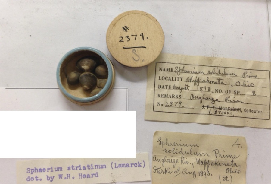 | Sphaerium striatinum (Lamarck, 1818) | 1893 | not recorded | Auglaize River, Wapakoneta [Wappakoneta] |
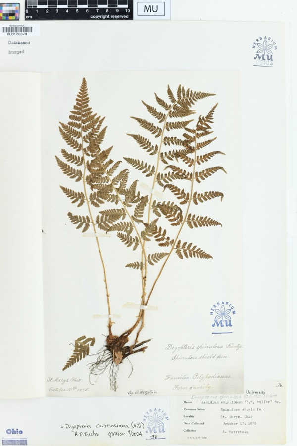 | Dryopteris spinulosa (O.F.Müll.) Watt | 1895 | Wetzstein, A. | St. Marys, Ohio. |
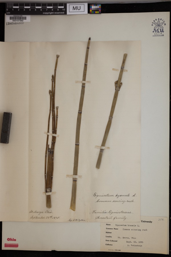 | Equisetum hyemale L. | 1895 | Wetzstein, A. | St. Marys. |
 | Mentha aquatica L. | 1800 | Ballenstedt, B. | Bremen: An der WÅmme in Oberneuland bei Bremen |
 | Recurvirostra americana J.F.Gmelin, 1789 | 1882 | Uller, C. (Clem) | St. Marys Res, Auglaize, Ohio, USA |
 | Geum urbanum L. | 1883 | Baßmann | Bremen: Vegesack, feuchtes, schattiges Gehîlz bei Holthorst, sehr selten |
 | Rubus idaeus L. | 1889 | Meyerholz | Bremen: auf Quellgrund, Torf u. Humus |
 | Stachys aspera Michx. | 1889 | Wilhelm Schibler | Ohio: St. Marys, borders of Canal. |
 | Lobelia dortmanna L. | 1892 | Wendelken | Bremen: Bremen-Lesum, Lesum |
 | Rubus condensatus P.J.Müll. | 1892 | Elmgoeth, Fr. | Niedersachsen: Soltau in der Lüneburger Heide |
 | Alasmidonta viridis (Rafinesque, 1820) | 1893 | Sterki, Victor | Wapakoneta |
 | Amblema plicata (Say, 1817) | 1893 | Sterki, Victor | Wapakoneta |
All 1,137 specimens within 10 miles, at the Global Biodiversity Information Facility.
Mines and quarries near this place
3 within 5 milesRegional context, not property-specific evidence. The federal mineral resources record lists 3 workings within 5 miles of Moulton: 1 producer, 1 past producer, 1 plant. 2 still produce. What was taken out: Stone, Crushed/Broken, Limestone, General. Distance is straight-line from the map coordinates, so a quarry counted here may appear on a neighbouring settlement's page as well.
| Where | Site | Commodity | Status | Recorded |
|---|---|---|---|---|
| Buckland Quarry | Limestone, General | Past Producer | Sedimentary | |
| Buckland Plant & Quarry | Stone, Crushed/Broken | Plant | ||
| Con-Ag, Inc. | Stone, Crushed/Broken | Producer |
Storms near this place
2 since 1998Regional context, not property-specific evidence. The National Weather Service names Moulton in 2 storm reports between 1998 and 2019: 1 hail, 1 tornado. No death or injury is recorded in these reports. Each account below is quoted exactly as the forecast office filed it, from the NOAA Storm Events Database, and each date opens the federal record of that event.
| When | Event | Place named | Harm | What the report says |
|---|---|---|---|---|
| May 2019 | Tornado (EF1) | Moulton | $500,000 | The tornado appears to have touched down very close to Kettlersville Road, just south of the intersection with County Road 33A. Extensive damage occurred here to a barn, grain silo, trees, and a 19th century residence. The north end of the barn was destroyed and the grain silo was lifted and rolled approximately 150 yards to the northeast. A swirl pattern was evident as well in vegetation along the shore of a pond near where the grain silo fragment came to rest. The back room and associated roof of the 19th century residence was pulled from the main structure, along with the plumbing fixtures and a portion of the concrete sub-floor. The structure and contents of the room and barn were scattered to the northeast along a path approximately 50 yards wide. Several pine trees with trunks approximately 8-10 inches wide were also snapped near the residence. This damage and its dispersal pattern was consistent with 100 to 110 mph winds of an EF1 tornado.||The tornado next crossed County Road 33A between Kettlersville Road and Kohler Lane, damaging power poles along County Road 33A. Two barns and another outbuilding on a property just north of the road were also destroyed. Only small segments of the barns were still standing, suggesting 100 to 110 mph (EF1) winds along this portion of the track. The debris from these structures was scattered over a large area of the adjoining field to the north, northeast and east near the intersection of County Road 33A and Woodland Drive. The tornado likely didn't track directly over this entire area, but instead debris was probably lofted and thrown free of the circulation in many directions, before falling back to the ground nearby.||An absence of damage for approximately 150 yards to the east of the field suggests the tornado briefly lifted, then descended again to strike two more barns and the north side of a house. Both barns lost their roofs and at least half of their exterior walls. Some roof damage also occurred to the house. Debris from these structures was lofted and then dropped to the east in an adjacent field and on both sides of US Route 33.||As the tornado continued east-northeast, it left visible striations in field vegetation and destroyed an outbuilding just west of the County Road 33A overpass across US Route 33. A large portion of the outbuilding was lifted and carried approximately 150 yards to the area just west of the overpass and dropped on the road, where a semi truck crashed into it. The semi driver was injured in the crash. The degree and pattern of damage both here and at the adjacent property to the west are indicative of 100 to 110 mph winds of an EF1 tornado.||No further damage was noted on the north side of US Route 33 or east of the overpass, so dissipation of the tornado likely occurred at this point. |
| June 1998 | Hail | Moulton | - | no account filed |
Nearest settlements
The eight closest, with where each one stands in the county. Distances are straight-line, computed from the Geographic Names Information System coordinates.
| Map | Place | Distance | Sheets |
|---|---|---|---|
| Bay (historical) | 1.0 miles | 14 | |
| Glynwood | 2.1 miles | 14 | |
| Pusheta Town (historical) | 3.7 miles | 15 | |
| New Knoxville | 4.4 miles | 15 | |
| Sherwood Forest | 4.9 miles | 15 | |
| Saint Marys | 5.0 miles | 14 | |
| Buckland | 5.0 miles | 14 | |
| Wapakoneta | 5.6 miles | 15 |
Provenance
This settlement is recorded in the Geographic Names Information System as feature 1043517. The sheet list is computed by point-in-boundary test against the United States Geological Survey's historical topographic inventory. Both are works of the United States government and carry no copyright under 17 U.S.C. 105.
Specimens. Global Biodiversity Information Facility (GBIF), https://www.gbif.org/. Only records licensed CC0 or CC BY are used. Records licensed CC BY-NC are excluded because this site carries advertising. Images are checked individually and any whose licence is non-commercial, no-derivatives or unreadable is refused.
Mines and quarries. USGS Mineral Resources Data System (MRDS) https://mrdata.usgs.gov/mrds/ A work of the United States government, no copyright under 17 U.S.C. 105.
Storms. NOAA National Centers for Environmental Information, Storm Events Database https://www.ncei.noaa.gov/stormevents/ A work of the United States government, no copyright under 17 U.S.C. 105. Narratives are quoted verbatim from the National Weather Service report and are not edited or summarised.