 Block
Block
Wapakoneta, Ohio
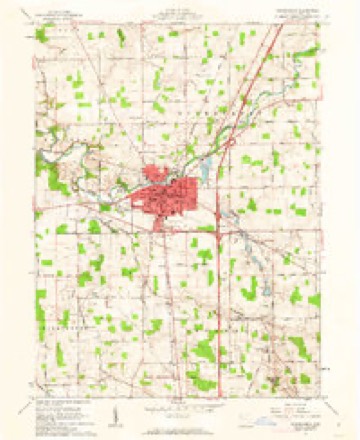
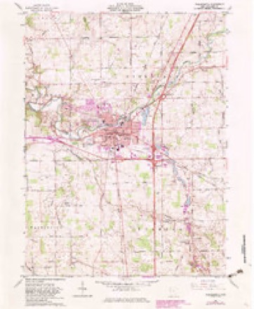
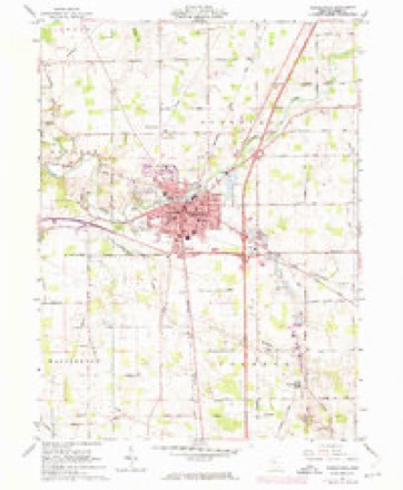
15 topographic sheets cover this place, the earliest surveyed in 1906 and the latest in 1986. It stands in Duchouquet Township. It lies in ZIP code area 45895. It stands on Quaker Run. The Survey maps it on the Wapakoneta quadrangle. 9,957 people lived here at the 2020 count. It stands 892 feet above sea level.
Research this city
This curated hub for Auglaize County, Ohio brings together the page's documented record links, visible map or image evidence where published, and routes to related local records.
What is documented here?
Use the page's provenance and linked records to distinguish the source material from the site's navigation and summaries.
How should I cite it?
Open the original record, preserve its repository and identifier, then use the citation tool for this page as a path back to the source.
Where should I go next?
Follow the county or state hub for related places and records, then use the guide for a source-aware research sequence.
Population over time
2 figuresWapakoneta grew from 9,867 to 9,957 between 2010 and 2020. These are the recorded population figures Wikidata holds for this place, reached through the Geographic Names Information System number this page is keyed on rather than by name, so they belong to this place and not to another of the same name. Most are census counts, but not all are: an early figure may be a founding or settlement estimate. The change column is computed, and is left blank where more than 20 years separate a figure from the one before it, because a gap that long is not a change between two counts.
| Year | People | Change |
|---|---|---|
| 2010 | 9,867 | |
| 2020 | 9,957 | +90 (+1%) |
Then and now
1906 to 1986The same ground, surveyed 80 years apart. Drag the handle to wipe between them. Both sheets are United States Geological Survey originals; neither has been altered.

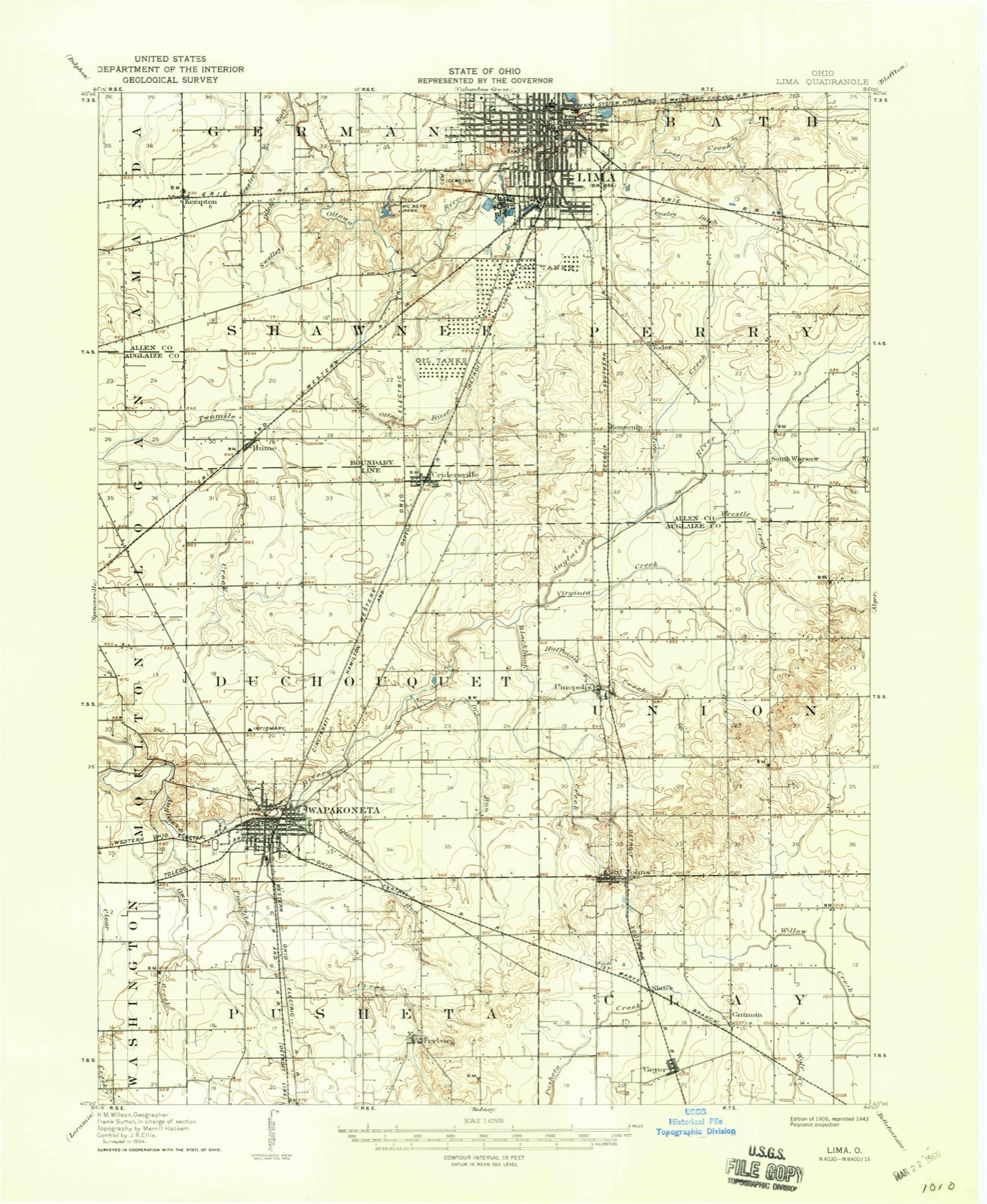
Topographic sheets covering this place
15 sheetsMatched by testing this settlement's coordinate against the published boundary of every sheet in the United States Geological Survey's historical collection. Each opens the scanned sheet at the Survey.
- 1906 USGS Lima quadrangle1:62500
- 1906 USGS Lima quadrangle1:62500
- 1953 USGS Muncie quadrangle1:250000
- 1953 USGS Muncie quadrangle1:250000
- 1953 USGS Muncie quadrangle1:250000
- 1953 USGS Muncie quadrangle1:250000
- 1953 USGS Muncie quadrangle1:250000
- 1956 USGS Muncie quadrangle1:250000
- 1961 USGS Wapakoneta quadrangle1:24000
- 1961 USGS Wapakoneta quadrangle1:24000
- 1961 USGS Wapakoneta quadrangle1:24000
- 1961 USGS Wapakoneta quadrangle1:24000
- 1986 USGS Lima quadrangle1:100000
- 1986 USGS Lima quadrangle1:100000
- 1986 USGS Lima quadrangle1:100000









Specimens collected nearby
12 of 1,060 shownMuseums hold 1,060 specimens collected within 10 miles of Wapakoneta between 1882 and 1975: 1,037 Animalia, 18 Plantae, 5 Fungi. 12 distinct Species records are shown. Collected by A. Wetzstein, Adler, K. K., Albert Wetzstein and others. Each is a physical object with a catalogue number, and each entry opens the museum's record. This is what was collected and kept, not a survey of what lives here - nothing can be concluded from a species being absent.
| Image | Species | Year | Collected by | Where, as recorded |
|---|---|---|---|---|
 | Sphaerium striatinum (Lamarck, 1818) | 1893 | not recorded | Auglaize River, Wapakoneta [Wappakoneta] |
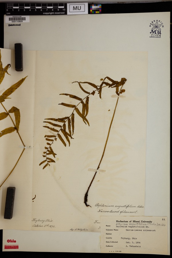 | Athyrium pycnocarpon (Spreng.) Tidestr. | 1896 | Wetzstein, A. | Fryburg. |
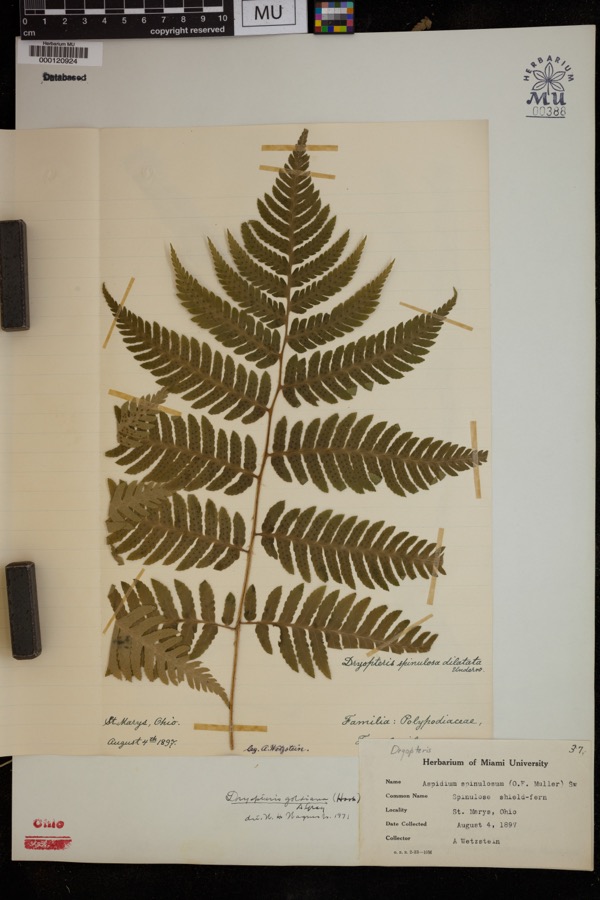 | Dryopteris goldiana (Hook. ex Goldie) A.Gray | 1897 | Wetzstein, A. | St. Marys |
 | Recurvirostra americana J.F.Gmelin, 1789 | 1882 | Uller, C. (Clem) | St. Marys Res, Auglaize, Ohio, USA |
 | Alasmidonta viridis (Rafinesque, 1820) | 1893 | Sterki, Victor | Wapakoneta |
 | Amblema plicata (Say, 1817) | 1893 | Sterki, Victor | Wapakoneta |
 | Ameiurus nebulosus (Lesueur, 1819) | 1893 | P. Kirsch | Anglaize Rver, Wapakaneta, Ohio |
 | Anodontoides ferussacianus (I.Lea, 1834) | 1893 | Sterki, Victor | Wapakoneta |
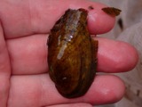 | Cambarunio iris (I.Lea, 1829) | 1893 | Sterki, Victor | Wapakoneta |
 | Campostoma anomalum (Rafinesque, 1820) | 1893 | P. Kirsch | Ohio, Auglaize River, Wapakoneta |
 | Catostomus commersonii (Lacepède, 1803) | 1893 | P. Kirsch | Ohio, Auglaize River, Wapakoneta |
 | Fusconaia flava (Rafinesque, 1820) | 1893 | Sterki, Victor | Wapakoneta |
All 1,060 specimens within 10 miles, at the Global Biodiversity Information Facility.
Mines and quarries nearby
3 within 5 milesThe federal mineral resources record lists 3 workings within 5 miles of Wapakoneta: 2 plants, 1 past producer. 2 still produce. What was taken out: Sand and Gravel, Construction, Stone, Crushed/Broken. Distance is straight-line from the map coordinates, so a quarry counted here may appear on a neighbouring settlement's page as well.
| Where | Site | Commodity | Status | Recorded |
|---|---|---|---|---|
| Buckland Plant & Quarry | Stone, Crushed/Broken | Plant | ||
| Quality Pit & Mill | Sand and Gravel, Construction | Plant | ||
| Quality Sand and Gravel Pit | Sand and Gravel, Construction | Past Producer | Sedimentary |
Storms nearby
60 of 67 shownThe National Weather Service names Wapakoneta in 67 storm reports between 1995 and 2026: 34 thunderstorm wind, 15 hail, 8 flood, 6 flash flood. The reports record 9 injuries. Each account below is quoted exactly as the forecast office filed it, from the NOAA Storm Events Database, and each date opens the federal record of that event.
| When | Event | Place named | Harm | What the report says |
|---|---|---|---|---|
| March 2023 | Tornado (EF1) | Wapakoneta | 7 hurt, $3,000,000 | The first sign of visible damage associated with this tornado occurred on Owl Creek Road. At one residence, two large trees were knocked down while a barn was destroyed at another residence. The tornado strengthened as it moved to the northeast, removing a significant portion of a warehouse building roof and snapping several power poles. Just northeast of here, a large commercial greenhouse was completely leveled. The tornado then crossed the intersection of U.S. 33 and Interstate 75, causing significant roof damage and partial exterior wall collapse to an industrial building. At this point, the tornado was at its strongest with estimated winds of up to 110 mph.||On the east side of Interstate 75 and just north of U.S. 33, a truck stop experienced significant damage and a few semi-trailers were blown over. Just northeast of here, a private campground suffered significant damage. At the campsite, numerous trailers were flipped over and a large meeting hall had its roof removed. Several trees were also knocked down. Seven people were injured when the trailers were flipped at the campground.||As the tornado continued northeast, several farmhouses were damaged and outbuildings were damaged or destroyed between Wapakoneta and Uniopolis, particularly along Middle Pike. Considerable debris was noted in nearby fields. A historic brick school building was also destroyed on Brown Road. Numerous trees were also snapped and uprooted along the path. Sporadic damage to trees and outbuildings continued to the northeast before the tornado apparently lifted near the Auglaize/Allen County line.||This tornado started at 2354 EST, March 31st, 2023 and ended at 0007 EST, April 1st, 2023. The injuries occurred just before midnight EST so were included in the March 2023 Storm Data for Ohio, Southwest. |
| June 2012 | Thunderstorm Wind | Wapakoneta | 1 hurt, $10,000 | Glass windows were blown in at an automobile dealership due to thunderstorm winds. One person was injured by the glass. |
| June 2012 | Thunderstorm Wind | Wapakoneta | 1 hurt, $1,000 | A woman was struck by a falling tree limb near the Auglaize County Public Library due to thunderstorm winds. |
| February 2011 | Flash Flood | Wapakoneta | $250,000 | Multiple homes were flooded with water rescues necessary. |
| August 2010 | Thunderstorm Wind | Wapakoneta | $120,000 | Damaging thunderstorm winds resulted in several barns being damaged or destroyed, several silos with major damage or destruction, trees down, and an old brick school being destroyed. |
| February 2011 | Flood | Wapakoneta | $100,000 | Flooding is a continuation from earlier flash flooding in the area. Several roads were impassible and hundreds of evacuations occurred due to the precipitation. Flooding began around 0645 EST on February 28th and continued until around 0900 EST on March 2nd. Damage estimates during March were around one-hundred thousand dollars. |
| March 2011 | Flood | Wapakoneta | $100,000 | Flooding is a continuation from earlier flash flooding in the area. Several roads were impassible and hundreds of evacuations occurred due to the precipitation. Flooding began around 0645 EST on February 28th and continued until around 0900 EST on March 2nd. Damage estimates during February were around one-hundred thousand dollars. |
| April 1996 | Lightning | Wapakoneta | $50,000 | no account filed |
| October 2010 | Tornado (EF0) | Wapakoneta | $30,000 | Damage from this brief tornado touchdown included a garage door that was blown in and a barn that collapsed. Based on this damage, wind speeds were estimated to be 75 miles per hour. |
| May 2008 | Thunderstorm Wind | Wapakoneta | $30,000 | Several mobile homes were damaged in a trailer park. Awnings were ripped off and basketball poles and other ground fixtures were damaged. A few 2x4 wooden planks were driven into a trailer, causing one injury. Power poles and trees were also downed in the area. |
| July 2011 | Thunderstorm Wind | Wapakoneta | $25,000 | A pole barn was destroyed due to damaging thunderstorm winds. |
| June 2013 | Thunderstorm Wind | Wapakoneta | $23,000 | A semi trailer was overturned at Walmart west of Interstate 75 in Wapakoneta due to thunderstorm winds. Trees were also reported down in the city of Wapakoneta. |
| June 2013 | Thunderstorm Wind | Wapakoneta | $20,000 | A semi trailer was blown over west of Wapakoneta on Route 33. |
| April 2011 | Thunderstorm Wind | Wapakoneta | $20,000 | Several vehicles were blown off of the interstate due to damaging thunderstorm winds. |
| June 2012 | Thunderstorm Wind | Wapakoneta | $10,000 | A tractor trailer rolled over on Route 33 due to thunderstorm winds. |
| May 2011 | Thunderstorm Wind | Wapakoneta | $10,000 | Trees were reported down along with snapped power poles due to damaging thunderstorm winds. |
| March 2007 | Flood | Wapakoneta | $10,000 | Several roads were flooded and closed. Over forty locations across the county dealt with high water. |
| March 2007 | Flood | Wapakoneta | $10,000 | A few roads were flooded in the north side of Wapakoneta due to rising water from the Auglaize River. Sandbagging of buildings took place in this part of the city as well. |
| June 2006 | Tornado (F0) | Wapakoneta | $10,000 | A weak tornado touched down near the intersection of US Route 33 and Interstate 75. Several homes sustained roof damage from the tornado. |
| June 1997 | Thunderstorm Wind | Wapakoneta | $10,000 | Numerous trees and power lines downed. |
| June 1995 | Thunderstorm Wind | Wapakoneta | $9,000 | Winds measured at 58 mph downed a few large trees, one fell on an automobile. |
| May 1995 | Thunderstorm Wind | Wapakoneta | $8,000 | Several trees downed, and windows were reported blown out of a house. |
| October 2010 | Thunderstorm Wind | Wapakoneta | $6,000 | Power poles were snapped due to damaging thunderstorm winds. |
| June 2013 | Thunderstorm Wind | Wapakoneta | $5,000 | There were numerous reports of trees downed due to thunderstorm winds. |
| June 2012 | Thunderstorm Wind | Wapakoneta | $5,000 | Eleven trees were reported down at the fairgrounds due to damaging thunderstorm winds. |
| August 2007 | Flash Flood | Wapakoneta | $5,000 | Several roads were flooded in and around Wapakoneta, Uniopolis and St. Johns. |
| July 1999 | Thunderstorm Wind | Wapakoneta | $5,000 | Trees downed. |
| May 2015 | Thunderstorm Wind | Wapakoneta | $4,000 | A tree fell onto the sun room of a home. |
| July 2013 | Thunderstorm Wind | Wapakoneta | $3,000 | Trees were downed due to thunderstorm winds. |
| April 2007 | Thunderstorm Wind | Wapakoneta | $3,000 | Power poles and power lines were knocked down. |
| March 2007 | Flood | Wapakoneta | $3,000 | A few roads were flooded and closed across the county. |
| May 2006 | Thunderstorm Wind | Wapakoneta | $3,000 | Rafters were torn off of a home under construction. |
| June 2006 | Thunderstorm Wind | Wapakoneta | $3,000 | Trees and power poles were knocked down. |
| May 2004 | Thunderstorm Wind | Wapakoneta | $3,000 | Trees were downed. |
| May 2003 | Thunderstorm Wind | Wapakoneta | $3,000 | Trees were knocked down across the town. |
| August 2003 | Thunderstorm Wind | Wapakoneta | $3,000 | Trees and powerlines were downed. |
| November 1998 | Thunderstorm Wind | Wapakoneta | $3,000 | Trees down. |
| May 1995 | Thunderstorm Wind | Wapakoneta | $3,000 | Two large trees were uprooted. |
| May 1996 | Flash Flood | Wapakoneta | $3,000 | no account filed |
| October 2010 | Thunderstorm Wind | Wapakoneta | $2,000 | Trees were reported down due to damaging thunderstorm winds. |
| December 2007 | Thunderstorm Wind | Wapakoneta | $2,000 | One tree was downed near the intersection of Kelly and Buckland River Roads. A power pole was knocked down just southeast of Wapakoneta. |
| June 2004 | Thunderstorm Wind | Wapakoneta | $2,000 | Tree limbs were knocked down. |
| November 2002 | Thunderstorm Wind | Wapakoneta | $2,000 | Two trees were knocked down. |
| June 2020 | Thunderstorm Wind | Wapakoneta | $1,000 | Numerous four to six inch diameter branches were knocked down. |
| June 2008 | Hail | Wapakoneta | $1,000 | no account filed |
| June 2008 | Hail | Wapakoneta | $1,000 | no account filed |
| July 2020 | Thunderstorm Wind | Wapakoneta | $100 | A few large branches were downed. |
| June 2019 | Flood | Wapakoneta | - | Numerous roads were closed across Auglaize County due to flooding. |
| July 2017 | Flash Flood | Wapakoneta | - | Some water rescues were needed in Wapakoneta due to rising water. |
| July 2017 | Flash Flood | Wapakoneta | - | High water was reported at the intersection of State Route 501 and Infirmary Road. |
| June 2015 | Flood | Wapakoneta | - | Barbara Lane was closed due to flooding. |
| June 2015 | Flood | Wapakoneta | - | Ohio State Route 67 was closed due to flooding between Blackhoof Creek Road and Golden Bridge Road. |
| June 2003 | Flash Flood | Wapakoneta | - | Several roads across the central portion of the county were underwater. Ditches overflowed in Wapakoneta, flooding lawns. |
| March 2026 | Hail | Wapakoneta | - | no account filed |
| April 2025 | Hail | Wapakoneta | - | no account filed |
| April 2020 | Hail | Wapakoneta | - | no account filed |
| April 2013 | Hail | Wapakoneta | - | no account filed |
| April 2013 | Hail | Wapakoneta | - | no account filed |
| June 2012 | Thunderstorm Wind | Wapakoneta | - | no account filed |
| March 2012 | Hail | Wapakoneta | - | no account filed |
Nearest settlements
The eight closest, with where each one stands in the county. Distances are straight-line, computed from the Geographic Names Information System coordinates.
| Map | Place | Distance | Sheets |
|---|---|---|---|
| Colonial Estates | 0.5 miles | 15 | |
| Pusheta Town (historical) | 1.9 miles | 15 | |
| Sherwood Forest | 1.9 miles | 15 | |
| Fryburg | 4.3 miles | 15 | |
| Bay (historical) | 4.6 miles | 14 | |
| Buckland | 5.2 miles | 14 | |
| Moulton | 5.6 miles | 14 | |
| Saint Johns | 5.9 miles | 14 |
Elsewhere
Matched on this settlement's Geographic Names Information System number rather than its name, so it cannot be a different place of the same name in another state.
| Wikipedia article on Wapakoneta | An encyclopaedic summary. Its text is share-alike, so it is linked here rather than copied. |
| Wikidata item Q492796 | The structured record the population and elevation above come from. Public domain (CC0). |
Provenance
This settlement is recorded in the Geographic Names Information System as feature 1070980. The sheet list is computed by point-in-boundary test against the United States Geological Survey's historical topographic inventory. Both are works of the United States government and carry no copyright under 17 U.S.C. 105.
Specimens. Global Biodiversity Information Facility (GBIF), https://www.gbif.org/. Only records licensed CC0 or CC BY are used. Records licensed CC BY-NC are excluded because this site carries advertising. Images are checked individually and any whose licence is non-commercial, no-derivatives or unreadable is refused.
Mines and quarries. USGS Mineral Resources Data System (MRDS) https://mrdata.usgs.gov/mrds/ A work of the United States government, no copyright under 17 U.S.C. 105.
Storms. NOAA National Centers for Environmental Information, Storm Events Database https://www.ncei.noaa.gov/stormevents/ A work of the United States government, no copyright under 17 U.S.C. 105. Narratives are quoted verbatim from the National Weather Service report and are not edited or summarised.