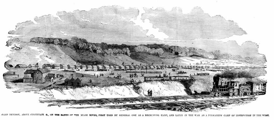
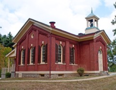
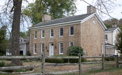
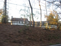
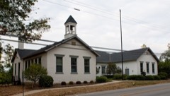
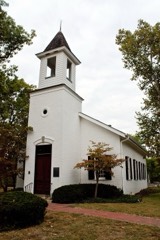
Built in 1861. Listed on the National Register of Historic Places in
1973. A historic map-sheet match is not published yet. The record needs a coordinate-quality review before it can be joined to a sheet boundary.
From the record
“Camp Dennison was a military recruiting, training, and medical post for the United States Army during the American Civil War. It was located near Cincinnati, Ohio, not far from the Ohio River.”
Wikipedia article Camp Dennison, CC BY-SA 4.0.
one of 314 National Register listings in Hamilton County · listed in 1973 · category: District · built in 1861 · one of 9 National Historic Landmarks in Hamilton County.
National Register reference number.73001471- the number the National Park Service assigned this property when it was listed, and the key its nomination file is catalogued under at the National Archives.
The little Miami railroad crosses about a mile and a half of the territory of Symmes in its southeastern part, on a line through Camp Dennison, averaging a half-mile's distance from the river. The Marietta & Cincinnati railroad enters at Allendale, near the opposite or southwest corner of the township, strikes the vicinity of the river at Remington and Montgomery stations, and thence follows the Little Miami closely, where it crosses into Clermont and shortly into Warren counties. The Cincinnati & Wooster turnpike passes through the township on the general line of the Little Miami railroad, crossing the river like that just below Miamiville. The old State road, from Columbia via Montgomery toward Chillicothe, also intersects the township, as do numerous other turnpikes and common roads.
Symmes township lies almost wholly in the valley of the Little Miami, and partakes of its general character. At some distance back from the river, however, especially in the northwestern part, the hill country infringes upon the territory of the township, and variegates its topography, and to some extent its capacity of production. It is abundantly watered by several small streams, which mostly take their rise in Warren county and Springfield township, and flow into the Little Miami. Across this river are several fine bridges crossing from Symmes township - as a large iron one at Loveland, and a long bridge above Miamiville. One of the finest bridges in southern Ohio is that between Branch Hill and Symmes' Station - places respectively in Clermont and Hamilton counties, and on the little Miami and Marietta & Cincinnati railroads. It is a suspension bridge three hundred and fifteen feet long, built at the joint expense of the two counties connected by it, and costing seventy thousand dollars. It was formally dedicated and opened to travel at a great celebration at this point on the Fourth of July, 1872, when appropriate addresses were
Regional context, not property-specific
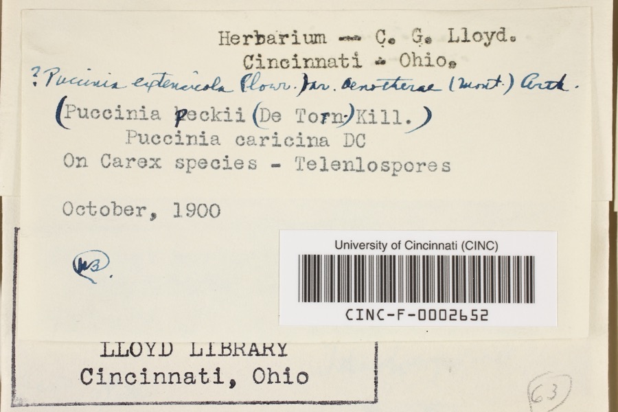
evidence. Museums hold 4,394 specimens
collected within 10 miles of Waldschmidt-Camp Dennison District between 1827 and
1975: 3,108 Fungi, 630 Animalia, 316 Protozoa, 306 Plantae, 24 Unrecorded, 10 Chromista. 12 distinct Species records are shown.
Collected by 14753, A. Braun, A. Gaufin and others. Each is a
physical object with a catalogue
number, and each entry opens the museum's record. This is what was
collected and kept, not a survey of what lives here - nothing can be
concluded from a species being absent.
Regional context, not property-specific
evidence. The federal mineral resources record lists
6 workings within 5 miles of Waldschmidt-Camp Dennison District: 4 past producers, 1 producer, 1 plant.
2 still produce. What was taken out: Sand and Gravel, Construction. Distance is straight-line from the
map coordinates, so a quarry counted here may appear on a neighbouring
settlement's page as well.
Regional context, not property-specific
evidence. The National Weather Service names
Cincinnati, the town this property stands in, in 70 storm reports between 1994 and 2025: 25 thunderstorm wind, 17 hail, 14 flash flood, 7 flood.
The reports record 1 injury. Each account below is quoted exactly as the forecast office
filed it, from the NOAA Storm Events Database, and each date
opens the federal record of that event.
Numerous roads were flooded throughout the Cincinnati area and some basements were flooded. Flooding also caused some damage at Reading High School and Whitaker Elementary School.
Lightning struck a home causing a fire in the attic, which spread toward the second floor before being extinguished. Significant fire and water damage occurred to the home.
High water was reported on several roads in the downtown Cincinnati area and the near West Side. A retaining wall collapsed onto a roadway near the intersection of State Avenue and Ernst Street and a building was flooded on Poplar Street. Also, an apartment basement flooded on Linn Street and one resident needed to be rescued.
14 papers published in this town,
digitised by the Library of Congress and free to read: 0 issues,
0 pages. Every page is searchable, so a name or a street can be
looked for directly in what the town printed about itself at the time.
No historic map-sheet match is published
for this property yet. That does not mean no map exists. This record needs
a coordinate-quality review before it can be joined to a sheet boundary.
Browse the county's mapped places while that work is
pending.
From the nomination file
2,297 words on record
When this property was proposed for the
National Register, someone wrote the case for it: what the building is,
and why it matters. That document is a federal record in the public domain.
It is quoted below word for word, never summarised. The text was read off the scanned case file by machine, so the
occasional stray character is the recogniser's and the 1970s
typewriter's.
Description of the property
Windows are 12/12 light wood sash. There are two doorways on the Fair The Christian Waldschmidt House is two-and-one-half stories high and dow and door openings are rectangular with key stone flat arch lintels. front five bay facade./The doors are recessed; the wall thickness Good
Quoted from the National Register nomination
for reference 73001471, 21 pages, held by the National Archives in Record
Group 79. See the
catalogue record.
Listed places nearby
6 within 8 miles
Other National Register properties close
enough to walk or drive between, ordered by distance from this one. Both
positions come from the same geocoding pass that matched these properties
to their map sheets.
Listing record. National Park Service National Register of Historic Places, listed-properties dataset, current to 2026-05-22.
Map join. Address geocoded through the United States Census geocoder, then tested against the published boundary of every sheet in the USGS Historical Topographic Map Collection.
How this page is made. Listing fields come from federal records; map-sheet coverage is a labelled coordinate-to-boundary calculation, not a source-field claim.
Specimens. Global Biodiversity Information Facility (GBIF), https://www.gbif.org/. Only records licensed CC0 or CC BY are used. Records licensed CC BY-NC are excluded because this site carries advertising. Images are checked individually and any whose licence is non-commercial, no-derivatives or unreadable is refused.
Mines and quarries. USGS Mineral Resources Data System (MRDS) https://mrdata.usgs.gov/mrds/ A work of the United States government, no copyright under 17 U.S.C. 105.
Storms. NOAA National Centers for Environmental Information, Storm Events Database https://www.ncei.noaa.gov/stormevents/ A work of the United States government, no copyright under 17 U.S.C. 105. Narratives are quoted verbatim from the National Weather Service report and are not edited or summarised.
 Block
Block