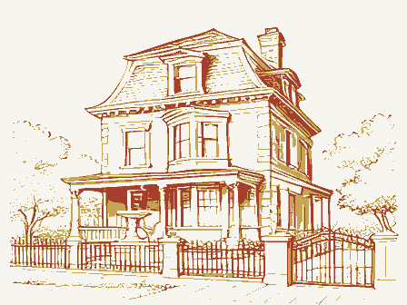
Listed on the National Register of Historic Places in
1974. A historic map-sheet match is not published yet. The record needs a coordinate-quality review before it can be joined to a sheet boundary.
From the record
one of 338 National Register listings in Cuyahoga County · listed in 1974 · category: Building · one of 3 National Historic Landmarks in Cuyahoga County.
National Register reference number.74001461- the number the National Park Service assigned this property when it was listed, and the key its nomination file is catalogued under at the National Archives.
Fires near this property
3 since 1993
Regional context, not property-specific
evidence. The
federal wildfire occurrence database
lists 3 fires within 5 miles of Froelich, John, House between
1993 and 2018, burning about 8 acres in total. 1 started naturally. 1 was recorded as arson.
Distance is straight-line from the map coordinates, so a fire counted
here may appear on a neighbouring settlement's page as well.
Reported cause
Fires
Arson/incendiarism
1
Missing data/not specified/undetermined
1
Natural
1
The most recent of
them, most recent first, with the day each was reported and the service
that recorded it.
Regional context, not property-specific
evidence. Museums hold 2,918 specimens
collected within 10 miles of Froelich, John, House between 1849 and
1975: 2,502 Animalia, 210 Fungi, 127 Plantae, 73 Protozoa, 4 Unrecorded, 1 Chromista, 1 incertae sedis. 12 distinct Species records are shown.
Collected by A. D. Huryn, A. D. Selby, A. Hall and others. Each is a
physical object with a catalogue
number, and each entry opens the museum's record. This is what was
collected and kept, not a survey of what lives here - nothing can be
concluded from a species being absent.
Regional context, not property-specific
evidence. The federal mineral resources record lists
9 workings within 5 miles of Froelich, John, House: 5 past producers, 4 producers.
4 still produce. What was taken out: Clay, Sand and Gravel, Construction, Bloating Material, Limestone, General. Distance is straight-line from the
map coordinates, so a quarry counted here may appear on a neighbouring
settlement's page as well.
Regional context, not property-specific
evidence. The National Weather Service names
Seven Hills, the town this property stands in, in 14 storm reports between 2000 and 2023: 8 thunderstorm wind, 6 hail.
No death or injury is recorded in these reports. Each account below is quoted exactly as the forecast office
filed it, from the NOAA Storm Events Database, and each date
opens the federal record of that event.
A microburst produced winds up to 70 mph in Seven Hills and Independence in Cuyahoga County. These severe winds produced extensive tree damage to these Cleveland suburbs with at least two dozen large trees snapped or uprooted and many large branches down. A couple of these trees and large branches landed upon homes and adjacent properties. A large tree fell on a house on Alla Drive. A large tree fell onto a deck of a house on Pasadena Drive. Large tree limbs fell on homes on Chestnut and Crossview Roads, causing relatively minor damage. Other streets with reported tree damage included: Karen Drive, Glenella Drive, Bonroi Drive, Somerset Lane, Parkgate Oval, Northview Drive, and East Decker Drive. A downed tree was also noted off Interstate 77 in Independence, south of the Rockside Road exit. Some of the downed trees during this event fell onto power lines and over 500 residences were without power. At least 8 homes in Seven Hills had roof replacements on account of storm-related damage.
No historic map-sheet match is published
for this property yet. That does not mean no map exists. This record needs
a coordinate-quality review before it can be joined to a sheet boundary.
Browse the county's mapped places while that work is
pending.
From the nomination file
1,274 words on record
When this property was proposed for the
National Register, someone wrote the case for it: what the building is,
and why it matters. That document is a federal record in the public domain.
It is quoted below word for word, never summarised. The text was read off the scanned case file by machine, so the
occasional stray character is the recogniser's and the 1970s
typewriter's.
Description of the property
There are two bays on the narrow end of the stone part, and owner believes that the frame wing is contemporary with the have been an original wing of the house, it is apparent that the only two rooms on each floor of the stone house. All of the west room, of a simple pattern with no moldings. Between the two ground floor rooms there is a large opening with casings (kitchen) to the second floor, where there are two bedrooms. Due to successive widenings of Broadview Road, the house now MAR 2 1 1974 parking.
CONDITION NATIONAL REGISTER Ruins The present of a late Federal pattern.A stair leads from the east room original woodwork is intact.There is paneled wainscotting in the attic fanlight openings.The windows have their original sash, three on the side.Above the end windows are two semi-circular the front (west) one was added later for a furnace. fronts directly on the highway.The lot immediately to the north Good ** Original Site and nearly all of the glass. rear section and the gambrel roof are later work. There are has been occupied by a small convenience store and paved for Moved This is a small two-story farmhouse, with a large frame wing. RECEIVED The rear (east) chimney is original;
Statement of significance
It has one unusual feature, the pair of semi-circular fan- are not extremely uncommon in southern and western this house is isolated in a rapidly developing commer- constitute a historic district. The house was built by John Froelich, a farmer, probably between 1840 and 1843, when he was listed as a resident landowner on the west side of the 1843 Education Commerce Conservation Communications Architecture Engineering Military Landscape losophy Aboriginal Invention Literature NATIONAL REGISTER itarian Religion/Phi Art building has no neighboring structures which would Music sandstone of Independence, Berea and other quarries, The primary significance of this house is architectural. Cuyahoga River. Industry lights, instead of the usual one.
Although stone houses Political Agriculture MAR 2 1 1974 Cuyahoga County, because of the proximity to the fine cial highway strip. As an isolated farmhouse, the RECEIVED LATITUDE AND LONGITUDE COORDINATES DEFINING A RECTANGLE LOCATING THE PROPERTY OF LESS THAN TEN ÁCRES MAR 2 1 1974
Quoted from the National Register nomination
for reference 74001461, 10 pages, held by the National Archives in Record
Group 79. See the
catalogue record.
Listed places nearby
6 within 8 miles
Other National Register properties close
enough to walk or drive between, ordered by distance from this one. Both
positions come from the same geocoding pass that matched these properties
to their map sheets.
Listing record. National Park Service National Register of Historic Places, listed-properties dataset, current to 2026-05-22.
Map join. Address geocoded through the United States Census geocoder, then tested against the published boundary of every sheet in the USGS Historical Topographic Map Collection.
How this page is made. Listing fields come from federal records; map-sheet coverage is a labelled coordinate-to-boundary calculation, not a source-field claim.
Wildfire. Short, Karen C. 2022. Spatial wildfire occurrence data for the United States, 1992-2020 [FPA_FOD_20221014]. 6th Edition. Fort Collins, CO: Forest Service Research Data Archive. https://doi.org/10.2737/RDS-2013-0009.6 Collected with United States Government funding and usable without additional permissions or fees.
Specimens. Global Biodiversity Information Facility (GBIF), https://www.gbif.org/. Only records licensed CC0 or CC BY are used. Records licensed CC BY-NC are excluded because this site carries advertising. Images are checked individually and any whose licence is non-commercial, no-derivatives or unreadable is refused.
Mines and quarries. USGS Mineral Resources Data System (MRDS) https://mrdata.usgs.gov/mrds/ A work of the United States government, no copyright under 17 U.S.C. 105.
Storms. NOAA National Centers for Environmental Information, Storm Events Database https://www.ncei.noaa.gov/stormevents/ A work of the United States government, no copyright under 17 U.S.C. 105. Narratives are quoted verbatim from the National Weather Service report and are not edited or summarised.
 Block
Block