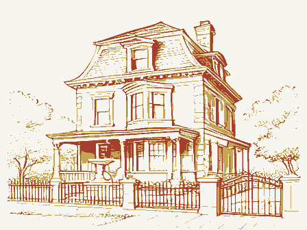
Listed on the National Register of Historic Places in
1978. A historic map-sheet match is not published yet. The record needs a coordinate-quality review before it can be joined to a sheet boundary.
From the record
one of 338 National Register listings in Cuyahoga County · listed in 1978 · category: Building · one of 3 National Historic Landmarks in Cuyahoga County.
National Register reference number.78002049- the number the National Park Service assigned this property when it was listed, and the key its nomination file is catalogued under at the National Archives.
Fires near this property
3 since 1993
Regional context, not property-specific
evidence. The
federal wildfire occurrence database
lists 3 fires within 5 miles of Gabel, Daniel, House between
1993 and 2018, burning about 8 acres in total. 1 started naturally. 1 was recorded as arson.
Distance is straight-line from the map coordinates, so a fire counted
here may appear on a neighbouring settlement's page as well.
Reported cause
Fires
Arson/incendiarism
1
Missing data/not specified/undetermined
1
Natural
1
The most recent of
them, most recent first, with the day each was reported and the service
that recorded it.
Regional context, not property-specific
evidence. Museums hold 3,220 specimens
collected within 10 miles of Gabel, Daniel, House between 1849 and
1975: 2,790 Animalia, 210 Fungi, 141 Plantae, 73 Protozoa, 4 Unrecorded, 1 Chromista, 1 incertae sedis. 12 distinct Species records are shown.
Collected by A. D. Huryn, A. D. Selby, A. Hall and others. Each is a
physical object with a catalogue
number, and each entry opens the museum's record. This is what was
collected and kept, not a survey of what lives here - nothing can be
concluded from a species being absent.
Regional context, not property-specific
evidence. The federal mineral resources record lists
9 workings within 5 miles of Gabel, Daniel, House: 5 past producers, 4 producers.
4 still produce. What was taken out: Clay, Sand and Gravel, Construction, Bloating Material, Limestone, General. Distance is straight-line from the
map coordinates, so a quarry counted here may appear on a neighbouring
settlement's page as well.
Regional context, not property-specific
evidence. The National Weather Service names
Seven Hills, the town this property stands in, in 14 storm reports between 2000 and 2023: 8 thunderstorm wind, 6 hail.
No death or injury is recorded in these reports. Each account below is quoted exactly as the forecast office
filed it, from the NOAA Storm Events Database, and each date
opens the federal record of that event.
A microburst produced winds up to 70 mph in Seven Hills and Independence in Cuyahoga County. These severe winds produced extensive tree damage to these Cleveland suburbs with at least two dozen large trees snapped or uprooted and many large branches down. A couple of these trees and large branches landed upon homes and adjacent properties. A large tree fell on a house on Alla Drive. A large tree fell onto a deck of a house on Pasadena Drive. Large tree limbs fell on homes on Chestnut and Crossview Roads, causing relatively minor damage. Other streets with reported tree damage included: Karen Drive, Glenella Drive, Bonroi Drive, Somerset Lane, Parkgate Oval, Northview Drive, and East Decker Drive. A downed tree was also noted off Interstate 77 in Independence, south of the Rockside Road exit. Some of the downed trees during this event fell onto power lines and over 500 residences were without power. At least 8 homes in Seven Hills had roof replacements on account of storm-related damage.
No historic map-sheet match is published
for this property yet. That does not mean no map exists. This record needs
a coordinate-quality review before it can be joined to a sheet boundary.
Browse the county's mapped places while that work is
pending.
From the nomination file
1,946 words on record
When this property was proposed for the
National Register, someone wrote the case for it: what the building is,
and why it matters. That document is a federal record in the public domain.
It is quoted below word for word, never summarised. The text was read off the scanned case file by machine, so the
occasional stray character is the recogniser's and the 1970s
typewriter's.
Description of the property
There is a plain cornice, gable roof, and interior end chimneys. The rear section, originally the kitchen ell, has a one bay recessed porch on Remaining windows, one per side, are identical to those described above. There It is now on a 85' x 208' 1og. Once it was part of a 53 acre farm. CONDITION UNEXPOSED EXCELLENT RUINS DESCRIPTION UNALTERED XALTERED both the east and west sides.The west porch was enlarged and enclosed. panel protected by a cast iron grillwork.Above the doors there is a segmental half round windows in each gable end.
CHECK ONE XORIGINAL SITE five bays with center entrance.Windows are l/l light with plain flush stone The T-shaped brick house consists of a two story front section and a 1-l/2 The interior has eleven rooms.The living and dining rooms have chair rails features a paneled double door.Each half of the door has a round arched glass at the ridgeline. isa small four light window in the rear gable end.There isa center chimney arched clear glass light. The stone lintel bears the words "18 DANIEL GABEL 72." The gable ends are two bays deep and have the same plain windows. There are two and plain paneling. Ceilings are 9 feet high. lintels and lug sills.There isa cut stone water table.The entrance AREAS OF
Statement of significance
in 1836, settling in Independence Township, Ohio, where the elder Gabel bought worked on the Ohio-Erie Canal, driving the donkeys along the towpath. In 1850 he married Sophi Scherer (1834-1908). On the 53 acres allotted to him moving into it by October 1872. This house stands back 130 feet from Short Road, so called because it ran for a short mile between two major dirt on granddaughter living there, until the 1960's.
1872 ART BUILDER/ARCHITECT RELIGION AGRICULTURE EDUCATION ARCHEOLOGY-HISTORIC PERIOD SIGNIFICANCE SCULPTURE TRANSPORTATION X1800-1899 XARCHITECTURE THEATER _ENGINEERING _POLITICS/GOVERNMENT MUSIC _PHILOSOPHY INDUSTRY began a more substantial home for his family, completing the brick home and conservative style for the third quarter of the nineteenth century.The he erected a good-sized log cabin about 40 feet from the site of the present SCIENCE double semi-circualr windows in the end gables and entrance are the only _COMMUNICATIONS -1500-1599 seven children moved back to the home to take over the management of the farm.
_CONSERVATION MILITARY Daniel Gabel was born March 3l,1824 in Germany.The family came to America they built their homes on sections of the original tract.In 1843 Daniel land and had an extensive orchard of cherry, apple, and peach trees.He was a -1700-1799 behind the church he helped build.The Weebers retained ownership of the home, -1400-1499 This is an interesting example ofa brick farmhouse built in a fairly Sophia Gabel died in 1908and Daniel in 1912.Both are buried in the cemetery bit of flamboyance.It is of local historic significance aswell. - LITERATURE _1600-1699 -1900- COMMUNITY PLANNING farm until 1902 when their daughter Katherine and her husband, C. Weeber and their 200 acres of land, which they cleared for farming.
Quoted from the National Register nomination
for reference 78002049, 16 pages, held by the National Archives in Record
Group 79. See the
catalogue record.
Listed places nearby
6 within 8 miles
Other National Register properties close
enough to walk or drive between, ordered by distance from this one. Both
positions come from the same geocoding pass that matched these properties
to their map sheets.
Listing record. National Park Service National Register of Historic Places, listed-properties dataset, current to 2026-05-22.
Map join. Address geocoded through the United States Census geocoder, then tested against the published boundary of every sheet in the USGS Historical Topographic Map Collection.
How this page is made. Listing fields come from federal records; map-sheet coverage is a labelled coordinate-to-boundary calculation, not a source-field claim.
Wildfire. Short, Karen C. 2022. Spatial wildfire occurrence data for the United States, 1992-2020 [FPA_FOD_20221014]. 6th Edition. Fort Collins, CO: Forest Service Research Data Archive. https://doi.org/10.2737/RDS-2013-0009.6 Collected with United States Government funding and usable without additional permissions or fees.
Specimens. Global Biodiversity Information Facility (GBIF), https://www.gbif.org/. Only records licensed CC0 or CC BY are used. Records licensed CC BY-NC are excluded because this site carries advertising. Images are checked individually and any whose licence is non-commercial, no-derivatives or unreadable is refused.
Mines and quarries. USGS Mineral Resources Data System (MRDS) https://mrdata.usgs.gov/mrds/ A work of the United States government, no copyright under 17 U.S.C. 105.
Storms. NOAA National Centers for Environmental Information, Storm Events Database https://www.ncei.noaa.gov/stormevents/ A work of the United States government, no copyright under 17 U.S.C. 105. Narratives are quoted verbatim from the National Weather Service report and are not edited or summarised.
 Block
Block