Listed on the National Register of Historic Places in
1974. A historic map-sheet match is not published yet. The record needs a coordinate-quality review before it can be joined to a sheet boundary.
From the record
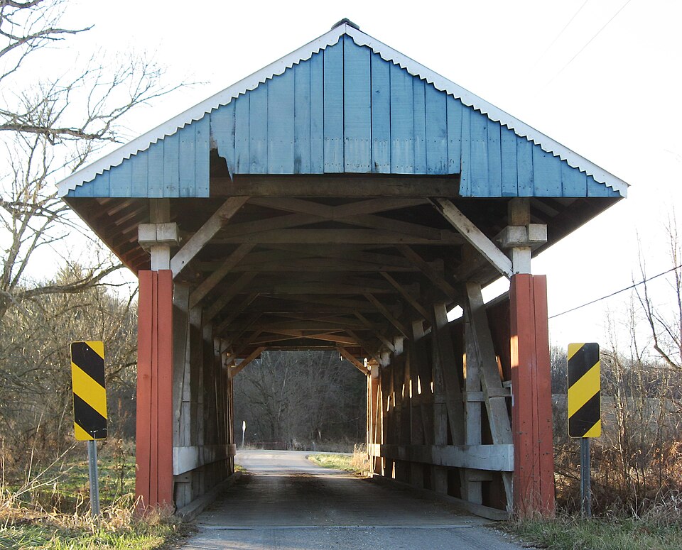
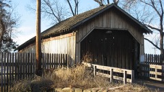
“The Parks Covered Bridge, in Perry County, Ohio near Chalfants, Ohio, was built in 1883. It was listed on the National Register of Historic Places in 1974.”
Wikipedia article Parks Covered Bridge (Chalfunts, Ohio), CC BY-SA 4.0.
one of 11 National Register listings in Perry County · listed in 1974 · category: Structure.
National Register reference number.74001590- the number the National Park Service assigned this property when it was listed, and the key its nomination file is catalogued under at the National Archives.
The ground it stands on
3,686 words
This property stands in Hopewell Township. 1883 History Perry County, Ohio, published 1883 gives that township a chapter of its own.
The chapter covers the township.
Machine-read from a century-old scan, so
expect the errors a machine makes: misspelled names, dropped words,
stray characters.
Regional context, not property-specific
evidence. The
federal wildfire occurrence database
lists 21 fires within 5 miles of Parks Covered Bridge between
2007 and 2020, burning about 19 acres in total. None started naturally. None was recorded as arson.
Distance is straight-line from the map coordinates, so a fire counted
here may appear on a neighbouring settlement's page as well.
Reported cause
Fires
Debris and open burning
12
Missing data/not specified/undetermined
6
Recreation and ceremony
3
The most recent of
them, most recent first, with the day each was reported and the service
that recorded it.
Regional context, not property-specific
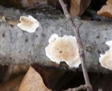
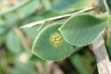
evidence. Museums hold 220 specimens
collected within 10 miles of Parks Covered Bridge between 1891 and
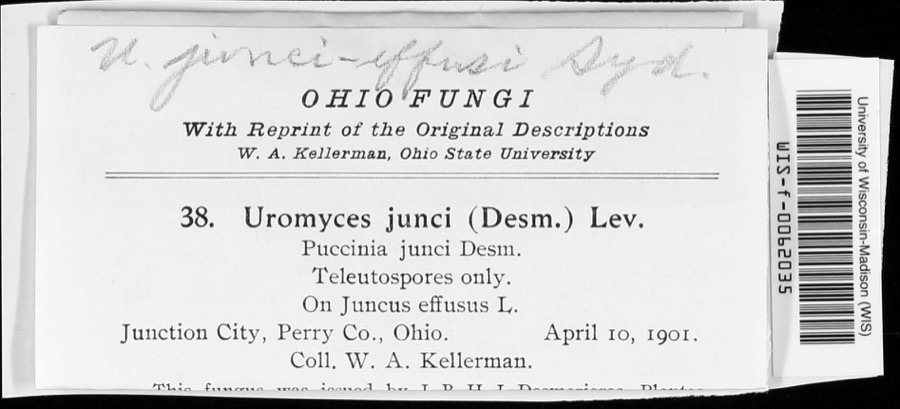
1975: 193 Animalia, 17 Fungi, 7 Plantae, 2 Unrecorded, 1 Protozoa. 12 distinct Species records are shown.
Collected by Bergstrom, J., Buchanan, J., Buker, W.E. and others. Each is a
physical object with a catalogue
number, and each entry opens the museum's record. This is what was
collected and kept, not a survey of what lives here - nothing can be
concluded from a species being absent.
Regional context, not property-specific
evidence. The federal mineral resources record lists
3 workings within 5 miles of Parks Covered Bridge: 1 producer, 1 plant, 1 past producer.
2 still produce. What was taken out: Stone, Crushed/Broken, Limestone, General. Distance is straight-line from the
map coordinates, so a quarry counted here may appear on a neighbouring
settlement's page as well.
No historic map-sheet match is published
for this property yet. That does not mean no map exists. This record needs
a coordinate-quality review before it can be joined to a sheet boundary.
Browse the county's mapped places while that work is
pending.
From the nomination file
1,926 words on record
When this property was proposed for the
National Register, someone wrote the case for it: what the building is,
and why it matters. That document is a federal record in the public domain.
It is quoted below word for word, never summarised. The text was read off the scanned case file by machine, so the
occasional stray character is the recogniser's and the 1970s
typewriter's.
Description of the property
boarded almost to the eaves, the roof is metal and the abutments are x 8's; the bottom chorda are 2-6% x 12's spaced 32" apart with a steel length of the bridge is 66' 4" with a clear span of 55' 6"; the overall The flooring is laid crosswise. The siding is painted an MAR 2 1 1974 CONDITION NATIONAL siding and portals are finished with battens.The Parks Bridge is The structure under consideration is a one span wooden truss covered attractive red and the portals are white with some blue trim.Both of a neighborhood carpenter-bridge-builder. The truss of this bridge is a 5 panel multiple kingpost.The kingpost post. The diagonals are in compression and the center post or kingpost, Ohio, spanning a branch of Jonathon Creek.
The siding is vertical, bridge on county road 33 in Hopowell Township section 27,Perry County, a fine example of the multiple kingpost truss and the building skills REGISTER barn and mill buiidings.In the Parks Bridge, the top chords are 2-8 6x 8's; the second kingposts are 7 x 8's; the middle panel diagonals (Check One) device added at a later date.The height of the trusses is l4';the end posts are 8 x 8's;the end diagonals are 8 x 8's which taper top are8x8g tapering to 6x8'sand the center kingpost is12x8 at 1s the earliest formel bridge truss, the basic triangle with a center are obviously not a part of the original design, but a strengthening and bottom to 6 x 8's; the second diagonals are I 8's tapering to RECEIVED native sandstone laid with mortar.
comes from the family that owned the land nearby when the bridge MAR 2 1 1974 1882 Communications losophy Commerce Conservation NATIONAL SIGNIFICANCE Theater Aboriginal Engineering REGISTER Landscape Agriculture Architecture Education itarian Music Political Pre-Columbian Social/Human- and bottom chords showing outstanding craftsmanship on the part of aspect of this well-cared for covered bridge.
Invention RECEIVED and white portals with their blue trim also add to the pleasing truss so common in early Ohio wooden bridge-building.It is un- This old covered span is known as the Parks Bridge.The name Parks Sculpture name of Dean in Hopewell Township.Mr..Dean is not listed as a those skilled farmer-carpenters in which Ohio abounded in the l9th was built.The builder is said to have been a man named Dean, who The building date is 1882. to the Perry County Atlas of 1875,there were landowners by the Other (Specify) PERIOD (Check One or More as Appropriate) , the builder.
The Parks Bridge is quite attractive with the pro- Art The Parks Bridge is a very good example of the multiple kingpost built at least two other Perry County covered bridges.According century.The native sandstone abutments were cut by Hugh Davis. usual in that the trusses are tapered and cleverly joined to the top bridge-builder in this atlas, so we can assume that he was one of AREAs OF SIGNIFICANCE (Check One or More as Appropriate)
Quoted from the National Register nomination
for reference 74001590, 14 pages, held by the National Archives in Record
Group 79. See the
catalogue record.
Listed places nearby
5 within 8 miles
Other National Register properties close
enough to walk or drive between, ordered by distance from this one. Both
positions come from the same geocoding pass that matched these properties
to their map sheets.
Listing record. National Park Service National Register of Historic Places, listed-properties dataset, current to 2026-05-22.
Map join. Address geocoded through the United States Census geocoder, then tested against the published boundary of every sheet in the USGS Historical Topographic Map Collection.
How this page is made. Listing fields come from federal records; map-sheet coverage is a labelled coordinate-to-boundary calculation, not a source-field claim.
Wildfire. Short, Karen C. 2022. Spatial wildfire occurrence data for the United States, 1992-2020 [FPA_FOD_20221014]. 6th Edition. Fort Collins, CO: Forest Service Research Data Archive. https://doi.org/10.2737/RDS-2013-0009.6 Collected with United States Government funding and usable without additional permissions or fees.
Specimens. Global Biodiversity Information Facility (GBIF), https://www.gbif.org/. Only records licensed CC0 or CC BY are used. Records licensed CC BY-NC are excluded because this site carries advertising. Images are checked individually and any whose licence is non-commercial, no-derivatives or unreadable is refused.
Mines and quarries. USGS Mineral Resources Data System (MRDS) https://mrdata.usgs.gov/mrds/ A work of the United States government, no copyright under 17 U.S.C. 105.
 Block
Block