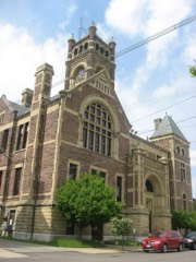
Listed on the National Register of Historic Places in
1980. A historic map-sheet match is not published yet. The record needs a coordinate-quality review before it can be joined to a sheet boundary.
From the record
“'At the time I write of, half the lots between High street and the Square were in commons and unfenced. The log cabins and small onestory frames were scattered along on each side of the street, and a little beaten path on either side marked the sidewalks.”
1883 History Perry County, Ohio (1883). Machine-read text.
one of 11 National Register listings in Perry County · listed in 1980 · category: Building.
National Register reference number.80003208- the number the National Park Service assigned this property when it was listed, and the key its nomination file is catalogued under at the National Archives.
The ground it stands on
20,608 words
The chapter on Reading Township in 1883 History Perry County, Ohio, published 1883 names Somerset. This is what it says, exactly as the scans read.
Reading township was probably authorized and named as early as 1804 or 1805, but the first record evidence of its organization into a Civil township, is early in the year 1807. It derived its name from Reading, Pennsylvania, and was named by Peter Overmyer, who came to the township in 1802. Reading township was originally a part of Fairfield county, comprised thirty-six sections, and was just six miles square ; but when the new county of Perry was organized, two rows of sections were taken from Richland township and attached to Reading, in order to give the new county the necessary number of square miles, and probably to make the western border of the county a little farther from Overmyertown and Somerset, both of which villages aspired to be the seat of justice for the new county. Reading township is now an oblong, six miles from north to south, and eight miles from east to west. iets. in extent of territory, the empire township of the county, and had no rival in population, until within a few years, in which time Pike, Saltlick, Coal and Monroe have become competitors with it in this respect, and two or three of them now surpass it.
Reading is, undoubtedly, one of the most desirable townships of land in Ohio, and long years of cultivation and care make the greater part of it show to the best advantage. About nine-tenths of it lies on the Hocking slope, and the remaining one-tenth on the Muskingum slope. That part of it which is on the Hocking side of the divide, is drained by West Rush Creek and tributaries, and by some of the tributaries of East Rush Creek. So much of the township as lies on the Muskingum side of the divide, is drained by Hood's Run, and a few other small tributaries of the north branch of Jonathan's Creek, or Moxahala. 'The land on both sides of the dividing ridge is naturally of excellent drainage, and only a very small percentage of stagnant water is ever known within the township limits. Most of the land is undulating, and a part of the southeast region ot the township is hilly. The land is about all arable, and most of it is very productive. Coal is found in the southeastern part in great abundance and of excellent quality. There are two or three seams in a partof the coal district, all of a good, merchantable quality. [ron ore is also very abundant in many places in the southern part of the township. The ore has been mined and shipped, to a considerable extent, and has been used with success in furnaces at Shawnee, Zanesville, Newark and other points. Some of the first coal mined in the county, was in this coal district, and the first coal miner is said to have been a colored man. The coal of this region found a market in early times at Somerset, Rushville, Lancaster and other points adjacent. at wool-growing receive much attention. 'There are also good orchards and vineyards, and the cultivation of many varieties of fruit has been crowned with considerable success.
Regional context, not property-specific
evidence. The
federal wildfire occurrence database
lists 12 fires within 5 miles of Sheridan House between
2014 and 2020, burning about 24 acres in total. None started naturally. None was recorded as arson.
Distance is straight-line from the map coordinates, so a fire counted
here may appear on a neighbouring settlement's page as well.
Reported cause
Fires
Missing data/not specified/undetermined
4
Recreation and ceremony
4
Debris and open burning
3
Smoking
1
The most recent of
them, most recent first, with the day each was reported and the service
that recorded it.
Regional context, not property-specific
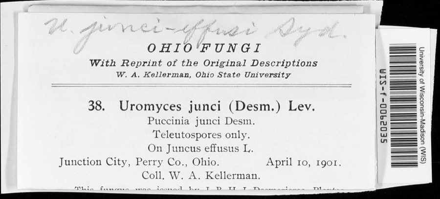
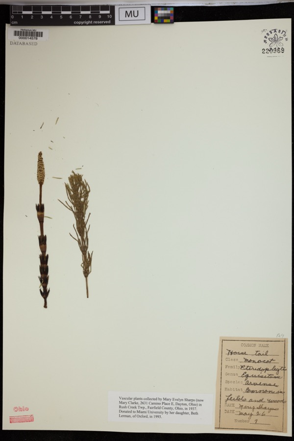
evidence. Museums hold 223 specimens
collected within 10 miles of Sheridan House between 1891 and
1975: 190 Animalia, 20 Fungi, 10 Plantae, 2 Unrecorded, 1 Protozoa. 12 distinct Species records are shown.
Collected by Bergstrom, J., Black R. J., Buchanan, J. and others. Each is a
physical object with a catalogue
number, and each entry opens the museum's record. This is what was
collected and kept, not a survey of what lives here - nothing can be
concluded from a species being absent.
Regional context, not property-specific
evidence. The federal mineral resources record lists
4 workings within 5 miles of Sheridan House: 2 past producers, 1 producer, 1 plant.
2 still produce. What was taken out: Stone, Crushed/Broken, Clay, Limestone, General. Distance is straight-line from the
map coordinates, so a quarry counted here may appear on a neighbouring
settlement's page as well.
Regional context, not property-specific
evidence. The National Weather Service names
Somerset, the town this property stands in, in 44 storm reports between 1995 and 2026: 31 thunderstorm wind, 11 hail, 1 heavy rain, 1 flash flood.
No death or injury is recorded in these reports. Each account below is quoted exactly as the forecast office
filed it, from the NOAA Storm Events Database, and each date
opens the federal record of that event.
In Somerset, a tree was blown down on State Route 757. Another downed tree was observed blocking a lane of Township Road 45 outside the town limits of Somerset.
A couple of trees were blown down onto Otterbein Road in Somerset. As the storm continued through the township, more trees and power lines were blown down.
1 paper published in this town,
digitised by the Library of Congress and free to read: 0 issues,
0 pages. Every page is searchable, so a name or a street can be
looked for directly in what the town printed about itself at the time.
No historic map-sheet match is published
for this property yet. That does not mean no map exists. This record needs
a coordinate-quality review before it can be joined to a sheet boundary.
Browse the county's mapped places while that work is
pending.
From the nomination file
1,417 words on record
When this property was proposed for the
National Register, someone wrote the case for it: what the building is,
and why it matters. That document is a federal record in the public domain.
It is quoted below word for word, never summarised. The text was read off the scanned case file by machine, so the
occasional stray character is the recogniser's and the 1970s
typewriter's.
Description of the property
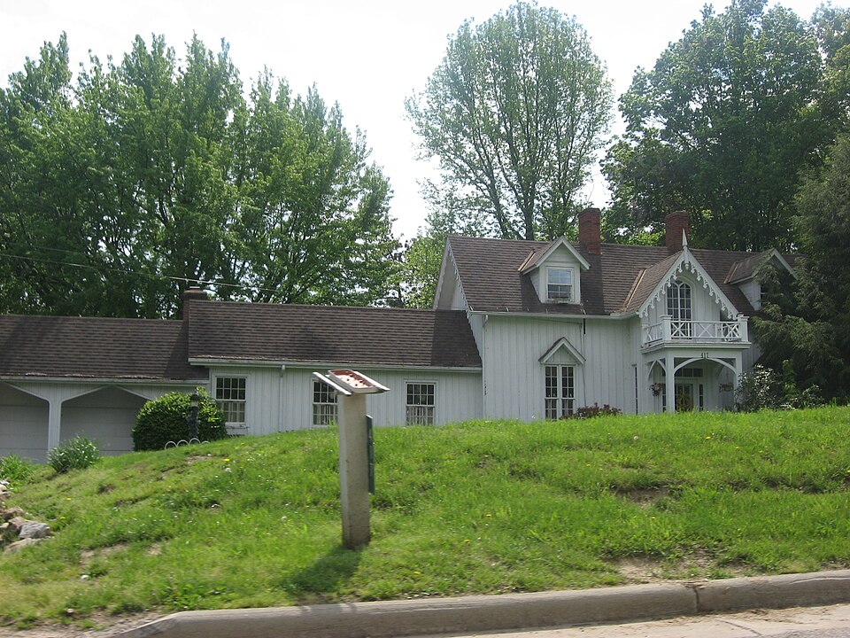
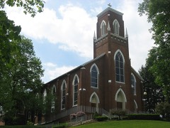
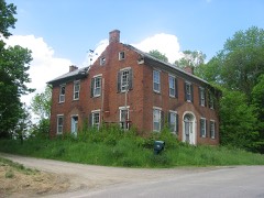
The Sheridan House is a 2-story residential structure built of wood referred to above characterizes this asa"symmetrical cottage,"and such is -unexposed -fair are located on the slope of the roof on the facade.
Presently, the roof is date The interior of the Sheridan House revolves around an wide central hallway, the case with the original house itself.From this pavillion rises the without considerable difficulty.The original house is rectangular in form as suggested by the pattern book, from which rises an open-string dog-leg stair, pattern book from which the design was probably taken suggests that bricks should be placed between the framing members--a feature that cannot be verified Somerset.Fireplaces with wood mantlepieces are 1ocated in each of the original Areas of SignificanceCheck and justify below -archeology-historic . conservation . law - science _ agriculture _ literature - sculpture _ military _ social/ -music .commerce _exploration/settlement.
- philosophy - theater -politics/government - transportation .other (specify) Specific dates Statement of
Statement of significance
(in one paragraph) Gothic Revival movement, which was popular in the United States from the 1830s its steeply-pitched intersecting gable roof, gabled dormers, tall windows, and structures, primarily vernacular in character, with a smattering of Federal and the county, for that matter--so embodies the characteristics of the Gothic Revival with a national military figure, General Phillip H. Sheridan. Sheridan (1810-1878) father was employed as a contractor on the then-new Zanesville, Ohio-Maysville, scription, "Nellie Sheridan, June lst, 1881." Local tradition has always held that the Sheridans chose the design for the house from Godey's Ladies' Book; research pattern was taken from A. J.
Downing's The Architecture of Country Houses, one of 1500-1599 1600-1699 1400-1499 1700-1799 communications Builder/Architect economics industry engineering humanitarian education invention XX1800-1899 1900- prehistoric The Sheridan House is nominated for its embodiment of the physical character- an upstairs bedroom, one of the panes of window glass bears the ring-inscribed in- 8. Significance the center of town.The village of Somerset consists of brick and wood frame was a New York native who came to Somerset with his parents at an early age when his the most widely-used pattern books of the mid-nineteenth century and one which ex- of a "symmetrical cottage,"which very closely resembles the Sheridan House. work of a local carpenter with a nationally-distributed plan book.
Historic District,N..R.,9-5-75),but this house is sited c.1mile south of as does the Sheridan House. Xx architecture -_ archeology-prehistoric community planning _ landscape architecture. _ religion - art through the Civil War. The picturesque silhouette of the house, highlighted by Armies during the Civil Nar.
Quoted from the National Register nomination
for reference 80003208, 14 pages, held by the National Archives in Record
Group 79. See the
catalogue record.
Listed places nearby
6 within 8 miles
Other National Register properties close
enough to walk or drive between, ordered by distance from this one. Both
positions come from the same geocoding pass that matched these properties
to their map sheets.
Listing record. National Park Service National Register of Historic Places, listed-properties dataset, current to 2026-05-22.
Map join. Address geocoded through the United States Census geocoder, then tested against the published boundary of every sheet in the USGS Historical Topographic Map Collection.
How this page is made. Listing fields come from federal records; map-sheet coverage is a labelled coordinate-to-boundary calculation, not a source-field claim.
Wildfire. Short, Karen C. 2022. Spatial wildfire occurrence data for the United States, 1992-2020 [FPA_FOD_20221014]. 6th Edition. Fort Collins, CO: Forest Service Research Data Archive. https://doi.org/10.2737/RDS-2013-0009.6 Collected with United States Government funding and usable without additional permissions or fees.
Specimens. Global Biodiversity Information Facility (GBIF), https://www.gbif.org/. Only records licensed CC0 or CC BY are used. Records licensed CC BY-NC are excluded because this site carries advertising. Images are checked individually and any whose licence is non-commercial, no-derivatives or unreadable is refused.
Mines and quarries. USGS Mineral Resources Data System (MRDS) https://mrdata.usgs.gov/mrds/ A work of the United States government, no copyright under 17 U.S.C. 105.
Storms. NOAA National Centers for Environmental Information, Storm Events Database https://www.ncei.noaa.gov/stormevents/ A work of the United States government, no copyright under 17 U.S.C. 105. Narratives are quoted verbatim from the National Weather Service report and are not edited or summarised.
 Block
Block