Listed on the National Register of Historic Places in
1975. A historic map-sheet match is not published yet. The record needs a coordinate-quality review before it can be joined to a sheet boundary.
From the record
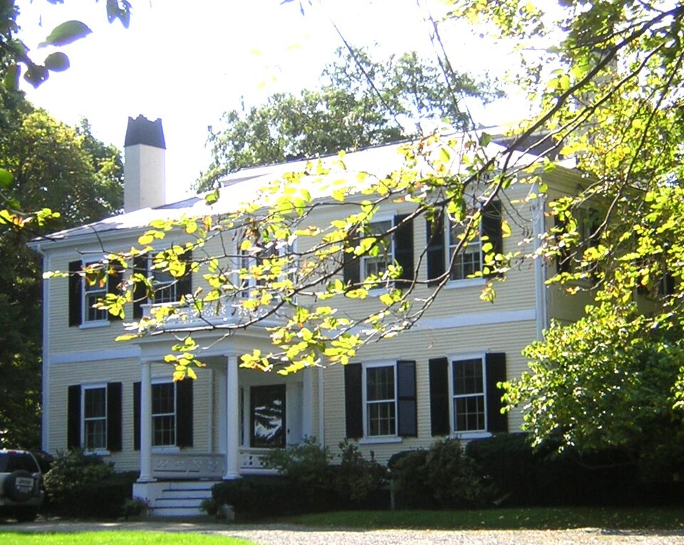
“Amos Holbrook House is a historic house at 203 Adams Street in Milton, Massachusetts. Amos Holbrook, a pioneer in the propagation of smallpox inoculations as a means of improving public health.”
Wikipedia article Dr. Amos Holbrook House, CC BY-SA 4.0.
one of 249 National Register listings in Norfolk County · listed in 1975 · category: Building · one of 2 National Historic Landmarks in Norfolk County.
National Register reference number.75000289- the number the National Park Service assigned this property when it was listed, and the key its nomination file is catalogued under at the National Archives.
Mr. Hunt was born in Scott's Woods, Milton. He is remembered with great affection as connected with the Sabbath School of the First Evangelical Church in his boyhood. The pastor of this church has followed him with the watchful interest of a sincere friend in his education and progress onward to the place he now occupies.
Since the above date a handsome church edifice has been erected on the Dorchester side, where the shepherd gathers his Milton and Dorchester flock. May the prophetic words come to pass : " There shall they lie in a good fold, and in a fat pasture shall they feed." - Ezekicl xxxiv. 14.
Regional context, not property-specific
evidence. The
federal wildfire occurrence database
lists 168 fires within 5 miles of Holbrook, Dr. Amos, House between
2015 and 2020, burning about 110 acres in total. None started naturally. None was recorded as arson.
Distance is straight-line from the map coordinates, so a fire counted
here may appear on a neighbouring settlement's page as well.
Reported cause
Fires
Recreation and ceremony
112
Smoking
31
Missing data/not specified/undetermined
20
Debris and open burning
3
Equipment and vehicle use
2
The most recent of
them, most recent first, with the day each was reported and the service
that recorded it.
Regional context, not property-specific
evidence. Museums hold 12,456 specimens
collected within 10 miles of Holbrook, Dr. Amos, House between 1810 and
1975: 5,126 Plantae, 3,654 Fungi, 3,120 Animalia, 256 Chromista, 204 Protozoa, 63 Unrecorded, 33 Bacteria. 12 distinct Species records are shown.
Collected by (MARSDEN, H W), ?, ? ex Herb. W.G. Farlow and others. Each is a
physical object with a catalogue
number, and each entry opens the museum's record. This is what was
collected and kept, not a survey of what lives here - nothing can be
concluded from a species being absent.
Regional context, not property-specific
evidence. The federal mineral resources record lists
4 workings within 5 miles of Holbrook, Dr. Amos, House: 2 producers, 1 unknown, 1 past producer.
2 still produce. What was taken out: Stone, Crushed/Broken, Granite, Sand and Gravel, Construction. Distance is straight-line from the
map coordinates, so a quarry counted here may appear on a neighbouring
settlement's page as well.
Regional context, not property-specific
evidence. The National Weather Service names
Milton, the town this property stands in, in 21 storm reports between 1996 and 2025: 9 thunderstorm wind, 5 lightning, 4 heavy rain, 1 hail.
The reports record 3 injuries. Each account below is quoted exactly as the forecast office
filed it, from the NOAA Storm Events Database, and each date
opens the federal record of that event.
Lightning struck a house on Augusta Road, causing a fire that engulfed the entire third floor of the house. No one was home at the time of the fire. Three firefighters were hospitalized for heat exhaustion but were released less than 24 hours later.
No historic map-sheet match is published
for this property yet. That does not mean no map exists. This record needs
a coordinate-quality review before it can be joined to a sheet boundary.
Browse the county's mapped places while that work is
pending.
From the nomination file
2,362 words on record
When this property was proposed for the
National Register, someone wrote the case for it: what the building is,
and why it matters. That document is a federal record in the public domain.
It is quoted below word for word, never summarised. The text was read off the scanned case file by machine, so the
occasional stray character is the recogniser's and the 1970s
typewriter's.
Description of the property
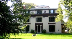
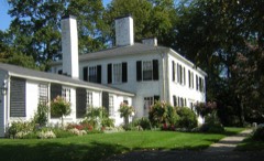
Moved ( - Unexposed * Original Site Surrounded by spacious lawns and ancient trees, the Amos Holbrook house is set back from the road at the apex of a curved driveway. Built in 1800, the Holbrook House is white clapboard over brick on the facade, with a protrusion signifying the belt course. The remaining elevations are brick. A two-story building with a five bay facade, it has a hip roof with two chimneys set in on each side. The lintels are brick (painted white) and the structure rests on a dressed granite foundation. The original building consisted only of the conventional arrangement of central hall and eight rooms, but it has had many later alterations.
In 1872, a brick service appendage, in the conforming Federal style, was added to the west elevation, causing it to become three bays wide. Of the appendage, which has one chimney, the north and south sides are five bays wide; the west side is three bays wide; the east side, projecting from the rear of the original structure, is two bays wide. The columned and balustraded front porch was also added in 1872, as were additional dormers on both sides of the hip roof. In 1907 a five-bay semi-octagonal wing was added to the rear southeast elevation of the original structure and the rear chimney relocated. A one-story Doric columned porch was added to the remaining three-bay south side of the original structure, between the two wings.
In 1935 all of the sash, which had at various times been altered, were returned to the original six over eight. The dining room retains the original trompe l'oeil ceiling and wall frescoes, as does the hall on both the first and second floors.
The Amos Holbrook House stands on the summit of Milton Hill. With its surrounding five acres of land, it is situated on what formerly was the estate of Thomas Hutchinson, the last royal governor of Massachusetts. Beginning in 1743 until he fled Ämerica for England in 1774, Governor Hutchinson attended in particular to the cultivation of his trees, some of which are believed to be extant on the property. The house was built in 1800 by DI.Amos Holbrook (1754-1842) who had been a Revolutionary War surgeon. On his return to Milton in 1777, Holbrook instigated the first attempt by an American community to establish a campaign for local small pox inoculation. The initiation of the Milton program resulted in the first state law for the betterment of community health.
Am eminent man in his profession, Holbrook ientertained General Lafayette in 1824 in the house. The trompe l'oeil architectural frescoes are believed to be contemporary with the house and traditionally said to be done by Italian craftsmen. They are considered by architectural historians to be unique, for their time, in America. Today these frescoes are in a remarkable state of preservation, with only a few signs of their age, and certain areas that have been repainted. The finely carved American Adam mantelpieces, door overpanels and mouldings highly compliment the frescoes. The Museum of the American China Trade purchased the Holbrook property in 1973 in order to preserve the house and save it from demolition and the subsequent development of tract housing.
The property, along with that of the adjacent Museum of the American China Trade (The Robert B.Forbes House, National Historic Landmark) is located across Adams Street from a preserved 14 acre open space that runs down to the Neponset Estuary.
Quoted from the National Register nomination
for reference 75000289, 8 pages, held by the National Archives in Record
Group 79. See the
catalogue record.
Listed places nearby
6 within 8 miles
Other National Register properties close
enough to walk or drive between, ordered by distance from this one. Both
positions come from the same geocoding pass that matched these properties
to their map sheets.
Listing record. National Park Service National Register of Historic Places, listed-properties dataset, current to 2026-05-22.
Map join. Address geocoded through the United States Census geocoder, then tested against the published boundary of every sheet in the USGS Historical Topographic Map Collection.
How this page is made. Listing fields come from federal records; map-sheet coverage is a labelled coordinate-to-boundary calculation, not a source-field claim.
Wildfire. Short, Karen C. 2022. Spatial wildfire occurrence data for the United States, 1992-2020 [FPA_FOD_20221014]. 6th Edition. Fort Collins, CO: Forest Service Research Data Archive. https://doi.org/10.2737/RDS-2013-0009.6 Collected with United States Government funding and usable without additional permissions or fees.
Specimens. Global Biodiversity Information Facility (GBIF), https://www.gbif.org/. Only records licensed CC0 or CC BY are used. Records licensed CC BY-NC are excluded because this site carries advertising. Images are checked individually and any whose licence is non-commercial, no-derivatives or unreadable is refused.
Mines and quarries. USGS Mineral Resources Data System (MRDS) https://mrdata.usgs.gov/mrds/ A work of the United States government, no copyright under 17 U.S.C. 105.
Storms. NOAA National Centers for Environmental Information, Storm Events Database https://www.ncei.noaa.gov/stormevents/ A work of the United States government, no copyright under 17 U.S.C. 105. Narratives are quoted verbatim from the National Weather Service report and are not edited or summarised.
 Block
Block