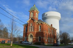
Listed on the National Register of Historic Places in
1976. A historic map-sheet match is not published yet. The record needs a coordinate-quality review before it can be joined to a sheet boundary.
From the record
one of 113 National Register listings in Lorain County · listed in 1976 · category: Building · one of 2 National Historic Landmarks in Lorain County.
Architectural style. Queen Anne style architecture in the United States
National Register reference number.76001468- the number the National Park Service assigned this property when it was listed, and the key its nomination file is catalogued under at the National Archives.
Specimens collected near this property
12 of 551 shown
Regional context, not property-specific
evidence. Museums hold 551 specimens
collected within 10 miles of Columbia Town Hall between 1888 and
1975: 509 Animalia, 21 Plantae, 17 Fungi, 4 Protozoa. 12 distinct Species records are shown.
Collected by A. Woolman, B Zahuranec & party, BJ Zahuranec & party and others. Each is a
physical object with a catalogue
number, and each entry opens the museum's record. This is what was
collected and kept, not a survey of what lives here - nothing can be
concluded from a species being absent.
No historic map-sheet match is published
for this property yet. That does not mean no map exists. This record needs
a coordinate-quality review before it can be joined to a sheet boundary.
Browse the county's mapped places while that work is
pending.
From the nomination file
2,225 words on record
When this property was proposed for the
National Register, someone wrote the case for it: what the building is,
and why it matters. That document is a federal record in the public domain.
It is quoted below word for word, never summarised. The text was read off the scanned case file by machine, so the
occasional stray character is the recogniser's and the 1970s
typewriter's.
Description of the property
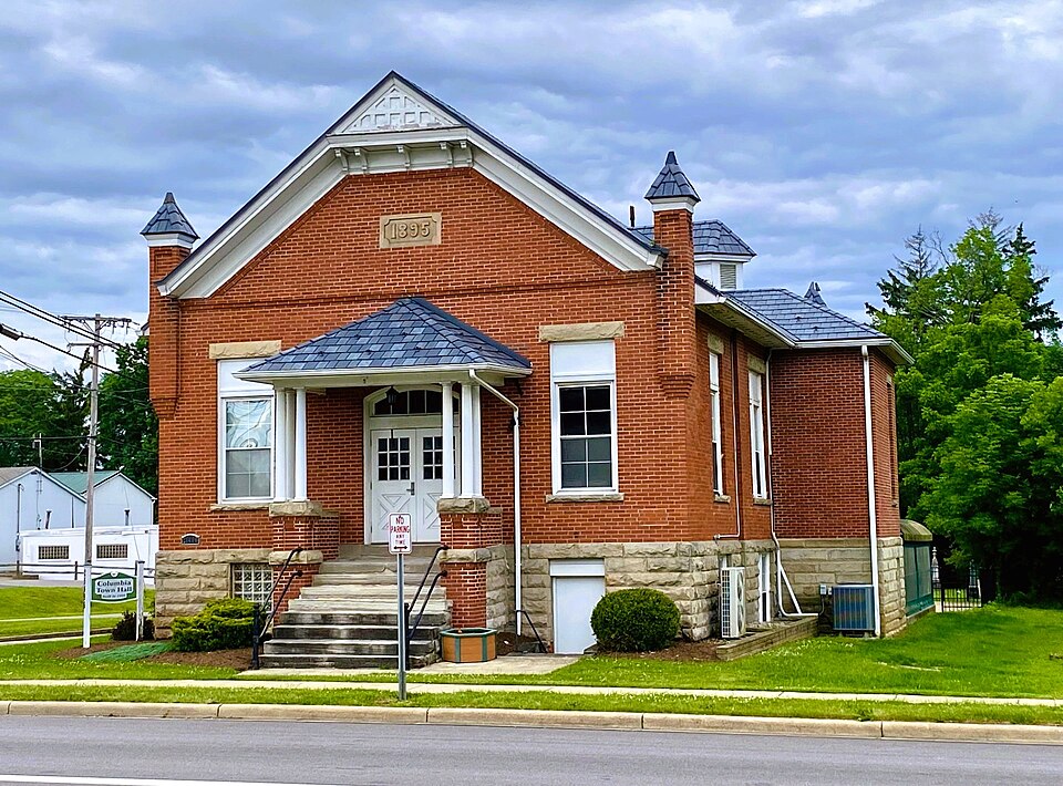
a louvered dormer on each side of the ridge, to ventilate the attic. Iaces South, and enters the upper level through a flight of sandstone purchased for the Town Hall at the time of its construction. The ceiling wainscoating surrounds the room, with plastered walls and ceiling above it. 1930) and the construction of the wall which creates the trustee's office main entrance porch with asphalt, and the addition of a small protective CONDITION UNEXPOSED UNALTERED DETERIORATED The upper level consists of a single large meeting room.A raised stage The upper level is as it was built, except for the addition of more modern a small square turret which projects several feet above the eaves, each The lower level contains a meeting room, kitchen facilities, and the office metal ceiling panels.
CHECK ONE lighting and heating equipment, and the replacement of the front doors. The Columbia Town Hall is a masonry structure built on a foundation 3l X so extensive as to virtually destroy the Town Hall as we know it. of the lower level is of ornamental stamped metal panels. the year 1895.At each of the four corners, the brick is extended to form roof over the West entrance to the lower level. level at the front and also on the West. -GOOD -FAIR The walls, up the level of the upper floor, are of sandstone cut The roof is of slate, and is ornamented by for the lower level projecting down into shallow stone lined wells. are also two windows in each end of the upper level. of the township trustees. steps and a columned porch.
There is a grade level entrance to the lower when the soffits were replaced, but have been preserved. Other external throughout. DATE grade. enclosed photographs were taken.
Quoted from the National Register nomination
for reference 76001468, 18 pages, held by the National Archives in Record
Group 79. See the
catalogue record.
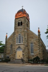
Listed places nearby
5 within 8 miles
Other National Register properties close
enough to walk or drive between, ordered by distance from this one. Both
positions come from the same geocoding pass that matched these properties
to their map sheets.
Listing record. National Park Service National Register of Historic Places, listed-properties dataset, current to 2026-05-22.
Map join. Address geocoded through the United States Census geocoder, then tested against the published boundary of every sheet in the USGS Historical Topographic Map Collection.
How this page is made. Listing fields come from federal records; map-sheet coverage is a labelled coordinate-to-boundary calculation, not a source-field claim.
Specimens. Global Biodiversity Information Facility (GBIF), https://www.gbif.org/. Only records licensed CC0 or CC BY are used. Records licensed CC BY-NC are excluded because this site carries advertising. Images are checked individually and any whose licence is non-commercial, no-derivatives or unreadable is refused.
 Block
Block