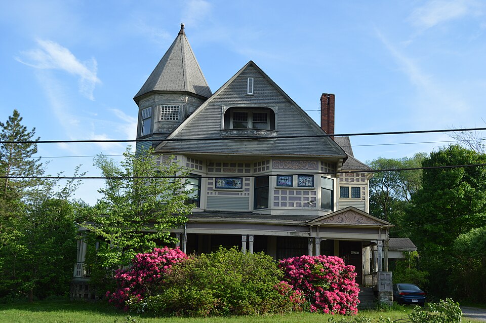
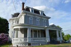
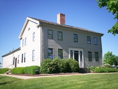
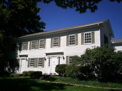
Listed on the National Register of Historic Places in
1976. A historic map-sheet match is not published yet. The record needs a coordinate-quality review before it can be joined to a sheet boundary.
From the record
“Elias Harmon, who can be set down as the fourth settler, was born in Suftield, Conn., in 1773, and started for the Reserve in February, 1799, in a twohorse aleigh, going as far as Pittston, N. After a lonct, tiresome and plariloos trip, partly by lake, partly by land and partly by river, Harmon landed at the clearing of Honey, as stated, on tho I'ith of June, where he stopped awhile, and then went to the place of Ebenezer iSheldou, who had engaged him before leaving home to help him in boarding and aiding the sarveyora in their allotment of Anrora, after* ward returning t-o Mantua with his wife in September, 1799, and settling on Lot IS.”
History of Portage County, Ohio. Containing a History of the County, Its Townships, Towns, Villages, Schools, Churches, Industries, Etc; Portraits of Early Settlers and Prominent Men; Biographies; History of the Northwest Territory; History of Ohio; Statistical and Miscellaneous Matter, Etc., Etc. .. (1885). Machine-read text.
one of 42 National Register listings in Portage County · listed in 1976 · category: Building.
Architectural style. Queen Anne style architecture in the United States, Shingle style architecture
National Register reference number.76001513- the number the National Park Service assigned this property when it was listed, and the key its nomination file is catalogued under at the National Archives.
The ground it stands on
10,315 words
The chapter on Mantua Township in History of Portage County, Ohio, published 1885 names Mantua. This is what it says, exactly as the scans read.
The first man to drive a stake, put up a cabin, make a clearing and settle down to business was Abraham L. Honey, which he did in the fall of 1798, and although it has been asserted that a man by the name of Peter French came in the fall of 1798, cleared off some land on the northwest quarter of Lot 24 and put out a small patch of wheat, he also cleared some land on the southwest quarter of Lot 29. After making those improvements he moved to Mentor. That a small crop of wheat was harvested the next season by Rufus Edwards, who came in and took possession of Lot 24, the lot settled upon by Honey, is beyond dispute. How he got possession of Lot 24 does not now appear. Honey remained only two or three years in Mantua, when he moved to Hiram and from there to Cuyahoga County. The wife of Honey was a sister of Rufus Edwards, and it is possible that Honey made the improvements for his brother-in-law, himself settling on a portion of the land, there being plenty of room on 420 acres for three or four families in those times. At any rate Rufus Edwai-ds was the second settler, for in the notes keptby Elias Harmon of those early days he says that just after he came in he chopped for Edwards and hewed for Crooks. Crooks by this appears to have been the third settler, though not a permanent one, as he only arrived at Mr. Honey's on the 12th of June, 1799. David Crooks, the person referred to, settled on the southwest part of Lot 29. He remained there until November, 1799, when he went for his family, who refused to return to Ohio with him. William Crooks died in Aurora, some time in the fifties at the age of eighty-five years. He located in Warren, then at Nelson, next at Parkman, and ultimately in Aurora.
Elias Harmon, who can be set down as the fourth settler, was born in Suflield. Conn., in 1773, and started for the Reserve in February, 1799, in a twohorse sleigh, going as far as Pittston, N. Y., where he remained till May, when, in company with Benjamin Tappan, David Hudson and Jotham Atwater, started for their future home - Ta,ppan for Ravenna, then Town 3, Range 8; Hudson for what is now Summit County; Atwater for Euclid, and Harmon for Mantua. After a long, tiresome and perilous trip, partly by lake, partly by land and partly by river, Harmon landed at the clearing of Honey, as stated, on the 12th of June, where he stopped awhile, and then went to the place of Ebenezer Sheldon, who had engaged him before leaving home to help him in boarding and aiding the surveyors in their allotment of Aurora, afterward returning to Mantua with his wife in September, 1799, and settling on Lot 18. One of two or three entries in his diary, shows that the erection of a habitation in those days was a matter to be accomplished in short order; he savs: "July 1, began to cut timber for our house. July 2, put up and moved into house. July 3, got timber for floor. July 4, laid thefloor."
Regional context, not property-specific
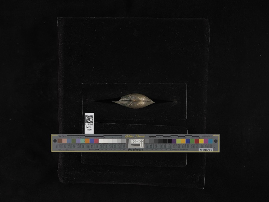
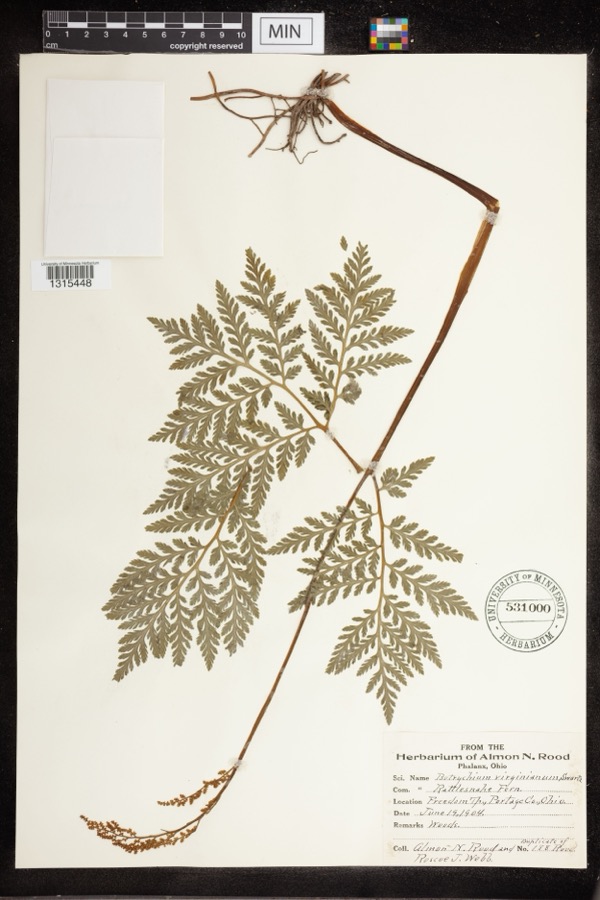
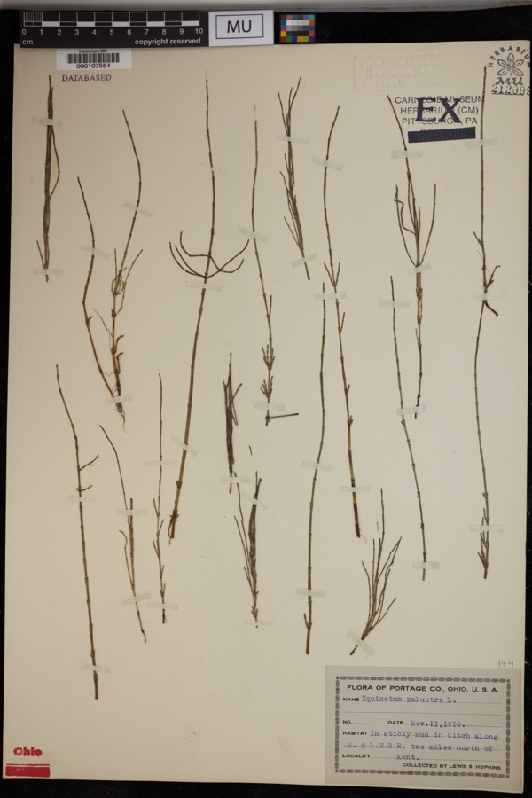
evidence. Museums hold 773 specimens
collected within 10 miles of Hine, Horace L., House between 1883 and
1975: 627 Animalia, 138 Plantae, 4 Fungi, 4 Unrecorded. 12 distinct Species records are shown.
Collected by A. D. Huryn, A. F. Clewell, A. Woolman and others. Each is a
physical object with a catalogue
number, and each entry opens the museum's record. This is what was
collected and kept, not a survey of what lives here - nothing can be
concluded from a species being absent.
Regional context, not property-specific
evidence. The federal mineral resources record lists
25 workings within 5 miles of Hine, Horace L., House: 13 past producers, 10 producers, 2 plants.
12 still produce. What was taken out: Sand and Gravel, Construction. Distance is straight-line from the
map coordinates, so a quarry counted here may appear on a neighbouring
settlement's page as well.
Regional context, not property-specific
evidence. The National Weather Service names
Mantua, the town this property stands in, in 31 storm reports between 1995 and 2026: 17 thunderstorm wind, 14 hail.
No death or injury is recorded in these reports. Each account below is quoted exactly as the forecast office
filed it, from the NOAA Storm Events Database, and each date
opens the federal record of that event.
No historic map-sheet match is published
for this property yet. That does not mean no map exists. This record needs
a coordinate-quality review before it can be joined to a sheet boundary.
Browse the county's mapped places while that work is
pending.
From the nomination file
3,372 words on record
When this property was proposed for the
National Register, someone wrote the case for it: what the building is,
and why it matters. That document is a federal record in the public domain.
It is quoted below word for word, never summarised. The text was read off the scanned case file by machine, so the
occasional stray character is the recogniser's and the 1970s
typewriter's.
Description of the property
of various projecting bays, the building is basically rectangular. A wide rooms. There are nine fireplaces, with imported marbles and carved room, trunk closet, an attic where the original water supply cistern UNEXPOSED CONDITION color. musicales. DETERIORATED UNALTERED FAIR CHECK ONE maple.There are seven double sliding doors between various large has a carved balustrade and continues to the third floor.There are on the east have been replaced with plain square posts.The original siding was entirely of horizontal clapboard. At present this is covered on the eight finished rooms.The main floor has seven rooms.The entrance carved double posts on the north show the original pattern, but two sets the Queen Anne and Shingle styles.The foundation is constructed of hand-cut bay windows.
At the northeast corner there is a three-story octagonal XEXCELLENT hall and all communicating halls are paneled.
The woodwork is of rock veranda wraps around the north facade and part of the east elevation.The mantels of fine woods - maple, pine and walnut.The main staircase chimneys with handsome brickwork rise above the roof line;another on tower with a steep pyramidal roof.At the eaves level there is a continuous frieze of square fretwork suggesting the influence of"Japonisme."Under- rock-faced ashlar.Although there is a sense of irregularity in plan because taste over the past 90 years.All of the elements are reversed in color This isa large residence of wood frame construction with elementsof to the west elevation.Beneath the east and north gables are two projecting the east gable has been cut down.
the village of Mantua, and symbolizes the worldly ambition of a successful Horace L. Hine was born in Shalersville, Ohio February 26, 1859. of the lumber and mill firm of Hine and Cook. Crafts, Hine and Co. took indicates that it was probably 1893-1895. Likewise, an oral tradition says that the architect was Henry L.
Searles of Ravenna, Ohio, but this is Sagamore Hill at Oyster Bay, New York, which it superficially 1600-1699 1700-1799 INVENTION ARCHEOLOGY-HISTORIC THEATER SIGNIFICANCE ART ECONOMICS PERIOD TRANSPORTATION EXPLORATION/SETTLEMENT 1900- PHILOSOPHY ARCHEOLOGY-PREHISTORIC AGRICULTURE MILITARY LITERATURE _COMMUNICATIONS X1800-1899 MUSIC _POLITICS/GOVERNMENT XARCHITECTURE The exact date of construction is not documented, but the best evidence SCIENCE Hine was raised by his maternal grandfather Silas Crocker from the age also undocumented.The house was considered the center of village society businessman.It is also an excellent and well-preserved example of the Queen Anne style. His father and grandfather had migrated to Ohio from Connecticut.H.L. INDUSTRY The Horace L.
Hine house is the dominant late l9th century home in with the First National Bank in 1894 or 1900,according to two different _ENGINEERING -1400-1499 Cook. Hine was married in 1886 to Ella Blanchfield.They had five children. in the early 2oth century, and was compared to Theodore Roosevelts over an earlier sawmill in l889,and Hine purchased the interest of of three years.He was.educated in the local schools and graduated from _CONSERVATION -COMMERCE - EDUCATION - RELIGION Mount Union College. Smith, Cook and Co. the following year, the business becoming. Hine and resembles. Horace L. Hine died in 1947. LAW BUILDER/ARCHITECT In 1885 he and W.H.Crafts opened a bank in Henry L. Searles (?)
Quoted from the National Register nomination
for reference 76001513, 16 pages, held by the National Archives in Record
Group 79. See the
catalogue record.
Listed places nearby
6 within 8 miles
Other National Register properties close
enough to walk or drive between, ordered by distance from this one. Both
positions come from the same geocoding pass that matched these properties
to their map sheets.
Listing record. National Park Service National Register of Historic Places, listed-properties dataset, current to 2026-05-22.
Map join. Address geocoded through the United States Census geocoder, then tested against the published boundary of every sheet in the USGS Historical Topographic Map Collection.
How this page is made. Listing fields come from federal records; map-sheet coverage is a labelled coordinate-to-boundary calculation, not a source-field claim.
Specimens. Global Biodiversity Information Facility (GBIF), https://www.gbif.org/. Only records licensed CC0 or CC BY are used. Records licensed CC BY-NC are excluded because this site carries advertising. Images are checked individually and any whose licence is non-commercial, no-derivatives or unreadable is refused.
Mines and quarries. USGS Mineral Resources Data System (MRDS) https://mrdata.usgs.gov/mrds/ A work of the United States government, no copyright under 17 U.S.C. 105.
Storms. NOAA National Centers for Environmental Information, Storm Events Database https://www.ncei.noaa.gov/stormevents/ A work of the United States government, no copyright under 17 U.S.C. 105. Narratives are quoted verbatim from the National Weather Service report and are not edited or summarised.
 Block
Block