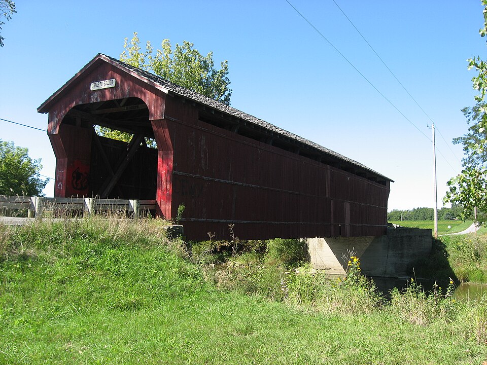
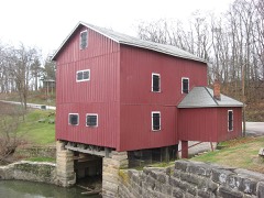
Built in 1878. Listed on the National Register of Historic Places in
1976. A historic map-sheet match is not published yet. The record needs a coordinate-quality review before it can be joined to a sheet boundary.
From the record
“The Swartz Covered Bridge, near Wyandot, Ohio, was built in 1880. It was listed on the National Register of Historic Places in 1976.”
Wikipedia article Swartz Covered Bridge, CC BY-SA 4.0.
one of 8 National Register listings in Wyandot County · listed in 1976 · category: Structure · built in 1878.
National Register reference number.76001553- the number the National Park Service assigned this property when it was listed, and the key its nomination file is catalogued under at the National Archives.
Zachariah Welsh came to this county in 1821, and settled in Wyandot Village. He died in 1849; his wife'b demise occurred in 1857. Edmund R. , his son, was born in Chillicothe, Ohio, in 1810. He came to this county with his parents and died January 29, 1880, in Nevada, to which place he removed in 1865. He came from Fairfield County.
In 1820, Col. M. H. Kirby entered 640 acres where Wyandot now is situated. He made additions to this till he owned L200 acres, on which he moved from Columbus in 1839, remaining till 1843, when he was appointed Receiver of the Northwestern Land Office. Ttiese were the principal settlers up to the date last mentioned, and, in fact, to the date of the organization of the county, 1845, after which time settlements were rapidly made.
Regional context, not property-specific
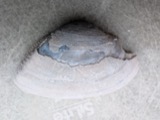
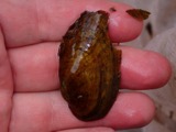
evidence. Museums hold 219 specimens
collected within 10 miles of Swartz Covered Bridge between 1885 and
1975: 203 Animalia, 13 Fungi, 3 Plantae. 12 distinct Species records are shown.
Collected by Acker, G., Allen, J. M., Blyth & Katz and others. Each is a
physical object with a catalogue
number, and each entry opens the museum's record. This is what was
collected and kept, not a survey of what lives here - nothing can be
concluded from a species being absent.
Regional context, not property-specific
evidence. The federal mineral resources record lists
1 working within 5 miles of Swartz Covered Bridge: 1 producer.
All of them still produce. What was taken out: Stone, Crushed/Broken. Distance is straight-line from the
map coordinates, so a quarry counted here may appear on a neighbouring
settlement's page as well.
No historic map-sheet match is published
for this property yet. That does not mean no map exists. This record needs
a coordinate-quality review before it can be joined to a sheet boundary.
Browse the county's mapped places while that work is
pending.
From the nomination file
1,872 words on record
When this property was proposed for the
National Register, someone wrote the case for it: what the building is,
and why it matters. That document is a federal record in the public domain.
It is quoted below word for word, never summarised. The text was read off the scanned case file by machine, so the
occasional stray character is the recogniser's and the 1970s
typewriter's.
Description of the property
projected portals, cedar shingle roof, stone and concrete abutments. abutment is the original stone, but the north abutment is now concrete. The floor is in one layer, laid crosswise- CONDITION UNEXPOSED EXCELLENT DETERIORATED RUINS MOVED UNALTERED XALTERED devised this truss plan which uses the wooden braces and counterbraces commonly This is known as the Swartz Bridge and is built on the once-popular Howe truss The structure under consideration is a one-span wooden truss covered bridge CHECK ONE preparing to replace a few missing boards and reroof the old span. The Swartz Bridge is a fine looking and well-cared for old covered bridge.
vandalism necessitated all new siding which was then painted a dark "barn significant development in the history of bridge engineering as it was the Wyandot County, Ohio.This fine old span has vertical, high-boarded siding The portals were painted red, too. A new roof, of cedar shingles from British Colombia was put on in l966, too.Extensive repairs are planed for the floor system of this bridge in 1976 to increase its safe load capacity. tightened to straighten the bridge if it began to sag.The Howe truss was a Vandals knocked off all the siding in September 1966 just as the county was 7DESCRIPTION.TAO XGOOD is a nine panel Howe truss,108i6 long overall with a clear span of 10oi6 DATE.
2-6"x 6"and the counterbraces are 1-6x 7#.The iron rods are all 1"in - FAIR first in which iron was used in combination with the wooden trusses and it rods as the truss verticals.These iron rods had turnbuckles which could be red.
ing Killdeer Wildlife Area. 1400-1499 1880 ECONOMICS ART SIGNIFICANCE ARCHITECTURE BUILDER/ARCHITECT EXPLORATION/SETTLEMENT PERIOD ARCHEOLOGY-HISTORIC MILITARY LAW SCULPTURE AGRICULTURE THEATER Historic LITERATURE XENGINEERING _COMMUNICATIONS supposed to have broken his sword and thrown it into this creek just before _EDUCATION crease its safe load capacity. Howe truss and that its development marked the end of the all-wooden bridge INVENTION in such good condition attests to the strength and durabilty of the Howe truss.
graffiti as the accompanying photos will show.An attempt was made to set the _RELIGION The Swartz Covered Bridge is a fine example of the Howe truss plan.It is on the physical description of the bridge, we discussed the importance of the old Wyandot Indian Reservation.Less than a mile west of the covered bridge, prevented much damage to the bridge.The county engineer's office is planning bridge on fire in the early summer of 1975,but prompt action by area residenbs _CONSERVATION _SOCIAL/HUMANITARIAN _1700-1799 -1600-1699 A sign over each portal of this bridge proclaims that it is the Swartz Bridge -1500-1599 extensive repairs to the floor system of this bridge sometime in l976to in- _COMMERCE -PHILOSOPHY -MUSIC -SCIENCE _1900- The bridgeis well-decorated with truss.
The Swartz Bridge crosses the Sandusky River not far from the headwaters of Broken Sword Creek enters the Sandusky River.Col.William Crawford is The county has taken good care of this fine old Howe truss bridge, despite after William Howe patented it. County when the old covered bridges were in their heyday. this area cherish their old covered bridge and want to see it preserved.
Quoted from the National Register nomination
for reference 76001553, 16 pages, held by the National Archives in Record
Group 79. See the
catalogue record.
Listed places nearby
4 within 8 miles
Other National Register properties close
enough to walk or drive between, ordered by distance from this one. Both
positions come from the same geocoding pass that matched these properties
to their map sheets.
Listing record. National Park Service National Register of Historic Places, listed-properties dataset, current to 2026-05-22.
Map join. Address geocoded through the United States Census geocoder, then tested against the published boundary of every sheet in the USGS Historical Topographic Map Collection.
How this page is made. Listing fields come from federal records; map-sheet coverage is a labelled coordinate-to-boundary calculation, not a source-field claim.
Specimens. Global Biodiversity Information Facility (GBIF), https://www.gbif.org/. Only records licensed CC0 or CC BY are used. Records licensed CC BY-NC are excluded because this site carries advertising. Images are checked individually and any whose licence is non-commercial, no-derivatives or unreadable is refused.
Mines and quarries. USGS Mineral Resources Data System (MRDS) https://mrdata.usgs.gov/mrds/ A work of the United States government, no copyright under 17 U.S.C. 105.
 Block
Block