Listed on the National Register of Historic Places in
1977. A historic map-sheet match is not published yet. The record needs a coordinate-quality review before it can be joined to a sheet boundary.
From the record
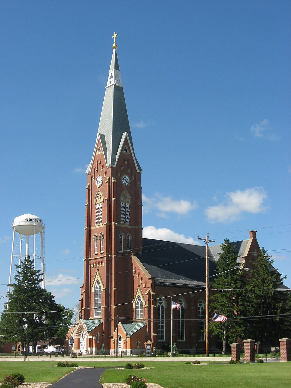
“John The Baptist Roman Catholic Church is a historic church at Ohio 694 and Main Street in Glandorf, Ohio. It was built in 1875 and added to the National Register in 1977.”
Wikipedia article St. John the Baptist Catholic Church (Glandorf, Ohio), CC BY-SA 4.0.
one of 7 National Register listings in Putnam County · listed in 1977 · category: Building.
National Register reference number.77001083- the number the National Park Service assigned this property when it was listed, and the key its nomination file is catalogued under at the National Archives.
What happened here
An account from the chapter on Ottawa township, The inset identifies its exact
source book and publication year.
In 1852, during the epidemic of cholera, Gilboa was the worst afflicted illage in the county. It had nineteen cases of the dread disease, from which fourteen deaths occurred, only five persons who had the disease recovering. A great many of the people fled from the village, and only two doctorsremained to administer to the afflicted.
The "first tavern was built of hewed logs and was kept by Michael Row. This tavern was well patronized by early travelers and early meetings of the citizens were held here to discuss matters pertaining to the welfare of the township and the early settlers. The first saw-mill was located on the Blanchard river a short distance west of the Glandorf bridge. It was built by James Adgate and was well patronized by the early settlers, there being few saw-mills in the county at this time and a plentiful supply of timber.
The colonists erected log cabins and these were provided with only the barest necessities of life. In laying out the village of Glandorf, the pioneers held very closely to the custom of the Province of Osnabruck, Germany, whence its founders came. There is but one street deserving the name and that extends over a mile north and south. This street is lined on either side with the quaint, durable and homelike houses of the villagers with their spacious and well-kept yards, the street being interspersed here and there with a few stores and shops. The early industries of Glandorf were shoemaking, woolen-mill, wooden-shoe manufactory and saw-mills, and it is well to note that in 1837 Father Horstmann built the first grist-mill in the village of Glandorf for the accommodation of the early settlers.
Regional context, not property-specific
evidence. The
federal wildfire occurrence database
lists 3 fires within 5 miles of St. John The Baptist Roman Catholic Church between
2002 and 2002, burning about 2 acres in total. None started naturally. None was recorded as arson.
Distance is straight-line from the map coordinates, so a fire counted
here may appear on a neighbouring settlement's page as well.
Reported cause
Fires
Recreation and ceremony
2
Missing data/not specified/undetermined
1
The most recent of
them, most recent first, with the day each was reported and the service
that recorded it.
Regional context, not property-specific
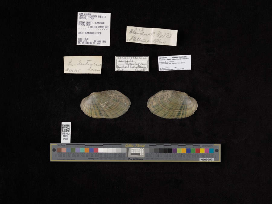
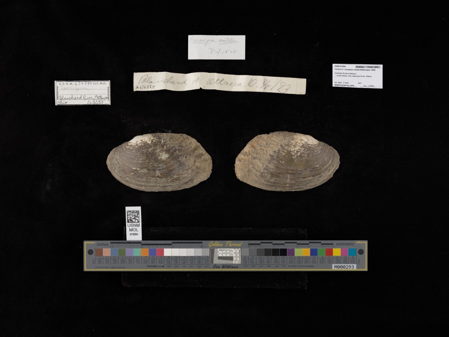
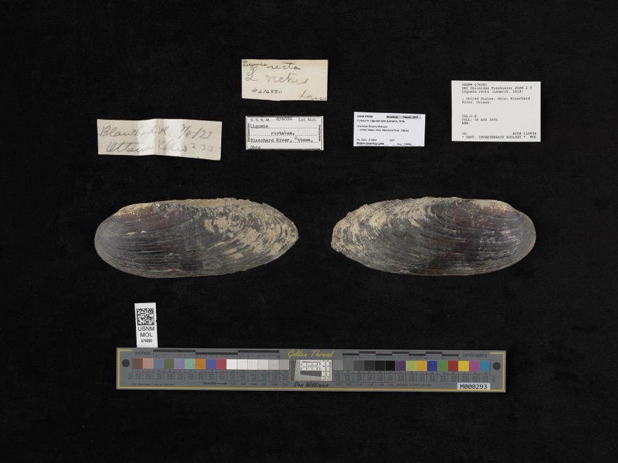
evidence. Museums hold 112 specimens
collected within 10 miles of St. John The Baptist Roman Catholic Church between 1860 and
1969: 104 Animalia, 8 Plantae. 12 distinct Species records are shown.
Collected by Adler, K. K., Blyth & Katz, Bureau of Fisheries and others. Each is a
physical object with a catalogue
number, and each entry opens the museum's record. This is what was
collected and kept, not a survey of what lives here - nothing can be
concluded from a species being absent.
Regional context, not property-specific
evidence. The federal mineral resources record lists
1 working within 5 miles of St. John The Baptist Roman Catholic Church: 1 past producer.
None of them still produces. What was taken out: Clay. Distance is straight-line from the
map coordinates, so a quarry counted here may appear on a neighbouring
settlement's page as well.
Regional context, not property-specific
evidence. The National Weather Service names
Glandorf, the town this property stands in, in 10 storm reports between 1999 and 2022: 4 thunderstorm wind, 3 hail, 1 tornado, 1 flood.
The reports record 1 death. Each account below is quoted exactly as the forecast office
filed it, from the NOAA Storm Events Database, and each date
opens the federal record of that event.
Flood waters from the Blanchard River, near Glandorf, caused a truck to be swept off the road on Road 15, north of Road J. Investigators believe that the driver exited the truck attempting to escape the flood water and was swept away. The body of the 74 year old male was recovered about 900 yards from the truck a few days after flood waters receded.
The tornado formed near Road 13I just south of Township Highway I and dissipated near the Firefox Lake Private Subdivision. As the tornado moved toward the Blanchard River it quickly widened to a peak width of 464 yards or just a little over a quarter of a mile. The tornado continued east before crossing the river again and quickly weakening. The most significant damage occurred along Township Highway I between Roads 13 and 13I. The tornado destroyed six outbuildings including pole barns and well built buildings constructed on a foundation. Over a half dozen homes were damaged with several sustaining major damage including the complete removal of roofs. A large amount of agricultural equipment and eleven vehicles were also damaged or destroyed with total monetary losses initially estimated at $1,200,000.
The public reported a barn was blown off its foundation, with numerous trees being downed. Roof damage also occurred to some nearby buildings. Damage is estimated at $25,000.
Four to six inches of rain fell across portions of central Putnam county, resulting in road closures from flowing water, including County Road 5-H and US 224.
No historic map-sheet match is published
for this property yet. That does not mean no map exists. This record needs
a coordinate-quality review before it can be joined to a sheet boundary.
Browse the county's mapped places while that work is
pending.
From the nomination file
1,900 words on record
When this property was proposed for the
National Register, someone wrote the case for it: what the building is,
and why it matters. That document is a federal record in the public domain.
It is quoted below word for word, never summarised. The text was read off the scanned case file by machine, so the
occasional stray character is the recogniser's and the 1970s
typewriter's.
Description of the property
construction. The building has a basilican plan with an apse and clerestory. The arches which employ bands of light and dark brick. All three entrances open into The interior is a three-aisled hall with tall aisle arcade, a blind triforium and clerestory. The vaulted ceiling is elegantly decorated with Christian a one-story, three car brick garage. CONDITION UNALTERED XALTERED RUINS DETERIORATED FAIR CHECK ONE chancel is also buttressed and has three more windows. box cornice.The wall brmers have decorative wood siding in the pediment area. open proch protects the front entrance.
The convent is a very plain,2-story brick building.The hip roof has four Stone belt courses are employed.There is a band of brick dentils below the Completed in 18V8 this High Victorian Gothic cathedral is built of brick masonry The front entry has an open, gable-roofed wood porch. A stained glass window are pedimented;the center entrance is recessed within a series of receeding The two-1/2 story building is nearly square with several gables and wall dormers _UNEXPOSED and the present convent building The rectory to the south of the church from the mother parish in Glandorf, Germany is in the rectory. To the rear is metal-roofed foyers. Above each entrance is a traceried, Gothic window. Sandstone central tower.
Gothic arched windows, clock faces, and tall pyramidal roof and buttresses. The ends of the transept have two tall windows. The three-sided accents of red, darker blue, and gilt. The ribbed vaulting is carried downward at the roofline. Windows are paired with either stone lintels or brick headers.
Allen, Auglaize, Hancock, Defiance, and Van Wert Counties for many years. The church contains priceless woodcarvings, altars, pulpit and communion rail 1400-1499 1600-1699 ENGINEERING COMMUNICATIONS INVENTION ARCHEOLOGY-HISTORIC SIGNIFICANCE EDUCATION PERIOD ART POLITICS/GOVERNMENT LAW BUILDER/ARCHITECT SCIENCE THEATER RELIGION INDUSTRY MILITARY SCULPTURE TRANSPORTATION AGRICULTURE LITERATURE _SOCIAL/HUMANITARIAN Victorian Gothic Church architecture.It was designed by the Cleveland firm St.John the Baptist Roman Catholic Church is an outstanding example of High and was the largest Catholic church in the Cleveland diocese for many years. _CONSERVATION the nomination because of their proximity to the church. of Cudell G Richardson.
It is in excellent condition and both the interior -1700-1799 and exterior details are true to the German cathedrals from which the plan sett1ers.(1954). also owns a school and a shrine constructed of the tombstones of early -COMMERCE Built in 1875-1878 the church was considered the"Cathedral of the Northwest" _1900- Cudell & Richardson -_1500-1599 - MUSIC SPECIFIC DATES 1875-1878 Putnam County.Roman Catholicism was established in Glandorf in 1834by
Quoted from the National Register nomination
for reference 77001083, 24 pages, held by the National Archives in Record
Group 79. See the
catalogue record.
Listed places nearby
6 within 8 miles
Other National Register properties close
enough to walk or drive between, ordered by distance from this one. Both
positions come from the same geocoding pass that matched these properties
to their map sheets.
Listing record. National Park Service National Register of Historic Places, listed-properties dataset, current to 2026-05-22.
Map join. Address geocoded through the United States Census geocoder, then tested against the published boundary of every sheet in the USGS Historical Topographic Map Collection.
How this page is made. Listing fields come from federal records; map-sheet coverage is a labelled coordinate-to-boundary calculation, not a source-field claim.
Wildfire. Short, Karen C. 2022. Spatial wildfire occurrence data for the United States, 1992-2020 [FPA_FOD_20221014]. 6th Edition. Fort Collins, CO: Forest Service Research Data Archive. https://doi.org/10.2737/RDS-2013-0009.6 Collected with United States Government funding and usable without additional permissions or fees.
Specimens. Global Biodiversity Information Facility (GBIF), https://www.gbif.org/. Only records licensed CC0 or CC BY are used. Records licensed CC BY-NC are excluded because this site carries advertising. Images are checked individually and any whose licence is non-commercial, no-derivatives or unreadable is refused.
Mines and quarries. USGS Mineral Resources Data System (MRDS) https://mrdata.usgs.gov/mrds/ A work of the United States government, no copyright under 17 U.S.C. 105.
Storms. NOAA National Centers for Environmental Information, Storm Events Database https://www.ncei.noaa.gov/stormevents/ A work of the United States government, no copyright under 17 U.S.C. 105. Narratives are quoted verbatim from the National Weather Service report and are not edited or summarised.
 Block
Block