Listed on the National Register of Historic Places in
1980. A historic map-sheet match is not published yet. The record needs a coordinate-quality review before it can be joined to a sheet boundary.
From the record
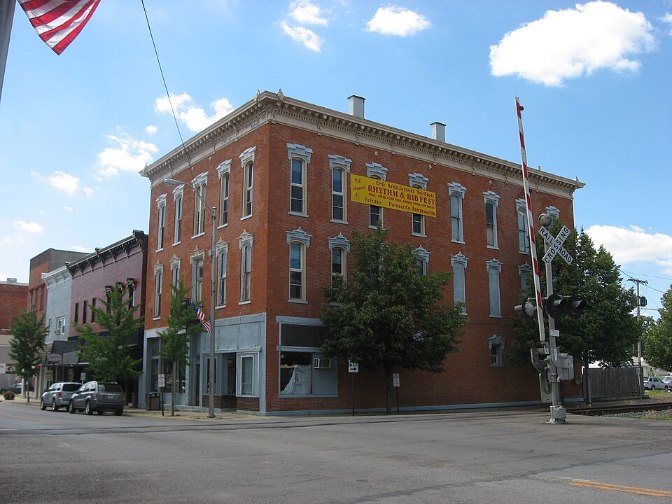
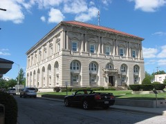
“Huber Block was a historic commercial building in downtown Ottawa, Ohio, United States. Hubert Huber, a native of Germany who immigrated to the nearby village of Glandorf in 1853.”
Wikipedia article Dr. H. Huber Block, CC BY-SA 4.0.
one of 7 National Register listings in Putnam County · listed in 1980 · category: Building.
National Register reference number.80003213- the number the National Park Service assigned this property when it was listed, and the key its nomination file is catalogued under at the National Archives.
What happened here
An account from the chapter on Ottawa township, The inset identifies its exact
source book and publication year.
In 1852, during the epidemic of cholera, Gilboa was the worst afflicted illage in the county. It had nineteen cases of the dread disease, from which fourteen deaths occurred, only five persons who had the disease recovering. A great many of the people fled from the village, and only two doctorsremained to administer to the afflicted.
Ottawa township was organized in March, 1835, with a limited number of people who had settled in the township during the previous two years. One of the first white settlers in the township was Geoi-ge Agner, who came here in the year 1832 and, the following year, settled on a farm east of Ottawa. William Galbreath settled on the farm adjoining Ottawa in the same year. Mr. Galbreath served in the War of 18 12 and was present at the battle of Fort Meigs. William and Jonathan Y. Sackett, Henry Crawfis, Meridith Parish, Henry Ridenour, James Parish and Christian Huber are numbered with the pioneers of this township.
The first school held in the township was taught by Christian Huber. It was held in a log cabin located northeast of the present waterworks of Ottawa. Mr. Huber was of German birth, well educated and took a prominent part in the early political affairs of the county. His pupils were a mixed assemblage of youths, a number of Indian boys being enrolled under him. The Indian boys, however, were loth to attend school regularly and frequently "played hookey," to hunt and fish.
Regional context, not property-specific
evidence. The
federal wildfire occurrence database
lists 4 fires within 5 miles of Huber, Dr. H., Block between
2002 and 2002, burning about 3 acres in total. None started naturally. None was recorded as arson.
Distance is straight-line from the map coordinates, so a fire counted
here may appear on a neighbouring settlement's page as well.
Reported cause
Fires
Recreation and ceremony
2
Equipment and vehicle use
1
Missing data/not specified/undetermined
1
The most recent of
them, most recent first, with the day each was reported and the service
that recorded it.
Regional context, not property-specific
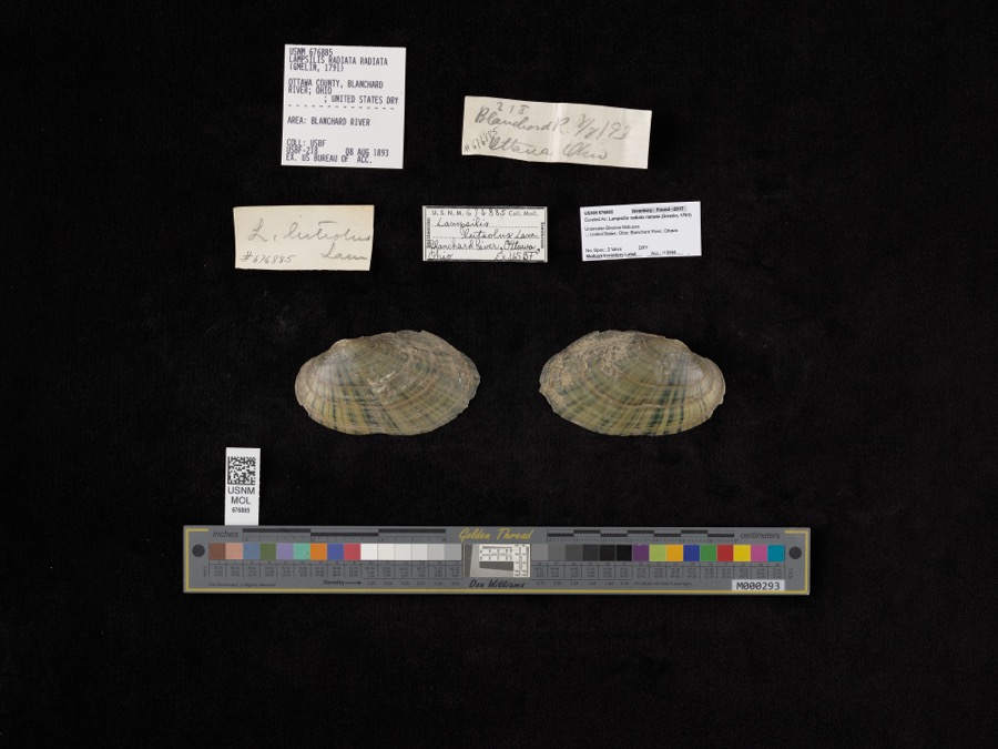
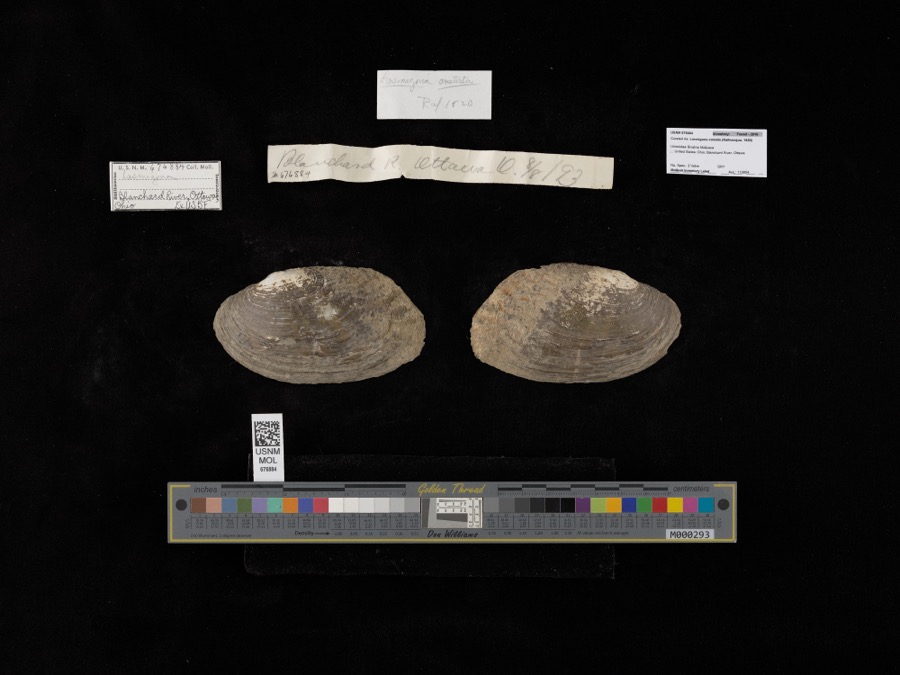
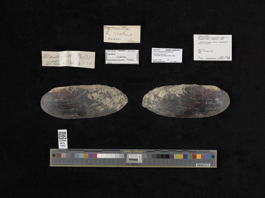
evidence. Museums hold 103 specimens
collected within 10 miles of Huber, Dr. H., Block between 1860 and
1969: 95 Animalia, 8 Plantae. 12 distinct Species records are shown.
Collected by Adler, K. K., Blyth & Katz, Bureau of Fisheries and others. Each is a
physical object with a catalogue
number, and each entry opens the museum's record. This is what was
collected and kept, not a survey of what lives here - nothing can be
concluded from a species being absent.
Regional context, not property-specific
evidence. The federal mineral resources record lists
3 workings within 5 miles of Huber, Dr. H., Block: 2 past producers, 1 producer.
1 still produces. What was taken out: Limestone, General, Stone, Crushed/Broken, Clay. Distance is straight-line from the
map coordinates, so a quarry counted here may appear on a neighbouring
settlement's page as well.
Regional context, not property-specific
evidence. The National Weather Service names
Ottawa, the town this property stands in, in 35 storm reports between 1993 and 2022: 18 thunderstorm wind, 13 hail, 3 flash flood, 1 dust devil.
The reports record 1 death. Each account below is quoted exactly as the forecast office
filed it, from the NOAA Storm Events Database, and each date
opens the federal record of that event.
Pictures and eyewitness reports confirmed a large dust devil developed on a clear and sunny day. This dust devil extended over 100 feet into the air as was easily visible. Local law enforceent officials did track the feature, with no damage being reported.
No historic map-sheet match is published
for this property yet. That does not mean no map exists. This record needs
a coordinate-quality review before it can be joined to a sheet boundary.
Browse the county's mapped places while that work is
pending.
From the nomination file
1,309 words on record
When this property was proposed for the
National Register, someone wrote the case for it: what the building is,
and why it matters. That document is a federal record in the public domain.
It is quoted below word for word, never summarised. The text was read off the scanned case file by machine, so the
occasional stray character is the recogniser's and the 1970s
typewriter's.
Description of the property
Check one X altered have glass display areas that are protected bya metal awning suspended by cables date from the first floor.Two storefronts with oblique recessed commercial entrances finials that extend from the brackets over the top of the cornice molding. drop labels.There are heavy paneled double doors that open onto an iron balcony This building is architecturally outstanding because of its formal balance frieze that is pierced by carved brackets.At the corners of the building are interior will be restored for a luxury lounge area,and a rear addition will 8.
Statement of significance
(in one paragraph) Columbus for over 75 years. X_1800-1899 of the Tax Reform Act of 1976. Li sculpture including a cafe or saloon, a grocery store, and a meat market. The second floor was Period art The new owners have chosen to protect the exterior appearance as they rehabilitate structures which were the envy of their associates.County seats like Ottawa business blocks with flat facades and parapeted cornices with name plates that photograph in the 1895 Atlas of Putnam County.It is unblemished from the recent .success due to the railroads, now invested great sums of money to construct enormous History of Putnam County, 1880. Atlas of Putnam County, 1895. Interview with Martha G. Huber, May, 1979. UTM NOT VERIFIED Quadrangle name - State . code 11.
Quoted from the National Register nomination
for reference 80003213, 10 pages, held by the National Archives in Record
Group 79. See the
catalogue record.
Listed places nearby
6 within 8 miles
Other National Register properties close
enough to walk or drive between, ordered by distance from this one. Both
positions come from the same geocoding pass that matched these properties
to their map sheets.
Listing record. National Park Service National Register of Historic Places, listed-properties dataset, current to 2026-05-22.
Map join. Address geocoded through the United States Census geocoder, then tested against the published boundary of every sheet in the USGS Historical Topographic Map Collection.
How this page is made. Listing fields come from federal records; map-sheet coverage is a labelled coordinate-to-boundary calculation, not a source-field claim.
Wildfire. Short, Karen C. 2022. Spatial wildfire occurrence data for the United States, 1992-2020 [FPA_FOD_20221014]. 6th Edition. Fort Collins, CO: Forest Service Research Data Archive. https://doi.org/10.2737/RDS-2013-0009.6 Collected with United States Government funding and usable without additional permissions or fees.
Specimens. Global Biodiversity Information Facility (GBIF), https://www.gbif.org/. Only records licensed CC0 or CC BY are used. Records licensed CC BY-NC are excluded because this site carries advertising. Images are checked individually and any whose licence is non-commercial, no-derivatives or unreadable is refused.
Mines and quarries. USGS Mineral Resources Data System (MRDS) https://mrdata.usgs.gov/mrds/ A work of the United States government, no copyright under 17 U.S.C. 105.
Storms. NOAA National Centers for Environmental Information, Storm Events Database https://www.ncei.noaa.gov/stormevents/ A work of the United States government, no copyright under 17 U.S.C. 105. Narratives are quoted verbatim from the National Weather Service report and are not edited or summarised.
 Block
Block