Listed on the National Register of Historic Places in
1977. A historic map-sheet match is not published yet. The record needs a coordinate-quality review before it can be joined to a sheet boundary.
From the record
one of 30 National Register listings in Warren County · listed in 1977 · category: Building.
National Register reference number.77001089- the number the National Park Service assigned this property when it was listed, and the key its nomination file is catalogued under at the National Archives.
Specimens collected near this property
12 of 1,548 shown
Regional context, not property-specific
evidence. Museums hold 1,548 specimens
collected within 10 miles of Harvey, Elizabeth, Free Negro School between 1844 and
1974: 1,470 Animalia, 47 Fungi, 15 Plantae, 14 Unrecorded, 2 Protozoa. 12 distinct Species records are shown.
Collected by A. R. Gaufin, A.R. Gaufin, H.H. Ross, ANSEL JOHN and others. Each is a
physical object with a catalogue
number, and each entry opens the museum's record. This is what was
collected and kept, not a survey of what lives here - nothing can be
concluded from a species being absent.
Regional context, not property-specific
evidence. The federal mineral resources record lists
2 workings within 5 miles of Harvey, Elizabeth, Free Negro School: 1 plant, 1 producer.
All of them still produce. What was taken out: Sand and Gravel, Construction. Distance is straight-line from the
map coordinates, so a quarry counted here may appear on a neighbouring
settlement's page as well.
Regional context, not property-specific
evidence. The National Weather Service names
Harveysburg, the town this property stands in, in 13 storm reports between 1998 and 2025: 10 thunderstorm wind, 1 hail, 1 tornado, 1 flood.
No death or injury is recorded in these reports. Each account below is quoted exactly as the forecast office
filed it, from the NOAA Storm Events Database, and each date
opens the federal record of that event.
Major structural damage was done to the city maintenance building and three homes. Numerous large trees were also downed across the village. Possibly a microburst.
Based on radar data, video evidence and eyewitness reports, a tornado appeared to briefly touch down about 4 miles NNE of Harveysburg in extreme northeast Warren County. No damage was observed so the maximum winds were estimated to be 50 mph, equivalent to a weak EF0 tornado.
No historic map-sheet match is published
for this property yet. That does not mean no map exists. This record needs
a coordinate-quality review before it can be joined to a sheet boundary.
Browse the county's mapped places while that work is
pending.
From the nomination file
1,323 words on record
When this property was proposed for the
National Register, someone wrote the case for it: what the building is,
and why it matters. That document is a federal record in the public domain.
It is quoted below word for word, never summarised. The text was read off the scanned case file by machine, so the
occasional stray character is the recogniser's and the 1970s
typewriter's.
Description of the property
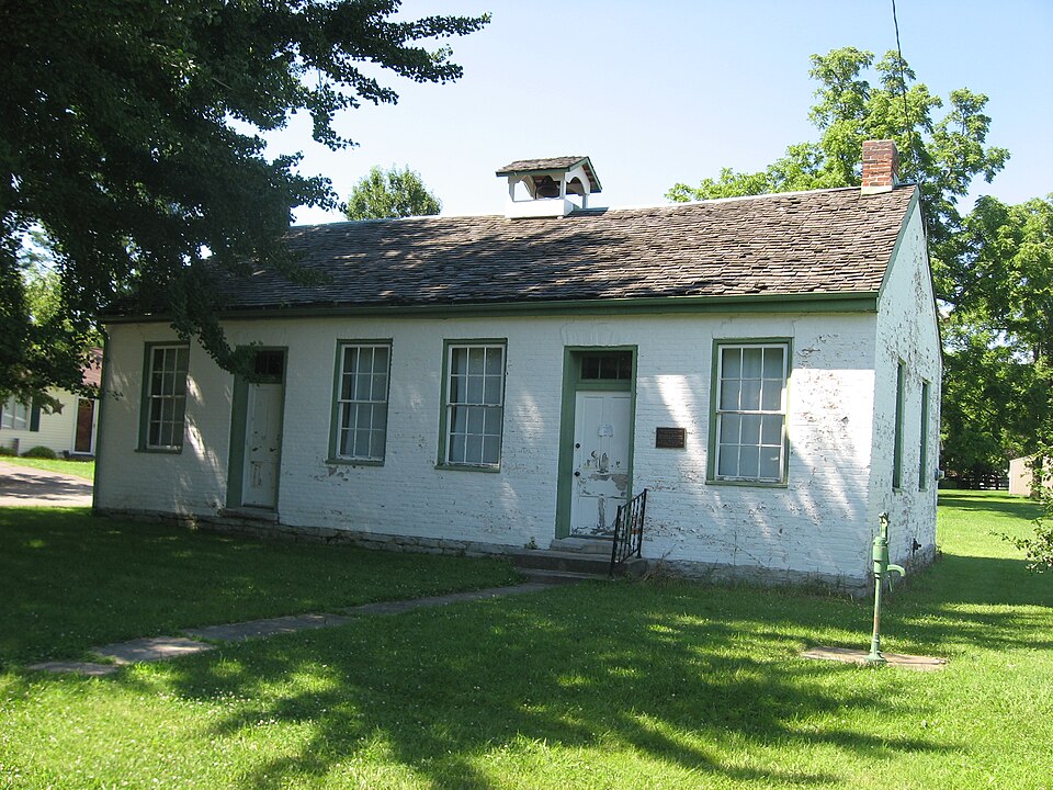
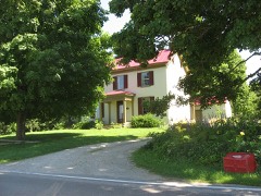
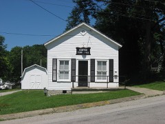
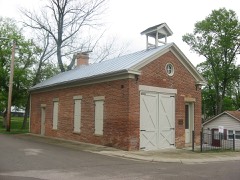
The second bay from each end has a plain doorway with brick headers. The remaining bays have 6/6 light windows. Windows and doors are framed with There is a stone foundation. right of center. There is a two bay, shed roofed addition across the eastern bays at the rear of the building. The gable roof is covered with asbestos painted with several coats of paint which is now peeling. The house, which CONDITION DESCRIPTION DATE XGOOD FAIR The west end has no openings.The east end has one window which is placed just CHECK ONE _EXCELLENT was built ca.1831,sits approximately 25' from the road. - UNEXPOSED - UNALTERED - MOVED X ALTERED The one-story, painted brick building faces south. The facade has six bays. _RUINS AREAS OF
Statement of significance
This simple structure is nominated for its importance as one of the earliest first, but this statement is contradicted in other histories of the education Between 1829 and 1840 several organizations opened private schools for the was one of the earliest. In the book Ohio Builds a Nation the author reports that this school in of the history of Warren County reports the same. Although it is doubted that this was the first school, it is known that the school was opened Harvey who laid out the town of Harveysburg in 1827. Another brother, Simon, was also an original settler in the town. They were the children of Issac Harvey of North Carolina.
Isaac came with his children to Ohio Ohio schools by the law enacted in 1829 could not admit Negroes, Elizabeth Public law establishing free schools for all children in Ohio was not Southern Ohio was particularly divided by the slavery question and it was here that most of these "free" schools were founded around the period of to use is as a museum for the Negro in Warren County.
1500-1599 1831 PERIOD ARCHEOLOGY-HISTORIC SIGNIFICANCE LAW AGRICULTURE BUILDER/ARCHITECT SCIENCE TRANSPORTATION ARCHITECTURE RELIGION MILITARY LITERATURE ARCHEOLOGY-PREHISTORIC THEATER _POLITICS/GOVERNMENT INDUSTRY _EXPLORATION/SETTLEMENT _COMMUNICATIONS X_SOCIAL/HUMANITARIAN _PHILOSOPHY _ECONOMICS were established by philanthropic men and women.It was during this period _CONSERVATION greatest anti-slavery excitement in 1835. _ENGINEERING documentedschools for Negroes in Ohio.Some references document it as The The Harveysburg Bicentennial Commission hopes to purchase the building and Enoch Harlon.She died in 1875 at age 83.The school served as a district -1600-1699 -1800-1899 X_EDUCATION school for Warren County and employed two teachers.
-1400-1499 -1700-1799 -1900- - MUSIC ART law was repealed and rewritten in 1829 to specifically exclude Negroes. Negro - most of these in southern Ohio.
Quoted from the National Register nomination
for reference 77001089, 11 pages, held by the National Archives in Record
Group 79. See the
catalogue record.
Listed places nearby
5 within 8 miles
Other National Register properties close
enough to walk or drive between, ordered by distance from this one. Both
positions come from the same geocoding pass that matched these properties
to their map sheets.
Listing record. National Park Service National Register of Historic Places, listed-properties dataset, current to 2026-05-22.
Map join. Address geocoded through the United States Census geocoder, then tested against the published boundary of every sheet in the USGS Historical Topographic Map Collection.
How this page is made. Listing fields come from federal records; map-sheet coverage is a labelled coordinate-to-boundary calculation, not a source-field claim.
Specimens. Global Biodiversity Information Facility (GBIF), https://www.gbif.org/. Only records licensed CC0 or CC BY are used. Records licensed CC BY-NC are excluded because this site carries advertising. Images are checked individually and any whose licence is non-commercial, no-derivatives or unreadable is refused.
Mines and quarries. USGS Mineral Resources Data System (MRDS) https://mrdata.usgs.gov/mrds/ A work of the United States government, no copyright under 17 U.S.C. 105.
Storms. NOAA National Centers for Environmental Information, Storm Events Database https://www.ncei.noaa.gov/stormevents/ A work of the United States government, no copyright under 17 U.S.C. 105. Narratives are quoted verbatim from the National Weather Service report and are not edited or summarised.
 Block
Block