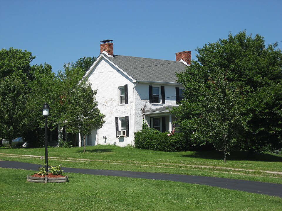
Listed on the National Register of Historic Places in
1978. A historic map-sheet match is not published yet. The record needs a coordinate-quality review before it can be joined to a sheet boundary.
From the record
one of 30 National Register listings in Warren County · listed in 1978 · category: Building.
National Register reference number.78002203- the number the National Park Service assigned this property when it was listed, and the key its nomination file is catalogued under at the National Archives.
Specimens collected near this property
12 of 480 shown
Regional context, not property-specific
evidence. Museums hold 480 specimens
collected within 10 miles of Hatton Farm between 1844 and
1973: 406 Animalia, 43 Fungi, 15 Plantae, 14 Unrecorded, 2 Protozoa. 12 distinct Species records are shown.
Collected by A. R. Gaufin, A.R. Gaufin, H.H. Ross, ANSEL JOHN and others. Each is a
physical object with a catalogue
number, and each entry opens the museum's record. This is what was
collected and kept, not a survey of what lives here - nothing can be
concluded from a species being absent.
Regional context, not property-specific
evidence. The federal mineral resources record lists
2 workings within 5 miles of Hatton Farm: 1 plant, 1 producer.
All of them still produce. What was taken out: Sand and Gravel, Construction. Distance is straight-line from the
map coordinates, so a quarry counted here may appear on a neighbouring
settlement's page as well.
Regional context, not property-specific
evidence. The National Weather Service names
Harveysburg, the town this property stands in, in 13 storm reports between 1998 and 2025: 10 thunderstorm wind, 1 hail, 1 tornado, 1 flood.
No death or injury is recorded in these reports. Each account below is quoted exactly as the forecast office
filed it, from the NOAA Storm Events Database, and each date
opens the federal record of that event.
Major structural damage was done to the city maintenance building and three homes. Numerous large trees were also downed across the village. Possibly a microburst.
Based on radar data, video evidence and eyewitness reports, a tornado appeared to briefly touch down about 4 miles NNE of Harveysburg in extreme northeast Warren County. No damage was observed so the maximum winds were estimated to be 50 mph, equivalent to a weak EF0 tornado.
No historic map-sheet match is published
for this property yet. That does not mean no map exists. This record needs
a coordinate-quality review before it can be joined to a sheet boundary.
Browse the county's mapped places while that work is
pending.
From the nomination file
1,741 words on record
When this property was proposed for the
National Register, someone wrote the case for it: what the building is,
and why it matters. That document is a federal record in the public domain.
It is quoted below word for word, never summarised. The text was read off the scanned case file by machine, so the
occasional stray character is the recogniser's and the 1970s
typewriter's.
Description of the property
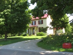
light windows with plain surrounds, capped by brick headers. Upper story windows are 6/6 light also, but of smaller proportions. The entrance has a plain of the lower story windows being 9/6 lights. High in the gable there are across the front of this addition. The roof of the addition and porch is covered with standing seam metal. The house is little altered since 1833. There is still no central heat or running corner to the upper floor. A closet is under the stairwell. All of the original iron hardware is intact including door latches and hinges. Upstairs there is a large landing with entrances to three bedrooms. One of these UNEXPOSED CONDITION EXCELLENT posts with plain capitals.The entablature and pediment are unornamented. large unfinished room.
CHECK ONE _DETERIORATED - MOVEDDATE The 2-1/2 story rectangular building of brick rests on a stone foundation.The rooms has a corner fireplace.A closed stairway leads tothe attic which isa three bay facade is almost austere. To either side of the center entrance are 6/6 gable roofed frame addition housing a kitchen and pantry. There is a porch The gable ends have windows similar to those of the facade with the exception is a large fireplace in the biggest room and two corner fireplaces in the two DATE water. and is covered with asbestos shingles.On the east end is a small one-story - RUINS AREAS OF
Statement of significance
Ohio where there are relatively few good examples of the style. This section Hatton farm land has been sold off. The house, though maintained over the years, has had few improvements. Levi Lukens came to Warren County in 1807 where he bought 1000 acres of land.
When his eldest daughter Rachel married Edward Hatton, Levi gave It is believed that Joseph Lukens, Rachel's brother, and Edward Hatton helped new location the road right-of-way comes to within approximately 35 feet of The house 1833 ARCHEOLOGY-HISTORIC RELIGION ECONOMICS ENGINEERING AGRICULTURE COMMUNICATIONS BUILDER/ARCHITECT LAW SIGNIFICANCE SCIENCE PERIOD ARCHEOLOGY-PREHISTORIC PREHISTORIC ART XARCHITECTURE 1900- INDUSTRY MUSIC _POLITICS/GOVERNMENT _TRANSPORTATION _EXPLORATION/SETTLEMENT _PHILOSOPHY LITERATURE George Washington during the Revolutionary War.
_SOCIAL/HUMANITARIAN -1400-1499 The house is a fine example of a restrained Greek revival mode in southern _EDUCATION _THEATER _SCULPTURE of Engineers the relocation of State Route 73 has been necessary.In its her 100 acres of good farm 1and.In the year 1833,the house was built. Hatton was the son of Robert Hatton who had served as private secretary to - MILITARY - 1700-1799 With the establishment of the Caesars Creek Reservoir by the U.S. Army Corps each other build their homes.Lukens home was on an adjoining farm.Edward x1800-1899 - INVENTION History of Warren County, Ohio. 1882. Tax records, Auditors Office, Warren County Courthouse Recorders Office, Warren County Courthouse Museum Files, Warren County Historical Society 10
Quoted from the National Register nomination
for reference 78002203, 14 pages, held by the National Archives in Record
Group 79. See the
catalogue record.
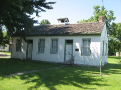
Listed places nearby
5 within 8 miles
Other National Register properties close
enough to walk or drive between, ordered by distance from this one. Both
positions come from the same geocoding pass that matched these properties
to their map sheets.
Listing record. National Park Service National Register of Historic Places, listed-properties dataset, current to 2026-05-22.
Map join. Address geocoded through the United States Census geocoder, then tested against the published boundary of every sheet in the USGS Historical Topographic Map Collection.
How this page is made. Listing fields come from federal records; map-sheet coverage is a labelled coordinate-to-boundary calculation, not a source-field claim.
Specimens. Global Biodiversity Information Facility (GBIF), https://www.gbif.org/. Only records licensed CC0 or CC BY are used. Records licensed CC BY-NC are excluded because this site carries advertising. Images are checked individually and any whose licence is non-commercial, no-derivatives or unreadable is refused.
Mines and quarries. USGS Mineral Resources Data System (MRDS) https://mrdata.usgs.gov/mrds/ A work of the United States government, no copyright under 17 U.S.C. 105.
Storms. NOAA National Centers for Environmental Information, Storm Events Database https://www.ncei.noaa.gov/stormevents/ A work of the United States government, no copyright under 17 U.S.C. 105. Narratives are quoted verbatim from the National Weather Service report and are not edited or summarised.
 Block
Block