BlockBefore
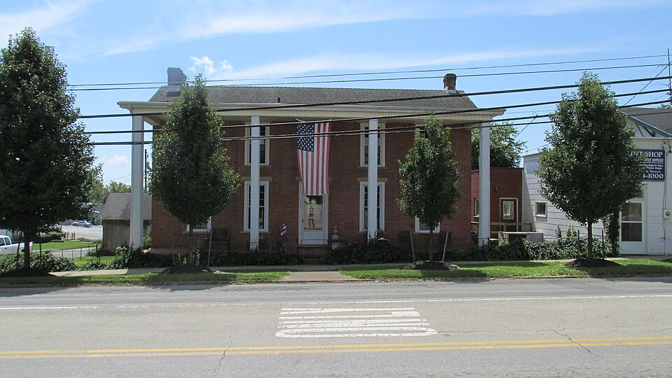
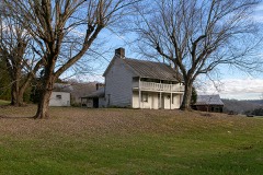
Photograph of Cockerill House
Photograph by Aesopposea, CC BY-SA 3.0. Via Wikimedia Commons.

Cockerill House

Listed on the National Register of Historic Places in 1978. A historic map-sheet match is not published yet. The record needs a coordinate-quality review before it can be joined to a sheet boundary.

From the record

“Parti*'an politics and its debauching influences caused the killing of Samuel Greenlee by Albert Adamson on the day following the presidential election in 1888. West Union was crowded with Republicans rejoicing over Harrison's election, and Samuel Greenlee, who had recently before joined their organization, and who had been drinking heavily for some days, was among the joUifiers.”

History of Adams County, Ohio (1900). Machine-read text.

one of 12 National Register listings in Adams County · listed in 1978 · category: Building.

Sources: the county history on the Internet Archive · the case file at the National Archives · the National Register database, National Park Service

The listing

  • What is counted as historic. The nomination lists 1 building as contributing to the listing.
  • Address. 115 E. Main St., West Union, 45693
  • When was it listed? 1978-11-21
  • Category. building
  • Township. Tiffin township
  • Architectural style. Federal architecture
  • National Register reference number. 78001998 - the number the National Park Service assigned this property when it was listed, and the key its nomination file is catalogued under at the National Archives.

The ground it stands on

7,452 words

The chapter on Tiffin Township in History of Adams County, Ohio, published 1900 names West Union. This is what it says, exactly as the scans read.

Joseph Eyler built the first cabin in this township where he afterwards made his home near Killinstown, in the winter of 1795. The Eyler farm of 300 acres is now owned by John Crawford, Samuel Mc- Feeters and Sandy Craigmile. When Rev. James B. Fintey passed over Tod's Trace from Limestone to Chillicothe with his father's cattle and "niggers" in 1796, he noted the fact that there was a cabin near where the town of West Union now stands, built by Mr. Oiler, but no one lived in - it. Daniel Collier, about this time, selected a site for his future home on one of the most beautiful terraces along Ohio Brush Creek, known to this day as the "Collier farm." Just below him on the creek was Duncan McKenzie. Andrew Ellison took up his residence on Lick Fork near the old stone house which he built in 1798, where the town of Waterford was laid out. Richard Harrison about the same time located at Waterford and kept a tavern there. John Treber built a cabin in 1796 a half mile further down Lick Fork where the old tavern building yet stands, and Peter Shoemaker, Simon Shoemaker, John Shepherd, and Thomas Davis located near by on Ohio Brush Creek. Job Dinning, John Killin, Jacob Piatt, James Ralston, and Adam Hempleman located in the vicinity of Killinstown. Simon Fields settled further east on Brush Creek. George Harper, James Collins, James January and Robert Mc- Clanahan located near West Union.

Passage source: History of Adams County, Ohio, published 1900.

Ohio Brush Creek, a beautiful little river, forms the northeastern and eastern boundary of the township. Lick Fork is its longest tributary in the township. It rises at a spring near West Union and flows north- east uniting with Ohio Brush Creek at the Sproull bridge. Beasley's Fork also takes its source from a spring in West Union, flows southeast and unites with Ohio Brush Creek opposite the Nathan Foster farm in Greene Township. A branch of the East Fork of Eagle Creek rises in the western part of the township and flows south along its western border.

Passage source: History of Adams County, Ohio, published 1900.

Machine-read from a century-old scan, so expect the errors a machine makes: misspelled names, dropped words, stray characters.

Read the whole chapter on Tiffin Township - 7,452 words on its settlement, mills, schools and churches.

Fires near this property

34 since 2003

Regional context, not property-specific evidence. The federal wildfire occurrence database lists 34 fires within 5 miles of Cockerill House between 2003 and 2020, burning about 43 acres in total. None started naturally. 12 were recorded as arson. Distance is straight-line from the map coordinates, so a fire counted here may appear on a neighbouring settlement's page as well.

Reported cause Fires
Debris and open burning16
Arson/incendiarism12
Missing data/not specified/undetermined3
Misuse of fire by a minor1
Power generation/transmission/distribution1
Smoking1

The most recent of them, most recent first, with the day each was reported and the service that recorded it.

DateCause SizeReported by Name on the report
10 September 2019Debris and open burningunder an acreOhio Department of Natural Resources15287
1 July 2017Smokingunder an acreOhio Department of Natural Resources8465
7 May 2008Arson/incendiarismunder an acreOhio Department of Natural Resourcesnot named
1 May 2019Missing data/not specified/undeterminedunder an acreOhio Department of Natural Resources15184
1 May 2008Missing data/not specified/undetermined1.0 acresOhio Department of Natural Resourcesnot named
9 April 2004Arson/incendiarism3.0 acresOhio Department of Natural Resourcesnot named
8 April 2004Debris and open burning1.0 acresOhio Department of Natural Resourcesnot named
8 April 2004Arson/incendiarism3.0 acresOhio Department of Natural Resourcesnot named

Every fire recorded in Adams County

Specimens collected near this property

12 of 727 shown

Regional context, not property-specific evidence. Museums hold 727 specimens collected within 10 miles of Cockerill House between 1866 and 1975: 407 Animalia, 205 Fungi, 97 Plantae, 18 Protozoa. 12 distinct Species records are shown. Collected by A JOHN, A. B. Seymour, A. Cronquist and others. Each is a physical object with a catalogue number, and each entry opens the museum's record. This is what was collected and kept, not a survey of what lives here - nothing can be concluded from a species being absent.

Image SpeciesYear Collected by Where, as recorded
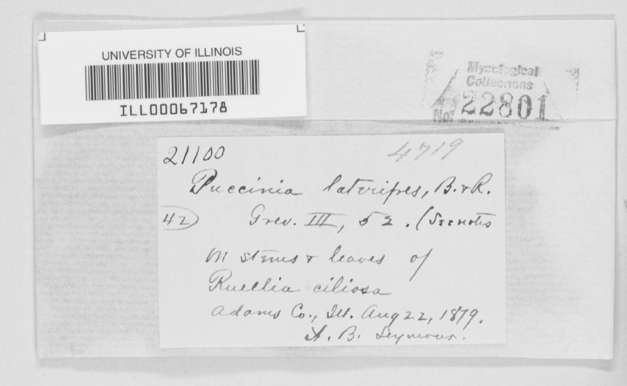
Specimen of Puccinia lateripes Berk. & RavenelPuccinia lateripes Berk. & Ravenel1879A. B. SeymourAdams County
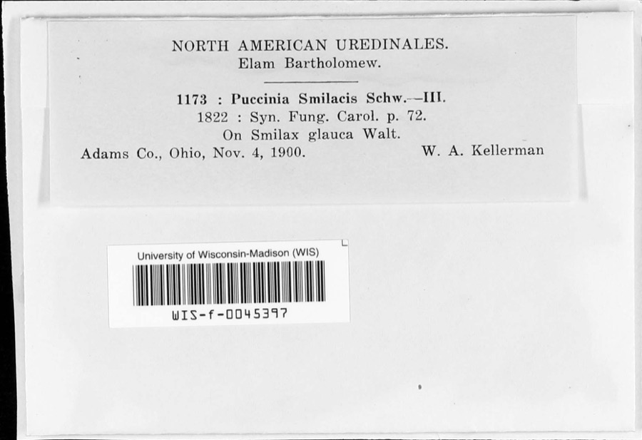
Specimen of Puccinia smilacis Schwein.Puccinia smilacis Schwein.1900W.A. Kellerman
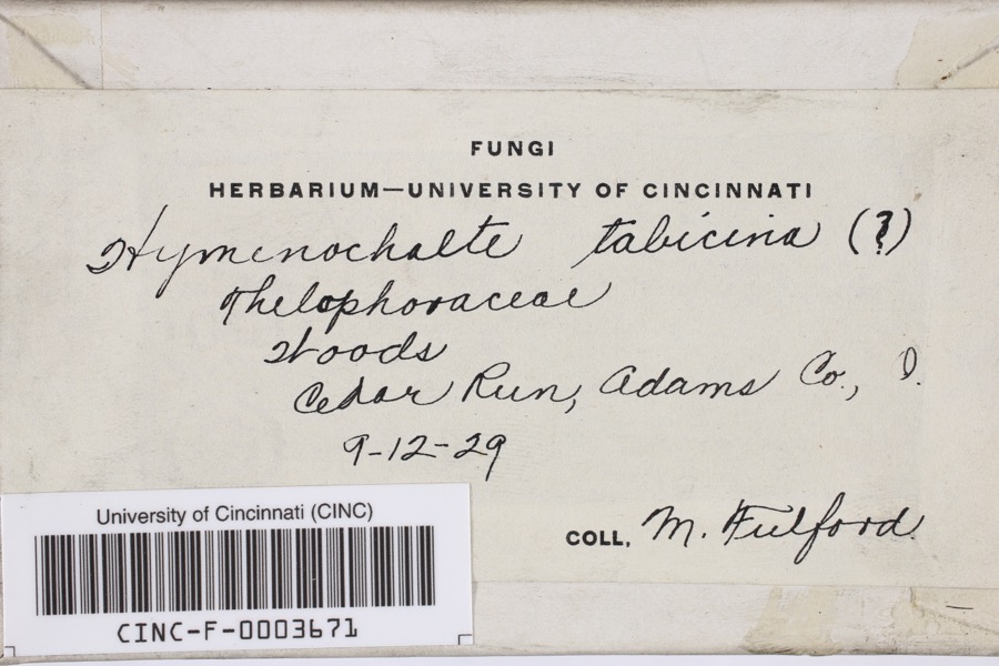
Specimen of Hymenochaete tabacina (Sowerby) Lév.Hymenochaete tabacina (Sowerby) Lév.1929Fulford, Margaret H.Cedar Run
A photograph of the species Asplenium ruta-muraria, not of this specimenAsplenium ruta-muraria L.1866C. B. Dyer
A photograph of the species Pleopeltis michauxiana, not of this specimenPleopeltis michauxiana (Weath.) Hickey & Sprunt1866C. B. Dyer
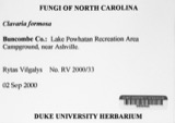
A photograph of the species Clavaria formosa, not of this specimenClavaria formosa Pers.1913Fulford, Margaret H.Adams County, Ohio
A photograph of the species Craterellus Pers., not of this specimenCraterellus Pers.1913Braun, E. LucyAdams County, Ohio
A photograph of the species Acroneuria frisoni, not of this specimenAcroneuria frisoni Stark & Brown, 19911925Clarence H. Kennedy
Scapania undulata (L.) Dumort.1925E. L. BraunWest tributary of Beech Fork
Crotalus horridus horridus1926Watters, G. T. (George Thomas)Green Twp.: Long Lick Run, Adams Co., Ohio
A photograph of the species Alosa chrysochloris, not of this specimenAlosa chrysochloris (Rafinesque, 1820)1927Trautman, M. B. (Milton Bernard)Ohio Brush Creek, within Adams Co, Adams County, township n/a
A photograph of the species Asplenium cryptolepis, not of this specimenAsplenium cryptolepis Fernald1927Braun, E. LucyBuzzard's Roost Rock

All 727 specimens within 10 miles, at the Global Biodiversity Information Facility.

Mines and quarries near this property

1 within 5 miles

Regional context, not property-specific evidence. The federal mineral resources record lists 1 working within 5 miles of Cockerill House: 1 producer. All of them still produce. What was taken out: Stone, Crushed/Broken. Distance is straight-line from the map coordinates, so a quarry counted here may appear on a neighbouring settlement's page as well.

Where SiteCommodity StatusRecorded
Ohio QuarryStone, Crushed/BrokenProducer

Every working recorded in Adams County

Storms near this property

60 of 70 shown

Regional context, not property-specific evidence. The National Weather Service names West Union, the town this property stands in, in 70 storm reports between 1995 and 2025: 32 thunderstorm wind, 15 hail, 11 flash flood, 8 flood. The reports record 1 death and 2 injuries. Each account below is quoted exactly as the forecast office filed it, from the NOAA Storm Events Database, and each date opens the federal record of that event.

WhenEvent Place namedHarm What the report says
March 2012Tornado (EF2)West Union1 killed, 2 hurt, $2,000,000The tornado touched down just east of Highway 41, about 2 miles northeast of West Union. The tornado then traveled east northeast for just over 11 miles, destroying at least 5 mobile homes. Two homes were also damaged. One of these homes was built of brick. A 99 year old woman was in her mobile home in Tiffin Township when the tornado struck. She was injured from this tornado and passed away several days later. Two others were also injured from this tornado. A dozen cattle were killed and major power transmission poles were knocked over. Numerous trees were snapped or uprooted. Based on the damage surveyed, the maximum estimated wind speed of this tornado was 125 miles per hour.
May 2014HailWest Union$200,000Damage occurred to houses and vehicles due to the hail.
November 2002Tornado (F1)West Union$100,000A tornado touched down and tracked east along State Route 125. The greatest damaged occurred at a farm where four barns were damaged, one of which was completely destroyed. Two nearby homes and a church sustained minor structural damage. At least three dozen trees were also downed along the path of the tornado.
August 1997Tornado (F0)West Union$100,000This thunderstorm had a long line of downbursts which caused damage to numerous trees, some of which fell on a house and a mobile home. Embedded within this path of damage was evidence that a tornado made brief touchdowns. In two different areas, tree damage showed twisting motion indicating that a tornado existed. Also, one home was knocked off its foundation in one of the areas where the tornado touched down. Winds from some of the downburst activity were near 100 mph.
May 2014Thunderstorm WindWest Union$50,000Several trees were downed near State Route 125 and Ralston Road due to thunderstorm winds. Numerous trees and power lines were also downed between West Union and Blue Creek.
May 1996Thunderstorm WindWest Union$50,000no account filed
April 1999Thunderstorm WindWest Union$30,000Damage was noted to several trees as well as a mobile home.
August 1999Thunderstorm WindWest Union$15,000Trees and power lines downed. One tree fell on a house causing damage.
July 2023Thunderstorm WindWest Union$10,000Several trees and power lines were downed in the West Union area.
July 2022Thunderstorm WindWest Union$10,000A pole was snapped in half and wires were downed onto a roadway.
May 2014HailWest Union$10,000Siding was damaged and windows were broken on Vaughn Ridge Road due to the hail.
July 2012Thunderstorm WindWest Union$10,000Numerous trees were downed from Manchester to West Union due to thunderstorm winds.
June 2008Thunderstorm WindWest Union$10,000Several trees were knocked down. One structure sustained roof damage.
May 2001Flash FloodWest Union$10,000Many roads were flooded and some were closed due to heavy rainfall.
August 2000Flash FloodWest Union$10,000Heavy rainfall caused a road to be washed out.
August 2021Thunderstorm WindWest Union$8,000A few power poles were blown down.
April 2025Thunderstorm WindWest Union$6,000Several power poles were downed.
May 1995Thunderstorm WindWest Union$6,000Trees were downed, one on an automobile. Warren County Springboro,14,0033EST,,,0,0,0,0,Hail (0.75)
May 2024Thunderstorm WindWest Union$5,000Several trees were downed in the West Union area.
June 2022Thunderstorm WindWest Union$5,000Several trees were downed.
July 2016Flash FloodWest Union$5,000Several roads were covered with rushing water across central Adams County. One house had a few feet of water in the basement.
June 2010Thunderstorm WindWest Union$5,000A tree fell onto a house. There were also reports of other trees down around the area.
January 2008Flash FloodWest Union$5,000The Eddies Apartment complex in West Union was evacuated due to rising water. One vehicle was stranded in the high water.
June 2008Flash FloodWest Union$5,000Several roads were flooded and closed with one to two feet of water rushing over them, including State Route 41 between State Route 136 and Panhandle Road. Numerous streams were out of their banks and overflowing roadways.
June 2002Thunderstorm WindWest Union$5,000Several trees were downed across the southern part of the county.
February 2000Flash FloodWest Union$5,000Heavy rainfall caused State Route 41 southwest of West Union to flood.
August 2020Thunderstorm WindWest Union$4,000Numerous trees were reported knocked down.
January 2008Thunderstorm WindWest Union$4,000Numerous trees were knocked down, including along old State Route 32 and Mineral Springs Road.
June 2020Thunderstorm WindWest Union$3,000Several trees were knocked down and were blocking the intersection of OH-125 between Raiston Rd and Frank Young Rd.
July 2018Thunderstorm WindWest Union$3,000A roof to a house was damaged and a billboard along State Route 41 was also damaged.
May 2018Thunderstorm WindWest Union$3,000Several trees were downed.
May 2010Flash FloodWest Union$3,000Flooded roadways were reported throughout the county.
July 2007Thunderstorm WindWest Union$3,000Trees were knocked down along Bethany Ridge Road.
August 2007Thunderstorm WindWest Union$3,000A few trees were downed.
August 2003Thunderstorm WindWest Union$3,000Several trees were downed along State Route 136.
October 2001Thunderstorm WindWest Union$3,000Four trees were knocked down in the southern part of the county.
June 1998Thunderstorm WindWest Union$3,000Trees and power lines downed.
August 1996Thunderstorm WindWest Union$3,000no account filed
May 2011FloodWest Union$2,000Multiple roads were closed due to water on roads.
May 2010Thunderstorm WindWest Union$2,000Numerous trees were reported down due to damaging thunderstorm winds.
June 2009Thunderstorm WindWest Union$2,000Several trees were blown down.
August 2007HailWest Union$2,000no account filed
September 2024Thunderstorm WindWest Union$1,000A tree was downed along Chapparal Road.
June 2019Thunderstorm WindWest Union$1,000A tree was knocked down along Old Cincinnati Pike near Wednell Shrivener Road.
October 2010Thunderstorm WindWest Union$1,000Large tree limbs were reported down due to damaging thunderstorm winds.
May 2022FloodWest Union-High water was reported on State Route 41, south of West Union.
May 2022FloodWest Union-Water was covering half of an apartment complex parking lot.
April 2021FloodWest Union-Water was flowing across Paige School Road.
April 2021FloodWest Union-Water was reported across State Route 247 near Chapparal Road.
August 2021Flash FloodWest Union-High water was reported on several roadways.
February 2019FloodWest Union-Several roads were closed due to flooding.
May 2016FloodWest Union-One to one and a half feet of water was covering Ohio Route 247 north of West Union.
December 2015Heavy RainWest Union-Multiple roads were closed across the county due to high water.
March 2006Flash FloodWest Union-Several roads were flooded and closed.
March 2006FloodWest Union-Heavy rain affected south central Ohio during the evening, with some locations receiving over one inch across Adams County. The heavy rain caused some high water over State Route 41 near Bentonville.
May 2003Flash FloodWest Union-Several roads were closed due to high water. Ohio Brush Creek was out of its banks in a couple of spots.
May 2003Flash FloodWest Union-State Route 41 was flooded and impassible.
June 1998Thunderstorm WindWest Union-Winds gusted to 60 mph.
August 2024HailWest Union-no account filed
July 2023HailWest Union-no account filed

Every storm recorded in Adams County

Newspapers printed here

0 digitised pages

1 paper published in this town, digitised by the Library of Congress and free to read: 0 issues, 0 pages. Every page is searchable, so a name or a street can be looked for directly in what the town printed about itself at the time.

NewspaperPublished
The People's Defender1866 to Current

Map coverage status

No historic map-sheet match is published for this property yet. That does not mean no map exists. This record needs a coordinate-quality review before it can be joined to a sheet boundary. Browse the county's mapped places while that work is pending.

From the nomination file

2,012 words on record

When this property was proposed for the National Register, someone wrote the case for it: what the building is, and why it matters. That document is a federal record in the public domain. It is quoted below word for word, never summarised. The text was read off the scanned case file by machine, so the occasional stray character is the recogniser's and the 1970s typewriter's.

Description of the property

size to those in the front, of the home. This window was partially bricked up in 1965 and DESCRIPTION CONDITION DETERIORATED weather-boarded. FAIR UNALTERED of the brick section originally had one window in the rear on the first floor equal in now visible is the second floor which has four single-sash windows.This side is now sash window matching the one on the east side was also installed on this side in 1965.

original brick house.The only portion of the original brick section on the south side four square wood columns representing "southern"influence.The east end of the brick home which made the new floor plan of the house rectangular.The east side of this frame CHECK ONE was built consisting ofa patio style brick floor and a two story high roof supported by The roof trim is wood and consists of boxed cornices with a plain frieze.The front of dow in the stone foundation with a flat brick arch with vertical joints..A small two- originally had a low gable roof of slate replaced in recent years by asbestos shingle.

with transom flanked on each side with two 2/2 windows on the first floor.All of these brick structure with a regular ashlar foundation.The brick is common bond and the home the home is five bays with five 2/2windows on the second floor and one central doorway installed in l965.This end also has a large chimney with a corbeled cap.

Read the complete 2,012-word case file.

Statement of significance

1600-1699 1500-1599 1400-1499 1700-1799 COMMERCE cont. Journalism RELIGION ENGINEERING COMMUNICATIONS EDUCATION ART INVENTION ARCHITECTURE POLITICS/GOVERNMENT THEATER TRANSPORTATION BUILDER/ARCHITECT PERIOD ARCHEOLOGY-HISTORIC SIGNIFICANCE INDUSTRY AGRICULTURE SCULPTURE LITERATURE SCIENCE Hamilton and Dayton, Ohio before accepting a reportorial position at the Cincinnati MUSIC promotion by Congress until after his resignation from the service.Cockerill's second St.

Louis Post-Dispatch, co-founder/editor of the Washington Post and editor of the SOCIAL/HUMANITARIAN Regiment.He displayed gallantry during the Battle of Shiloh and was recommended by Baltimore Gazette, New York World, New York Morning Advertiser, and the New York XMILITARY OTHER(SPECIFY) Colonel on the staff of Governor William Allen in l872.John then edited newspapers in and was a pioneer in the use of photographs in daily newspapers.Cockerill is also and lived in this home from l850 to 1868.After serving as a drummer in the Civil War Joseph R.

Cockerill Scion.In l863 he became part owner and editor of The Democratic Union also in West Enguirer.He later became editor of the Enquirer as well as co-founder/editor of the commissioned by Ohio Governor Todd in 186l as Colonel of the 70th Ohio Volunteer Infantry -PHILOSOPHY Union.He served as Journal Clerk in the Ohio Legislature from 1868 to 187l-and was X1900- COMMUNITY PLANNING Cockerill served in the Ohio House of Representatives in 1852-53 and 1868-72. He was credited as being one of the first syndicated newspaper columnists and originated the Generals Grant and Sherman for promotion to Brigadier General.He was not given this PREHISTORIC ARCHEOLUGY-PREHISTORIC in l862,John started a career in journalism setting type for the West Union Commercial Advertiser.

He was a special war correspondent for the New York Herald at the time of his death.John A. Cockerill is known as the "Father of the New Journalism XLAW

The whole case file for this property - 2,012 words, 14 pages, reproduced complete.

Quoted from the National Register nomination for reference 78001998, 14 pages, held by the National Archives in Record Group 79. See the catalogue record.

Listed places nearby

6 within 8 miles

Other National Register properties close enough to walk or drive between, ordered by distance from this one. Both positions come from the same geocoding pass that matched these properties to their map sheets.

Photograph PropertyDistance Listed
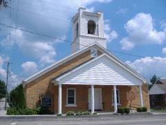
West Union Presbyterian Churchunder 500 feet1976
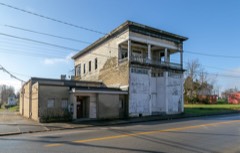
Woods, Tet, Building0.1 miles1982
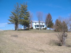
Kirker, Gov. Thomas, Homestead3.2 miles1975
Kirker Covered Bridge3.2 miles1975
Treber Inn4.9 miles1976
Buckeye Station6.1 miles1974

Sources for this property

National Archives recordThe nomination case file for reference 78001998 in Record Group 79.
Adams CountyAll 12 listed properties in this county.

Provenance

  • Listing record. National Park Service National Register of Historic Places, listed-properties dataset, current to 2026-05-22.
  • Map join. Address geocoded through the United States Census geocoder, then tested against the published boundary of every sheet in the USGS Historical Topographic Map Collection.
  • How this page is made. Listing fields come from federal records; map-sheet coverage is a labelled coordinate-to-boundary calculation, not a source-field claim.
  • Wildfire. Short, Karen C. 2022. Spatial wildfire occurrence data for the United States, 1992-2020 [FPA_FOD_20221014]. 6th Edition. Fort Collins, CO: Forest Service Research Data Archive. https://doi.org/10.2737/RDS-2013-0009.6 Collected with United States Government funding and usable without additional permissions or fees.
  • Specimens. Global Biodiversity Information Facility (GBIF), https://www.gbif.org/. Only records licensed CC0 or CC BY are used. Records licensed CC BY-NC are excluded because this site carries advertising. Images are checked individually and any whose licence is non-commercial, no-derivatives or unreadable is refused.
  • Mines and quarries. USGS Mineral Resources Data System (MRDS) https://mrdata.usgs.gov/mrds/ A work of the United States government, no copyright under 17 U.S.C. 105.
  • Storms. NOAA National Centers for Environmental Information, Storm Events Database https://www.ncei.noaa.gov/stormevents/ A work of the United States government, no copyright under 17 U.S.C. 105. Narratives are quoted verbatim from the National Weather Service report and are not edited or summarised.