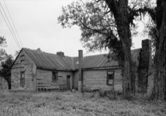
Listed on the National Register of Historic Places in
1975. A historic map-sheet match is not published yet. The record needs a coordinate-quality review before it can be joined to a sheet boundary.
From the record
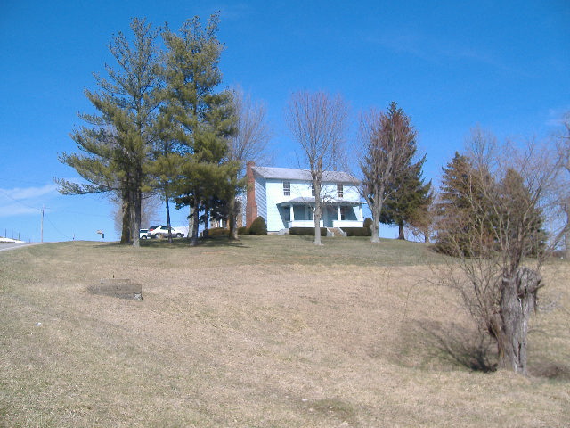
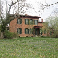
“Thomas Kirker Homestead, in Liberty Township, Adams County, Ohio near West Union, Ohio, was built in 1805. It was listed on the National Register of Historic Places in 1975.”
Wikipedia article Gov. Thomas Kirker Homestead, CC BY-SA 4.0.
one of 12 National Register listings in Adams County · listed in 1975 · category: Building.
National Register reference number.75001310- the number the National Park Service assigned this property when it was listed, and the key its nomination file is catalogued under at the National Archives.
Jons A. Cluxton. - The subject of this sketch is of Irish descent. His paternal grandfather was a native of Ireland and grew to years of manhood, married and raised a family there. About 1798, he, with his wife and two children, emigrated to America, three of their children remaining in Ireland. He settled in New Jersey, where he died shortly afterwards, being suddenly stricken down with apoplexy or something of that nature, while working in the field. After Mr. Cluxton's death, the widowed mother with her two children, John and Betsy, removed to Penn., and settled near Connellstown, where she lived until they grew up and married. The daughter, Betsy, married William Phillips, and the son, John, married Nancy Page. These last were the parents of John A. Cluxton, whose name stands at the head of this article. Early in 1813, all these families consisting of mother Cluxton, her son John and wife, his wife's parents, Rev. William Page and family, and William Phillips, who had married Betsy, left Peun., in company and came to Adams county. Mr. Phillips settled near Brush creek, where he andh's wife both lived and died. They are buried in Stone chapel grave yard. With them also lived the grandmother Cluxton, 'Mrs. Phillip's mother), until her decease. This old farm is now owned by a son, John Phillips. Rev. William Page, the maternal grandfather of John A. Cluxton, settled on the farm now owned by Samuel McFeeters, near Killiustown. Here Mrs. Page died - . Page afterwards married a second wife, moved to Clermont where he died of a cancer. John Cluxton settled in We3t U uion, built a house near the M. E. church, and worked some years at shoemaking, then bought a farm near Xillingstown to which he moved. He finally removed to Bentonville, where he died in 1855, and was buried in the WesV Union grave yard. Mrs. Cluxton, after her husband's death, lived a widow twenty years. Her latter days were spent at her daughter's near Ripley, Brown county,' Ohio, where she died. She was buried in the West Union grave yard, where she now sleeps, beside her husband and three daughters. She was a faithful and devoted Christian, and in' early years united with the Methodist ehtirch in West Union, and when the family removed near Brush creek, she transferred her membership to the Stone Chapel che rob in i he neighborhood of he^hOlinn; Bnt no matter where her lot was cast, she was ever the samt?, tmassnming but faithful follower Of the meek and holy Savior. Mrs. Cluxton was a devoted laborer in the Sabbath School, and no doubt many in this community yet remember her pious teachings. Truly a good mother in Israel is gane - bnt her work go* on, and many remain to bless her memory. John and Nancy Clnxton were the parents of thirteen children : William, George, Rebecca, Grecnberry J., Angellne, John A., Qavis B., James R., Nancy Jane, Susan Thomas, Samuel P., Henry B. - Two of t'iew, Augeline and Susan died In early years. The othare are all living but Rebecca Greenbury and WilUttm. Rebecca married Rev. Jedlah Foster. 8h« died In West Uhlob, with colors in 1835. John H. the subject of oar sketch was born In 'West Union, May, 14,1825, and MhrOaUrertce M. Mosier, Nov. 18, 1847. He started in life under disadvantageous circumstances. He remalnod with Ins fattier until he was twenty-one years of ago, then commenced life on bis own account, working from spring until full the first two years at $9 a month, with no extra pay for harvest work. After bis marriage Mr. Cluxton rented land and farmed, but "diligence and perseverance will overcome difficulties as is proved in this case. He slowly and steadily gained in the world until he has now a good farm and pleasant and beautiful home of his own, surrounded with all the comforts of lifo. A view of his pretty house is shown in the pages of our book. He is also fortunate in being blessed with a good wife, to whoso aid and good counsels he attributes much of his success in life. Mr. Cluxton seems to bo a nature genius in all mechanical implements and is a skillful workman in almost every mechanic art. He is the inventor of a posthole digger that will excavate post-boles with an ease and facility . never attained before. HU most recent and the greatest invention of his life, and one that seems destined to surpass all previous efforts of the kind, is his pendulum drag-saw, by which log9 of any kind or size, from the saw or shingle trees of the forest to the fire or stove wood at the door ciin be cut. In short, it can do any work that the cross-cut saw will do, and with a speed and ease that has heretofore never been equaled. This invention is secured by patent. Mrs. Catherine M. Cluxton, daughter of Jacob Mosier, and wife of John A. Cluxton, .was born October 21, 1828, near Masontown, Fayette county Pa., Her ancestors were German. Her grandfather, Abraham Mosier, was probably born in Germany! His children were John, Abraham, George, and Julia Auu^Ckfherine Betsy, Mary and Nancy. Her father was born in Penn., in 1796. He married Elizabeth Newcomer. They came to Adams county at an early day and settled on the farm now owned by John A. Cluxton, in Liberty township, where they b.oth di'ed. Mr. Mosier died in 1841, Mrs. Mosier in 1864. They both lie buried in the Kirker grave yard. They were the parents of nine children, Abraham, Jacob, Mary John, Samuel, Catharine, Nancy, George and Elizabeth. The last two died iu infancy, the othor seven grew to years of maturity, are married ana all still living. Mrs. Cluxton's maternal grandparents were Jacob and Mary Newcomer. They raised a family of seven children, Elizabeth, Jacob, Uriah, Mary, John, Nancy and Martha, but trto of these, John and Martha, now survive, tho others are dead. One of these children, Elizabeth, 'married Jacob Mosier. They are the parents of Mrs. Cluxton.
It is said that Governor Thomas Kirker was the first settler, but it is more accurate to say he was among the first of the pioneers of this region. His cabin was erected on Zane's Trace on what is 'known as the old Kirker farm in the southeastern part of the township. James January came as early as 1796 and one year later opened a tavern on the Trace at the foot of the hill west of West Union on the Swearengen farm. About this date also came Needham Perry, Alexander Meharry, Richard Askren, John Mahaffey, Rev. Thomas Odell, David Robe, George Dillinger, Bezebel Gordon, Col. John Lodwick, Daniel Marlatt, James Wade and Joseph Wade. And later, James McGovney, John Stivers^Conrad Foster, and Lewis Coryell. These were mostly Revolutionary soldiers from Virginia, and to perpetuate among their descendants the memory of the cause for which they had struggled, the name Liberty was given to this township when formed. Land warrant number one issued to Richard Askren, was laid in this township.
Regional context, not property-specific
evidence. The
federal wildfire occurrence database
lists 37 fires within 5 miles of Kirker, Gov. Thomas, Homestead between
2003 and 2019, burning about 132 acres in total. None started naturally. 12 were recorded as arson.
Distance is straight-line from the map coordinates, so a fire counted
here may appear on a neighbouring settlement's page as well.
Reported cause
Fires
Debris and open burning
13
Arson/incendiarism
12
Missing data/not specified/undetermined
9
Smoking
1
Misuse of fire by a minor
1
Power generation/transmission/distribution
1
The most recent of
them, most recent first, with the day each was reported and the service
that recorded it.
Regional context, not property-specific
evidence. Museums hold 581 specimens
collected within 10 miles of Kirker, Gov. Thomas, Homestead between 1866 and
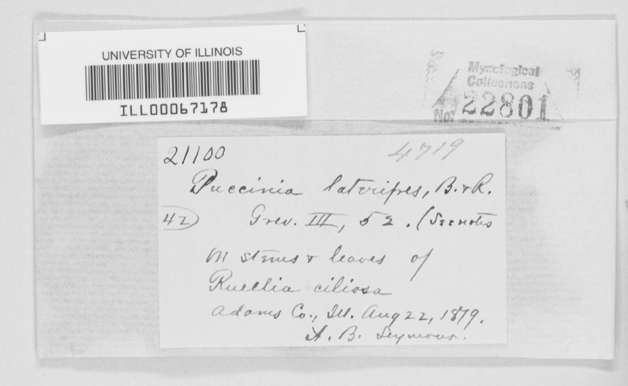
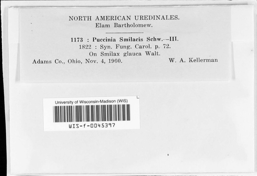
1975: 362 Animalia, 128 Fungi, 73 Plantae, 18 Protozoa. 12 distinct Species records are shown.
Collected by A JOHN, A. B. Seymour, A. Cronquist and others. Each is a
physical object with a catalogue
number, and each entry opens the museum's record. This is what was
collected and kept, not a survey of what lives here - nothing can be
concluded from a species being absent.
Regional context, not property-specific
evidence. The federal mineral resources record lists
1 working within 5 miles of Kirker, Gov. Thomas, Homestead: 1 producer.
All of them still produce. What was taken out: Stone, Crushed/Broken. Distance is straight-line from the
map coordinates, so a quarry counted here may appear on a neighbouring
settlement's page as well.
Regional context, not property-specific
evidence. The National Weather Service names
West Union, the town this property stands in, in 70 storm reports between 1995 and 2025: 32 thunderstorm wind, 15 hail, 11 flash flood, 8 flood.
The reports record 1 death and 2 injuries. Each account below is quoted exactly as the forecast office
filed it, from the NOAA Storm Events Database, and each date
opens the federal record of that event.
The tornado touched down just east of Highway 41, about 2 miles northeast of West Union. The tornado then traveled east northeast for just over 11 miles, destroying at least 5 mobile homes. Two homes were also damaged. One of these homes was built of brick. A 99 year old woman was in her mobile home in Tiffin Township when the tornado struck. She was injured from this tornado and passed away several days later. Two others were also injured from this tornado. A dozen cattle were killed and major power transmission poles were knocked over. Numerous trees were snapped or uprooted. Based on the damage surveyed, the maximum estimated wind speed of this tornado was 125 miles per hour.
A tornado touched down and tracked east along State Route 125. The greatest damaged occurred at a farm where four barns were damaged, one of which was completely destroyed. Two nearby homes and a church sustained minor structural damage. At least three dozen trees were also downed along the path of the tornado.
This thunderstorm had a long line of downbursts which caused damage to numerous trees, some of which fell on a house and a mobile home. Embedded within this path of damage was evidence that a tornado made brief touchdowns. In two different areas, tree damage showed twisting motion indicating that a tornado existed. Also, one home was knocked off its foundation in one of the areas where the tornado touched down. Winds from some of the downburst activity were near 100 mph.
Several trees were downed near State Route 125 and Ralston Road due to thunderstorm winds. Numerous trees and power lines were also downed between West Union and Blue Creek.
Several roads were flooded and closed with one to two feet of water rushing over them, including State Route 41 between State Route 136 and Panhandle Road. Numerous streams were out of their banks and overflowing roadways.
Heavy rain affected south central Ohio during the evening, with some locations receiving over one inch across Adams County. The heavy rain caused some high water over State Route 41 near Bentonville.
1 paper published in this town,
digitised by the Library of Congress and free to read: 0 issues,
0 pages. Every page is searchable, so a name or a street can be
looked for directly in what the town printed about itself at the time.
No historic map-sheet match is published
for this property yet. That does not mean no map exists. This record needs
a coordinate-quality review before it can be joined to a sheet boundary.
Browse the county's mapped places while that work is
pending.
From the nomination file
2,183 words on record
When this property was proposed for the
National Register, someone wrote the case for it: what the building is,
and why it matters. That document is a federal record in the public domain.
It is quoted below word for word, never summarised. The text was read off the scanned case file by machine, so the
occasional stray character is the recogniser's and the 1970s
typewriter's.
Description of the property
a 3 x 2 bay, 1-1/2 story structure made of local limestone and dolomite with All doors, floors, window frames and sashes, latches and doorknobs are has two small side-by-side 3/3 double sash windows on the single bay north Looking from left to right, the east side is three bays and has four the west side. This side also has two 6/6 double sash windows, one on the top has a large (8 ft. x 30 ft.) three bay porch (added at a later date) with only one window, a 6/6 double sash on the lower floor to the rear of the home. The doors, window frames and sashes, doorknobs, and floors of this section are CONDITION FAIR DESCRIPTION GOOD CHECK ONE hollow through which Zane's Trace meanders.
Shawnee at the Battle of Fallen Timbers, Kirker was the first to settle permanently 250 feet from Zane's Trace, which was blazed through Ohio in 1797. to the Ohio Constitutional Convention in 1802. After statehood, Kirker served in the Ohio House of Representatives from 3/1/1803 to 4/16/1803. He then served in the 12/15/1816 to 1/28/1817 serving as Speaker. He was again elected to the Ohio Senate George S. Kirker, youngest son of the governor, owned the home at that time.
George 1700-1799 ARCHEOLOGY-HISTORIC COMMERCE PERIOD BUILDER/ARCHITECT INVENTION ECONOMICS ENGINEERING PREHISTORIC PHILOSOPHY SIGNIFICANCE ARCHITECTURE EXPLORATION/SETTLEMENT XPOLITICS/GOVERNMENT ART AGRICULTURE THEATER MILITARY EDUCATION _CONSERVATION Kirker was a popular man and was elected as one of Adams County's three representatives MUSIC _TRANSPORTATION SPECIFIC DATES INDUSTRY The Kirker Homestead was visited in July 1863 by Confederate soldiers under the LITERATURE _COMMUNICATIONS find any as a result of the Kirkers being forewarned of the enemy's approach. Kirker died in 1837 and is buried within sight of his home in the Kirker Cemetery. after Governor Tiffin resigned that position on March 4,1807.
Kirker finished -1400-1499 _SCIENCE - RELIGION The Homestead has been in the Kirker family since 1805. December 1808 when the gubernatorial election between Nathanial Massie and Return J. and served from 12/3/1821 to 2/8/1825.He was a presidential elector in 1824.Governor Kentucky and in 1793 joined the small company of men and women at the fort at Massie's immigrated to Lancaster Co.,Penn. in 1779.In 1790 he moved with his new bride to Kirker served in the Civil War as Captain in the 14lst 0.V.I.
Quoted from the National Register nomination
for reference 75001310, 15 pages, held by the National Archives in Record
Group 79. See the
catalogue record.
Listed places nearby
6 within 8 miles
Other National Register properties close
enough to walk or drive between, ordered by distance from this one. Both
positions come from the same geocoding pass that matched these properties
to their map sheets.
Listing record. National Park Service National Register of Historic Places, listed-properties dataset, current to 2026-05-22.
Map join. Address geocoded through the United States Census geocoder, then tested against the published boundary of every sheet in the USGS Historical Topographic Map Collection.
How this page is made. Listing fields come from federal records; map-sheet coverage is a labelled coordinate-to-boundary calculation, not a source-field claim.
Wildfire. Short, Karen C. 2022. Spatial wildfire occurrence data for the United States, 1992-2020 [FPA_FOD_20221014]. 6th Edition. Fort Collins, CO: Forest Service Research Data Archive. https://doi.org/10.2737/RDS-2013-0009.6 Collected with United States Government funding and usable without additional permissions or fees.
Specimens. Global Biodiversity Information Facility (GBIF), https://www.gbif.org/. Only records licensed CC0 or CC BY are used. Records licensed CC BY-NC are excluded because this site carries advertising. Images are checked individually and any whose licence is non-commercial, no-derivatives or unreadable is refused.
Mines and quarries. USGS Mineral Resources Data System (MRDS) https://mrdata.usgs.gov/mrds/ A work of the United States government, no copyright under 17 U.S.C. 105.
Storms. NOAA National Centers for Environmental Information, Storm Events Database https://www.ncei.noaa.gov/stormevents/ A work of the United States government, no copyright under 17 U.S.C. 105. Narratives are quoted verbatim from the National Weather Service report and are not edited or summarised.
 Block
Block