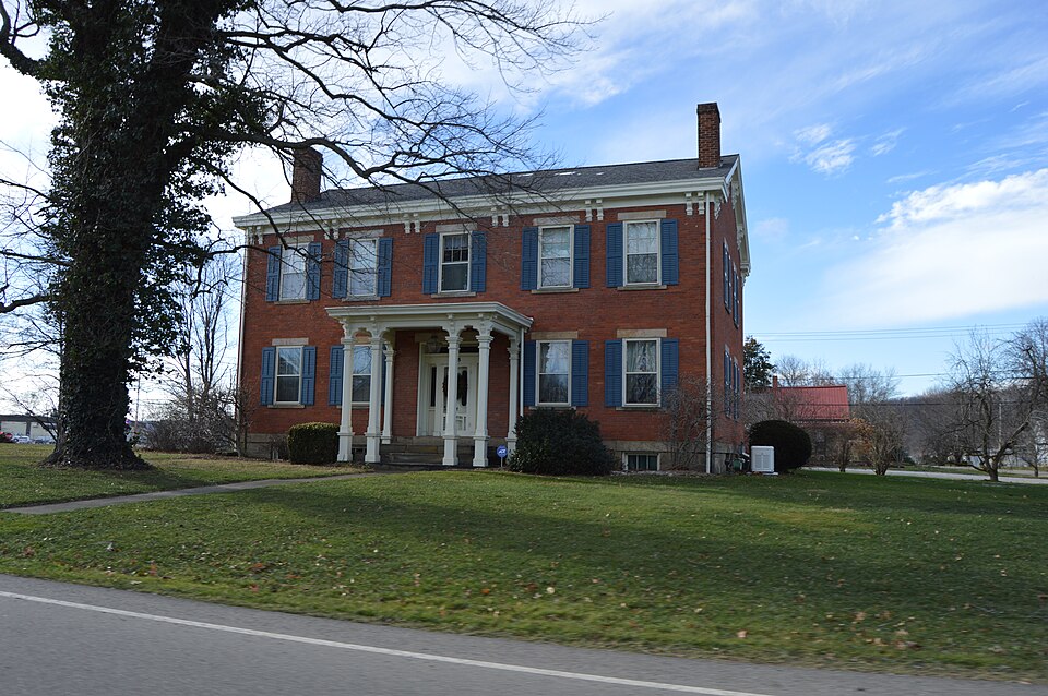
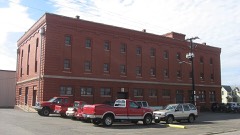
Listed on the National Register of Historic Places in
1984. A historic map-sheet match is not published yet. The record needs a coordinate-quality review before it can be joined to a sheet boundary.
From the record
“Canal Lewisville lies partly in Keene and partly in Tusjjarawas township. The dividing line passes diagonally through the plat, leaving the larger portion of it, and almost entirely the occupied part, in Tuscarawas township.”
History of Coshocton County, Ohio: Its Past and Present, 1740-1881. Containing a Comprehensive History of Ohio; a Complete History of Coshocton County ... a History of Its Soldiers in the Late War ... Biographies and Histories of Pioneer Families, Etc (1881). Machine-read text.
one of 16 National Register listings in Coshocton County · listed in 1984 · category: Building.
National Register reference number.84000125- the number the National Park Service assigned this property when it was listed, and the key its nomination file is catalogued under at the National Archives.
It would be a difficult matter to find another tract of equal extent with Tuscarawas township, in this portion of the State, that marks the site of so many and so varied scenes of Indian history. Many of these, unfortunately, have faded from the knowledge of men beyond recall. The earliest visitation of its territory by white men, of whom a record is preserved, was in the winter of 1751, when Christopher Gist, an agent of the Ohio company, remained a month in a village of the Wyandot's called in Hutchin's map, "Old Wyandot Town." It was situated on the Tuscarawas, several miles from the forks of that and the Walhonding rivers, in all probability at or near the site of Canal Lewisville. On Christmas day, 1751, Mr. Gist read the English service here, and delivered a discourse to the Indians, which was well received. The next day a woman, who had attempted to escape from captivity, and had been retaken, was put to death in a very cruel manner. Mr. Gist found here one Thomas Burney, a blacksmith, who had settled here. George Croghan, an English trader, afterward deputy Indian agent to Sir William Johnson, Andrew Montour, a half-breed, and other white men.
Canal Lewisville lies partly in Keene and partly in Tusjjarawas township. The dividing line passes diagonally through the plat, leaving the larger portion of it, and almost entirely the occupied part, in Tuscarawas township. It lies in the beautiful Tuscarawas valley, a short distance north of the river. The Ohio canal passes through the village, and gave rise to its location and growth. It was laid out by the county survej'or, James Ravenscraft, July 2, 1832, Solomon Vail and Thomas B Lewis being the proprietors. Their expectations of its rapid development were if the size of the plat be any indication. It contained 220 lots, besides a number of outlots. The village of Newport had been founded about two years previous, a half mile to the west, in Keene township. The road to Millersburg, then a principal thoroughfare, passed through Newport northward, but shortly before Lewisville was laid out, the road was altered and made to pass through the site of the future Lewisville, and this fact more than anything else, induced the proprietors to lay the foundation for a town. It was designed from the first to be a shipping point for grain, and for a number of years an immense business was done here in this line. Before the Cleveland and Mt. "Vernon road was built through Holmes county, it was customary for the farmers as far north- as Millersburg to haul their wheat to this place. The amount of grain transported from the three warehouses about 1847 was immensse.
Regional context, not property-specific
evidence. The
federal wildfire occurrence database
lists 22 fires within 5 miles of Lamberson-Markley Houses between
2007 and 2020, burning about 36 acres in total. None started naturally. None was recorded as arson.
Distance is straight-line from the map coordinates, so a fire counted
here may appear on a neighbouring settlement's page as well.
Reported cause
Fires
Debris and open burning
13
Missing data/not specified/undetermined
5
Smoking
2
Power generation/transmission/distribution
1
Recreation and ceremony
1
The most recent of
them, most recent first, with the day each was reported and the service
that recorded it.
Regional context, not property-specific
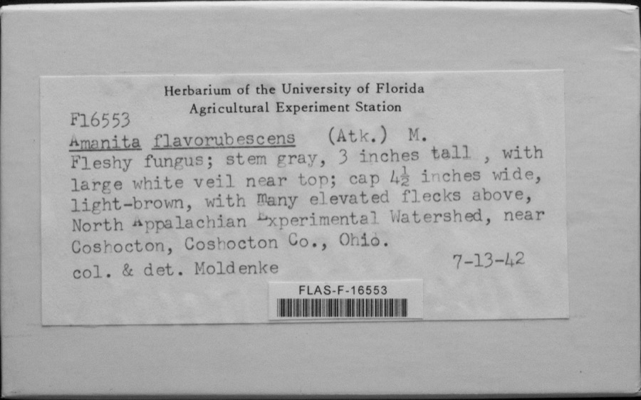
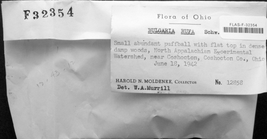
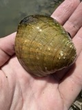
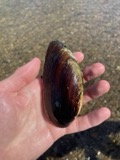
evidence. Museums hold 1,579 specimens
collected within 10 miles of Lamberson-Markley Houses between 1846 and
1974: 791 Animalia, 658 Plantae, 120 Fungi, 4 Bacteria, 4 Protozoa, 2 Unrecorded. 12 distinct Species records are shown.
Collected by A. D. Huryn, A. Spreitzer, Albaugh, W. F. and others. Each is a
physical object with a catalogue
number, and each entry opens the museum's record. This is what was
collected and kept, not a survey of what lives here - nothing can be
concluded from a species being absent.
Regional context, not property-specific
evidence. The federal mineral resources record lists
4 workings within 5 miles of Lamberson-Markley Houses: 2 past producers, 2 producers.
2 still produce. What was taken out: Sand and Gravel, Construction. Distance is straight-line from the
map coordinates, so a quarry counted here may appear on a neighbouring
settlement's page as well.
Regional context, not property-specific
evidence. The National Weather Service names
Canal Lewisville, the town this property stands in, in 4 storm reports between 2002 and 2019: 2 hail, 1 thunderstorm wind, 1 flash flood.
No death or injury is recorded in these reports. Each account below is quoted exactly as the forecast office
filed it, from the NOAA Storm Events Database, and each date
opens the federal record of that event.
No historic map-sheet match is published
for this property yet. That does not mean no map exists. This record needs
a coordinate-quality review before it can be joined to a sheet boundary.
Browse the county's mapped places while that work is
pending.
From the nomination file
1,903 words on record
When this property was proposed for the
National Register, someone wrote the case for it: what the building is,
and why it matters. That document is a federal record in the public domain.
It is quoted below word for word, never summarised. The text was read off the scanned case file by machine, so the
occasional stray character is the recogniser's and the 1970s
typewriter's.
Description of the property
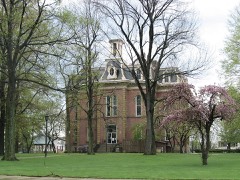
These two buildings stand on four lots which are contiguous and which remained in the about a central living room. That it has no upper floor is another indication of its later style and porches and a steeper roof were also added in the Queen Anne style. This nomination consists of a large brick residence and a smaller wood frame house which are located on fairly spacious grounds in the small rural community of Canal Lewisville. is present.More recent bathrooms and kitchen cabinets were added to the house.
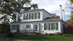
The frame residence dates from l842, the same year the main house was built.It was side outside wall.An unusually broad stairway rises from the hallway to a wide landing enlarged and modified into Mr.Markley's retirement home about 1890 and is now an recently been restored to highlight its Queen Anne character with new bathrooms anda kitchen. restored landmark buildings.A small frame garage dating to the 1930s is located between the gable roof,6-over-6windows and amain entrance with side and top lights.A robust wood -fair near the second floor where it returns to ascend the last few steps. It has an elaborate the front entrance. and very massive woodwork is present throughout the largely unchanged interiors. wise to the street.
It is five bays wide and is unusually broad, having four bays on the those which face the rear. The plan is repeated on the upstairs, except that a bathroom The frame house is I-shaped in planand its major rooms are on the first floor, clustered intended use as a retirement home for Mr. Markley. The house has two fireplaces which are ornamented by carved natural woodwork and glazed tiles.
(in one paragraph) The Markley House, which has a continuous and important historical association with the residence in 1842 and lived here for thirty years, when he moved to an Italianate style frame building, built at the same time as the main house, as a dry goods store, which he operated as a side business.
small house, it displays a high degree of ornament, reflecting Markley's status even Roscoe Village, which has many large and impressive brick commercial buildings, Canal 1842 1600-1699 1500-1599 1400-1499 1700-1799 commerce communications education economics transportation archeology-historic invention philosophy industry music architecture art engineering science Period theater military literature Builder/Architect unknown exploration/settlement humanitarian sculpture Specific dates depressed community. law social/ 8.
Significance -conservation The Lamberson and Markley residences embody the distinctive characteristics of major virtually the only well-preserved and restored buildings in this small economically ornamented and best preserved examples of Greek Revival residential architecture.It residence in nearby Coshocton which he built for his retirement.Lamberson utilized the 1900- larger and more architecturally significant Lamberson House, shows influences of the The pilings of this canal-side mill are still visible.Lamberson built this imposing Samuel Lamberson was a prosperous grain merchant and one of the leading businessmen in Thus, perhaps the three dominant styles of the nineteenth vividly conveys the historical information that its first owner was one of the county's --politics/government AreasofSignificance-Check and justify below well-detailed and finely crafted and add to the historical character of this house.
Criterion C Queen Anne style. unique fashion the trends in American architecture from Greek Revival to Italianate to house for a number of years.Markley was probably responsible for adding the Italianate his son and his son's family to move in there.
Quoted from the National Register nomination
for reference 84000125, 12 pages, held by the National Archives in Record
Group 79. See the
catalogue record.
Listed places nearby
6 within 8 miles
Other National Register properties close
enough to walk or drive between, ordered by distance from this one. Both
positions come from the same geocoding pass that matched these properties
to their map sheets.
Listing record. National Park Service National Register of Historic Places, listed-properties dataset, current to 2026-05-22.
Map join. Address geocoded through the United States Census geocoder, then tested against the published boundary of every sheet in the USGS Historical Topographic Map Collection.
How this page is made. Listing fields come from federal records; map-sheet coverage is a labelled coordinate-to-boundary calculation, not a source-field claim.
Wildfire. Short, Karen C. 2022. Spatial wildfire occurrence data for the United States, 1992-2020 [FPA_FOD_20221014]. 6th Edition. Fort Collins, CO: Forest Service Research Data Archive. https://doi.org/10.2737/RDS-2013-0009.6 Collected with United States Government funding and usable without additional permissions or fees.
Specimens. Global Biodiversity Information Facility (GBIF), https://www.gbif.org/. Only records licensed CC0 or CC BY are used. Records licensed CC BY-NC are excluded because this site carries advertising. Images are checked individually and any whose licence is non-commercial, no-derivatives or unreadable is refused.
Mines and quarries. USGS Mineral Resources Data System (MRDS) https://mrdata.usgs.gov/mrds/ A work of the United States government, no copyright under 17 U.S.C. 105.
Storms. NOAA National Centers for Environmental Information, Storm Events Database https://www.ncei.noaa.gov/stormevents/ A work of the United States government, no copyright under 17 U.S.C. 105. Narratives are quoted verbatim from the National Weather Service report and are not edited or summarised.
 Block
Block