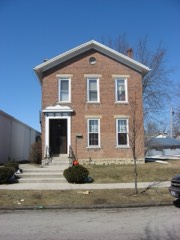
Listed on the National Register of Historic Places in
1978. A historic map-sheet match is not published yet. The record needs a coordinate-quality review before it can be joined to a sheet boundary.
From the record
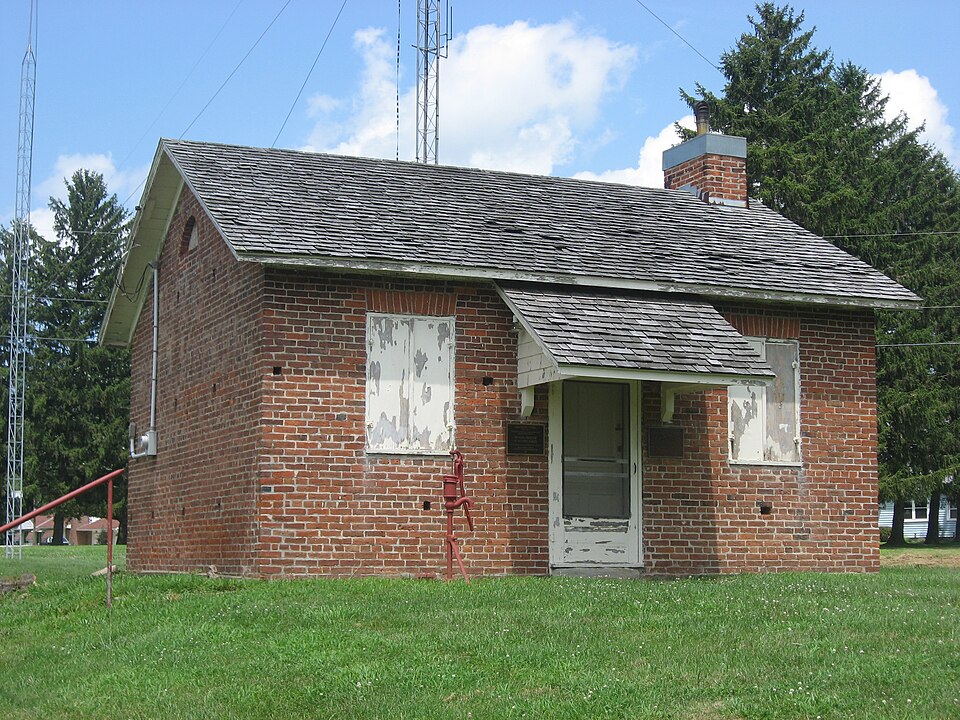
“The Studabaker-Scott House and Beehive School are two historic buildings near the city of Greenville in Darke County, Ohio, United States. Located along State Route 49 south of the city, both are unusually well-preserved remnants of the architecture of the middle third of the 19th century.”
Wikipedia article Studabaker-Scott House and Beehive School, CC BY-SA 4.0.
one of 25 National Register listings in Darke County · listed in 1978 · category: Building.
National Register reference number.78002053- the number the National Park Service assigned this property when it was listed, and the key its nomination file is catalogued under at the National Archives.
Darke County was organized in March, 1817, from Miami County. It is abundantly timbered with poplar, walnut, blue ash, hickory, beech and sugar maple. It yields superior wheat, and is well adapted to grazing. In this county occurred the lamentable defeat of St. Clair, and the treaty of Greenville.
Greenville is the county seat, and was laid out August 10, 1808, by Robert Gray and John Dover. In December, 1793, Wayne built Fort Greenville on this spot, which covered about the same extent as the present town.
Regional context, not property-specific
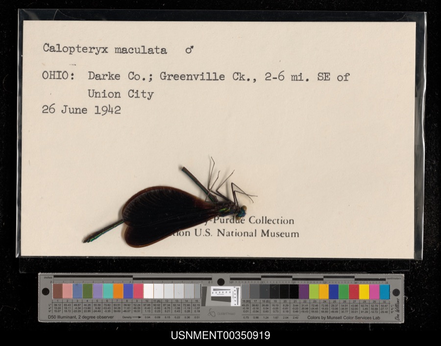
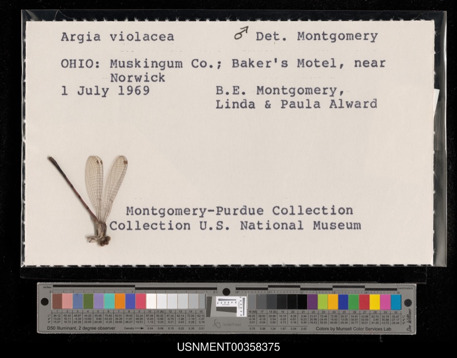
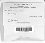
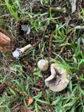
evidence. Museums hold 461 specimens
collected within 10 miles of Studabaker-Scott House and Beehive School between 1838 and
1975: 428 Animalia, 19 Plantae, 14 Fungi. 12 distinct Species records are shown.
Collected by A VERWYST, A. F. C.; Stover, W. G., Albrecht, C. and others. Each is a
physical object with a catalogue
number, and each entry opens the museum's record. This is what was
collected and kept, not a survey of what lives here - nothing can be
concluded from a species being absent.
Regional context, not property-specific
evidence. The federal mineral resources record lists
8 workings within 5 miles of Studabaker-Scott House and Beehive School: 4 past producers, 4 producers.
4 still produce. What was taken out: Sand and Gravel, Construction, Clay, Limestone, General. Distance is straight-line from the
map coordinates, so a quarry counted here may appear on a neighbouring
settlement's page as well.
Regional context, not property-specific
evidence. The National Weather Service names
Greenville, the town this property stands in, in 65 storm reports between 1994 and 2026: 31 thunderstorm wind, 18 hail, 9 flood, 4 flash flood.
No death or injury is recorded in these reports. Each account below is quoted exactly as the forecast office
filed it, from the NOAA Storm Events Database, and each date
opens the federal record of that event.
Several mobile homes in the Sherwood Forest Trailer Park suffered severe damage, and a nearby 10' by 12' shed was destroyed. The roof of a home on Hog Path Road was torn off.
High water was reported on roads and some roads were closed due to heavy rainfall and previous snow melt. Flooding began around 0749 EST on February 28th and continued until around 1100 EST on March 1st. Damage estimates during February were around five-thousand dollars.
High water was reported on roads and some of the roads were closed due to heavy rainfall and previous snow melt. Flooding began around 0749 EST on February 28th and continued until around 1100 EST on March 1st. Damage estimates during March were around five-thousand dollars.
Hail as large as baseballs fell across the county for the second time in 90 minutes. This time the hail fell over a populated area causing damage to many cars, including 2 car lots.
1 paper published in this town,
digitised by the Library of Congress and free to read: 0 issues,
0 pages. Every page is searchable, so a name or a street can be
looked for directly in what the town printed about itself at the time.
No historic map-sheet match is published
for this property yet. That does not mean no map exists. This record needs
a coordinate-quality review before it can be joined to a sheet boundary.
Browse the county's mapped places while that work is
pending.
From the nomination file
2,472 words on record
When this property was proposed for the
National Register, someone wrote the case for it: what the building is,
and why it matters. That document is a federal record in the public domain.
It is quoted below word for word, never summarised. The text was read off the scanned case file by machine, so the
occasional stray character is the recogniser's and the 1970s
typewriter's.
Description of the property
been appended to the frame wing. (1942) A porch on the left reentrant angle with entablature, terminal This is a plain rectangular functional brick structure, c. 1846, CONDITION UNEXPOSED UNALTERED courses and caps. XALTERED FAIR office/study. XEXCELLENT historically significant. Federal work in the basic house. The Scott Turkey Farm is in a rural setting one mile extensively renovated adding a central advancing wing and bracketed rectangular windows are shuttered and have radiating voussoirs Greek Revival entranceway with frontispiece and crisscross The interior has considerable original trim in evidence in block the windows have flat brick arches with radiating voussoirs.
CHECK ONE pilaster, and balustraded deck has been enclosed for use as an facade is rectangular with a large shed roofed hood.The To the northwest by the highway is the beehive school house. has inside end two stack bridged chimneys with decorative corbelled The three bay American bond brick facade has an embrasure south of Greenville.There is a vernacular brick smokehouse The Federal structure of l838 had a rectangular central hall _DETERIORATED XORIGINAL SITE -GOOD DATE There is a semi-circular brick arched gable rear that has been considerably renovated but appears to be behind the garage.
antique in its origins.A large garage of compatible design has The ridged sheet metal roof window in the west end.The eaves and gables project with sash with stone lintels and sills.On the federal transverse plan with five bay Flemish bond facade.Around 1850 the house was facia alone.There is a large chimney inside in the right end. framed doorway in the right bay.The windows are 6/6 double hung The other outbuildings of the farm are not both parts including the entrance hall in the "new" wing and -RUINS AREAS OF
Statement of significance
Abraham Studebaker, the builder, and his heirs were very in 1846. Abraham Studebaker died in 1852. 1400-1499 1500-1599 1700-1799 ECONOMICS COMMERCE INVENTION ART ARCHEOLOGY-HISTORIC X1800-1899 PHILOSOPHY AGRICULTURE LAW PERIOD PREHISTORIC SCIENCE TRANSPORTATION SIGNIFICANCE MILITARY BUILDER/ARCHITECT ARCHITECTURE LITERATURE THEATER INDUSTRY _ENGINEERING MUSIC XPOLITICS/GOVERNMENT _CONSERVATION associates in incorporating the Greenville and Miami Railroad X_EXPLORATION/SETTLEMENT The beehive school house was Darke County's first permanent in the bend of a major highway gives the visual effect of this is currently housing an amateur radio station. _COMMUNICATIONS style of Early Victorian that grew out of the Greek Revival and is but has considerable historical interest.
It was undoubtedly son George who gave the house its present he was secretary of the Darke County Agricultural Society in biographical compendium as a lawyer. appearance after he occupied the farm in 1852.George is not as prosperous in the 1850's and renovated the old homesteads but The building is a fine example architecturally of an attractive -1600-1699 pioneer from Pennsylvania moving west to Ohio in 1795,finally moved there in l8l8 and subsequently built the Federal style house sits was owned by the State of ohio at the time Abraham President (l878) of the Farmers Bank and is listed in one settling in a "block house"east of Greenville in l808,the - RELIGION 1858 and on the Fair Board in the 60's, _1900- (school handsome property unusual force.
The old school is vernacular style near Greenville. Many of the second generation settlers were school building.The school district bought the land in February well represented in southwest ohio.It is the best in this first settler of Adams Township.He was noted for his good heir to the farm deeded the building to the D.A.R.The school 1846 from Abraham Studebaker and sold it back to George in 1868.
Quoted from the National Register nomination
for reference 78002053, 23 pages, held by the National Archives in Record
Group 79. See the
catalogue record.
Listed places nearby
6 within 8 miles
Other National Register properties close
enough to walk or drive between, ordered by distance from this one. Both
positions come from the same geocoding pass that matched these properties
to their map sheets.
Listing record. National Park Service National Register of Historic Places, listed-properties dataset, current to 2026-05-22.
Map join. Address geocoded through the United States Census geocoder, then tested against the published boundary of every sheet in the USGS Historical Topographic Map Collection.
How this page is made. Listing fields come from federal records; map-sheet coverage is a labelled coordinate-to-boundary calculation, not a source-field claim.
Specimens. Global Biodiversity Information Facility (GBIF), https://www.gbif.org/. Only records licensed CC0 or CC BY are used. Records licensed CC BY-NC are excluded because this site carries advertising. Images are checked individually and any whose licence is non-commercial, no-derivatives or unreadable is refused.
Mines and quarries. USGS Mineral Resources Data System (MRDS) https://mrdata.usgs.gov/mrds/ A work of the United States government, no copyright under 17 U.S.C. 105.
Storms. NOAA National Centers for Environmental Information, Storm Events Database https://www.ncei.noaa.gov/stormevents/ A work of the United States government, no copyright under 17 U.S.C. 105. Narratives are quoted verbatim from the National Weather Service report and are not edited or summarised.
 Block
Block