Listed on the National Register of Historic Places in
1978. A historic map-sheet match is not published yet. The record needs a coordinate-quality review before it can be joined to a sheet boundary.
From the record
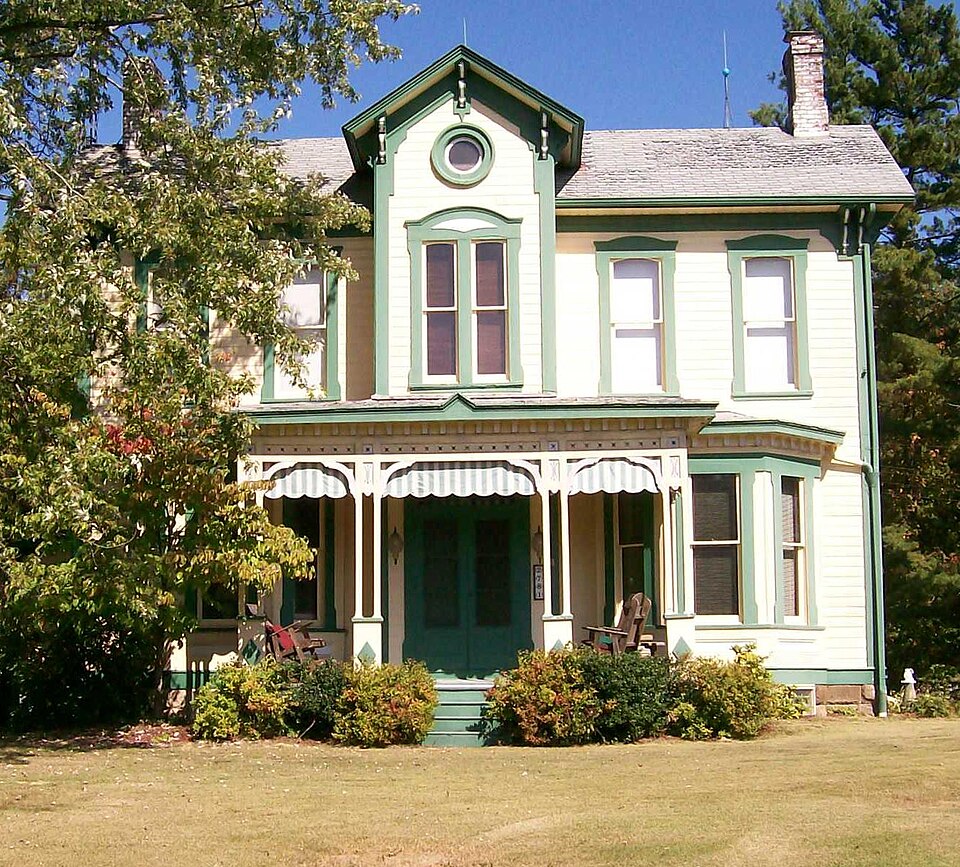
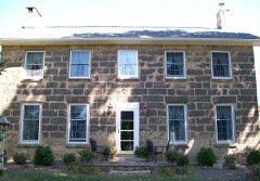
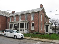
“The Barnett-Criss House is an Italianate style house constructed on the much traveled National Road a few miles east of New Concord, Ohio. The house was placed on the National Register on 1978-12-08.”
Wikipedia article Barnett-Criss House, CC BY-SA 4.0.
one of 18 National Register listings in Guernsey County · listed in 1978 · category: Building · one of 1 National Historic Landmarks in Guernsey County.
National Register reference number.78002070- the number the National Park Service assigned this property when it was listed, and the key its nomination file is catalogued under at the National Archives.
The ground it stands on
904 words
The chapter on Westland Township in History of Guernsey County, Ohio, published 1911 names Cambridge. This is what it says, exactly as the scans read.
Westland township is one of Guernsey county's original townships, hence dates its precinct history from April 23, 1810; its first election for township officers took place in June of that year. It is in the southwestern part of the county, bounded on the west by Muskingum county, on the north by Adams township, on the east by Jackson and Cambridge townships and on the south by Spencer township and Muskingum county and contains twenty-five sections of land, it being five miles square. Crooked creek, the old National pike and the Baltimore & Ohio railroad pass through its northwestern corner. Like other townships in Guernsey county, this is quite rough, hilly and broken by valley and ridge. Its only platted village is Claysville, an inland platting described elsewhere with other plattings. Once this township embraced much more territory than at present, for in 1819 Knox township was formed from parts of this and Wheeling townships.
William Cosgrove, a native of Mifflin county, Pennsylvania, was born in 1812 and in 1827 came to Ohio with his parents, living near Freeport, Harrison county, three years, then went to Cambridge where he mastered the cabinetmaker's trade. In 1833 he removed to Cumberland where he engaged in chair making until 1868, when he engaged in the hotel business, being the proprietor of the old Eagle hotel. One peculiarity of this gentleman was that he never failed of taking a mid-day nap, which he argued gave great strength and long life.
Regional context, not property-specific
evidence. The
federal wildfire occurrence database
lists 43 fires within 5 miles of Barnett-Criss House between
2007 and 2020, burning about 132 acres in total. None started naturally. None was recorded as arson.
Distance is straight-line from the map coordinates, so a fire counted
here may appear on a neighbouring settlement's page as well.
Reported cause
Fires
Debris and open burning
26
Missing data/not specified/undetermined
10
Equipment and vehicle use
3
Recreation and ceremony
2
Smoking
1
Power generation/transmission/distribution
1
The most recent of
them, most recent first, with the day each was reported and the service
that recorded it.
Regional context, not property-specific
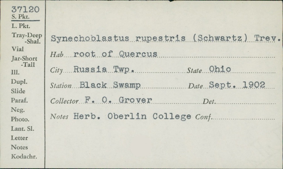
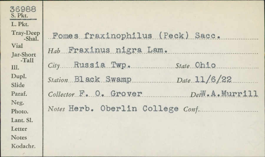
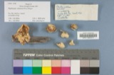
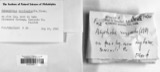
evidence. Museums hold 239 specimens
collected within 10 miles of Barnett-Criss House between 1875 and
1972: 132 Fungi, 60 Plantae, 43 Animalia, 2 Unrecorded, 2 Protozoa. 12 distinct Species records are shown.
Collected by Adams, W., Adams, W. (William), Adams, W.; Adams, S. and others. Each is a
physical object with a catalogue
number, and each entry opens the museum's record. This is what was
collected and kept, not a survey of what lives here - nothing can be
concluded from a species being absent.
Regional context, not property-specific
evidence. The federal mineral resources record lists
3 workings within 5 miles of Barnett-Criss House: 2 past producers, 1 occurrence.
None of them still produces. What was taken out: Limestone, General, Stone, Crushed/Broken, Titanium, Silica, Iron, Aluminum. Distance is straight-line from the
map coordinates, so a quarry counted here may appear on a neighbouring
settlement's page as well.
Regional context, not property-specific
evidence. The National Weather Service names
Cambridge, the town this property stands in, in 78 storm reports between 1994 and 2026: 47 thunderstorm wind, 22 hail, 7 flash flood, 1 flood.
The reports record 3 injuries. Each account below is quoted exactly as the forecast office
filed it, from the NOAA Storm Events Database, and each date
opens the federal record of that event.
An intense thunderstorm gust known as a macroburst raked across central Guernsey County, wind gusts were estimated between 80 and 90 mph. The thunderstorm formed in northeast Guernsey County about 430 pm just ahead of another very intense thunderstorm moving through Muskingum County. It then moved southeast at nearly 40 mph.The swath of damage produced by this intense downburst of wind was estimated to be nearly 8 miles long. Its width fluctuated between 0.75 miles to over 2.5 miles. The damage started just south of Cambridge and continued southeast to near the town of Buffalo. There were 3 reported injuries which consisted of cuts and abrasions. One person was treated and released from the hospital. The town of Byesville was hardest hit. Hundreds of trees were snapped or toppled. Power lines and telephone poles were also downed which resulted in widespread power outages. There were some outbuildings destroyed, as well as damage to shingles, siding and roofs. Part of a roof of a school was torn off. Billboards, business signs and Interstate highway signs were also partially or totally destroyed. It was also reported that about 30 automobiles in a grocery store parking lot had their windows completely shattered. A plate glass window in a fast food restaurant was also shattered. The area was declared a disaster area by the Governor of Ohio. On Interstate 77, there was a report of a tractor-trailed truck which was stopped in its tracks by the tremendous gust as it tried to move forward. It actually spun its wheels as if it were on ice without moving and an automobile behind it collided with the truck.
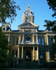
Emergency manager reported damage to the clock tower of an 150 year old courthouse, the collapse of a church, and several other structures damaged in the city of Cambridge.
Between 840 PM EDT and 9 PM EDT, a microburst struck just southwest of Warrentown, about 4 miles northeast of Cambridge. Numerous trees toppled or snapped. Siding and shingles torn from a few houses. Two small barns knocked down. One mobile home was pushed off its foundation. Maximum estimated wind 75 mph (65 knots). This microburst made a swath of sporadic damage about half a mile in length and 350 yards wide. It started from just south of Lakespur Lane, and moved northeastward to just south of Route 22
No historic map-sheet match is published
for this property yet. That does not mean no map exists. This record needs
a coordinate-quality review before it can be joined to a sheet boundary.
Browse the county's mapped places while that work is
pending.
From the nomination file
2,136 words on record
When this property was proposed for the
National Register, someone wrote the case for it: what the building is,
and why it matters. That document is a federal record in the public domain.
It is quoted below word for word, never summarised. The text was read off the scanned case file by machine, so the
occasional stray character is the recogniser's and the 1970s
typewriter's.
Description of the property
The Barnett-Criss House is a I-shaped wood frame dwelling, 2 1/2 stories in height, and the second story level of the projecting center bay on the front, directly above the The interior of the Barnett-Criss House is in a very fine state of repair, with virtually distinctive characteristic of the interior is the magnificent natural woodwork, all of which is intact and well-preserved.
A handsome open balustrade, all walnut, adorns the stairway in the front hall, and features sawn decorative brackets, turned balusters, an mantlepieces are of walnut and chestnut, and feature round-arched openings with paneled CONDITION UNEXPOSED XEXCELLENT UNALTERED DETERIORATED XALTERED CHECK ONE main doorway.At attic height there are small bullet windows providing light for the handsome open frame porch, decorated with sawn scrollwork extends across the area with transoms, and are four-panel in form, with walnut and chestnut inserts. at each corner and smaller brackets under the leaves of the projecting center bay.
three-bay facade, with a projecting full height gable-roof center entrance bay.A Historic photos indicate the presence of rows of small consoles between the larger in the process.Fenestration is accomplished through the use of double-hung sash, Bathrooms have been sensitively added in part of the pantry and in a large walk-in closet House is capped with a metal gable roof, with the roof of the northern section inter- and west bays and feature some paneled decorative elements.At the northeast angle of north gable ends. located at the intersection of these roofs; it is no longer in place, although a -GOOD -FAIR the "T" was originally located an open frame side porch; this porch was long ago arched frames, with restrained ornamentation.
birth until the Civil War, when he enlisted in Company B of the Fifteenth Ohio Volunteer Infantry.
Moving to Pittsburgh, Pennsylvania after the war, he remained in Pennsylvania country house, he apparently sent to Pittsburgh for a father and son team of contractors, John and Charles Halstead, who built the house, fashioned its fine interior ornamental trim, and, according to local traditional history, even made some of the furnishings for Unfortunately, the cost of the house (rumored to be in the neighborhood of $12,000) was apparently too much for Barnett's financial situation to bear, for in 1890 he was less pretentious dwelling about one-half mile to the south, within view of the Criss out of the Criss family the house has had various owners, all of whom 1400-1499 1600-1699 passing PHILOSOPHY COMMERCE ENGINEERING ARCHEOLOGY-HISTORIC EDUCATION AGRICULTURE ART LAW ECONOMICS SIGNIFICANCE PERIOD POLITICS/GOVERNMENT THEATER ARCHEOLOGY-PREHISTORIC CONSERVATION RELIGION MILITARY SCULPTURE INDUSTRY 1900- EXPLORATION/SETTLEMENT 1700-1799 extremely fine condition.
SOCIAL/HUMANITARIAN the house. MUSIC The Barnett-Criss House is an outstanding example of rural Italianate domestic archi- _COMMUNICATIONS the house is far more ornate than most of its contemporaries found along this highway.
Quoted from the National Register nomination
for reference 78002070, 12 pages, held by the National Archives in Record
Group 79. See the
catalogue record.
Listed places nearby
6 within 8 miles
Other National Register properties close
enough to walk or drive between, ordered by distance from this one. Both
positions come from the same geocoding pass that matched these properties
to their map sheets.
Listing record. National Park Service National Register of Historic Places, listed-properties dataset, current to 2026-05-22.
Map join. Address geocoded through the United States Census geocoder, then tested against the published boundary of every sheet in the USGS Historical Topographic Map Collection.
How this page is made. Listing fields come from federal records; map-sheet coverage is a labelled coordinate-to-boundary calculation, not a source-field claim.
Wildfire. Short, Karen C. 2022. Spatial wildfire occurrence data for the United States, 1992-2020 [FPA_FOD_20221014]. 6th Edition. Fort Collins, CO: Forest Service Research Data Archive. https://doi.org/10.2737/RDS-2013-0009.6 Collected with United States Government funding and usable without additional permissions or fees.
Specimens. Global Biodiversity Information Facility (GBIF), https://www.gbif.org/. Only records licensed CC0 or CC BY are used. Records licensed CC BY-NC are excluded because this site carries advertising. Images are checked individually and any whose licence is non-commercial, no-derivatives or unreadable is refused.
Mines and quarries. USGS Mineral Resources Data System (MRDS) https://mrdata.usgs.gov/mrds/ A work of the United States government, no copyright under 17 U.S.C. 105.
Storms. NOAA National Centers for Environmental Information, Storm Events Database https://www.ncei.noaa.gov/stormevents/ A work of the United States government, no copyright under 17 U.S.C. 105. Narratives are quoted verbatim from the National Weather Service report and are not edited or summarised.
 Block
Block