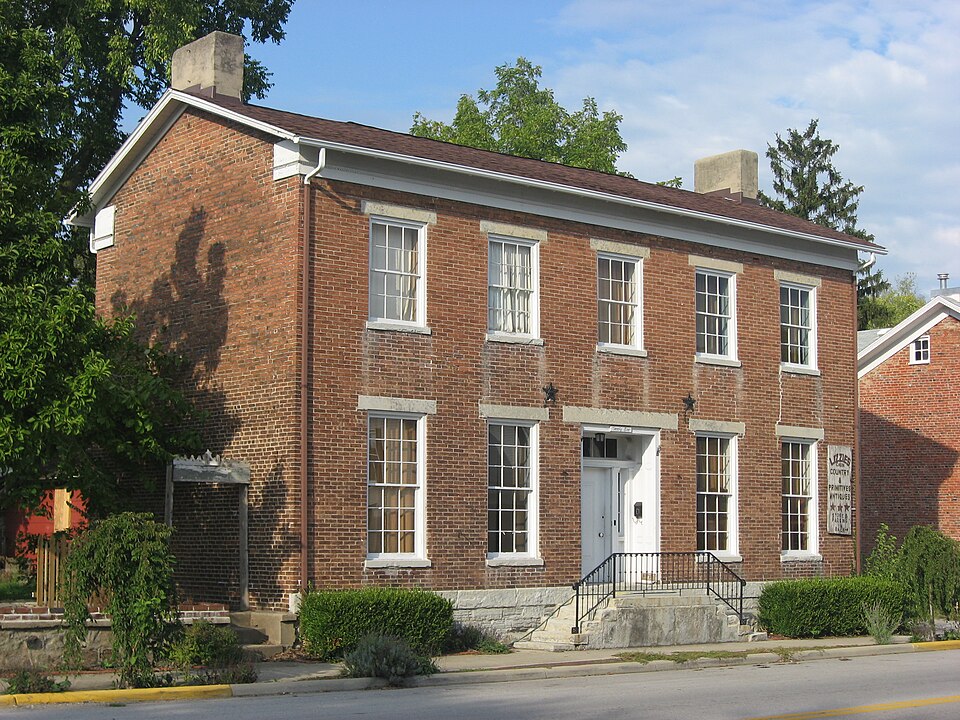
Listed on the National Register of Historic Places in
1978. A historic map-sheet match is not published yet. The record needs a coordinate-quality review before it can be joined to a sheet boundary.
From the record
“The first church in the township was organized by the Dunkards, pr German Baptists, now called the Church of the Brethren. This church started about the year 1806, at the home of Samuel Teal, the Aukermans.and Haldermans also being present, and for several years services were held at the diffeemt homes thereabout.”
History of Preble County Ohio: Her People, Industries and Institutions (1915). Machine-read text.
one of 16 National Register listings in Preble County · listed in 1978 · category: Building.
National Register reference number.78002176- the number the National Park Service assigned this property when it was listed, and the key its nomination file is catalogued under at the National Archives.
Extending nearly east and west across the township near the center is a comparatively high ridge, passing about one-half mile south of Ingomar, and thence into Montgomery county. From this ridge the waters flow northerly or southerly down its slopes to their outlets finally into Twin creek. The ridge seems to have been highest just west of where Twin creek, when formed, cut the ridge in two, to form its channel, and this ridge, or hilltop, at that place is named after an early settler as the Morningstar hill, or Rattlesnake hill, from the old cave. This hill is some seventy-five or eighty feet higher than West Alexandria and is capped with a layer of Clinton limestone, some fifteen feet thick, which in many places crops out. Along the lower slopes of the ridge there are many fine springs of water, two or three flowing several thousand gallons daily.
There is but little doubt that Jacob Parker was the first settler in the township, and probably the first white man to build a cabin in the county, for family tradition has it that as early as the year 1798, before the United States surveyor laid off the sections, he came back to the Twin creek bottoms, southeast of West Alexandria, and built his cabin near the old camp of Wayne's soldiers, as related elsewhere. He found this a lonesome job, and also apparently realized that "it was not good for man to be alone," for he returned to near Middletown. In 1803, however, he returned and resided during the remainder of his life on the northeast quarter of section 3, dying in 1848. His son, Peter Parker, always claimed to be the first white boy born in the county, and that he was born five or six months before George D. Hendrix. Martin Ruple came to the township with Jacob Parker in 1803 and settled on the southeast quarter of section 3.
Regional context, not property-specific
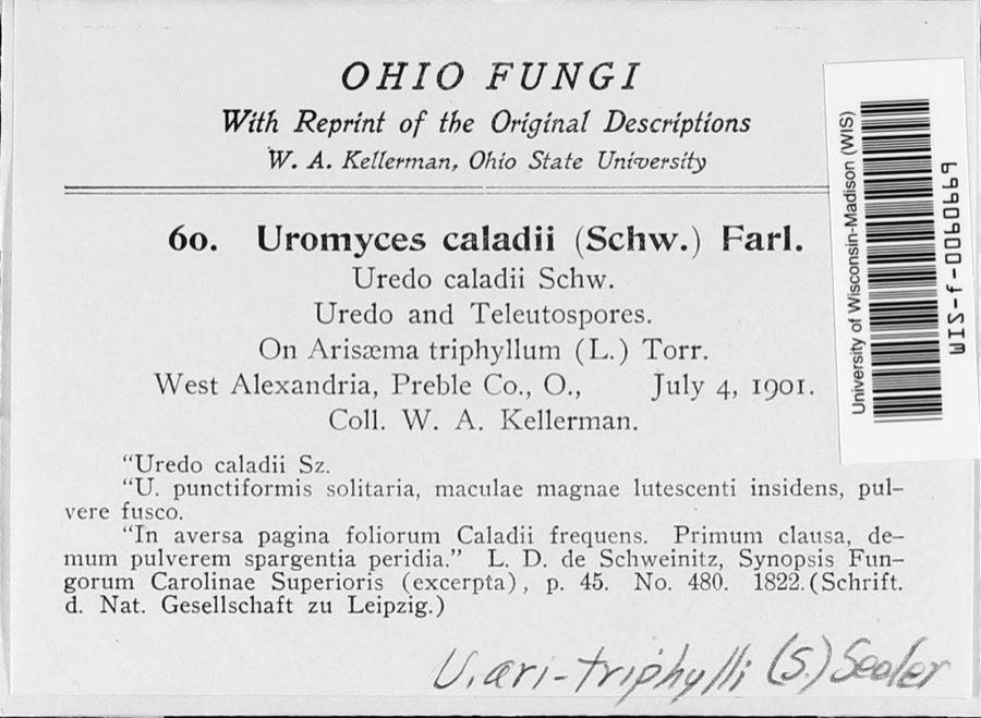
evidence. Museums hold 805 specimens
collected within 10 miles of Unger, George B., House between 1896 and
1974: 766 Animalia, 30 Fungi, 9 Plantae. 12 distinct Species records are shown.
Collected by A.R. Gaufin, H.H. Ross, Arden R. Gaufin, B. Fink and others. Each is a
physical object with a catalogue
number, and each entry opens the museum's record. This is what was
collected and kept, not a survey of what lives here - nothing can be
concluded from a species being absent.
Regional context, not property-specific
evidence. The federal mineral resources record lists
2 workings within 5 miles of Unger, George B., House: 1 past producer, 1 producer.
1 still produces. What was taken out: Sand and Gravel, Construction. Distance is straight-line from the
map coordinates, so a quarry counted here may appear on a neighbouring
settlement's page as well.
Regional context, not property-specific
evidence. The National Weather Service names
West Alexandria, the town this property stands in, in 13 storm reports between 1998 and 2014: 9 thunderstorm wind, 3 hail, 1 flash flood.
No death or injury is recorded in these reports. Each account below is quoted exactly as the forecast office
filed it, from the NOAA Storm Events Database, and each date
opens the federal record of that event.
No historic map-sheet match is published
for this property yet. That does not mean no map exists. This record needs
a coordinate-quality review before it can be joined to a sheet boundary.
Browse the county's mapped places while that work is
pending.
From the nomination file
3,514 words on record
When this property was proposed for the
National Register, someone wrote the case for it: what the building is,
and why it matters. That document is a federal record in the public domain.
It is quoted below word for word, never summarised. The text was read off the scanned case file by machine, so the
occasional stray character is the recogniser's and the 1970s
typewriter's.
Description of the property
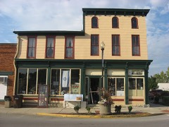
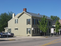
Springfield through Dayton to Richmond, Indiana. CONDITION RUINS DETERIORATED and preservation projects. FAIR cant to the community. double hung sash windows having flat arches and wood sills.The The house stands in a solid row of buildings having like The symmetrical five bay Flemish bond brick facade faces CHECK ONE the right rear is a three bay structure with rectangular 6/6 -UNEXPOSED straight stone double steps with wrought iron railing.The This L-plan Greek Revival influence building was built in west side is an entrance porch covered by the pitched roof.The stone linteled doorway is an a paneled recess and has pilasters, has inside end chimneys.
XUNALTERED the street was built in(l874 and is architecturally very signifi- wing which was completed in l830 has little influence on the scale with limited side yards on the Main Street tow blocks are 2/2 double hung sash on the first floor and 6/6 double hung XEXCELLENT XORIGINAL SITE The central hall plan has a single room on each side both is part of the Dayton cut-off of the Old National Road from _GOOD There is a wide frieze. The south. The gable up and downstairs. The high sawn stone foundation has a water table and Mr. and Mrs.Collins are very active in Preble County historical verges projecting with narrow facia.Tha asphalt shingle roof American bond brick sides are blind and undecorated. The interior trim is an austere Greek Revival. and scroll sawn rafter ends.
The small one story very plain vernacular wing to from the small business district.The Dayton Pike two stages. AREAS OF
Statement of significance
original plat was the Sorber family residence for a time. -CONSERVATION on a regional basis. up a saw mill on Twin Creek and constructed most of the early - ECONOMICS George B.Unger, the owner when the front part was built, was -1400-1499 The oldest part of the house (l830) was built by pioneer then married his employer's daughter, Caroline Gale, in 1848. its locale and by its location on U.S.35 has a high.visibility -SCIENCE a Pennsylvanian who came west to Ohio in 1808 and to West _RELIGION -LAW Sorber's son-in-law, William Alexander SP Revival influenced town house. the employ of merchant J.H. Gale.Unger outlived two wives wife and four of their children west in l8l6.Sorber set building in the area. The house which stands on lot 30 of the It is the best example in of West Alexandria. LE
Quoted from the National Register nomination
for reference 78002176, 28 pages, held by the National Archives in Record
Group 79. See the
catalogue record.
Listed places nearby
6 within 8 miles
Other National Register properties close
enough to walk or drive between, ordered by distance from this one. Both
positions come from the same geocoding pass that matched these properties
to their map sheets.
Listing record. National Park Service National Register of Historic Places, listed-properties dataset, current to 2026-05-22.
Map join. Address geocoded through the United States Census geocoder, then tested against the published boundary of every sheet in the USGS Historical Topographic Map Collection.
How this page is made. Listing fields come from federal records; map-sheet coverage is a labelled coordinate-to-boundary calculation, not a source-field claim.
Specimens. Global Biodiversity Information Facility (GBIF), https://www.gbif.org/. Only records licensed CC0 or CC BY are used. Records licensed CC BY-NC are excluded because this site carries advertising. Images are checked individually and any whose licence is non-commercial, no-derivatives or unreadable is refused.
Mines and quarries. USGS Mineral Resources Data System (MRDS) https://mrdata.usgs.gov/mrds/ A work of the United States government, no copyright under 17 U.S.C. 105.
Storms. NOAA National Centers for Environmental Information, Storm Events Database https://www.ncei.noaa.gov/stormevents/ A work of the United States government, no copyright under 17 U.S.C. 105. Narratives are quoted verbatim from the National Weather Service report and are not edited or summarised.
 Block
Block