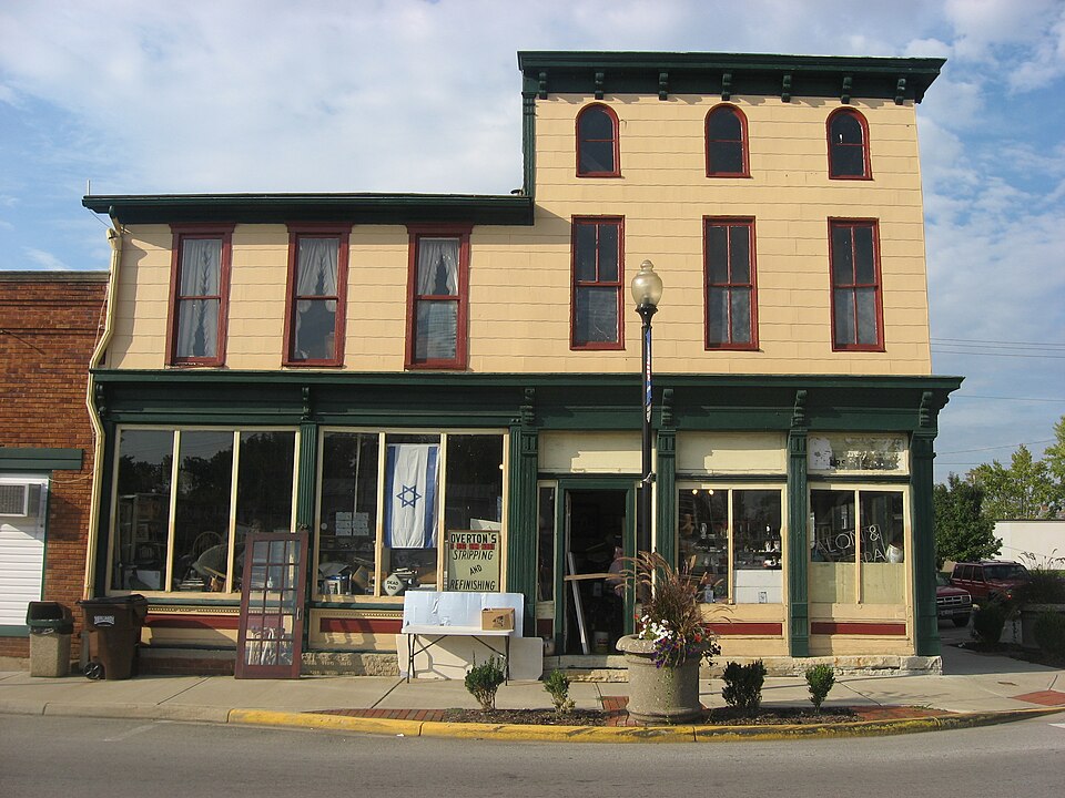
Listed on the National Register of Historic Places in
1991. A historic map-sheet match is not published yet. The record needs a coordinate-quality review before it can be joined to a sheet boundary.
From the record
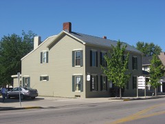
“The Lange Hotel was a historic commercial building and former hotel in the village of West Alexandria, Ohio, United States. One of the area's leading early farmhouses, it was the latest in a series of hotels on the same spot, and it had been designated a historic site.”
Wikipedia article Lange Hotel, CC BY-SA 4.0.
one of 16 National Register listings in Preble County · listed in 1991 · category: Building.
National Register reference number.90002213- the number the National Park Service assigned this property when it was listed, and the key its nomination file is catalogued under at the National Archives.
The ground it stands on
32,442 words
The chapter on Twin Township in History of Preble County Ohio, published 1881 names West Alexandria. This is what it says, exactly as the scans read.
In the early days of settlement the land, which was owned by the 'Government, was sold in parcels of not less than a section, at two dollars per acre. Of course, many of the early settlers were unable to take so much land, and it became necessary for some one man to buy a section of land, and, after sub-dividing to suit the purchaser, sell it tosettlers; or a number of men would club together, appoint one of their number treasurer, and authorize him to buy a section of land. This was done by many of the early settlers of Twin township. This plan gave abundant opportunities for land sharks, but there is no instance of any fraud of this kind in Twin township. Among the first settlers who entered land in the township, were the Van Winkles, the Millers, and the Keslings, who came in 1804; and the Nisbits, Quinns, Bantas, Whitesells, Rapes, and Ozias, who came about The first permanent settlement in Twin township was made by Simeon Van Winkle. He was born in Georgia, June 5, 1768, and his wife, Phebe, was born in the same State, October 3, 1766. They emigrated to Kentucky, and in February, 1804, came to Ohio and entered section twenty-seven, on which the village of New Lexington now stands. 'They afterwards sold a portion of this land, and retained the northwestern corner, now known as the Ozias farm. They were parents of ten children, five boys and five girls. Mr. Van Winkle gave each of his sons eighty acres of land, upon which each one finally settled. David, the eldest, owned what is now the Copp farm. He lived there for several years, and went to Anderson, Indiana, where he died, in 1872. He is buried in the Baptist graveyard at New Lexington. John, who was active among the early members of the New Light church, used to live on the Solomon Meekley farm. He afterwards emigrated to Missouri, where he died. James, Robert, and Jesse followed David to Anderson, Indiana. Jesse is dead, but James is living in Anderson, Indiana, and Robert is living in that vicinity. Susan, now the widow Robinson, is living in West Alexandria. Louisa is living, and Phebe, Tirza, and Hannah are dead. The Van Winkles were very prominent in the early affairs of the township, in the commuity, and in the Baptist church, of which they were members. Simeon Van Winkle was one of the first township trustees. He donated the ground on which the Baptist church was built, and he and his wife were buried in the adjoining burying-ground. He died in 1831, aged sixty-three years. His wife nearly completed her centennial year, dying September r2, 1866, aged ninety-nine years, eleven months, and nine days. There is now none of the name living in Ohio. Frederick Miller was the next settler in Twin township. He was a native of Virginia, born in 1761. His wife, Elizabeth, was born in 1762. Mr. Miller was a soldier of the Revolution, having served under Washington, and was present at the surrender of Cornwallis, at Yorktown. He subsequently removed to what is now Anderson county, Tennessee. In the fall of 1803 he emigrated to Ohio with his family, which he left at Lebanon, Warren county, while he searched for a suitable location for his new home. In March, 1804, taking with him his daughter Abbie, aged thirteen, and his son, Jacob F., aged eleven, he left Lebanon, and brought a portion of his goods to the place he had chosen for the location of his wilderness home. The way was obstructed by the heavy timber, and the road had to be cut out as they advanced. After several days' weary travelling they arrived on the land whereon their new home was to be built. They built a pole shanty against a coffee-bean tree, which is still standing on the farm of the late James H. Curry, about one hundred yards east of the pike from Lexington to West Alexandria. After seeing that the children were comfortably fixed, Mr. Miller left them in charge of the camp, and returned to Lebanon for the remainder of his family and goods. The brave little guards were not molested by anything, although wild beasts and Indians were plenty at that time. Ra
Frederick and Elizabeth Miller had 'three sons and two daughters: Sarah, wife of Robert Davidson, died in July, 1880; Abbie lived in Indiana; Jacob F. lived near Lewisburgh, and was at one time county commissioner; he died in 1849; John died in West Alexandria, and Solomon, the only one living, emigrated to Elkhart county, Indiana, where he founded Millersburgh, of which he is at present the postmaster.
Regional context, not property-specific
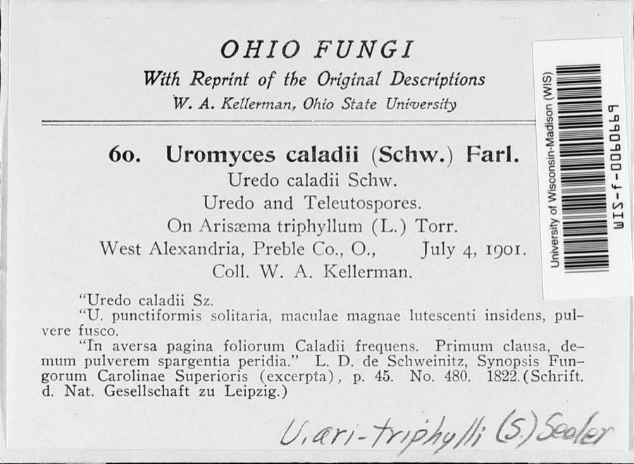
evidence. Museums hold 805 specimens
collected within 10 miles of Lange Hotel between 1896 and
1974: 766 Animalia, 30 Fungi, 9 Plantae. 12 distinct Species records are shown.
Collected by A.R. Gaufin, H.H. Ross, Arden R. Gaufin, B. Fink and others. Each is a
physical object with a catalogue
number, and each entry opens the museum's record. This is what was
collected and kept, not a survey of what lives here - nothing can be
concluded from a species being absent.
Regional context, not property-specific
evidence. The federal mineral resources record lists
2 workings within 5 miles of Lange Hotel: 1 past producer, 1 producer.
1 still produces. What was taken out: Sand and Gravel, Construction. Distance is straight-line from the
map coordinates, so a quarry counted here may appear on a neighbouring
settlement's page as well.
Regional context, not property-specific
evidence. The National Weather Service names
West Alexandria, the town this property stands in, in 13 storm reports between 1998 and 2014: 9 thunderstorm wind, 3 hail, 1 flash flood.
No death or injury is recorded in these reports. Each account below is quoted exactly as the forecast office
filed it, from the NOAA Storm Events Database, and each date
opens the federal record of that event.
No historic map-sheet match is published
for this property yet. That does not mean no map exists. This record needs
a coordinate-quality review before it can be joined to a sheet boundary.
Browse the county's mapped places while that work is
pending.
From the nomination file
2,908 words on record
When this property was proposed for the
National Register, someone wrote the case for it: what the building is,
and why it matters. That document is a federal record in the public domain.
It is quoted below word for word, never summarised. The text was read off the scanned case file by machine, so the
occasional stray character is the recogniser's and the 1970s
typewriter's.
Statement of significance
Areas of Significance (enter categories from instructions) entertainment to be located where the Hotel now stands.The hotel was built at this site In 1875,West Alexandria had a population of 459.County and State directories indicate The Henry Lange Hotel is being nominated under Criterion A for its association with West The town of West Alexandria is located on a bluff above Twin Creek.
Settlers first came Iisted in the directories are 41 businesses and industries, four doctors and three Applicable National Register Criteria Period of Significance This indicates that even before the railroad,West Alexandria was a local that there were two hotels in town: the Twin Valley House and the Eagle Hotel.Also The article goes on to say: in 1817,according toa May 18,1888 article in the Weekly_Register,an Eaton newspaper. LX locally Criteria Considerations (Exceptions) Alexandria's transportation history. Between 1886 and the 1930's, this small Preble statewide strong association with this significant phase of West Alexandria's history. flour (or grist)mills turned the settlement into a regional agricultural processing wended its slow way, drawn by oxen from Cincinnati to Indiana.
nationally 1875 Prebel County Directory, Morgan Abstracts from Eaton, Ohio's Weekly Register and West Alexandria, Ohio's Iwin Valley Echo Plat map of West Alexandria, 1912 Previous documentation on file (NPS): N/A preliminary determination of individual listing (36 CFR 67) Primary location of additional data: X State historic preservation office 11.
Quoted from the National Register nomination
for reference 90002213, 34 pages, held by the National Archives in Record
Group 79. See the
catalogue record.
Listed places nearby
6 within 8 miles
Other National Register properties close
enough to walk or drive between, ordered by distance from this one. Both
positions come from the same geocoding pass that matched these properties
to their map sheets.
Listing record. National Park Service National Register of Historic Places, listed-properties dataset, current to 2026-05-22.
Map join. Address geocoded through the United States Census geocoder, then tested against the published boundary of every sheet in the USGS Historical Topographic Map Collection.
How this page is made. Listing fields come from federal records; map-sheet coverage is a labelled coordinate-to-boundary calculation, not a source-field claim.
Specimens. Global Biodiversity Information Facility (GBIF), https://www.gbif.org/. Only records licensed CC0 or CC BY are used. Records licensed CC BY-NC are excluded because this site carries advertising. Images are checked individually and any whose licence is non-commercial, no-derivatives or unreadable is refused.
Mines and quarries. USGS Mineral Resources Data System (MRDS) https://mrdata.usgs.gov/mrds/ A work of the United States government, no copyright under 17 U.S.C. 105.
Storms. NOAA National Centers for Environmental Information, Storm Events Database https://www.ncei.noaa.gov/stormevents/ A work of the United States government, no copyright under 17 U.S.C. 105. Narratives are quoted verbatim from the National Weather Service report and are not edited or summarised.
 Block
Block