Listed on the National Register of Historic Places in
1979. A historic map-sheet match is not published yet. The record needs a coordinate-quality review before it can be joined to a sheet boundary.
From the record
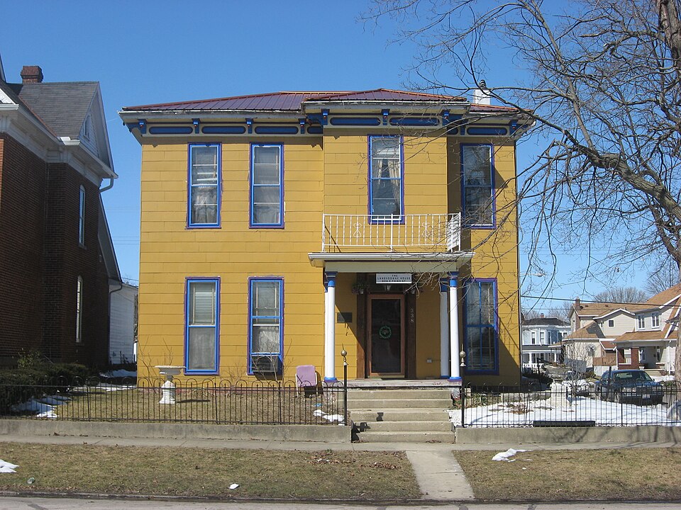
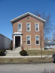
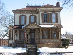
“The Lansdowne House is a historic house in Greenville, Ohio, United States. Built in 1870, it was the residence of Zachary Lansdowne, who was a pioneer in the development of the U.S.”
Wikipedia article Lansdowne House (Greenville, Ohio), CC BY-SA 4.0.
one of 25 National Register listings in Darke County · listed in 1979 · category: Building.
National Register reference number.79001824- the number the National Park Service assigned this property when it was listed, and the key its nomination file is catalogued under at the National Archives.
Darke County was organized in March, 1817, from Miami County. It is abundantly timbered with poplar, walnut, blue ash, hickory, beech and sugar maple. It yields superior wheat, and is well adapted to grazing. In this county occurred the lamentable defeat of St. Clair, and the treaty of Greenville.
Greenville is the county seat, and was laid out August 10, 1808, by Robert Gray and John Dover. In December, 1793, Wayne built Fort Greenville on this spot, which covered about the same extent as the present town.
Regional context, not property-specific
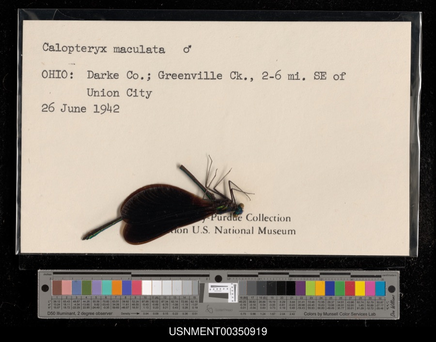
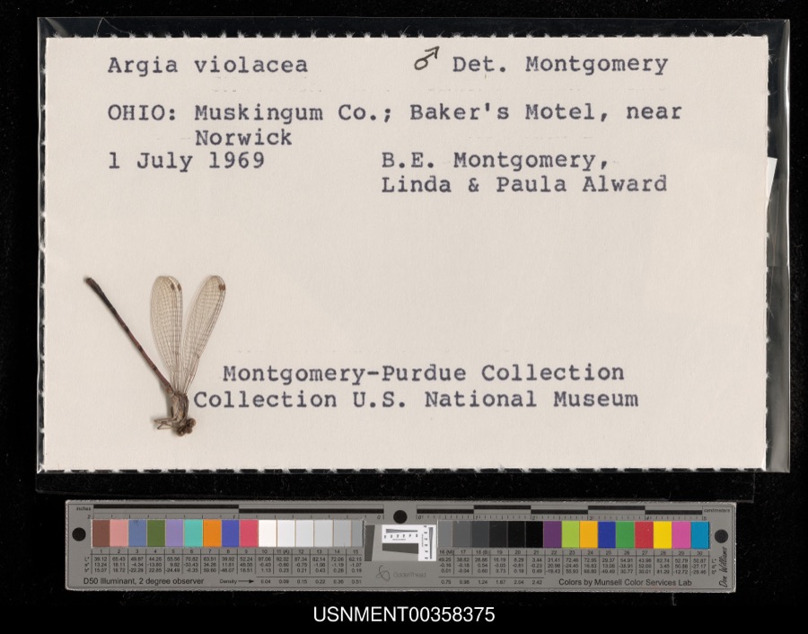
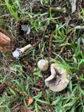
evidence. Museums hold 540 specimens
collected within 10 miles of Lansdowne House between 1895 and
1975: 508 Animalia, 18 Plantae, 14 Fungi. 12 distinct Species records are shown.
Collected by A VERWYST, A. F. C.; Stover, W. G., Albrecht, C. and others. Each is a
physical object with a catalogue
number, and each entry opens the museum's record. This is what was
collected and kept, not a survey of what lives here - nothing can be
concluded from a species being absent.
Regional context, not property-specific
evidence. The federal mineral resources record lists
5 workings within 5 miles of Lansdowne House: 3 producers, 2 past producers.
3 still produce. What was taken out: Sand and Gravel, Construction, Clay. Distance is straight-line from the
map coordinates, so a quarry counted here may appear on a neighbouring
settlement's page as well.
Regional context, not property-specific
evidence. The National Weather Service names
Greenville, the town this property stands in, in 65 storm reports between 1994 and 2026: 31 thunderstorm wind, 18 hail, 9 flood, 4 flash flood.
No death or injury is recorded in these reports. Each account below is quoted exactly as the forecast office
filed it, from the NOAA Storm Events Database, and each date
opens the federal record of that event.
Several mobile homes in the Sherwood Forest Trailer Park suffered severe damage, and a nearby 10' by 12' shed was destroyed. The roof of a home on Hog Path Road was torn off.
High water was reported on roads and some roads were closed due to heavy rainfall and previous snow melt. Flooding began around 0749 EST on February 28th and continued until around 1100 EST on March 1st. Damage estimates during February were around five-thousand dollars.
High water was reported on roads and some of the roads were closed due to heavy rainfall and previous snow melt. Flooding began around 0749 EST on February 28th and continued until around 1100 EST on March 1st. Damage estimates during March were around five-thousand dollars.
Hail as large as baseballs fell across the county for the second time in 90 minutes. This time the hail fell over a populated area causing damage to many cars, including 2 car lots.
1 paper published in this town,
digitised by the Library of Congress and free to read: 0 issues,
0 pages. Every page is searchable, so a name or a street can be
looked for directly in what the town printed about itself at the time.
No historic map-sheet match is published
for this property yet. That does not mean no map exists. This record needs
a coordinate-quality review before it can be joined to a sheet boundary.
Browse the county's mapped places while that work is
pending.
From the nomination file
2,126 words on record
When this property was proposed for the
National Register, someone wrote the case for it: what the building is,
and why it matters. That document is a federal record in the public domain.
It is quoted below word for word, never summarised. The text was read off the scanned case file by machine, so the
occasional stray character is the recogniser's and the 1970s
typewriter's.
Description of the property
CONDITION UNEXPOSED UNALTERED EXCELLENT RUINS DETERIORATED FAIR XALTERED CHECK ONE decorative brackets and a paneled freize.Its horizontal wooden siding is now covered porch supported by round classical columns originally projected to the right of the iron railing. removed along with its railing and gablet.The latter has been replaced with a new tinquishing features are its tall and narrow windows anda projecting cornice with main entrance and had a wooden railing and gablet.The right half of the porch has been The Lansdowne House is a simple rectangular two-story frame building ona limestone with synthetic shingles and the original louvred shutters have been removed andre- foundation and with a hipped roof covered with standing seam metal. Its sole dis- AREAS OF
Statement of significance
the Greenville schools. Shortly before graduation, Zachary left for the Annapolis Here Lansdowne became involved with lighter-than-air craft, and upon returning to the states, was made commander of the Naval Air Station at Akron, Ohio, where he helped supervise blimp construction. In 1921, Captain Lansdowne was attached to the new built large rigid airship. For a time in the early 20s, he served at the American airship, the Shenandoah, and it was in this position that he obtained the greatest later American built airships, and helped make the use of helium a practicality over comprehensive mapping showing airship ports, elevations, radio beacons; simplified Captain developed special techniques for long overland flights and landings which were entirely unprecedented.
Shenandoah in October 1924, the Captain flew over Greenville and circled it while he floats in community parades during the 1920s, and through the veneration of the Lansdowne ART 1400-1499 COMMERCE LAW CONSERVATION EDUCATION TRANSPORTATION AGRICULTURE BUILDER/ARCHITECT SIGNIFICANCE PERIOD ARCHEOLOGY-HISTORIC ARCHITECTURE 1600-1699 THEATER SCIENCE INDUSTRY _COMMUNICATIONS _POLITICS/GOVERNMENT _EXPLORATION/SETTLEMENT He made forward-looking recommendations regarding experiments with hook-on planes to ENGINEERING the more explosive and dangerous helium.He prepared a manual on airship operation responded by celebrating its favorite son, dedicating the next year's high school language in landing and mooring operations; and improved watch schedules for crewmen.
annual to Lansdowne and publishing pictures of the city taken from the Shenandoah. The military and public acclaim. Captain Lansdowne maintained close ties with his hometown of Greenville where his elderly Embassy in Berlin as the special liason with the Zeppelin Works.After transfer back Zachary Lansdowne had an impressive list of pioneering achievements in lighter-than-air which was subsequently adopted as the official instruction manual in the Navy's program. during the 1920s.
Quoted from the National Register nomination
for reference 79001824, 21 pages, held by the National Archives in Record
Group 79. See the
catalogue record.
Listed places nearby
6 within 8 miles
Other National Register properties close
enough to walk or drive between, ordered by distance from this one. Both
positions come from the same geocoding pass that matched these properties
to their map sheets.
Listing record. National Park Service National Register of Historic Places, listed-properties dataset, current to 2026-05-22.
Map join. Address geocoded through the United States Census geocoder, then tested against the published boundary of every sheet in the USGS Historical Topographic Map Collection.
How this page is made. Listing fields come from federal records; map-sheet coverage is a labelled coordinate-to-boundary calculation, not a source-field claim.
Specimens. Global Biodiversity Information Facility (GBIF), https://www.gbif.org/. Only records licensed CC0 or CC BY are used. Records licensed CC BY-NC are excluded because this site carries advertising. Images are checked individually and any whose licence is non-commercial, no-derivatives or unreadable is refused.
Mines and quarries. USGS Mineral Resources Data System (MRDS) https://mrdata.usgs.gov/mrds/ A work of the United States government, no copyright under 17 U.S.C. 105.
Storms. NOAA National Centers for Environmental Information, Storm Events Database https://www.ncei.noaa.gov/stormevents/ A work of the United States government, no copyright under 17 U.S.C. 105. Narratives are quoted verbatim from the National Weather Service report and are not edited or summarised.
 Block
Block