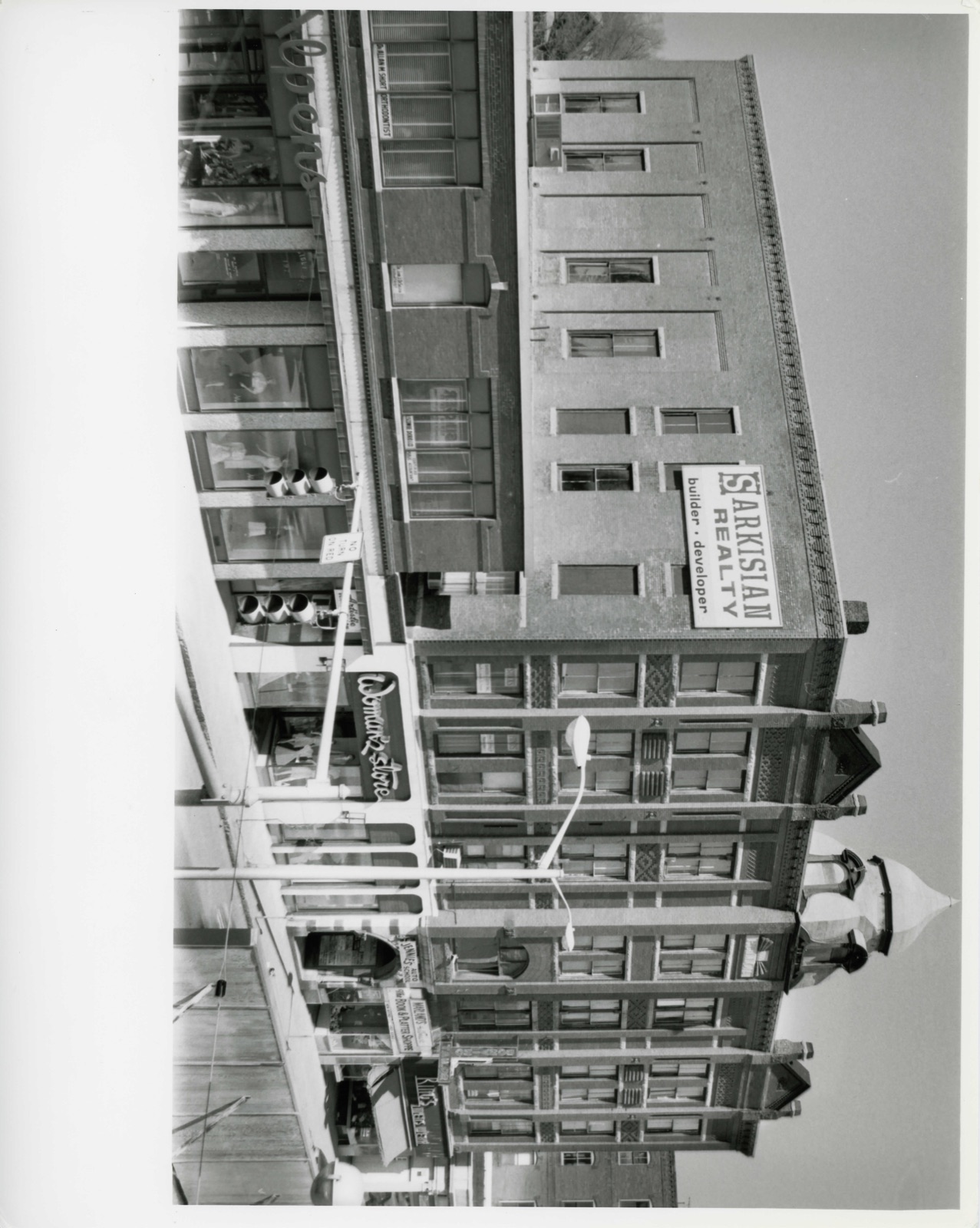
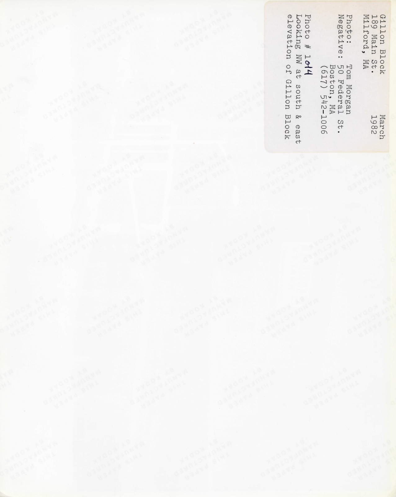
Photographs from the nomination case file, National Park Service records.
Gillon Block
Listed on the National Register of Historic Places in
1982. A historic map-sheet match is not published yet. The record needs a coordinate-quality review before it can be joined to a sheet boundary.
From the record
one of 500 National Register listings in Worcester County · listed in 1982 · category: Building · one of 1 National Historic Landmarks in Worcester County.
National Register reference number.82000488- the number the National Park Service assigned this property when it was listed, and the key its nomination file is catalogued under at the National Archives.
Fires near this property
111 since 2003
Regional context, not property-specific
evidence. The
federal wildfire occurrence database
lists 111 fires within 5 miles of Gillon Block between
2003 and 2020, burning about 200 acres in total. None started naturally. 39 were recorded as arson.
Distance is straight-line from the map coordinates, so a fire counted
here may appear on a neighbouring settlement's page as well.
Reported cause
Fires
Arson/incendiarism
39
Debris and open burning
29
Missing data/not specified/undetermined
19
Recreation and ceremony
10
Smoking
7
Equipment and vehicle use
4
Railroad operations and maintenance
1
Power generation/transmission/distribution
1
Misuse of fire by a minor
1
The most recent of
them, most recent first, with the day each was reported and the service
that recorded it.
Regional context, not property-specific
evidence. Museums hold 428 specimens
collected within 10 miles of Gillon Block between 1844 and
1975: 190 Plantae, 132 Animalia, 101 Fungi, 3 Unrecorded, 2 Chromista. 12 distinct Species records are shown.
Collected by A. B. Seymour, A. P. D. Piguet, A. R. Hodgdon; F. L. Steele and others. Each is a
physical object with a catalogue
number, and each entry opens the museum's record. This is what was
collected and kept, not a survey of what lives here - nothing can be
concluded from a species being absent.
Regional context, not property-specific
evidence. The federal mineral resources record lists
13 workings within 5 miles of Gillon Block: 10 past producers, 2 producers, 1 unknown.
2 still produce. What was taken out: Sand and Gravel, Construction, Granite. Distance is straight-line from the
map coordinates, so a quarry counted here may appear on a neighbouring
settlement's page as well.
Regional context, not property-specific
evidence. The National Weather Service names
Milford, the town this property stands in, in 20 storm reports between 1997 and 2023: 8 hail, 7 thunderstorm wind, 2 flood, 1 heavy rain.
The reports record 1 injury. Each account below is quoted exactly as the forecast office
filed it, from the NOAA Storm Events Database, and each date
opens the federal record of that event.
A 27 year old man was injured inside his home when lightning struck a tree just outside. Newspaper reports indicate that the man was standing in his doorway when lightning struck the tree about 30 feet away. The man was transported to Milford Regional Medical Center for observation.
Heavy rain associated with Tropical Storm Hanna ranged from three and a half inches to six and a half inches. This resulted in widespread street flooding. Following are a few of the reports. A one hundred foot section of Stonybrook Road in Milford was washed out. Multiple cars were stuck in flood waters under the railroad bridge on Cambridge Street in Worcester. Extensive flooding occurred on Cambridge Street with water up to ten feet at one business. A stream in Westborough extended its banks blocking off a portion of Warren Street.
No historic map-sheet match is published
for this property yet. That does not mean no map exists. This record needs
a coordinate-quality review before it can be joined to a sheet boundary.
Browse the county's mapped places while that work is
pending.
From the nomination file
2,324 words on record
When this property was proposed for the
National Register, someone wrote the case for it: what the building is,
and why it matters. That document is a federal record in the public domain.
It is quoted below word for word, never summarised. The text was read off the scanned case file by machine, so the
occasional stray character is the recogniser's and the 1970s
typewriter's.
Description of the property
The Gillon Block, a four story, flat roofed, red brick conmercial block, is situated in the center of the downtown business district of Milford. The building fronts 96 teet on Main Street, extends 106 feet back, and rises 78 feet. It covers nearly all of the 100' X 111' parcel on which it stands. A 12 feet wide interior court extends to the rear and gives the second, third, and fourth floors a U-shaped layout (see enclosed floor plans). The building's heavy timber framing members are augmented by iron columns in the first floor stores. It is Main Street's most outstanding late nine- teenth century conmercial block. The Main Street facade is eclectic in style but completely syrmetrical in form, being divided into seven bays by brick piers.
A central pavilion gives the suggestion of a tower, as it projects two feet towards the street and is topped by a curved mansard roof. The mansard features a semicircular pedimented dormer on each side and an onion shaped dome at the top. -Flanking the central frontispiece are two secondary pavilions, each of which is framed by brick piers which rise above the cornice line to enclose a brick pediment.(photograph1) The ornamentation of the Gillon Block is hectic. Rectangular, 2 over 2 windows occur singly and in pairs, articulated by granite sills and lintels. (The only arched win- dow occurs on the second floor of the frontispiece.) Spandrel panels are filled with brick corbelling, terra cotta ornament, and brownstone carvings.
Terra cotta panels are also employed within the facade pediments and piers. An elaborate corbelled cornice encircles the building. Unfortunately, all of the block's first floor storefronts have been remodelled in the twentieth century.
/Architect Rinaldo V. Carey Statement of Significance (in one paragraph) The Gillon Block retains integrity of design, materials, workmanship, setting, and 1o- cation. The building is closely linked to Milford's late 19th century development and is Milford's most outstanding excellent example of eclectic, late Victorian cormercial architecture; it meets criteria A and C of the National Register. The Gillon Block was designed by Rinaldo V. Carey, a local architect whose self- proclaimed specialty was public buildings. This is Carey's only known building, however, 'The Gillion Block's variety of mofis, materials, textures, and colors exude a plyfulness and exuberance typical of the late. Victorian period, although tha idiosyncrasy of this design is highly distinctive.
The largely intact interior spaces are a rare survivor of the period. In the 19th amd early 20th centuries, Milford's economy rested on shoe manufacturing and granite quarring. Milford granite was preferred by many an architect-- McKim, Mead & White among others-- and was shipped to all corners of the U.S. and even to Europe. The Gillon Block is the largest of a number of imposing conmercial buildings erected dur- These late Victorian, red brick structures contin- ue to dominate Main Street and to define its character. Patrick Gi1lon, was errected, made his fortune in the liquor business 1 number of survivina bottles markec suggest that he was a bottle manufacturer as well. The lower floors of the Gillon Blockhavehoused a great many conmercial interests.
These include insurance, legal, medical, and dental offices, musicians" studios, a tailor, bank, barbershop, union hall, municipal offices, and a number of restaurants and stores. The building's two large third floor meeting halls were originally known as Temperance Hall and Red Men's Hall.
Quoted from the National Register nomination
for reference 82000488, 14 pages, held by the National Archives in Record
Group 79. See the
catalogue record.
Listed places nearby
6 within 8 miles
Other National Register properties close
enough to walk or drive between, ordered by distance from this one. Both
positions come from the same geocoding pass that matched these properties
to their map sheets.
Listing record. National Park Service National Register of Historic Places, listed-properties dataset, current to 2026-05-22.
Map join. Address geocoded through the United States Census geocoder, then tested against the published boundary of every sheet in the USGS Historical Topographic Map Collection.
How this page is made. Listing fields come from federal records; map-sheet coverage is a labelled coordinate-to-boundary calculation, not a source-field claim.
Wildfire. Short, Karen C. 2022. Spatial wildfire occurrence data for the United States, 1992-2020 [FPA_FOD_20221014]. 6th Edition. Fort Collins, CO: Forest Service Research Data Archive. https://doi.org/10.2737/RDS-2013-0009.6 Collected with United States Government funding and usable without additional permissions or fees.
Specimens. Global Biodiversity Information Facility (GBIF), https://www.gbif.org/. Only records licensed CC0 or CC BY are used. Records licensed CC BY-NC are excluded because this site carries advertising. Images are checked individually and any whose licence is non-commercial, no-derivatives or unreadable is refused.
Mines and quarries. USGS Mineral Resources Data System (MRDS) https://mrdata.usgs.gov/mrds/ A work of the United States government, no copyright under 17 U.S.C. 105.
Storms. NOAA National Centers for Environmental Information, Storm Events Database https://www.ncei.noaa.gov/stormevents/ A work of the United States government, no copyright under 17 U.S.C. 105. Narratives are quoted verbatim from the National Weather Service report and are not edited or summarised.
 Block
Block