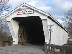
Listed on the National Register of Historic Places in
1982. A historic map-sheet match is not published yet. The record needs a coordinate-quality review before it can be joined to a sheet boundary.
From the record
“Under the parental 'roof Enoch Rinehart was reared and to the common school system of the neighborhood he was indebted for the educational privileges which he enjoyed. After his marriage he purchased one hundred acres of the old home farm and devoted his energies to agricultural pursuits throughout his active business career.”
A Biographical History of Preble County, Ohio : Compendium of National Biography (1900). Machine-read text.
one of 16 National Register listings in Preble County · listed in 1982 · category: Building.
National Register reference number.82001486- the number the National Park Service assigned this property when it was listed, and the key its nomination file is catalogued under at the National Archives.
What happened here
An account from the chapter on Washington township, The inset identifies its exact
source book and publication year.
The most fearful calamity that ever befell the town was in July and August, 1849, still styled in local annals the cholera year. The disease seemed to come into this county as an epidemic from Boston, Indiana, which was on the stage route from Cincinnati to Richmond. _ Eaton at that time had a population of about twelve hundred.
Growing tired of farming, he conceived the idea of becoming a lawyer, and in 1836 began the study of law in Eaton, with J. M. U. McNutt, then the leading attorney of the county and one of the first lawyers of the state. Not long after commencing to read law, his esteemed preceptor died. 'Mr. Charles then left for Tennessee to visit relatives living there, and through the influence of his uncle, he entered the office of
Then as a means of support he engaged in teaching school, and while in pedagogy he contracted an itching for journalistic life. In the years 1845-6-7 he was the editorial writer of the Eaton Register, and in. 1848 purchased the Hamilton Intelligencer, which, after conducting it for some time, he sold. He then went to Minnesota with. Charles K. Smith, the newly appointed secretary of that territory, as his clerk, in which capacity he wrote up the first records of that state in 1849. It was his privilege to make the roll call of the popular branch of its first law-making assembly. The next year he received an appointment at Washington to a clerkship in the pension bureau, from which position lie was removed by President Pierce, being an ' "offensive partisan," and no protective civil service existed in those days, to the victors being given the spoils ; and his bureau chief said to him, "Mr. Charles, there is no objection to you, but our friends are clamorous for place and somebody must be removed." In those days they recognized the fact that parties failing to take care of friends were likely soon to need friends to take care of them.
Regional context, not property-specific
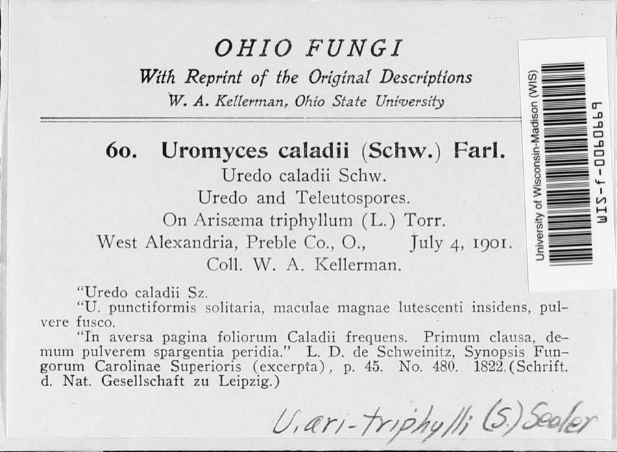
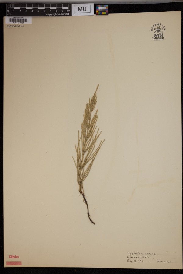
evidence. Museums hold 971 specimens
collected within 10 miles of Christman, Daniel, Homestead between 1876 and
1974: 901 Animalia, 44 Fungi, 26 Plantae. 12 distinct Species records are shown.
Collected by A.R. Gaufin, H.H. Ross, Arden R. Gaufin, B. Fink and others. Each is a
physical object with a catalogue
number, and each entry opens the museum's record. This is what was
collected and kept, not a survey of what lives here - nothing can be
concluded from a species being absent.
Regional context, not property-specific
evidence. The National Weather Service names
Eaton, the town this property stands in, in 75 storm reports between 1994 and 2023: 43 thunderstorm wind, 19 hail, 10 flash flood, 2 flood.
No death or injury is recorded in these reports. Each account below is quoted exactly as the forecast office
filed it, from the NOAA Storm Events Database, and each date
opens the federal record of that event.
Fifteen or more large trees were knocked down near Eaton High School. An equipment trailer and a marching band tower were blown over by high wind, and there was damage to fencing at the athletic complex. Also, shingle damage occurred to roofs along Hillcrest Drive from wind and hail.
A two story 100 foot by 100 foot barn was destroyed. A camper was blown into the road near the intersection of US Route 35 and Wayne Trace Road just east of Eaton.
5 papers published in this town,
digitised by the Library of Congress and free to read: 0 issues,
0 pages. Every page is searchable, so a name or a street can be
looked for directly in what the town printed about itself at the time.
No historic map-sheet match is published
for this property yet. That does not mean no map exists. This record needs
a coordinate-quality review before it can be joined to a sheet boundary.
Browse the county's mapped places while that work is
pending.
From the nomination file
1,566 words on record
When this property was proposed for the
National Register, someone wrote the case for it: what the building is,
and why it matters. That document is a federal record in the public domain.
It is quoted below word for word, never summarised. The text was read off the scanned case file by machine, so the
occasional stray character is the recogniser's and the 1970s
typewriter's.
Description of the property
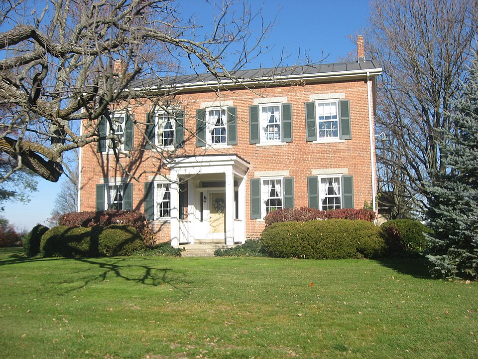
entry hall has a winding staircase of cherry.The floors are six-inch poplar boards throughout altered with the addition of two windows in the 1940s).The windows are six over six with shown on early pictures have been removed.) An addition to the right rear seems to be quite early.The brick appears to be of the The Daniel Christman House is a Greek Revival dwelling of brick with a entrance porch which has been removed.) There are five bays on the front (south) side and same origin as that used for the front section of the house. -There are two bays on both the east and the west parts of this addition, with an insert' porch on the east side. (The' A brick smokehouse in excellent' condition is behind the house.
Its form--brick with cantilevered frame roof--is a classic smokehouse design, and its interior features include cate that cornice boards may have originally been attached just below the eaves.) The deteriorated unaltered two on the west side of the original rectangular section of the house.(The east side was altered.The yellow poplar painted trim is complete and of very high quality.The main with a brick fireplace still kitchen has been incorporated into a garage.) The gabled roof is standing seam metal with plain boxed eaves.(Marks on the walls indi- 8.
Statement of significance
(in one paragraph) The homestead remained in its original condition well into the twentieth century. The _economics Areas of Significance-Check and justify below with the erection of the house in1856and the barn in 1857.Christman prospered during the - archeology-prehistoric _ religion from the federal government by Daniel Christman's father in 1812. Daniel, who was born in the county, acquired the homestead in 1848. He developed the farm into its present state night. The murderer was later lynched by a mob in the nearby town of Eaton.) Builder/Architect Unknown Civil War and was able to add 160 acres to the original homestead in 1872.
(He lived until community planning landscape architecture present owners are working to preserve the homestead as much as possible in its nineteenth- a significant segment of the agricultural history of Preble County and southwestern Ohio. top fifteen counties.in the state in corn production.Tobacco and wheat were also important Specific dates 1856-1857 in southwestern Ohio.The southwestern section of the state emerged early asa key crop- 9.
Quoted from the National Register nomination
for reference 82001486, 12 pages, held by the National Archives in Record
Group 79. See the
catalogue record.
Listed places nearby
6 within 8 miles
Other National Register properties close
enough to walk or drive between, ordered by distance from this one. Both
positions come from the same geocoding pass that matched these properties
to their map sheets.
Listing record. National Park Service National Register of Historic Places, listed-properties dataset, current to 2026-05-22.
Map join. Address geocoded through the United States Census geocoder, then tested against the published boundary of every sheet in the USGS Historical Topographic Map Collection.
How this page is made. Listing fields come from federal records; map-sheet coverage is a labelled coordinate-to-boundary calculation, not a source-field claim.
Specimens. Global Biodiversity Information Facility (GBIF), https://www.gbif.org/. Only records licensed CC0 or CC BY are used. Records licensed CC BY-NC are excluded because this site carries advertising. Images are checked individually and any whose licence is non-commercial, no-derivatives or unreadable is refused.
Storms. NOAA National Centers for Environmental Information, Storm Events Database https://www.ncei.noaa.gov/stormevents/ A work of the United States government, no copyright under 17 U.S.C. 105. Narratives are quoted verbatim from the National Weather Service report and are not edited or summarised.
 Block
Block