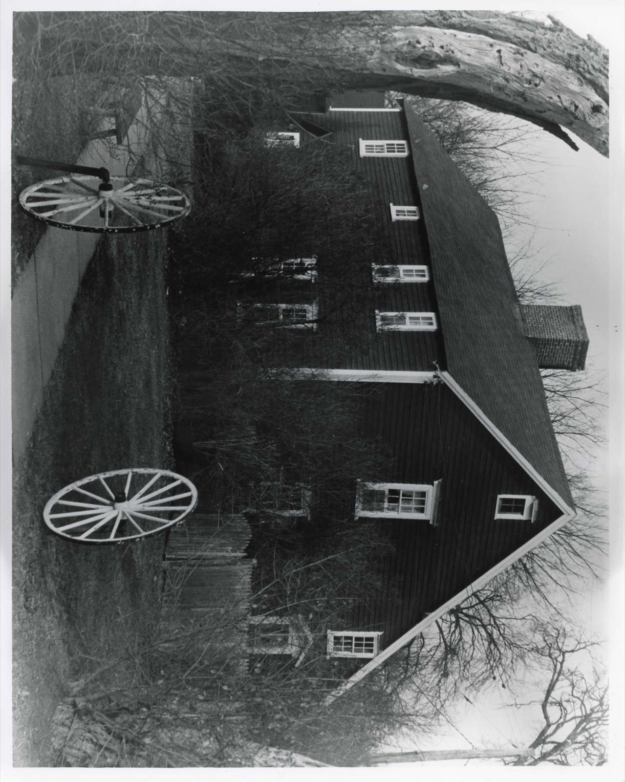
Photographs from the nomination case file, National Park Service records.
Manning Manse
Listed on the National Register of Historic Places in
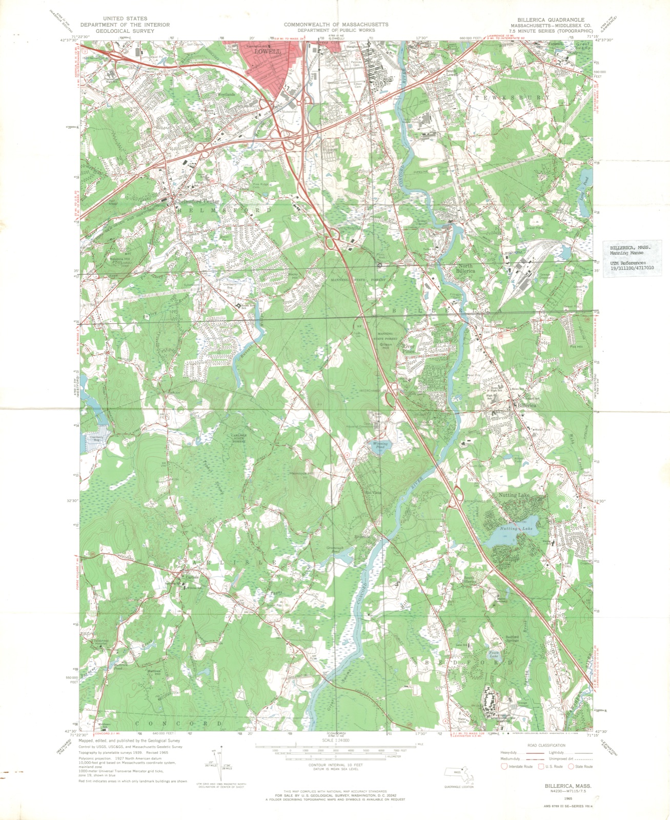
1982. A historic map-sheet match is not published yet. The record needs a coordinate-quality review before it can be joined to a sheet boundary.
From the record
“US, to prevent our plantation from breaking up or brealiing in peicess, after all that charge we have been at, And hazards that we have run, to keep our ground hitherto & not broke wliolly in piecess. We still asert, as we did before, our case is Honest.”
History of Billerica, Massachusetts, with a Genealogical Register (1883). Machine-read text.
one of 1100 National Register listings in Middlesex County · listed in 1982 · category: Building · one of 3 National Historic Landmarks in Middlesex County.
National Register reference number.82001912- the number the National Park Service assigned this property when it was listed, and the key its nomination file is catalogued under at the National Archives.
What happened here
An account from the chapter on Billerica town, The inset identifies its exact
source book and publication year.
14. Josiah, son of Josiali. 5, b. 1704, Aug. 5; m. 1729-30, Feb. 3, Elizabetli French, dau. of William, 7. She d. 1739, Nov. 27. He d. before 1743. Killed by the Indians says tradition. Ch. Josiah. b. 3730, Nov. 24. He was in the military service in 1747, on the C-onnecticut river, and narrowly escaped with his life by swimming the river from the anibusead(» in which French.
For encouragement and aid in tlie work, thanks are due to friends more nuraei'ous than I can mention. Many, not named, are not forgotten, if I refer to a few, whom it Avere unpardonable to omit. The kindness and cooperation of each member of the Historical Committee have been constant and unstinted, and I record it here most gratefully ; while to Mr. Foster and his good wife (whose recent death makes their pleasant home desolate) , I am specially indebted for the lists of town officers, and for the useful alphabetical copy, made by thein, of the Baptisms found in the records of the First Church. Mr. Franklin .Taquith copied the inscriptions in the South BurjMng Ground, and those in the Old Corner Burj'ing Ground were as kindly copied by Mrs. Holt. Mr. Jaquith also prepared with great care the list of soldiers from Billerlca in the late war. Dr. C. E. Hosmer rendered important aid in preparing the Map of Ancient Billerica. The use of valuable surveys and papers has been generously granted by Mrs. Samuel Sage, Mr. Leander Crosbj% Mr. Merton Simonds, of Bedford, Peter E. Vose, Esq., of Dennysville, Me., and the Rev. Henry M. Dexter, D. D., of New Bedford. Mr. and Mrs. A. B. Cutler, of Bedford, have most kindly given me every opportunity to use the invaluable Lane Papers in their possession. The Hon. Samuel A. Green, M. D., Mayor of Boston, has not only given free access to the library of the Massachusetts Historical Society, but, by constant and valuable suggestions, aided me very materiallj'^ ; and Mr. John Ward Dean, of the New England Historic, Genealogical Society, has been not less helpful. The Congregational Library, rich in local history and genealogy, has been always at mj^ service, while to IMiss Mary E. Stone, its assistant lil)rarian, especial thanks are due, for invaluable aid, most cheerfully rendered, in reading proof of nian^y of these pages. In n)y researches among the Massachusetts Archives in the Secretarj' of State's office, the aid of Dr. Edward Strong has been of great service ; and thanks are due to Mr. David Pulsifer, of the same office. Others, who should be named in the same spirit, are, Mrs. Bennett and Mr. W. W. AVarren, Dr. Augustus Whiting, of Charlestown, Mr. and Mrs. L. W. Faulkner, Mr. C. H. Hill, Mr. E. J. Hill and Dr. F. V. Noj^es ; and the volume might have an appropriate dedication to the memory of Cai)t. Charles A. Kanlett, to whose historic interest much was due in the inception of the enterjti-ise.
Indian deeds, 123; sale, of Wamesit, 124; the Winthrops seek lo recover, 125; military company, 125; Canada expedition; Dunstable assailed; Lt. Wilson at Cocheco, 126; Billerica's first massacre, 127; second massacre, 129 ; Mrs. Toothaker, 130 ; militai-y life and trials, 132 ; Hunt's garrison, 134 ; Col. John Lane, 135 ; Queen Anne's war, 136 ; soldiers from Billerica, 137 ; Dunstable attacked, 140 ; Lovewell's expedition, 141 ; Louisburg, 142 ; service on Connecticut river, 143 ; sad day for Billerica, 143 ; Josiah Crosby, 144 ; French and Indian war, 145 ; soldiers from Billerica, 147 ; the French neutrals, 151.
Regional context, not property-specific
evidence. The
federal wildfire occurrence database
lists 63 fires within 5 miles of Manning Manse between
2002 and 2020, burning about 30 acres in total. None started naturally. None was recorded as arson.
Distance is straight-line from the map coordinates, so a fire counted
here may appear on a neighbouring settlement's page as well.
Reported cause
Fires
Debris and open burning
29
Missing data/not specified/undetermined
24
Recreation and ceremony
3
Equipment and vehicle use
2
Misuse of fire by a minor
1
Power generation/transmission/distribution
1
Railroad operations and maintenance
1
Smoking
1
Other causes
1
The most recent of
them, most recent first, with the day each was reported and the service
that recorded it.
Regional context, not property-specific
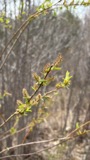
evidence. Museums hold 435 specimens
collected within 10 miles of Manning Manse between 1898 and
1975: 194 Animalia, 172 Plantae, 64 Fungi, 3 Chromista, 2 Protozoa. 12 distinct Species records are shown.
Collected by A. B. Seymour, A. C. Mathieson, A. F. Newton and others. Each is a
physical object with a catalogue
number, and each entry opens the museum's record. This is what was
collected and kept, not a survey of what lives here - nothing can be
concluded from a species being absent.
Regional context, not property-specific
evidence. The federal mineral resources record lists
10 workings within 5 miles of Manning Manse: 4 past producers, 4 plants, 2 producers.
6 still produce. What was taken out: Sand and Gravel, Construction, Graphite, Stone, Crushed/Broken. Distance is straight-line from the
map coordinates, so a quarry counted here may appear on a neighbouring
settlement's page as well.
Regional context, not property-specific
evidence. The National Weather Service names
Billerica, the town this property stands in, in 24 storm reports between 1998 and 2023: 11 thunderstorm wind, 6 hail, 3 heavy rain, 3 flood.
No death or injury is recorded in these reports. Each account below is quoted exactly as the forecast office
filed it, from the NOAA Storm Events Database, and each date
opens the federal record of that event.
At 4:10 PM EST, media reported that the Concord River in Billerica had risen above its banks. At 6:34 PM EST, flooding was reported on Elsie Avenue in Billerica from the Concord River.
No historic map-sheet match is published
for this property yet. That does not mean no map exists. This record needs
a coordinate-quality review before it can be joined to a sheet boundary.
Browse the county's mapped places while that work is
pending.
From the nomination file
2,809 words on record
When this property was proposed for the
National Register, someone wrote the case for it: what the building is,
and why it matters. That document is a federal record in the public domain.
It is quoted below word for word, never summarised. The text was read off the scanned case file by machine, so the
occasional stray character is the recogniser's and the 1970s
typewriter's.
Description of the property
The Manning Manse is sited on a 3.9 acre lot located on the south side of Chelmsford Road, in a rural area about 24 miles from Billerica Center. The property is completely surrounded by Manning State Forest. The house is a fine example of the plain and substantial colonial architecture of the late 17th century. It is 2½ stories high, of framed timber construction with the main entrance on the south side, Iacing away trom the street. Long and 19 feet 5 inches wide, but a leanto increases the width to a total of 30 feet 7 inches. The age of this integral leanto is unknown, although there are indications that it is somewhat later than the house itselt. For example, boards on an interior north wall on the second floor are weathered as though they had been exposed.
The chimney, with three fireplaces on the first floor, measures about 9 feet 9 inches by 8 feet 5 inches at this level. Where it passes through the roof ridge it is about 4 feet 8 inches square. which are mortised together and fastened to the wall by great handmade spikes whose heads The main entrance of the Manse is slightly off center on the south facade. A small gabled vestibule shelters the facade doorway, which has a plain architrave and glazed transom. An entrance in the east end of the leanto (ornamented only with a shallow, peaked hood) probably served' as access to the tavern for travellers using the Chelmsford Road during colonial days. On the interior, walls are panelled floor to ceiling with wide chamfered boards, laid both vertically and horizontally on the varicus walls.
Boxed posts, beams, and Summer beams articulate the Irame, while early chimneypieces ornament the fireplace openings.
(in one paragraph) Samuel Manning The Manning Manse retains integrity of design, setting, and location. It is significant in the developmental history of Billerica and in its association with Warren H. Marning (1860-1938), a distinguished landscape architect. Additionally, it is important as an example of an early attempt to preserve and restore a 17th century family homestead. The Marning Manse meets criteria A, B, and C of the National Register of Historic Places. Billerica was settled during the decade following a vast land grant made to Cambridge in 1641. In 1655 a petition was made for addditonal land west of the Concord River, a move generally regarded asthe establishment of the Town of Billerica.
Scattered meadow lands and some upland lots have soon divided, but no farmsteads were settled west of the river until after 1690. Ihe Manning Manse was probably the first. Samue1 Marning (1644-1711) acquired this land by 1673, and is thought to have built the Manse. in 1696. is certainly the closer of the two to its early form. During the 18th century, the farmstead gained considerable prominence in the conmmity. The house was established as a tavern in 1752 and continued in service until after 1800. Its eighteenth century tavern account books are preserved by the Marning Family Association in the University of Lowell Special Collections. Tradition claims that troops.
from Amherst, New Hampshire, bivouacked, here en route to Bunker Also dating to the Revolutionary War, the crude foundation of a "salt-peter house" is still visible on the grounds. During this time, Manse was the home of William Manning (1747-1814), author of The Key of Liberty (1798), inter alia. Samuel Gompers has noted that this is the first suggestion anywhere that laborers organize.
Quoted from the National Register nomination
for reference 82001912, 14 pages, held by the National Archives in Record
Group 79. See the
catalogue record.
Listed places nearby
6 within 8 miles
Other National Register properties close
enough to walk or drive between, ordered by distance from this one. Both
positions come from the same geocoding pass that matched these properties
to their map sheets.
Listing record. National Park Service National Register of Historic Places, listed-properties dataset, current to 2026-05-22.
Map join. Address geocoded through the United States Census geocoder, then tested against the published boundary of every sheet in the USGS Historical Topographic Map Collection.
How this page is made. Listing fields come from federal records; map-sheet coverage is a labelled coordinate-to-boundary calculation, not a source-field claim.
Wildfire. Short, Karen C. 2022. Spatial wildfire occurrence data for the United States, 1992-2020 [FPA_FOD_20221014]. 6th Edition. Fort Collins, CO: Forest Service Research Data Archive. https://doi.org/10.2737/RDS-2013-0009.6 Collected with United States Government funding and usable without additional permissions or fees.
Specimens. Global Biodiversity Information Facility (GBIF), https://www.gbif.org/. Only records licensed CC0 or CC BY are used. Records licensed CC BY-NC are excluded because this site carries advertising. Images are checked individually and any whose licence is non-commercial, no-derivatives or unreadable is refused.
Mines and quarries. USGS Mineral Resources Data System (MRDS) https://mrdata.usgs.gov/mrds/ A work of the United States government, no copyright under 17 U.S.C. 105.
Storms. NOAA National Centers for Environmental Information, Storm Events Database https://www.ncei.noaa.gov/stormevents/ A work of the United States government, no copyright under 17 U.S.C. 105. Narratives are quoted verbatim from the National Weather Service report and are not edited or summarised.
 Block
Block